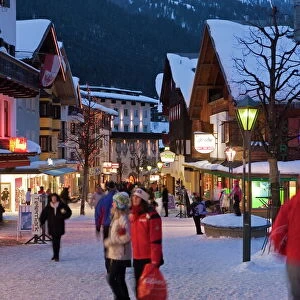
Canvas Print > Europe > Austria > Sports > Skiing
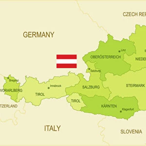
Canvas Print : Tyrol map 1895


![]()
Canvas Prints from Fine Art Storehouse
Tyrol map 1895
Meyers Konversations-Lexikon. Ein Nachschlagewerk des allgemeinen Wissens, 5th edition 17 volumes Bibliographisches Institut - Leipzig 1895-1897
Unleash your creativity and transform your space into a visual masterpiece!
THEPALMER
Media ID 13609323
© This content is subject to copyright
Alps Austria European Alps Innsbruck Resorts Tirol Tyrol Tyrol State
20"x16" (51x41cm) Canvas Print
Introducing the captivating "Tyrol Map 1895" Canvas Print from Media Storehouse's Fine Art Storehouse collection. This exquisite piece showcases an intricately detailed map of Tyrol, meticulously reproduced from the fifth edition of Meyers Konversations-Lexikon, published by Bibliographisches Institut in Leipzig between 1895 and 1897. Travel back in time with this historical artwork that beautifully captures the geographical layout of Tyrol during the late 19th century. Decorate your space with this unique blend of history and art, and bring a touch of vintage charm to your home or office.
Delivered stretched and ready to hang our premium quality canvas prints are made from a polyester/cotton blend canvas and stretched over a 1.25" (32mm) kiln dried knot free wood stretcher bar. Packaged in a plastic bag and secured to a cardboard insert for safe transit.
Canvas Prints add colour, depth and texture to any space. Professionally Stretched Canvas over a hidden Wooden Box Frame and Ready to Hang
Estimated Product Size is 50.8cm x 40.6cm (20" x 16")
These are individually made so all sizes are approximate
Artwork printed orientated as per the preview above, with landscape (horizontal) orientation to match the source image.
FEATURES IN THESE COLLECTIONS
> Europe
> Austria
> Innsbruck
> Europe
> Austria
> Related Images
> Europe
> Austria
> Sports
> Skiing
> Europe
> Related Images
> Maps and Charts
> Related Images
> Fine Art Storehouse
> Map
> Historical Maps
EDITORS COMMENTS
This print takes us back in time to the year 1895, showcasing a meticulously detailed map of Tyrol. Derived from Meyers Konversations-Lexikon, a renowned encyclopedia of general knowledge during that era, this antique piece offers a glimpse into the rich history and geography of the region. The Tyrol state, nestled amidst the majestic European Alps in Austria, is beautifully depicted with intricate engravings and etchings. The map serves as an invaluable resource for those intrigued by physical geography and cartography. It unveils not only the geographical features but also highlights various resorts and ski destinations scattered across Tyrol's picturesque landscape. Innsbruck, known for its stunning alpine scenery and vibrant culture, stands out prominently on this historical document. As we admire this horizontal artwork, it transports us to a time when technology had yet to shape our world. Its vintage charm evokes nostalgia while reminding us of how far we have come since then. This print by THEPALMER captures every minute detail with precision and showcases their passion for preserving historical artifacts. Whether you are an avid collector or simply fascinated by old-world charm, this exquisite illustration promises to be a cherished addition to any space it graces. Let your imagination wander through time as you explore the wonders of Tyrol through this remarkable piece of art.
MADE IN AUSTRALIA
Safe Shipping with 30 Day Money Back Guarantee
FREE PERSONALISATION*
We are proud to offer a range of customisation features including Personalised Captions, Color Filters and Picture Zoom Tools
SECURE PAYMENTS
We happily accept a wide range of payment options so you can pay for the things you need in the way that is most convenient for you
* Options may vary by product and licensing agreement. Zoomed Pictures can be adjusted in the Cart.