Canvas Print > Arts > Landscape paintings > Waterfall and river artworks > River artworks
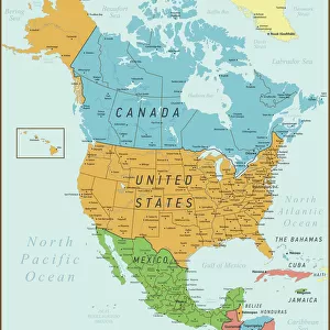
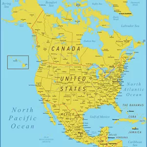
Canvas Print : North America Green Map with United States, Canada, Mexico, geographical borders and rivers


![]()
Canvas Prints from Fine Art Storehouse
North America Green Map with United States, Canada, Mexico, geographical borders and rivers
North America Map with United States, Canada, Mexico and Cuba Map was found: http://legacy.lib.utexas.edu/maps/americas/txu-oclc-71353734-north_america_pol_2006.jpg Map was found: http://legacy.lib.utexas.edu/maps/united_states/united_states_pol02.jpg Created with Adobe Illustrator with splines
Unleash your creativity and transform your space into a visual masterpiece!
Media ID 20249925
20"x16" (51x41cm) Canvas Print
Discover the beauty and complexity of North America with our stunning Canvas Print from Media Storehouse. This exquisite piece features a detailed map of North America, highlighting the geographical borders of the United States, Canada, and Mexico, as well as the major rivers that flow through this vast and diverse continent. Each Canvas Print is meticulously crafted using premium materials and vibrant, fade-resistant inks, ensuring a museum-quality finish that will bring a touch of world exploration to your home or office. Order now and let this captivating map be the conversation starter you've been looking for.
Delivered stretched and ready to hang our premium quality canvas prints are made from a polyester/cotton blend canvas and stretched over a 1.25" (32mm) kiln dried knot free wood stretcher bar. Packaged in a plastic bag and secured to a cardboard insert for safe transit.
Canvas Prints add colour, depth and texture to any space. Professionally Stretched Canvas over a hidden Wooden Box Frame and Ready to Hang
Estimated Product Size is 40.6cm x 50.8cm (16" x 20")
These are individually made so all sizes are approximate
Artwork printed orientated as per the preview above, with portrait (vertical) orientation to match the source image.
FEATURES IN THESE COLLECTIONS
> Arts
> Landscape paintings
> Waterfall and river artworks
> River artworks
> Maps and Charts
> Related Images
> North America
> Canada
> Maps
> North America
> Canada
> Related Images
> North America
> Cuba
> Maps
> North America
> Cuba
> Related Images
> North America
> Mexico
> Maps
> North America
> Mexico
> Related Images
> North America
> Related Images
> Fine Art Storehouse
> Map
> Reference Maps
EDITORS COMMENTS
This print showcases a detailed map of North America, highlighting the geographical borders and rivers that define this vast continent. The map encompasses the United States, Canada, Mexico, and even includes Cuba as an additional feature. With its intricate design and vibrant colors, this artwork is both visually stunning and educational. The artist skillfully created this masterpiece using Adobe Illustrator with splines on January 12th, 2019. Every curve and contour has been meticulously crafted to ensure accuracy in representing the landmasses and water bodies of North America. As we gaze upon this print, we are reminded of the diverse landscapes that make up this region - from the majestic Rocky Mountains to the sprawling Great Plains; from the lush forests of Canada to the arid deserts of Mexico. The rivers depicted on this map serve as lifelines for countless communities across these countries. Whether you are a geography enthusiast or simply appreciate fine art, this North America Green Map is sure to captivate your imagination. It serves as a reminder of our interconnectedness within this vast continent while also celebrating its unique cultural heritage
MADE IN AUSTRALIA
Safe Shipping with 30 Day Money Back Guarantee
FREE PERSONALISATION*
We are proud to offer a range of customisation features including Personalised Captions, Color Filters and Picture Zoom Tools
SECURE PAYMENTS
We happily accept a wide range of payment options so you can pay for the things you need in the way that is most convenient for you
* Options may vary by product and licensing agreement. Zoomed Pictures can be adjusted in the Cart.