Canvas Print > Fine Art Storehouse > Map
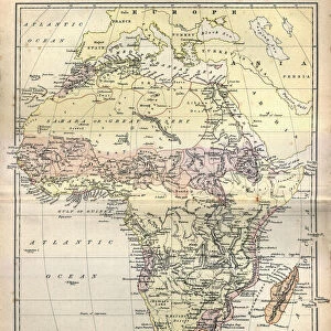
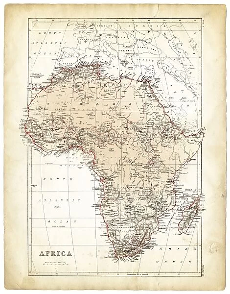
Canvas Print : Africa map 1878


![]()
Canvas Prints from Fine Art Storehouse
Africa map 1878
Encyclopedia Britannica 9th Edition Vol I New York, Samuel Hall 1878
Unleash your creativity and transform your space into a visual masterpiece!
THEPALMER
Media ID 13609273
© This content is subject to copyright
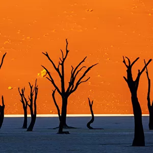
Central Africa East Africa Madagascar Sahara Desert
20"x16" (51x41cm) Canvas Print
Step into the past with our captivating Africa Map 1878 Canvas Print from ThePalmer at Media Storehouse. This exquisite piece, originally sourced from the Encyclopedia Britannica 9th Edition Vol I New York, published in 1878, showcases intricate detail and historical accuracy. Samuel Hall's classic cartography brings the African continent to life, making this canvas print an essential addition to any home or office. Transport yourself back in time and add a touch of vintage charm and intellectual curiosity to your space. Order yours today!
Delivered stretched and ready to hang our premium quality canvas prints are made from a polyester/cotton blend canvas and stretched over a 1.25" (32mm) kiln dried knot free wood stretcher bar. Packaged in a plastic bag and secured to a cardboard insert for safe transit.
Canvas Prints add colour, depth and texture to any space. Professionally Stretched Canvas over a hidden Wooden Box Frame and Ready to Hang
Estimated Product Size is 40.6cm x 50.8cm (16" x 20")
These are individually made so all sizes are approximate
Artwork printed orientated as per the preview above, with portrait (vertical) orientation to match the source image.
FEATURES IN THESE COLLECTIONS
> Fine Art Storehouse
> Map
> Historical Maps
> Fine Art Storehouse
> Ultimate Earth Prints
> Amazing Deserts
EDITORS COMMENTS
This print showcases an exquisite piece of history - the Africa map from the Encyclopedia Britannica 9th Edition, published in 1878. Crafted by Samuel Hall in New York, this engraving and etching is a true testament to the artistry and precision of cartography during that era. The map takes us on a journey through time, revealing the intricate details of Africa's physical geography as understood over a century ago. From its vertical orientation to its central focus on regions like Central Africa, East Africa, and Madagascar, every element has been meticulously captured in this lithograph. One cannot help but marvel at how this antique engraved image has stood the test of time. The Sahara Desert dominates vast stretches of North Africa while rivers and mountain ranges crisscross various territories. It serves as a reminder not only of our ever-changing world but also of the enduring beauty found within these old maps. "The Palmer" known for their expertise in sourcing fine art prints, presents this remarkable piece with utmost care and attention to detail. As we gaze upon it, we are transported back to an era when exploration was paramount and cartographers were revered for their ability to bring distant lands closer through illustrations such as these. Whether you're an avid collector or simply appreciate historical artifacts, this print offers a glimpse into the past that will surely captivate any viewer.
MADE IN AUSTRALIA
Safe Shipping with 30 Day Money Back Guarantee
FREE PERSONALISATION*
We are proud to offer a range of customisation features including Personalised Captions, Color Filters and Picture Zoom Tools
SECURE PAYMENTS
We happily accept a wide range of payment options so you can pay for the things you need in the way that is most convenient for you
* Options may vary by product and licensing agreement. Zoomed Pictures can be adjusted in the Cart.