Canvas Print > Europe > Italy > Veneto > Venice
Canvas Print : PTOLEMY, Claudius Ptolemaeus ( c. AD 100 - c


![]()
Canvas Prints From Mary Evans Picture Library
PTOLEMY, Claudius Ptolemaeus ( c. AD 100 - c
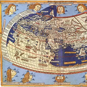
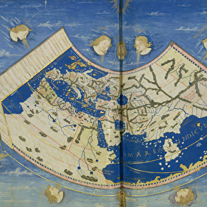
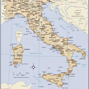
" PTOLEMY, Claudius Ptolemaeus ( c. AD 100 - c. AD 170). Egyptian astronomer, mathematician and geographer. Map of the Ancient World. From the work " Ptolomeus Geographicorum Libri". ITALY. Venice. Biblioteca nazionale marciana (St. Marks Library)."
Mary Evans Picture Library makes available wonderful images created for people to enjoy over the centuries
Media ID 8269213
© Mary Evans Picture Library 2015 - https://copyrighthub.org/s0/hub1/creation/maryevans/MaryEvansPictureID/10685897
Astronomer Biblioteca Claudius Geographer Libri Marciana Mathematician Nazionale Ptolemaeus Ptolemy Venice
20"x16" (51x41cm) Canvas Print
Discover the rich history of ancient geography with our stunning Canvas Prints from Media Storehouse, featuring the iconic map "Ptolemy's Map of the Ancient World" by Claudius Ptolemaeus. This exquisite piece, sourced from Mary Evans Prints Online, showcases the meticulous work of the renowned Egyptian astronomer, mathematician, and geographer. Bring the wisdom and knowledge of Ptolemy's groundbreaking geographical discoveries into your home or office, elevating any space with an air of sophistication and intellectual curiosity. Our high-quality Canvas Prints are sure to be a captivating addition to your collection.
Delivered stretched and ready to hang our premium quality canvas prints are made from a polyester/cotton blend canvas and stretched over a 1.25" (32mm) kiln dried knot free wood stretcher bar. Packaged in a plastic bag and secured to a cardboard insert for safe transit.
Canvas Prints add colour, depth and texture to any space. Professionally Stretched Canvas over a hidden Wooden Box Frame and Ready to Hang
Estimated Product Size is 50.8cm x 40.6cm (20" x 16")
These are individually made so all sizes are approximate
Artwork printed orientated as per the preview above, with landscape (horizontal) orientation to match the source image.
FEATURES IN THESE COLLECTIONS
> Africa
> Egypt
> Related Images
> Europe
> Italy
> Veneto
> Venice
> Maps and Charts
> Early Maps
> Maps and Charts
> Italy
> Maps and Charts
> Related Images
> Maps and Charts
> World
MADE IN AUSTRALIA
Safe Shipping with 30 Day Money Back Guarantee
FREE PERSONALISATION*
We are proud to offer a range of customisation features including Personalised Captions, Color Filters and Picture Zoom Tools
SECURE PAYMENTS
We happily accept a wide range of payment options so you can pay for the things you need in the way that is most convenient for you
* Options may vary by product and licensing agreement. Zoomed Pictures can be adjusted in the Basket.