Cushion > Maps and Charts > Americas
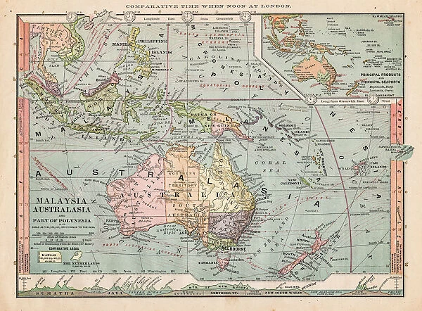
Cushion : Map of Australasia 1889
![]()

Home Decor from Fine Art Storehouse
Map of Australasia 1889
Comprehensive Geography by James Monteith - American Book Company 1882, 1889
Unleash your creativity and transform your space into a visual masterpiece!
THEPALMER
Media ID 18357271
Cushion
Refresh your home decor with a beautiful full photo 16"x16" (40x40cm) cushion, complete with cushion pad insert. Printed on both sides and made from 100% polyester with a zipper on the bottom back edge of the cushion cover. Care Instructions: Warm machine wash, do not bleach, do not tumble dry. Warm iron inside out. Do not dry clean.
Accessorise your space with decorative, soft cushions
Estimated Product Size is 40cm x 40cm (15.7" x 15.7")
These are individually made so all sizes are approximate
Artwork printed orientated as per the preview above, with landscape (horizontal) or portrait (vertical) orientation to match the source image.
FEATURES IN THESE COLLECTIONS
> Maps and Charts
> Related Images
> Fine Art Storehouse
> Map
> Historical Maps
EDITORS COMMENTS
This print showcases a remarkable piece of history, the "Map of Australasia 1889" from James Monteith's Comprehensive Geography. Created in 1882 and updated in 1889 by the American Book Company, this map offers a fascinating glimpse into the geographical understanding of that era. With its intricate details and vibrant colors, it transports us back to a time when exploration and discovery were at their peak. The map covers the vast region known as Australasia, encompassing Australia, New Zealand, Papua New Guinea, and surrounding islands. It provides an invaluable snapshot of how these lands were perceived over a century ago – their coastlines meticulously outlined, cities marked with tiny dots representing population centers, and mountain ranges depicted with artistic precision. As we admire this vintage treasure captured by THEPALMER for Fine Art Storehouse, we are reminded of the immense progress made in cartography since then. Today's satellite imagery may offer more accurate representations but lacks the charm and historical significance found within this print. Whether you're an avid collector or simply intrigued by history's cartographic marvels, this print is sure to captivate your imagination. Let it transport you to a time when explorers embarked on daring adventures across uncharted territories while simultaneously appreciating how far our knowledge has advanced since those early days.
MADE IN AUSTRALIA
Safe Shipping with 30 Day Money Back Guarantee
FREE PERSONALISATION*
We are proud to offer a range of customisation features including Personalised Captions, Color Filters and Picture Zoom Tools
SECURE PAYMENTS
We happily accept a wide range of payment options so you can pay for the things you need in the way that is most convenient for you
* Options may vary by product and licensing agreement. Zoomed Pictures can be adjusted in the Cart.


