Cushion > Animals > Birds > Passerines > Finches > Atlantic Canary
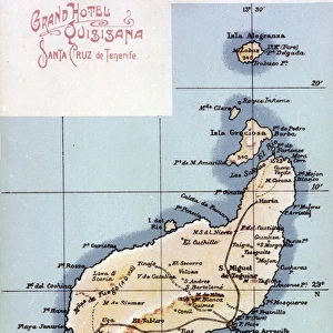
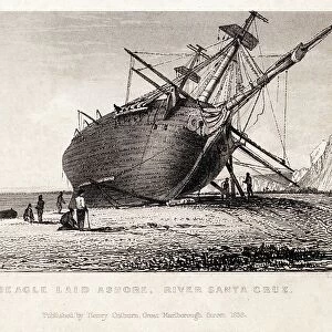
Cushion : Map of La Gomera, Canary Islands


![]()
Home Decor from Mary Evans Picture Library
Map of La Gomera, Canary Islands
Map of La Gomera, Canary Islands. Date: circa 1908
Mary Evans Picture Library makes available wonderful images created for people to enjoy over the centuries
Media ID 14262712
© Mary Evans / Pharcide
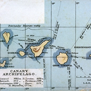
Atlantic Canaries Canary Cruz Maps Quisisana Tenerife Gomera
Cushion
Refresh your home decor with a beautiful full photo 16"x16" (40x40cm) cushion, complete with cushion pad insert. Printed on both sides and made from 100% polyester with a zipper on the bottom back edge of the cushion cover. Care Instructions: Warm machine wash, do not bleach, do not tumble dry. Warm iron inside out. Do not dry clean.
Accessorise your space with decorative, soft cushions
Estimated Product Size is 40cm x 40cm (15.7" x 15.7")
These are individually made so all sizes are approximate
Artwork printed orientated as per the preview above, with landscape (horizontal) or portrait (vertical) orientation to match the source image.
FEATURES IN THESE COLLECTIONS
> Animals
> Birds
> Passerines
> Finches
> Atlantic Canary
> Animals
> Mammals
> Cricetidae
> Santa Cruz Mouse
> Animals
> Mammals
> Muridae
> Water Mouse
> Arts
> Artists
> O
> Oceanic Oceanic
> Europe
> France
> Canton
> Landes
> Maps and Charts
> Related Images
EDITORS COMMENTS
Step back in time with this map print of La Gomera, one of the beautiful Canary Islands located in the Atlantic Ocean. Dated circa 1908, this map offers a glimpse into the past, showcasing the intricate details of the island's coastline and topography. The vibrant hues of the ocean and land beautifully contrast against each other, inviting the viewer to explore the wonders of this enchanting destination. La Gomera, the second smallest of the Canary Islands, is situated between Tenerife and El Hierro. The island's unique shape and diverse landscape are evident in this map, with its rugged cliffs, lush valleys, and sandy beaches. The map also highlights various points of interest, including the historic towns of San Sebastian de La Gomera and Vallehermoso, as well as the iconic Garajonay National Park, home to the ancient laurel forests. The map's title, "Mapa de La Gomera," is accompanied by the names of neighboring islands, Tenerife and Gran Canaria, as well as the capital city of the Canaries, Santa Cruz de Tenerife. The presence of the Grand Hotel Quisisana in the map indicates the island's growing popularity as a tourist destination in the early 1900s. This map print is an essential addition to any collection of historical maps or travel memorabilia, offering a fascinating look into the past and the rich history of the Canary Islands. Let this map transport you to a bygone era and ignite your sense of adventure as you explore the wonders of La Gomera and the surrounding islands.
MADE IN AUSTRALIA
Safe Shipping with 30 Day Money Back Guarantee
FREE PERSONALISATION*
We are proud to offer a range of customisation features including Personalised Captions, Color Filters and Picture Zoom Tools
SECURE PAYMENTS
We happily accept a wide range of payment options so you can pay for the things you need in the way that is most convenient for you
* Options may vary by product and licensing agreement. Zoomed Pictures can be adjusted in the Cart.