Fraud Blocker Skip to main content

Home > Europe > Austria > Maps

Maps Collection (page 9)

Austria is a landlocked country in Central Europe and is bordered by eight other countries and has a rich cultural heritage and stunning landscapes

589 items

Background imageMaps Collection: Anna Sachse-Hofmeister, Austrian opera singer (engraving)

Anna Sachse-Hofmeister, Austrian opera singer (engraving)
7157322 Anna Sachse-Hofmeister, Austrian opera singer (engraving) by German School, (19th century); Private Collection; (add.info.: Anna Sachse-Hofmeister (1850-1904), Austrian opera singer

Background imageMaps Collection: Promenade concert in the Kursalon in the Stadtpark, Vienna, Austria (engraving)

Promenade concert in the Kursalon in the Stadtpark, Vienna, Austria (engraving)
7157356 Promenade concert in the Kursalon in the Stadtpark, Vienna, Austria (engraving) by Gause, Wilhelm (1853-1916); Private Collection; (add.info)

Background imageMaps Collection: Grand Hotel, Vienna (b / w photo)

Grand Hotel, Vienna (b / w photo)
7159884 Grand Hotel, Vienna (b/w photo) by American Photographer, (19th century); Private Collection; (add.info.: Grand Hotel, Vienna)

Background imageMaps Collection: Mada Primavesi, c. 1925 (pencil on simli japan paper)

Mada Primavesi, c. 1925 (pencil on simli japan paper)
6436331 Mada Primavesi, c.1925 (pencil on simli japan paper) by Klimt, Gustav (1862-1918); 55.2x36.8 cm; Private Collection

Background imageMaps Collection: Henrietta Treffz, Austrian mezzo-soprano singer (engraving)

Henrietta Treffz, Austrian mezzo-soprano singer (engraving)
7153756 Henrietta Treffz, Austrian mezzo-soprano singer (engraving) by German School, (19th century); Private Collection; (add.info.: Henrietta Treffz (1818-1878)

Background imageMaps Collection: British soldiers of the 21st Royal Scots Fusiliers, Battle of Dettingen, Germany

British soldiers of the 21st Royal Scots Fusiliers, Battle of Dettingen, Germany, War of the Austrian Succession
7153968 British soldiers of the 21st Royal Scots Fusiliers, Battle of Dettingen, Germany, War of the Austrian Succession, 1743 (colour litho) by Stewart, J. A

Background imageMaps Collection: Le cardinal Fleury (engraving)

Le cardinal Fleury (engraving)
7194285 Le cardinal Fleury (engraving) by French School, (19th century); Private Collection; (add.info.: Le cardinal Fleury)

Background imageMaps Collection: Members of the League of Nations (colour litho)

Members of the League of Nations (colour litho)
7163177 Members of the League of Nations (colour litho) by English School, (20th century); Private Collection; (add.info.: Members of the League of Nations)

Background imageMaps Collection: Portrait du gouverneur des Pays Bas Don Juan d Autriche (1547-1578)

Portrait du gouverneur des Pays Bas Don Juan d Autriche (1547-1578) (portrait of the governor of the Habsburg)
FIA5358361 Portrait du gouverneur des Pays Bas Don Juan d Autriche (1547-1578) (portrait of the governor of the Habsburg Netherlands Don John of Austria)

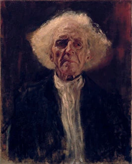
Background imageMaps Collection: Homme aveugle - Peinture de Gustav Klimt (1862-1918), huile sur toile, 1896 (66x53)

Homme aveugle - Peinture de Gustav Klimt (1862-1918), huile sur toile, 1896 (66x53, 2 cm) - Blind Man
FIA5386775 Homme aveugle - Peinture de Gustav Klimt (1862-1918), huile sur toile, 1896 (66x53, 2 cm) - Blind Man, Oil on canvas by Gustav Klimt, 1896 - Leopold Museum, Vienna by Klimt

Background imageMaps Collection: Portrait of Isabella Reisser - Romako, Anton (1832-1889) - 1885 - Oil on canvas - 130

Portrait of Isabella Reisser - Romako, Anton (1832-1889) - 1885 - Oil on canvas - 130, 5x90 - Leopold Museum, Vienna
FIA5394408 Portrait of Isabella Reisser - Romako, Anton (1832-1889) - 1885 - Oil on canvas - 130, 5x90 - Leopold Museum, Vienna by Romako, Anton (1832-89); Leopold Museum, Vienna

Background imageMaps Collection: Devant le miroir - Before the Mirror par Schiele, Egon (1890-1918)

Devant le miroir - Before the Mirror par Schiele, Egon (1890-1918). Pencil, Gouache on paper, size : 48, 3x32, 1, 1913
FIA5404963 Devant le miroir - Before the Mirror par Schiele, Egon (1890-1918). Pencil, Gouache on paper, size : 48, 3x32, 1, 1913, Leopold Museum, Vienna by Schiele, Egon (1890-1918); Leopold Museum

Background imageMaps Collection: Portrait of Holy Roman Emperor Francis II (1768-1835)

Portrait of Holy Roman Emperor Francis II (1768-1835)
FIA5635218 Portrait of Holy Roman Emperor Francis II (1768-1835) by Kreutzinger, Josef (1751/7-1829); Steiermarkisches Landesmuseum Joanneum

Background imageMaps Collection: Portrait of Emperor Joseph II

Portrait of Emperor Joseph II
FIA5635211 Portrait of Emperor Joseph II by Hickel, Joseph (1736-1807); 130x90 cm; Steiermarkisches Landesmuseum Joanneum, Austria; (add.info.: Portrait of Emperor Joseph II (1741-1790), by Hickel

Background imageMaps Collection: Projet de decor pour le ballet Le poisson dore de Leon (ou Ludwig) Minkus (1826-1917)

Projet de decor pour le ballet Le poisson dore de Leon (ou Ludwig) Minkus (1826-1917)
FIA5350071 Projet de decor pour le ballet Le poisson dore de Leon (ou Ludwig) Minkus (1826-1917) (Stage design for the ballet The Golden Fish by L. Minkus)

Background imageMaps Collection: Portrait de Clement (Klemens) Wenzel, prince de Metternich (1773-1859). Homme politique autrichien

Portrait de Clement (Klemens) Wenzel, prince de Metternich (1773-1859). Homme politique autrichien
FIA5373452 Portrait de Clement (Klemens) Wenzel, prince de Metternich (1773-1859). Homme politique autrichien. Peinture de sir Thomas Lawrence (1769-1830), huile sur toile, entre 1814 et 1819

Background imageMaps Collection: Portrait of Elisabeth of Bavaria

Portrait of Elisabeth of Bavaria
FIA5381257 Portrait of Elisabeth of Bavaria by Austrian School, (19th century); Private Collection; (add.info.: Portrait d Elisabeth de Baviere (1837-1898) (imperatrice d Autriche)

Background imageMaps Collection: Bataille de Jemappes (Jemmapes) le 6 novembre 1792 entre l Autriche et la France

Bataille de Jemappes (Jemmapes) le 6 novembre 1792 entre l Autriche et la France (Victoire des Francais)
FIA5378346 Bataille de Jemappes (Jemmapes) le 6 novembre 1792 entre l Autriche et la France (Victoire des Francais, commandes par le general Charles Francois Dumouriez (1739-1823)

Background imageMaps Collection: Une scene de la guerre d independance de Hongrie en 1849. (A Scene of The War of Independence in)

Une scene de la guerre d independance de Hongrie en 1849. (A Scene of The War of Independence in Hungary on 1849)
FIA5367439 Une scene de la guerre d independance de Hongrie en 1849. (A Scene of The War of Independence in Hungary on 1849)

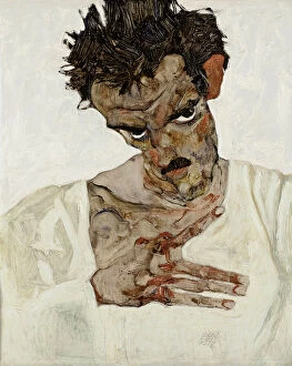
Background imageMaps Collection: Autoportrait a la tete baissee. Peinture de Egon Schiele (1890-1918), huile sur bois, 1912

Autoportrait a la tete baissee. Peinture de Egon Schiele (1890-1918), huile sur bois, 1912
FIA5381889 Autoportrait a la tete baissee. Peinture de Egon Schiele (1890-1918), huile sur bois, 1912. Art autrichien, 20e siecle, art nouveau, modernisme. Leopold Museum, Vienne (Autriche)

Background imageMaps Collection: Mere et enfant. (Mother and Child). Oeuvre de Egon Schiele (1890-1918)

Mere et enfant. (Mother and Child). Oeuvre de Egon Schiele (1890-1918), aquarelle et gouache sur papier, 1910
FIA5381861 Mere et enfant. (Mother and Child). Oeuvre de Egon Schiele (1890-1918), aquarelle et gouache sur papier, 1910. Art autrichien, 20e siecle, art nouveau. Collection privee

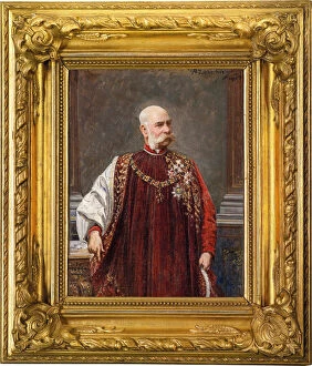
Background imageMaps Collection: Portrait of Franz Joseph I of Austria as Grand Master of the Golden Fleece

Portrait of Franz Joseph I of Austria as Grand Master of the Golden Fleece
FIA5381240 Portrait of Franz Joseph I of Austria as Grand Master of the Golden Fleece by Liebscher, Adolf (1857-1919); Private Collection; (add.info)

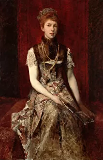
Background imageMaps Collection: Dora Fournier-Gabillon around 1879

Dora Fournier-Gabillon around 1879
FIA5379885 Dora Fournier-Gabillon around 1879 by Makart, Hans (1840-84); Wien Museum Karlsplatz, Vienna, Austria; (add.info.:Portrait de Dora Fournier Gabillon (Fournier-Gabillon)

Background imageMaps Collection: Fanny (Franziska, 1810-1884) et Theresa Elssler (1808-1878) (Fanny and Theresa Elssler)

Fanny (Franziska, 1810-1884) et Theresa Elssler (1808-1878) (Fanny and Theresa Elssler)
FIA5377023 Fanny (Franziska, 1810-1884) et Theresa Elssler (1808-1878) (Fanny and Theresa Elssler). Portrait des soeurs autrichiennes danseuses. Oeuvre anonyme, lithogaphie et aquarelle, vers 1830

Background imageMaps Collection: Life And Death, circa 1910-1915 (Oil on canvas)

Life And Death, circa 1910-1915 (Oil on canvas)
FIA5386770 Life And Death, circa 1910-1915 (Oil on canvas) by Klimt, Gustav (1862-1918); 180, 5x201 cm; Leopold Museum, Vienna

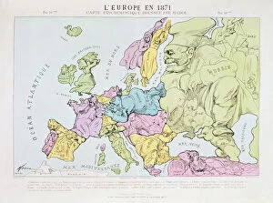
Background imageMaps Collection: L Europe en 1871, 1871 (colour litho)

L Europe en 1871, 1871 (colour litho)
XCF290996 L Europe en 1871, 1871 (colour litho) by Hadol, Paul (1835-1875); Private Collection; French, out of copyright

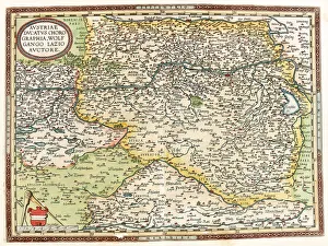
Background imageMaps Collection: Map of Austria with the Danube River and the city of Vienna, 1570 (engraving)

Map of Austria with the Danube River and the city of Vienna, 1570 (engraving)
LRI4704621 Map of Austria with the Danube River and the city of Vienna, 1570 (engraving) by Ortelius, Abraham (1527-98); Museo Navale di Pegli, Genoa

Background imageMaps Collection: Portrait en pied de Marie Antoinette de Lorraine Habsburg (1754-1793) dit '

Portrait en pied de Marie Antoinette de Lorraine Habsburg (1754-1793) dit "
JLJ4569150 Portrait en pied de Marie Antoinette de Lorraine Habsburg (1754-1793) dit " portrait au globe" Marie-Antoinette, queen of France, is represented in 1775, in a large court suit

Background imageMaps Collection: Map of the Flanders campaign between french army and austrian army, 1794 (engraving)

Map of the Flanders campaign between french army and austrian army, 1794 (engraving)
LRI4675588 Map of the Flanders campaign between french army and austrian army, 1794 (engraving) by Unknown artist, (18th century); Private Collection; (add.info.: War of the French Revolution)

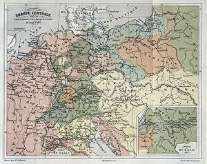
Background imageMaps Collection: Central Europe showing the historic sites and battlefields of 1792-1813 - Central Europe

Central Europe showing the historic sites and battlefields of 1792-1813 - Central Europe
XEE4154372 Central Europe showing the historic sites and battlefields of 1792-1813 - Central Europe indicating historic sites

Background imageMaps Collection: Drolatic map of Europe for 1870 (litho)

Drolatic map of Europe for 1870 (litho)
PCT4267732 Drolatic map of Europe for 1870 (litho) by Hadol, Paul (1835-1875); (add.info.: England, isolated, plague of rage and almost forgets about Ireland, which it holds on a leash)

Background imageMaps Collection: A View of the City of Vienna, the Capital of Germany (engraving)

A View of the City of Vienna, the Capital of Germany (engraving)
1092960 A View of the City of Vienna, the Capital of Germany (engraving) by English School, (18th century); Private Collection; (add.info.: A View of the City of Vienna)

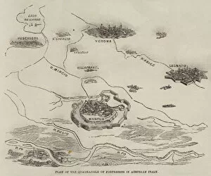
Background imageMaps Collection: Plan of the Quadrangle of Fortresses in Austrian Italy (engraving)

Plan of the Quadrangle of Fortresses in Austrian Italy (engraving)
1098060 Plan of the Quadrangle of Fortresses in Austrian Italy (engraving) by English School, (19th century); Private Collection; (add.info.: Plan of the Quadrangle of Fortresses in Austrian Italy)

Background imageMaps Collection: Map of the Siege of Mantua, published by William Blackwood and Sons, Edinburgh & London

Map of the Siege of Mantua, published by William Blackwood and Sons, Edinburgh & London
746934 Map of the Siege of Mantua, published by William Blackwood and Sons, Edinburgh & London, 1848 (hand-coloured engraving) by Johnston

Background imageMaps Collection: Map of the Battle of Aspern or Essling, published by William Blackwood and Sons

Map of the Battle of Aspern or Essling, published by William Blackwood and Sons
746902 Map of the Battle of Aspern or Essling, published by William Blackwood and Sons, Edinburgh & London, 1848 (hand-coloured engraving) by Johnston

Background imageMaps Collection: Map of the Battle of Hanau, published by William Blackwood and Sons, Edinburgh & London

Map of the Battle of Hanau, published by William Blackwood and Sons, Edinburgh & London
746884 Map of the Battle of Hanau, published by William Blackwood and Sons, Edinburgh & London, 1848 (hand-coloured engraving) by Johnston

Background imageMaps Collection: Map of the Battle of Stockach, published by William Blackwood and Sons

Map of the Battle of Stockach, published by William Blackwood and Sons
746926 Map of the Battle of Stockach, published by William Blackwood and Sons, Edinburgh & London, 1848 (hand-coloured engraving) by Johnston

Background imageMaps Collection: Map of the Battle of Hohenlinden, published by William Blackwood and Sons

Map of the Battle of Hohenlinden, published by William Blackwood and Sons
746919 Map of the Battle of Hohenlinden, published by William Blackwood and Sons, Edinburgh & London, 1848 (hand-coloured engraving) by Johnston

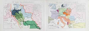
Background imageMaps Collection: PanGermanic and AntiGermanic plans for the division of Europe after the Great War of 1914

PanGermanic and AntiGermanic plans for the division of Europe after the Great War of 1914
CHT411553 PanGermanic and AntiGermanic plans for the division of Europe after the Great War of 1914, c.1917 (colour litho) by Czech School

Background imageMaps Collection: Family connections between European monarchs (litho)

Family connections between European monarchs (litho)
3094403 Family connections between European monarchs (litho) by French School, (20th century); Private Collection; (add.info.: Family connections between European monarchs)

Background imageMaps Collection: Map of Nuremberg, Ulm, and Saltzburg, from Civitates Orbis Terrarum

Map of Nuremberg, Ulm, and Saltzburg, from Civitates Orbis Terrarum
STC121026 Map of Nuremberg, Ulm, and Saltzburg, from Civitates Orbis Terrarum by Georg Braun (1541-1622) and Frans Hogenberg (1535-90), c.1572 (colour engraving) by Hoefnagel

Background imageMaps Collection: Plan of events at the Battle of Gunzburg between Austrian and French Troops in 1805

Plan of events at the Battle of Gunzburg between Austrian and French Troops in 1805
CHT217257 Plan of events at the Battle of Gunzburg between Austrian and French Troops in 1805, 1808 (colour litho) by French School

Background imageMaps Collection: Vienna, Austria (engraving, 1572-1617)

Vienna, Austria (engraving, 1572-1617)
LRI4716103 Vienna, Austria (engraving, 1572-1617) by Braun, Georg (1541-1622) and Hogenberg, Franz (1535-90); Private Collection; (add.info.: Vienna, Austria - Vienna Austria (Wien)

Background imageMaps Collection: Map of the roads leading to the main italian cities from all over Europe (Engraving

Map of the roads leading to the main italian cities from all over Europe (Engraving
LRI4713013 Map of the roads leading to the main italian cities from all over Europe (Engraving, 1717) by Nolin, Jean-Baptiste (c.1657-1708); Private Collection; (add.info)

Background imageMaps Collection: Italian advance, August 1917 (litho)

Italian advance, August 1917 (litho)
STC410975 Italian advance, August 1917 (litho) by English School, (20th century); Private Collection; The Stapleton Collection; English, out of copyright

Background imageMaps Collection: Caricature of the Congress of Vienna 1814-15 (colour litho)

Caricature of the Congress of Vienna 1814-15 (colour litho)
CHT211432 Caricature of the Congress of Vienna 1814-15 (colour litho) by Delaunois (fl.1815); Bibliotheque des Arts Decoratifs, Paris

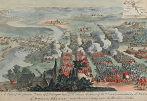
Background imageMaps Collection: A View of the Glorious Action of Dettingen, 16th-27th June 1743, engraved by I

A View of the Glorious Action of Dettingen, 16th-27th June 1743, engraved by I
NAM261106 A View of the Glorious Action of Dettingen, 16th-27th June 1743, engraved by I. Pano, published by Robert Wilkinson, London, 1743 (coloured engraving) by Daremberg, F

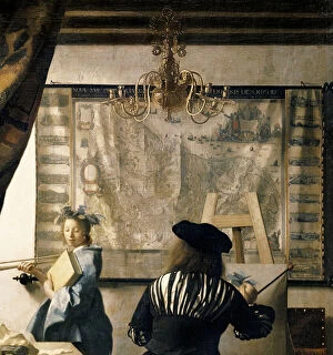
Background imageMaps Collection: The Artists Studio, c. 1665-66 (oil on canvas) (detail of 408)

The Artists Studio, c. 1665-66 (oil on canvas) (detail of 408)
BBC263564 The Artists Studio, c.1665-66 (oil on canvas) (detail of 408) by Vermeer, Jan (Johannes) (1632-75); 120x100 cm; Kunsthistorisches Museum, Vienna, Austria; (add.info.: Clio)


All Professionally Made to Order for Quick Shipping


-

Maps Collection

Austria is a landlocked country in Central Europe and is bordered by eight other countries and has a rich cultural heritage and stunning landscapes, making it a popular tourist destination. Austria covers an area of 83,879 square kilometres and has a population of 8.9 million people. The country is divided into nine states, each with its own unique culture and attractions. Maps of Austria Europe are essential for navigating the country's varied terrain, including its mountains, rivers, lakes, forests and cities. It also provide information on the major roads that connect the different regions as well as important landmarks such as castles and churches. In addition to physical maps of Austria Europe, there are also digital versions available online which can be used to plan trips or simply explore the region from home.
+

Our beautiful Wall Art and Photo Gifts include Framed Prints, Photo Prints, Poster Prints, Canvas Prints, Jigsaw Puzzles, Metal Prints and so much more

The Maps of Austria Europe collection from Media Storehouse is a stunning selection of wall art and framed prints that showcase the beauty and history of Austria. Our collection features a wide range of maps, including antique maps dating back to the 16th century, as well as modern-day maps highlighting key landmarks and cities. Each print in our collection is expertly crafted using high-quality materials to ensure longevity and durability. Whether you're looking for a unique piece to add to your home decor or an eye-catching gift for someone special, our collection has something for everyone. From intricate details depicting mountain ranges and rivers to vibrant colors showcasing cultural landmarks such as Vienna's Schönbrunn Palace or Salzburg's Hohensalzburg Fortress, these prints are sure to impress. The Maps of Austria Europe collection offers a beautiful way to explore the rich history and geography of this fascinating country.
+

What are Maps of Austria Europe art prints?

Maps of Austria Europe art prints are high-quality reproductions of antique and contemporary maps that depict the geography, topography, and landmarks of Austria. These prints are created using advanced printing technologies that ensure accurate color reproduction and sharpness. Maps of Austria Europe art prints are popular among collectors, historians, travelers, and anyone who appreciates the beauty and intricacy of cartography. They can be used to decorate homes, offices, libraries, museums or any other space where a touch of elegance is desired. These art prints come in various sizes and formats including framed or unframed options. The framed versions usually feature high-quality frames made from wood or metal that complement the artwork while protecting it from damage. Whether you're looking for a vintage map to add character to your living room or a modern one for your office wall, Maps of Austria Europe art prints offer an excellent way to showcase your love for this beautiful country.
+

What Maps of Austria Europe art prints can I buy from Media Storehouse?

We offer a wide range of Maps of Austria Europe art prints that are perfect for adding a touch of elegance and sophistication to any space. These maps showcase the beautiful landscapes, cities, and regions of Austria in stunning detail, making them ideal for anyone who loves this country or wants to learn more about it. Some popular options include vintage-style maps that feature intricate illustrations and detailed labeling, as well as modern designs that use bold colors and typography to create a contemporary look. You can choose from different sizes and formats such as canvas prints, framed prints or photographic prints depending on your preference. Whether you're looking for something classic or trendy, we have plenty of options available to suit your style. With their high-quality printing technology and attention to detail, these Maps of Austria Europe art prints are sure to impress anyone who sees them.
+

How do I buy Maps of Austria Europe art prints?

To buy Maps of Austria Europe art prints from Media Storehouse, you can browse through our extensive collection of maps and select the one that catches your eye. Once you have found the map you want to purchase, simply add it to your cart and proceed to checkout. You will be prompted to enter your shipping information and payment details. We offer a variety of sizes for their art prints, so make sure to choose the size that best fits your needs. We also offer different framing options if you would like to have your print framed before delivery. If you have any questions or concerns about purchasing a Maps of Austria Europe art print from Media Storehouse, they have a customer service team available to assist you. Simply reach out via email or phone and they will be happy to help guide you through the process.
+

How much do Maps of Austria Europe art prints cost?

We offer a wide range of Maps of Austria Europe art prints at various price points. The cost of these prints depends on several factors such as the size and type of print selected. We have options ranging from small to large sizes, with different finishes like canvas or framed prints. Our collection includes vintage maps, modern designs and artistic interpretations that cater to diverse tastes and preferences. Our you can choose from a variety of styles including colorful abstracts, black-and-white sketches or detailed topographical maps. We take pride in providing high-quality products that are affordable for our customers without compromising on quality. Our Maps of Austria Europe art prints are perfect for decorating homes or offices while also serving as educational tools. The cost of our Maps of Austria Europe art prints is reasonable and competitive within the market. We strive to provide excellent value for money while delivering exceptional customer service.
+

How will my Maps of Austria Europe art prints be delivered to me?

Your Maps of Austria Europe art prints will be delivered to you in a safe and secure manner. We take great care in packaging your order so that it arrives at your doorstep in pristine condition. Your art prints will be rolled up and placed inside a sturdy cardboard tube, which is then sealed with tape to prevent any damage during transit. We work with trusted delivery partners who ensure that your package is handled carefully throughout the journey from our warehouse to your address. You can track the progress of your delivery online using the tracking number provided once we dispatch your order. Upon receiving your Maps of Austria Europe art prints, we recommend unrolling them carefully and allowing them to rest flat for a few hours before framing or hanging them on display. This will help eliminate any curling or creases caused by being rolled up during shipping. You can expect a hassle-free delivery experience when ordering from Media Storehouse.