
Maps Collection
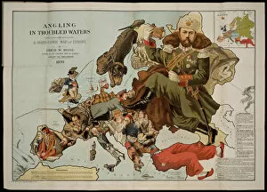
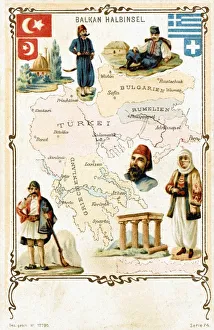
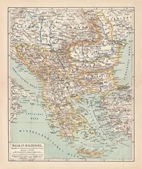
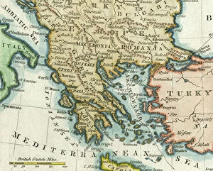
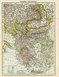
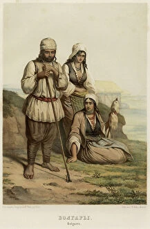
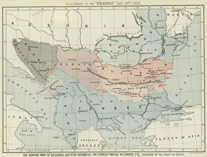
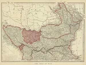
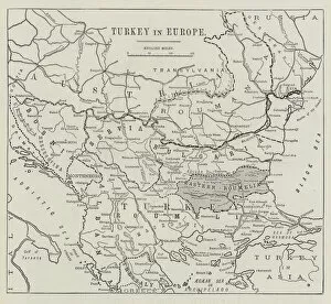
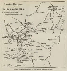
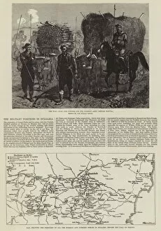
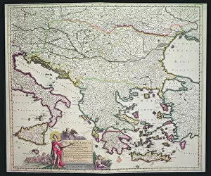
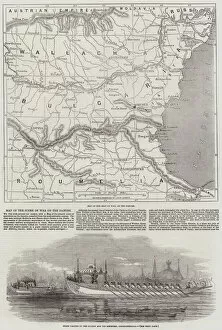
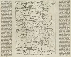
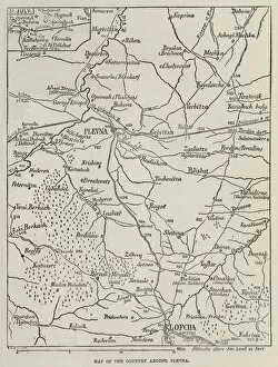
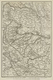
Bulgaria is a small country located in southeastern Europe, bordered by Romania to the north, Serbia and Macedonia to the west, Greece and Turkey to the south
Choose a picture from our Maps Collection for your Wall Art and Photo Gifts
70 items


All Professionally Made to Order for Quick Shipping
-
Maps Collection
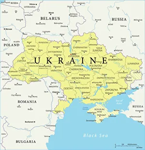
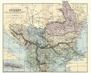
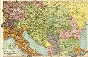
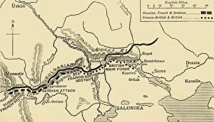
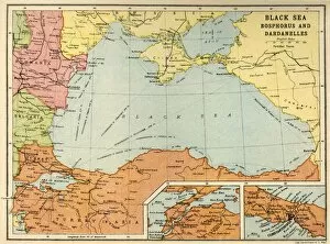
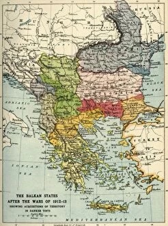
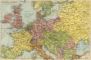
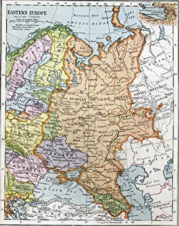
Bulgaria is a small country located in southeastern Europe, bordered by Romania to the north, Serbia and Macedonia to the west, Greece and Turkey to the south, and the Black Sea to the east. Bulgaria has a rich history dating back thousands of years. Maps of Bulgaria Europe provide an overview of its geography, showing its major cities and towns as well as its rivers, mountains and other features. they also show Bulgaria's borders with neighboring countries. In addition to physical features such as rivers and mountains, maps of Bulgaria Europe also include information about roads, airports and other transportation infrastructure and can essential for travelers who want to explore this fascinating country or plan their routes in advance.
+
Our beautiful pictures are available as Framed Prints, Photos, Wall Art and Photo Gifts
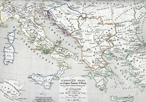
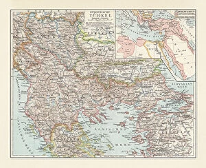
Media Storehouse offers a stunning collection of Maps of Bulgaria Europe wall art and framed prints. Our collection features an array of maps that showcase the country's rich history, geography, and culture. These maps are perfect for anyone who loves to explore new places or has an interest in Bulgarian heritage. The Maps of Bulgaria Europe collection includes vintage maps from different periods, including Ottoman times, as well as modern-day maps with detailed information about cities, regions, and landmarks. Each map is carefully curated to provide accurate information while also being aesthetically pleasing. These high-quality prints are available in various sizes and styles to suit any home decor style. They make great gifts for travelers or anyone interested in cartography or Bulgarian history. Our Maps of Bulgaria Europe collection is a must-see for those looking to add some unique and educational artwork to their walls.
+
What are Maps of Bulgaria Europe art prints?
Maps of Bulgaria Europe art prints are high-quality reproductions of maps depicting the country of Bulgaria and its surrounding regions. These prints showcase intricate details such as topography, cities, rivers, and other geographical features that make up the landscape of this beautiful country. They are perfect for anyone who is interested in Bulgarian history or geography. These art prints come in a variety of sizes and styles to suit any taste or decor. Whether you prefer a vintage-style map with an antique look or a more modern design with bold colors and clean lines, there is something for everyone. Maps of Bulgaria Europe art prints are not only decorative but also educational. They can be used to teach children about geography or to plan trips around the country. Additionally, they make great gifts for friends or family members who have an interest in travel or history. Maps of Bulgaria Europe art prints offer a unique way to appreciate the beauty and complexity of this fascinating region while adding style and sophistication to any space.
+
What Maps of Bulgaria Europe art prints can I buy from Media Storehouse?
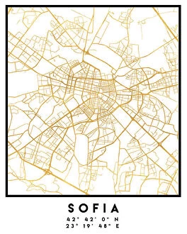
We offer a wide range of Maps of Bulgaria Europe art prints that you can purchase. These maps are perfect for those who want to explore the geography and history of Bulgaria, as well as its surrounding countries in Europe. You can choose from different styles and designs, including vintage maps, modern maps, topographic maps, and more. Some of the popular options include detailed city plans of Sofia or Plovdiv, historical maps dating back to the Ottoman Empire or Roman times, and colorful political or physical maps highlighting natural landmarks such as mountains or rivers. The prints come in various sizes and formats to suit your needs - from small posters to large canvas prints. Whether you're a traveler looking for inspiration for your next trip or an art lover seeking unique wall decor pieces with cultural significance, we have something for everyone interested in Bulgarian cartography.
+
How do I buy Maps of Bulgaria Europe art prints?
To buy Maps of Bulgaria Europe art prints from Media Storehouse, you can browse our extensive collection of maps and select the one that catches your eye. Once you have found the map you want to purchase, simply add it to your cart and proceed to checkout. You will be prompted to enter your shipping information and payment details. We offer a range of sizes for their art prints, so make sure to choose the size that best fits your needs. We also offer different framing options if you prefer a framed print. If you have any questions or concerns about purchasing Maps of Bulgaria Europe art prints from Media Storehouse, our customer service team is available to assist you. Simply reach out via email or phone and they will be happy to help answer any questions or resolve any issues that may arise during the buying process.
+
How much do Maps of Bulgaria Europe art prints cost?
We offer a range of Maps of Bulgaria Europe art prints at varying prices. Our collection includes both vintage and modern maps, with different sizes and finishes to choose from. The cost of the art prints depends on factors such as the size, finish, and type of paper used. We strive to provide our customers with high-quality products that are affordable without compromising on quality. Our Maps of Bulgaria Europe art prints make great additions to any home or office space. They can be used for educational purposes or simply as decorative pieces. Whether you're looking for a detailed map or a more artistic representation, we have something for everyone. We take pride in offering our customers a wide selection of artwork that is not only visually appealing but also meaningful and informative. Our Maps of Bulgaria Europe art prints are no exception - they showcase the beauty and diversity of this region while providing valuable information about its geography and history.
+
How will my Maps of Bulgaria Europe art prints be delivered to me?
Your Maps of Bulgaria Europe art prints will be delivered to you in a safe and secure manner. We use high-quality packaging materials to ensure that your artwork arrives at your doorstep in pristine condition. Our delivery partners are reliable and efficient, ensuring that your order is delivered promptly. We offer various shipping options depending on your location, so you can choose the one that best suits your needs. You can track the progress of your shipment online using our tracking system, which provides real-time updates on the status of your order. We take great pride in providing our customers with exceptional service and quality products. Whether you're purchasing art prints for personal or commercial use, we guarantee that you'll be satisfied with the final product. So sit back and relax while we take care of delivering your Maps of Bulgaria Europe art prints straight to your door.