
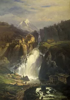
Maps Collection
The Czech Republic is a landlocked country located in Central Europe, and is bordered by Germany, Austria, Slovakia and Poland
Choose a picture from our Maps Collection for your Wall Art and Photo Gifts
117 items


All Professionally Made to Order for Quick Shipping
-
Maps Collection
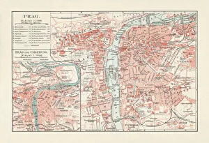
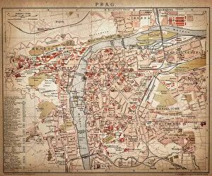
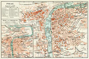
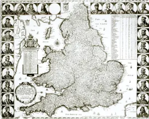
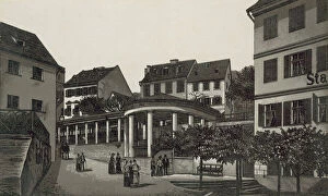
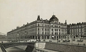
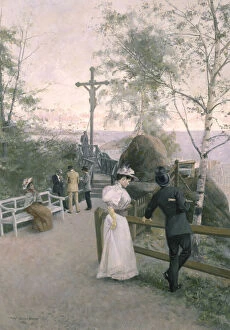
The Czech Republic is a landlocked country located in Central Europe, and is bordered by Germany, Austria, Slovakia and Poland. The country has a rich history and culture that can be explored through its many maps. Maps of the Czech Republic show its major cities, rivers, lakes, mountains and forests. They also show the country's road network and rail system as well as its national parks and protected areas. In addition to physical features, maps of the Czech Republic also provide information about its population density, political divisions and economic activity. With so much to explore in this small but fascinating country, maps of the Czech Republic are essential for travelers looking to get off the beaten path or just learn more about this unique corner of Europe.
+
Our beautiful pictures are available as Framed Prints, Photos, Wall Art and Photo Gifts
Media Storehouse offers a stunning collection of Maps of Czech Republic Europe, which includes a wide range of wall art and framed prints. Our collection features various maps that showcase the beautiful country of Czech Republic in detail. The maps are designed to provide an accurate representation of the geography and topography of the region, including its cities, towns, rivers, mountains, and other landmarks. The Maps of Czech Republic Europe collection is perfect for anyone who loves history or geography or wants to add some unique decor to their home or office space. These high-quality prints are available in different sizes and styles to suit every taste and budget. Whether you're looking for a vintage-style map or a modern interpretation, Media Storehouse has something for everyone. With its exceptional quality and attention to detail, our collection is sure to impress anyone who appreciates fine art and design. So why not explore this fantastic selection today?
+
What are Maps of Czech Republic Europe art prints?
Maps of Czech Republic Europe art prints are high-quality reproductions of maps that depict the geography and topography of the Czech Republic. These prints are designed to be visually appealing, with vibrant colors and intricate details that make them ideal for display in homes, offices, or other settings. These art prints can serve a variety of purposes. For example, they may be used as educational tools for students studying geography or history. They may also be used by travelers who want to better understand the layout of cities and regions within the Czech Republic. In addition to their practical uses, Maps of Czech Republic Europe art prints can also be appreciated for their aesthetic value. Many people enjoy displaying these prints simply because they find them beautiful or interesting. Maps of Czech Republic Europe art prints offer a unique way to explore and appreciate this fascinating country's landscape and culture.
+
What Maps of Czech Republic Europe art prints can I buy from Media Storehouse?
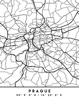
We offer a wide range of Maps of Czech Republic Europe art prints that you can purchase. These maps are available in different sizes and styles, including vintage, modern, and artistic designs. You can choose from various formats such as canvas prints, framed prints, or photographic prints to suit your preferences. Some popular options include detailed street maps of Prague or the entire country with landmarks and attractions marked out. There are also topographical maps showing mountain ranges and rivers for those interested in outdoor activities like hiking or kayaking. Additionally, we have political maps that illustrate the administrative regions within the Czech Republic as well as its neighboring countries. These would be ideal for students studying geography or history. Whether you're looking for practical navigation tools or decorative wall art pieces showcasing this beautiful European nation's landscape and culture – Media Storehouse has something to offer everyone.
+
How do I buy Maps of Czech Republic Europe art prints?
To purchase Maps of Czech Republic Europe art prints from Media Storehouse, you can browse our extensive collection online. We offer a wide range of maps in various styles and sizes to suit your preferences. Once you have found the map that you like, simply add it to your cart and proceed to checkout. During the checkout process, you will be prompted to provide your shipping information and payment details. We accept all major credit cards as well as PayPal for added convenience. Once your order has been processed, your Maps of Czech Republic Europe art print will be carefully packaged and shipped directly to your door. You can expect high-quality printing on premium paper stock that is sure to impress. Whether you are looking for a unique piece of wall art or a thoughtful gift for someone special, we have everything you need to bring the beauty of Czech Republic's maps into your home or office space.
+
How much do Maps of Czech Republic Europe art prints cost?
We offer a wide range of Maps of Czech Republic Europe art prints that vary in price depending on the size and type of print. Our collection includes vintage maps, modern maps, and artistic interpretations of the country's geography. We have options for every budget and taste, from affordable poster prints to high-quality canvas prints. Our Maps of Czech Republic Europe art prints are perfect for anyone who loves travel or has an interest in geography. They make great gifts for friends and family members who have visited or plan to visit the country. We take pride in offering top-quality products at competitive prices. All our art prints are made using premium materials to ensure they look stunning on your wall for years to come. Browse our selection today to find the perfect map print for your home or office.
+
How will my Maps of Czech Republic Europe art prints be delivered to me?
We take great care in ensuring that your Maps of Czech Republic Europe art prints are delivered to you safely and securely. We use high-quality packaging materials to protect your print during transit and ensure it arrives in pristine condition. Your art print will be carefully rolled up and placed inside a sturdy cardboard tube for shipping. This ensures that the print is protected from any damage or creases during transport. The tube will then be sealed with tape to prevent any moisture or dust from entering. Once your order has been dispatched, you will receive an email confirmation with tracking information so you can keep track of its progress until it arrives at your doorstep. We pride ourselves on providing excellent customer service, so if you have any questions about the delivery process or need assistance with anything else, please don't hesitate to contact us.