Fraud Blocker Skip to main content

Greetings Card > Europe > France > Maps

Maps Greetings Card Collection (page 6)

Discover the beauty of France and Europe with our exquisite Maps of France and Europe collection of Greetings Cards from Media Storehouse. Each card features intricately detailed, hand-drawn maps that showcase the stunning landscapes, historic sites, and cultural landmarks of these beloved regions. Perfect for expressing your thoughts and feelings, these cards are an ideal gift for travel enthusiasts, history buffs, or anyone who cherishes the charm of Europe. Send a piece of the continent right to their doorstep with our beautifully designed, blank-inside greetings cards.

Maps of France Europe are essential tools for travelers and tourists who want to explore the continent

11,159 Greetings Cards

Background imageMaps Greetings Card Collection: Vellum chart of Africa, India and the Mediterranean, 1554 (vellum)

Vellum chart of Africa, India and the Mediterranean, 1554 (vellum)
7339652 Vellum chart of Africa, India and the Mediterranean, 1554 (vellum) by Agnese, Battista (c.1500-64); 26x40 cm; National Maritime Museum, London

Background imageMaps Greetings Card Collection: A map of the British and French dominions in North America with the roads, distances

A map of the British and French dominions in North America with the roads, distances
7339367 A map of the British and French dominions in North America with the roads, distances, limits and extent of the settlements

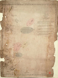
Background imageMaps Greetings Card Collection: A chart of the islands in the China Sea near the Straits of Malacca with the positions of

A chart of the islands in the China Sea near the Straits of Malacca with the positions of the English fleet
7339495 A chart of the islands in the China Sea near the Straits of Malacca with the positions of the English fleet and the squadron of Admiral Linois on the 14 & 15th February 1804

Background imageMaps Greetings Card Collection: Map of the southwest of Africa, 18th century, 1754 (coloured engraving)

Map of the southwest of Africa, 18th century, 1754 (coloured engraving)
7339407 Map of the southwest of Africa, 18th century, 1754 (coloured engraving) by French School, (18th century); 95x66 cm; National Maritime Museum, London

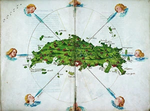
Background imageMaps Greetings Card Collection: Isolario, in verse, with coloured drawings and a chart of the eastern Mediterranean on vellum

Isolario, in verse, with coloured drawings and a chart of the eastern Mediterranean on vellum
7339139 Isolario, in verse, with coloured drawings and a chart of the eastern Mediterranean on vellum. c.1480 (drawing on vellum) by Sonetti

Background imageMaps Greetings Card Collection: Chart of the western Mediterrean showing the north African and Spanish coasts, and the Atlantic

Chart of the western Mediterrean showing the north African and Spanish coasts, and the Atlantic
7339123 Chart of the western Mediterrean showing the north African and Spanish coasts, and the Atlantic, 17th century (ink on vellum) by Unknown Artist

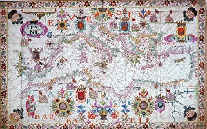
Background imageMaps Greetings Card Collection: Chart of the entire Mediterrean, 17th century (ink on vellum)

Chart of the entire Mediterrean, 17th century (ink on vellum)
7339120 Chart of the entire Mediterrean, 17th century (ink on vellum) by Unknown Artist, (17th century); 66.5x133.5 cm; National Maritime Museum, London

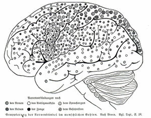
Background imageMaps Greetings Card Collection: Map of nerve bundles in the human brain by Paul Broca

Map of nerve bundles in the human brain by Paul Broca
5309460 Map of nerve bundles in the human brain by Paul Broca; (add.info.: Map of nerve bundles in the human brain by Paul Broca)

Background imageMaps Greetings Card Collection: Julius Caesar's camps at Nointel, Oise, France, 51 BC, showing the outer fortified enclosure

Julius Caesar's camps at Nointel, Oise, France, 51 BC, showing the outer fortified enclosure, headquarters camp
6867258 Julius Caesar's camps at Nointel, Oise, France, 51 BC, showing the outer fortified enclosure, headquarters camp, camps for troops and observation post

Background imageMaps Greetings Card Collection: Plan of Versailles, France in 1789. From Historical Atlas, published 1923 (print)

Plan of Versailles, France in 1789. From Historical Atlas, published 1923 (print)
2603518 Plan of Versailles, France in 1789. From Historical Atlas, published 1923 (print)

Background imageMaps Greetings Card Collection: Intensity of Suicide in France in each department, Period 1872-76 (colour litho)

Intensity of Suicide in France in each department, Period 1872-76 (colour litho)
8634280 Intensity of Suicide in France in each department, Period 1872-76 (colour litho) by English School, (19th century); Private Collection; (add.info)

Background imageMaps Greetings Card Collection: France, Norman to Tudor Period, illustrating the French and English Wars (colour litho)

France, Norman to Tudor Period, illustrating the French and English Wars (colour litho)
8652273 France, Norman to Tudor Period, illustrating the French and English Wars (colour litho) by English School, (19th century); Private Collection; (add.info.: France, Norman to Tudor Period)

Background imageMaps Greetings Card Collection: Map of the Suez Canal (litho)

Map of the Suez Canal (litho)
8663893 Map of the Suez Canal (litho) by German School, (20th century); Private Collection; (add.info.: Map of the Suez Canal, Egypt)

Background imageMaps Greetings Card Collection: Modern Turkey (litho)

Modern Turkey (litho)
8661150 Modern Turkey (litho) by English School, (20th century); Private Collection; (add.info.: Modern Turkey. The boundaries of the new Turkey were fixed by the Treaty of Lausanne, 1923)

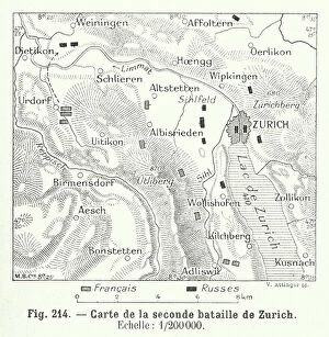
Background imageMaps Greetings Card Collection: Plan of the Battle of Second Battle of Zurich, Switzerland, 1798 (engraving)

Plan of the Battle of Second Battle of Zurich, Switzerland, 1798 (engraving)
8673028 Plan of the Battle of Second Battle of Zurich, Switzerland, 1798 (engraving) by Swiss School, (19th Century); Private Collection; (add.info.: Plan of the Battle of Second Battle of Zurich)

Background imageMaps Greetings Card Collection: Plan of the Battle of Morat, Switzerland, 1476 (engraving)

Plan of the Battle of Morat, Switzerland, 1476 (engraving)
8673006 Plan of the Battle of Morat, Switzerland, 1476 (engraving) by Swiss School, (19th Century); Private Collection; (add.info.: Plan of the Battle of Morat, Switzerland, Burgundian Wars, 1476)

Background imageMaps Greetings Card Collection: Map of Cherbourg, France (engraving)

Map of Cherbourg, France (engraving)
8676462 Map of Cherbourg, France (engraving) by English School, (19th century); Private Collection; (add.info.: Map of Cherbourg, France, showing the harbour, docks and fortifications)

Background imageMaps Greetings Card Collection: L'Atlas des Vins de France: Commune de Pomerol (b/w photo)

L'Atlas des Vins de France: Commune de Pomerol (b/w photo)
8675207 L'Atlas des Vins de France: Commune de Pomerol (b/w photo) by French Photographer, (20th century); Private Collection; (add.info.: Commune de Pomerol)

Background imageMaps Greetings Card Collection: Geography map: representation of the meridional part of South America (Argentina, Chile)

Geography map: representation of the meridional part of South America (Argentina, Chile)
VEN5030237 Geography map: representation of the meridional part of South America (Argentina, Chile, Falkland Islands) from the Atlas " Amerique meridionale" by French cartographer

Background imageMaps Greetings Card Collection: Map of Fort Ticonderoga near Lake Champlain in 1759 at the time of the French War against

Map of Fort Ticonderoga near Lake Champlain in 1759 at the time of the French War against the Indians
NWI4836012 Map of Fort Ticonderoga near Lake Champlain in 1759 at the time of the French War against the Indians. Colourful engraving of the 19th century.; (add.info)

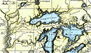
Background imageMaps Greetings Card Collection: French map of the Great Lakes (Upper Lake, Lake Huron, Lake Illinois)

French map of the Great Lakes (Upper Lake, Lake Huron, Lake Illinois) and Northern Mississippi at the border between
NWI4852510 French map of the Great Lakes (Upper Lake, Lake Huron, Lake Illinois) and Northern Mississippi at the border between Canada and the United States around 1700

Background imageMaps Greetings Card Collection: Universal Geography: French department of the Hautes Pyrenees (65)

Universal Geography: French department of the Hautes Pyrenees (65). Advertising images edited for the brand Louit
DUV4218058 Universal Geography: French department of the Hautes Pyrenees (65). Advertising images edited for the brand Louit. Debut 20th century. (lithograph); 9.5x6.5 cm; Photo © Duvallon

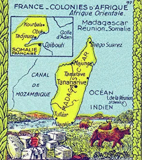
Background imageMaps Greetings Card Collection: Universal Geography: French colonies of East Africa (Madagascar, Reunion, Somalia)

Universal Geography: French colonies of East Africa (Madagascar, Reunion, Somalia), beg of 20th century (lithograph)
DUV4218009 Universal Geography: French colonies of East Africa (Madagascar, Reunion, Somalia), beg of 20th century (lithograph); 9.5x6.5 cm; (add.info)

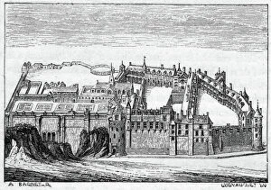
Background imageMaps Greetings Card Collection: Chateau de la Loire: Amboise, at the gates of Touraine. Engraving by A

Chateau de la Loire: Amboise, at the gates of Touraine. Engraving by A. Racinet in the book "Les residences
PCT4264115 Chateau de la Loire: Amboise, at the gates of Touraine. Engraving by A. Racinet in the book "Les residences royales de la Loire" by Jules Loiseleur

Background imageMaps Greetings Card Collection: Universal Geography: French Department of Morbihan (56). Advertising images edited for the brand

Universal Geography: French Department of Morbihan (56). Advertising images edited for the brand Louit
DUV4218079 Universal Geography: French Department of Morbihan (56). Advertising images edited for the brand Louit. Debut 20th century. (lithograph); 9.5x6.5 cm; Photo © Duvallon

Background imageMaps Greetings Card Collection: Universal Geography: French Department of Puy de Dome (63). Advertising images edited for

Universal Geography: French Department of Puy de Dome (63). Advertising images edited for the brand Louit
DUV4218061 Universal Geography: French Department of Puy de Dome (63). Advertising images edited for the brand Louit. Debut 20th century. (lithograph); 9.5x6.5 cm; Photo © Duvallon

Background imageMaps Greetings Card Collection: L'Indiscret, Satirique en N & B, 1903_6_10: Marianne, Delcasse Theophile (1852-1923)

L'Indiscret, Satirique en N & B, 1903_6_10: Marianne, Delcasse Theophile (1852-1923)
ICA4942319 L'Indiscret, Satirique en N & B, 1903_6_10: Marianne, Delcasse Theophile (1852-1923), Andre Louis (1891-1978) Illustration by Okun; (add.info.: L'Indiscret, Satirique en N & B)

Background imageMaps Greetings Card Collection: History of kings. Map of Europe under King Charlemagne (742-814) between 768 and 814

History of kings. Map of Europe under King Charlemagne (742-814) between 768 and 814
NWI4943751 History of kings. Map of Europe under King Charlemagne (742-814) between 768 and 814. Color lithograph of the 19th century.; (add.info.: History of kings)

Background imageMaps Greetings Card Collection: Map of France at the times of king Louis IX (Map of France at the times of king Louis IX)

Map of France at the times of king Louis IX (Map of France at the times of king Louis IX)
ELD4930429 Map of France at the times of king Louis IX (Map of France at the times of king Louis IX) Plate from "Atlas Universel" by Houze

Background imageMaps Greetings Card Collection: Map of the frankish kingdom on Chlothar I's death (561) Engraving from ' Atlas Universel' by Houze

Map of the frankish kingdom on Chlothar I's death (561) Engraving from " Atlas Universel" by Houze 1851
ELD4921543 Map of the frankish kingdom on Chlothar I's death (561) Engraving from " Atlas Universel" by Houze 1851 Private collection; (add.info)

Background imageMaps Greetings Card Collection: Ancient History: Map of the Battle of Cannes (Italy, Canne della Battaglia)

Ancient History: Map of the Battle of Cannes (Italy, Canne della Battaglia)
NWI4860053 Ancient History: Map of the Battle of Cannes (Italy, Canne della Battaglia) between Hannibal and the Romans during the Second Punic War, 216 BC

Background imageMaps Greetings Card Collection: Color map of the city of Marseille by Joseph de Razaud (Rasaud) (1685-1754)

Color map of the city of Marseille by Joseph de Razaud (Rasaud) (1685-1754) Dim 97x61 cm Musee du Vieux Marseille
JEB4867620 Color map of the city of Marseille by Joseph de Razaud (Rasaud) (1685-1754) Dim 97x61 cm Musee du Vieux Marseille; Musee du Vieux-Marseille, Marseille

Background imageMaps Greetings Card Collection: Architecture: cross section and plan of the Church of St. Michael of Entraigues

Architecture: cross section and plan of the Church of St. Michael of Entraigues, founded in the 12th century
JEB4864650 Architecture: cross section and plan of the Church of St. Michael of Entraigues, founded in the 12th century. 19th century board

Background imageMaps Greetings Card Collection: The establishment of the French colony of Samuel de Champlain (1567-1635) at Quebec, on the St

The establishment of the French colony of Samuel de Champlain (1567-1635) at Quebec, on the St
NWI4849596 The establishment of the French colony of Samuel de Champlain (1567-1635) at Quebec, on the St. Lawrence River, New France (Canada), in 1613

Background imageMaps Greetings Card Collection: Map of New France showing the coasts of Canada and the Gulf of St

Map of New France showing the coasts of Canada and the Gulf of St. Lawrence around 1550 (Map of New France, 1550)
NWI4901669 Map of New France showing the coasts of Canada and the Gulf of St. Lawrence around 1550 (Map of New France, 1550, showing coast of Canada and the St)

Background imageMaps Greetings Card Collection: Siege of Cazal in 1630 - City map and citadel of Cazal (Casale) - Engraving of the 17th century

Siege of Cazal in 1630 - City map and citadel of Cazal (Casale) - Engraving of the 17th century
XEE5027215 Siege of Cazal in 1630 - City map and citadel of Cazal (Casale) - Engraving of the 17th century; (add.info.: Siege of Cazal in 1630 - City map and citadel of Cazal (Casale)

Background imageMaps Greetings Card Collection: Fort in Canada: View of Fort Frontenac on Lake Ontario built in the 17th century by the French in

Fort in Canada: View of Fort Frontenac on Lake Ontario built in the 17th century by the French in New France
NWI4902686 Fort in Canada: View of Fort Frontenac on Lake Ontario built in the 17th century by the French in New France (now Kingston, Canada). Engraving

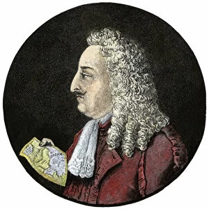
Background imageMaps Greetings Card Collection: Portrait of Robert Cavelier de La Salle (1643 - 1687)

Portrait of Robert Cavelier de La Salle (1643 - 1687)
NWI4904036 Portrait of Robert Cavelier de La Salle (1643 - 1687).; (add.info.: Portrait of Robert Cavelier de La Salle (1643 - 1687).); Photo © North Wind Pictures

Background imageMaps Greetings Card Collection: Illustration of the book by Leo Taxil and J. Vindex 'Marat ou les heros de la revolution'

Illustration of the book by Leo Taxil and J. Vindex "Marat ou les heros de la revolution"
PCT4285584 Illustration of the book by Leo Taxil and J. Vindex "Marat ou les heros de la revolution", Librairie anti-clerical (anti-clerical, anticlerical) 1883 - Revolution Francaise

Background imageMaps Greetings Card Collection: Map of the 19th century (circa 1850) of the Tarn and Garonne (46, Region Midi Pyrenees)

Map of the 19th century (circa 1850) of the Tarn and Garonne (46, Region Midi Pyrenees)
PCT4267869 Map of the 19th century (circa 1850) of the Tarn and Garonne (46, Region Midi Pyrenees). Map of the Illustrious National Atlas of Lavasseur showing, framing Saint George

Background imageMaps Greetings Card Collection: First World War: Patriotic Map showing a bouquet of lily valley in a tricolor ribbon, 1916

First World War: Patriotic Map showing a bouquet of lily valley in a tricolor ribbon, 1916, I bring happiness
LUX4744996 First World War: Patriotic Map showing a bouquet of lily valley in a tricolor ribbon, 1916, I bring happiness'; (add.info.: World War I - War 14-18 (1914-1918) - World War I (WWI or WW1)

Background imageMaps Greetings Card Collection: First World War: Patriotic Map of France Inducing French Soldiers to Charge Sword in the Clear, 1915

First World War: Patriotic Map of France Inducing French Soldiers to Charge Sword in the Clear, 1915
LUX4744882 First World War: Patriotic Map of France Inducing French Soldiers to Charge Sword in the Clear, 1915; (add.info.: First World War - War 14-18 (1914-1918) - World War I (WWI or WW1)

Background imageMaps Greetings Card Collection: First World War: Patriotic map showing the cathedral of Metz with a Lorraine cross

First World War: Patriotic map showing the cathedral of Metz with a Lorraine cross
LUX4744755 First World War: Patriotic map showing the cathedral of Metz with a Lorraine cross and a young woman in a medallion in traditional dress and surrounded by tricolor flower

Background imageMaps Greetings Card Collection: First World War: Patriotic map showing a young woman at the door of a bourgeois house hosting a

First World War: Patriotic map showing a young woman at the door of a bourgeois house hosting a soldier in uniform
LUX4745145 First World War: Patriotic map showing a young woman at the door of a bourgeois house hosting a soldier in uniform and declaring to her

Background imageMaps Greetings Card Collection: First World War: Patriotic map showing a vendean wearing a tricolor flag with a heart of Jesus is

First World War: Patriotic map showing a vendean wearing a tricolor flag with a heart of Jesus is with inscribed Heart
LUX4744498 First World War: Patriotic map showing a vendean wearing a tricolor flag with a heart of Jesus is with inscribed Heart of Jesus saves France

Background imageMaps Greetings Card Collection: First World War: France, Patriotic Map showing a soldier in uniform returning to his fiancee

First World War: France, Patriotic Map showing a soldier in uniform returning to his fiancee surrounded by flower, 1915
LUX4741266 First World War: France, Patriotic Map showing a soldier in uniform returning to his fiancee surrounded by flower

Background imageMaps Greetings Card Collection: First World War: France, Patriotic Map showing a caricature of an ugly and fat German woman, 1916

First World War: France, Patriotic Map showing a caricature of an ugly and fat German woman, 1916
LUX4741828 First World War: France, Patriotic Map showing a caricature of an ugly and fat German woman, 1916, Map titled: Berlin elegance; (add.info)

Background imageMaps Greetings Card Collection: First World War: France, Patriotic Map showing a sailor regaining his fiancee during a leave, 1918

First World War: France, Patriotic Map showing a sailor regaining his fiancee during a leave, 1918
LUX4741805 First World War: France, Patriotic Map showing a sailor regaining his fiancee during a leave, 1918; (add.info.: World War I - War 14-18 (1914-1918) - World War I (WWI or WW1): France


All Professionally Made to Order for Quick Shipping


-

Maps Greetings Card Collection

Maps of France Europe are essential tools for travelers and tourists who want to explore the continent. They provide an overview of the country, its major cities, and its attractions and are show roads, rivers, mountains, lakes, and other natural features that make up the landscape. Additionally, they often include information about local customs and culture as well as points of interest such as museums or monuments, and are be found in bookstores or online in various formats including paper maps or digital versions that can be accessed on mobile devices. With a map of France Europe in hand travelers will have no trouble navigating their way around this beautiful country.
+

Our beautiful Wall Art and Photo Gifts include Framed Prints, Photo Prints, Poster Prints, Canvas Prints, Jigsaw Puzzles, Metal Prints and so much more

The Maps of France Europe collection is a stunning assortment of wall art and framed prints that showcase the beauty and diversity of France. Our collection features an extensive range of maps, including antique maps dating back to the 16th century, as well as modern-day maps highlighting the country's cities, regions, and landmarks. Each print in our collection has been carefully curated by Media Storehouse to provide customers with a unique glimpse into French history and culture. From detailed depictions of Parisian streets to panoramic views of the Alps, these prints are sure to captivate anyone who loves France or European geography. Whether you're looking for a beautiful piece of artwork for your home or office or want to give someone special a thoughtful gift, Maps of France Europe offers something for everyone. With its high-quality printing techniques and durable framing options, our collection is sure to impress even the most discerning art enthusiasts.
+

What are Maps of France Europe art prints?

Maps of France Europe art prints are high-quality reproductions of vintage and contemporary maps showcasing the geography, topography, and landmarks of France and its neighboring European countries. These prints are perfect for those who love history, travel, or simply appreciate the beauty of cartography. The collection includes a wide range of styles, from antique maps dating back to the 16th century to modern designs featuring vibrant colors and intricate details. Some prints focus on specific regions or cities within France or Europe while others provide an overview of the entire continent. These art prints can be used to decorate any room in your home or office, adding a touch of sophistication and elegance to your space. They also make great gifts for anyone with an interest in geography or history. Whether you're looking for a unique piece to add to your personal collection or want to give someone special a thoughtful gift they'll treasure forever, Maps of France Europe art prints from Media Storehouse are sure to impress.
+

What Maps of France Europe art prints can I buy from Media Storehouse?

We offer a wide range of Maps of France Europe art prints that are perfect for those who love to travel or have an interest in geography. These maps come in various styles and designs, including vintage, antique, and modern versions. You can choose from different sizes and formats such as canvas prints, framed prints, posters or photographic prints. Some popular options include the Antique Map of France by John Speed which dates back to 1626; the Vintage Map of Paris which showcases the city's famous landmarks; and the Modern Map of Europe which highlights all major cities across the continent. Whether you're looking for a decorative piece for your home or office space or want to gift it to someone who loves history or geography- Media Storehouse has got you covered with their vast collection of Maps of France Europe art prints.
+

How do I buy Maps of France Europe art prints?

To buy Maps of France Europe art prints from Media Storehouse, you can browse through our extensive collection of maps and select the ones that interest you. Once you have made your selection, add them to your cart and proceed to checkout. You will be prompted to enter your shipping and payment information before completing the purchase. We offer a variety of sizes for their art prints, so make sure to choose the one that best fits your needs. The maps are printed on high-quality paper using state-of-the-art printing technology, ensuring that they look great in any setting. If you have any questions or concerns about purchasing Maps of France Europe art prints from Media Storehouse, our customer service team is available to assist you. They can provide additional information about the products or help with any issues that may arise during the ordering process.
+

How much do Maps of France Europe art prints cost?

We offer a wide range of Maps of France Europe art prints at varying prices. The cost of these prints depends on several factors such as the size, quality, and type of print you choose. Our standard paper prints are more affordable than our premium canvas or framed options. Additionally, some maps may be more intricate and detailed than others which can also impact the price. We strive to provide high-quality products at reasonable prices for all customers. Our Maps of France Europe art prints make great additions to any home or office decor and are perfect for history buffs or those who love travel. With a variety of sizes and styles available, there is something for everyone's taste and budget. We encourage customers to browse our selection online to find the perfect map print that fits their needs and preferences without breaking the bank.
+

How will my Maps of France Europe art prints be delivered to me?

We take great care in delivering your Maps of France Europe art prints to you. We use high-quality packaging materials to ensure that your artwork arrives in pristine condition. Your print will be carefully rolled and placed inside a sturdy tube for protection during transit. We work with trusted shipping partners who offer reliable delivery services. Once your order has been dispatched, you will receive an email notification with tracking information so that you can monitor the progress of your shipment. Our team is dedicated to providing excellent customer service, and we are always available to answer any questions or concerns you may have about the delivery process. If there are any issues with your order upon arrival, please contact us immediately so that we can resolve them as quickly as possible. You can trust Media Storehouse to deliver your Maps of France Europe art prints safely and efficiently straight to your doorstep.