Fraud Blocker Skip to main content

Jigsaw Puzzle > Europe > France > Maps

Maps Jigsaw Puzzle Collection

Discover the beauty and rich history of France and Europe with our Maps of France, Europe jigsaw puzzles from Media Storehouse. Each puzzle features intricately detailed and accurate maps, perfect for puzzle enthusiasts and geography lovers alike. Explore the winding roads of Provence, the majestic Alps, or the vibrant cities of Paris and Rome. These high-quality puzzles come with 500-1000 pieces, providing hours of engaging and enjoyable assembly. Bring a piece of Europe into your home and ignite your sense of adventure with our Maps of France, Europe jigsaw puzzles.

Maps of France Europe are essential tools for travelers and tourists who want to explore the continent

Choose a picture from our Maps Jigsaw Puzzle Collection for your Wall Art and Photo Gifts

11,167 Jigsaw Puzzles

Background imageMaps Jigsaw Puzzle Collection: France country map

France country map
2011 edition

Background imageMaps Jigsaw Puzzle Collection: France Administrative Political Map

France Administrative Political Map
A detailed Administrative map of France showing the political administrative divisions of the country. Each Departement is coloured individually

Background imageMaps Jigsaw Puzzle Collection: D-DAY MAP 1944

D-DAY MAP 1944
Plan 1C - Operation Neptune, an elaborate map detailing the proposed D-Day Normandy assault landings by Allied troops on the French beaches. Date: June 1944

Background imageMaps Jigsaw Puzzle Collection: Reference Map of Spain

Reference Map of Spain
The Spain Map shows that Spain is situated in south-western Europe. Spain is bordered by Mediterranean Sea, Gibraltar, France, Andorra, Bay of Biscay, Atlantic Ocean and Portugal

Background imageMaps Jigsaw Puzzle Collection: Map of France - Vector

Map of France - Vector illustration

Background imageMaps Jigsaw Puzzle Collection: Daily Mail War Map, WW1

Daily Mail War Map, WW1
A fold out war map issued by the Daily Mail in the early weeks of the First World War. The map offers statistics regarding the manpower strength of each of the warring nations

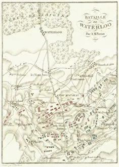
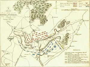
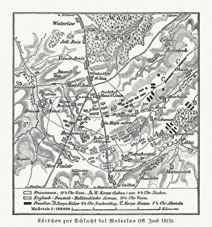
Background imageMaps Jigsaw Puzzle Collection: Map of the Battle of Waterloo, 18th June 1815 (19th century)

Map of the Battle of Waterloo, 18th June 1815 (19th century). Battle plan showing the positions of the British and French armies at the outset of the battle

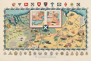
Background imageMaps Jigsaw Puzzle Collection: WW2 poster, activities of 52 (Lowland) Division

WW2 poster, activities of 52 (Lowland) Division
Screen-print poster, published circa 1950, showing the activities of the 52nd Lowland Division during the Second World War, with a map of Northern Europe, and unit badges along the top and bottom

Background imageMaps Jigsaw Puzzle Collection: Battle Of Waterloo

Battle Of Waterloo
A plan of the Battle of Waterloo in present-day Belgium during the Napoleonic Wars, 18th June 1815. Here an Anglo-Allied army under the command of the Duke of Wellington defeated the Imperial French

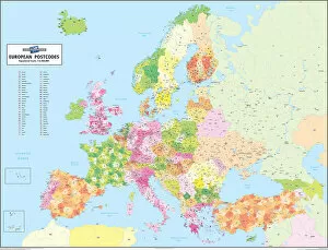
Background imageMaps Jigsaw Puzzle Collection: European Postcode Map

European Postcode Map
This colour European Postcode business map covers all of Europe from Norway in the north to Crete in the south and from Portugal in the west through to Azerbaijan in the east

Background imageMaps Jigsaw Puzzle Collection: Europe Map with France, Portugal, Spain and Netherlands

Europe Map with France, Portugal, Spain and Netherlands
Europe Map. Vector Illustration with France, Portugal, Spain and Netherlands

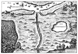
Background imageMaps Jigsaw Puzzle Collection: Carte du Tendre: imaginary map by a character in the novel Cl├®lie

Carte du Tendre: imaginary map by a character in the novel Cl├®lie
Madeleine de Scudery, often known simply as Mademoiselle de Scudery, was a French writer. Illustration of a Carte du Tendre

Background imageMaps Jigsaw Puzzle Collection: MAP OF FRANCE, c1900. With inset detail of Paris and surrounding area

MAP OF FRANCE, c1900. With inset detail of Paris and surrounding area

Background imageMaps Jigsaw Puzzle Collection: Street Map 1878

Street Map 1878
An aerial map of Paris, showing the important monuments and the Seine

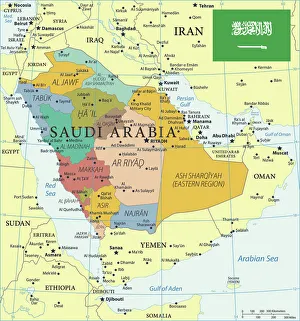
Background imageMaps Jigsaw Puzzle Collection: Map of Saudi Arabia with Flag

Map of Saudi Arabia with Flag
The map shows Saudi Arabia, officially the Kingdom of Saudi Arabia, a desert country in southwestern Asia (Middle East) that occupies most of the Arabian Peninsula

Background imageMaps Jigsaw Puzzle Collection: Battle Of Waterloo

Battle Of Waterloo
A plan of the Battle of Waterloo in present-day Belgium during the Napoleonic Wars, 18th June 1815. Here an Anglo-Allied army under the command of the Duke of Wellington defeated the Imperial French

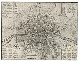
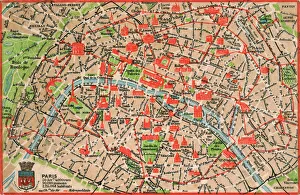
Background imageMaps Jigsaw Puzzle Collection: Map / Paris 18C

Map / Paris 18C
Detailed map of Paris, showing the many churches

Background imageMaps Jigsaw Puzzle Collection: Jersey Airways Poster

Jersey Airways Poster
Poster, Jersey Airways Ltd, Regular Daily Services, Multi-Engined Air-Liners. Showing a De Havilland biplane with a map below. 20th century

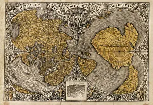
Background imageMaps Jigsaw Puzzle Collection: Oronce Fines world map, 1531

Oronce Fines world map, 1531
Oronce Fines world map. Map of the worlds northern and southern hemispheres by the French mathematician and cartographer Oronce Fine (1494-1555)

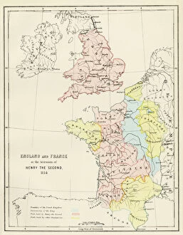
Background imageMaps Jigsaw Puzzle Collection: Map of England and France, 1154

Map of England and France, 1154
England and France at the accession of Henry II, 1154. Color lithograph reproduction of a 19th-century illustration

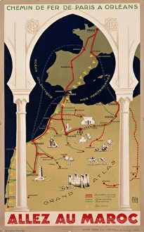
Background imageMaps Jigsaw Puzzle Collection: Poster for French railways to Morocco

Poster for French railways to Morocco
Poster advertising French railways to Morocco, via Paris, Bordeaux, Toulouse and Madrid, to Tangier, Casablanca, Marrakech, and other exotic places

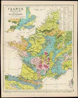
Background imageMaps Jigsaw Puzzle Collection: Map / France / Belgium / Nethe

Map / France / Belgium / Nethe
Map of France, Belgium and the Netherlands

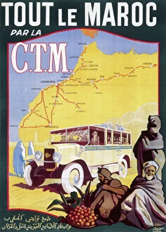
Background imageMaps Jigsaw Puzzle Collection: Poster for French railways to Morocco

Poster for French railways to Morocco
Poster for French railways, serving Tangier, Casablanca, Marrakech and other exotic locations

Background imageMaps Jigsaw Puzzle Collection: Map of the Battle of Waterloo, Belgium, 18 June 1815

Map of the Battle of Waterloo, Belgium, 18 June 1815
Topographic map of the Battle of Waterloo, Belgium. The defeat of the French army under the command of Napoleon Bonaparte on 18 June 1815 marked the end of the Napoleonic Wars

Background imageMaps Jigsaw Puzzle Collection: Le pave de Chailly 1865 (Oil on Canvas)

Le pave de Chailly 1865 (Oil on Canvas)
7212095 Le pave de Chailly 1865 (Oil on Canvas) by Monet, Claude (1840-1926); Musee d Orsay, Paris, France; (add.info.: Le pave de Chailly 1865. Oil on Canvas)

Background imageMaps Jigsaw Puzzle Collection: Map of Paris in 1908 with geographic and demographical data

Map of Paris in 1908 with geographic and demographical data
Map of Paris in 1908 with geographic and demographic data featured (as well as the location of all of the major sites in the city centre). Date: 1908

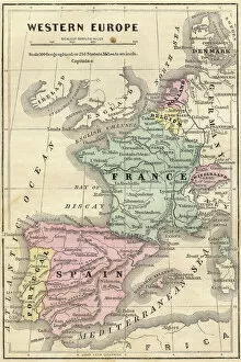
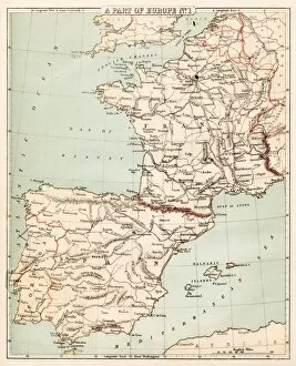
Background imageMaps Jigsaw Puzzle Collection: France Spain Portugal map 1856

France Spain Portugal map 1856
Colton and Fitchs Modern School Geography by George W. Fitch - New York 1856

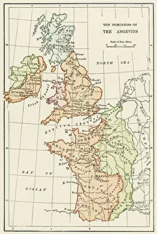
Background imageMaps Jigsaw Puzzle Collection: Angevin kings holdings in France and Britain

Angevin kings holdings in France and Britain
British Isles and France under the Angevins, 1100s-1400s. Color lithograph reproduction of a 19th-century illustration

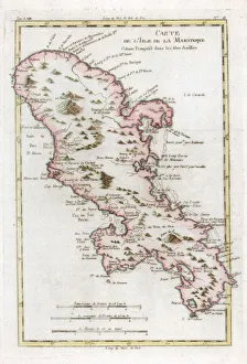
Background imageMaps Jigsaw Puzzle Collection: Map of the Caribbean island of Martinique, c1783

Map of the Caribbean island of Martinique, c1783

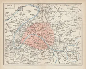
Background imageMaps Jigsaw Puzzle Collection: City map of Paris, lithograph, published in 1877

City map of Paris, lithograph, published in 1877
City map of Paris, France. Lithograph, published in 1877

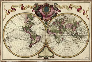
Background imageMaps Jigsaw Puzzle Collection: Map of the world, 1720

Map of the world, 1720
(Original Caption) 18th century map of the world. Published in Paris in 1720, this French map shows the known world, including the new lands that had been discovered in the preceding centuries by

Background imageMaps Jigsaw Puzzle Collection: Map of Spain and France 1869

Map of Spain and France 1869
Cornells Grammars-School Geography - S.S. Cornell - New York D. Appleton and Company 1869

Background imageMaps Jigsaw Puzzle Collection: Map of Ancient Gaul (France)

Map of Ancient Gaul (France)
Vintage engraving of a Map of Ancient Gaul (France)

Background imageMaps Jigsaw Puzzle Collection: City map of Paris

City map of Paris
Antique illustration of a City map of Paris

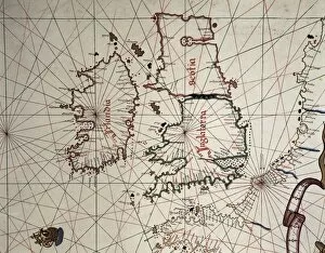
Background imageMaps Jigsaw Puzzle Collection: Spanish map of England, Scotland and Ireland

Spanish map of England, Scotland and Ireland
A Spanish map of England, Scotland and Ireland and the coast of northern France from the time of the Anglo Spanish War. Joan Martines (1556-1591). Date: 1587

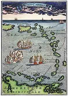
Background imageMaps Jigsaw Puzzle Collection: CARIBBEAN MAP. A map of the Caribbean islands: woodcut, French, c. 1688

CARIBBEAN MAP. A map of the Caribbean islands: woodcut, French, c. 1688

Background imageMaps Jigsaw Puzzle Collection: PROY2A-00017

PROY2A-00017
Map of Europe in the time of Charlemagne, 768-814 AD. Printed color lithograph, 19th century

Background imageMaps Jigsaw Puzzle Collection: Hudsons Bay Map

Hudsons Bay Map
HUDSONs BAY, at the time of the Seven Years War, showing French and English forts including Fort York, the principal settlement of the Hudsons Bay Company

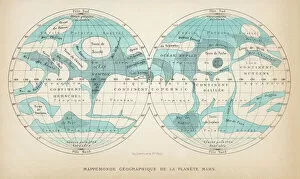
Background imageMaps Jigsaw Puzzle Collection: French map of the planet Mars

French map of the planet Mars
A French map of the planet Mars, showing two views

Background imageMaps Jigsaw Puzzle Collection: ABC OF BABAR O, 1939 (illustration)

ABC OF BABAR O, 1939 (illustration)
7206800 ABC OF BABAR O, 1939 (illustration) by Brunhoff, Jean de (1899-1937); 22x16, 5 cm; Private Collection; (add.info.: O: 7 words to find: oranges, orange trees, olive trees, umbrellas, bears)

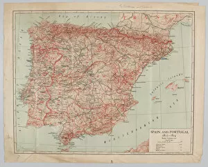
Background imageMaps Jigsaw Puzzle Collection: Map - Spain and Portugal, 1807-1814

Map - Spain and Portugal, 1807-1814
Spain and Portugal, 1807-1814. From a collection of maps relevant to campaigns between 1794-1815. From the collection of the former Buffs Regimental Museum

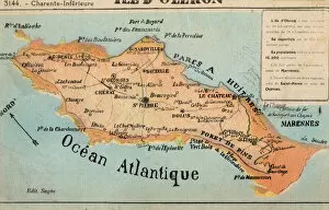
Background imageMaps Jigsaw Puzzle Collection: Ile d Oleron - off the French Atlantic Coast

Ile d Oleron - off the French Atlantic Coast
Ile d Oleron - an island off the Atlantic coast of France, on the southern side of the Pertuis d Antioche strait. It is the second largest island of Metropolitan France, after Corsica

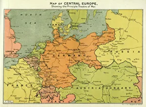
Background imageMaps Jigsaw Puzzle Collection: Map of Central Europe, World War One

Map of Central Europe, World War One
Map of Central Europe in World War One, showing the Principal Theatre of War. Date: World War One

Background imageMaps Jigsaw Puzzle Collection: Europe map 1867

Europe map 1867
Mitchellas Modern Atlas - Published by E.H. Butler and Co - Philadelphia 1867

Background imageMaps Jigsaw Puzzle Collection: Caribbean map

Caribbean map
Antique map of Cuba, Jamaica, Puerto Rico

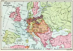
Background imageMaps Jigsaw Puzzle Collection: Map of Europe after the Peace of Tilsit in 1807, from A Short History of the

Map of Europe after the Peace of Tilsit in 1807, from A Short History of the
KW392529 Map of Europe after the Peace of Tilsit in 1807, from A Short History of the English People by J. R. Green, published 1893 (colour litho) by English School

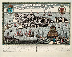
Background imageMaps Jigsaw Puzzle Collection: Map of Saint Malo, 17th c. Engraving

Map of Saint Malo, 17th c. Engraving

Background imageMaps Jigsaw Puzzle Collection: Guernsey Airways Poster

Guernsey Airways Poster
Guernsey Airways Ltd, poster giving a stylised route map of flights from London and Southampton to Channel Islands, and Dinard on the French coast. 20th century


All Professionally Made to Order for Quick Shipping


-

Maps Jigsaw Puzzle Collection

Maps of France Europe are essential tools for travelers and tourists who want to explore the continent. They provide an overview of the country, its major cities, and its attractions and are show roads, rivers, mountains, lakes, and other natural features that make up the landscape. Additionally, they often include information about local customs and culture as well as points of interest such as museums or monuments, and are be found in bookstores or online in various formats including paper maps or digital versions that can be accessed on mobile devices. With a map of France Europe in hand travelers will have no trouble navigating their way around this beautiful country.
+

Our beautiful pictures are available as Framed Prints, Photos, Wall Art and Photo Gifts

The Maps of France Europe collection is a stunning assortment of wall art and framed prints that showcase the beauty and diversity of France. Our collection features an extensive range of maps, including antique maps dating back to the 16th century, as well as modern-day maps highlighting the country's cities, regions, and landmarks. Each print in our collection has been carefully curated by Media Storehouse to provide customers with a unique glimpse into French history and culture. From detailed depictions of Parisian streets to panoramic views of the Alps, these prints are sure to captivate anyone who loves France or European geography. Whether you're looking for a beautiful piece of artwork for your home or office or want to give someone special a thoughtful gift, Maps of France Europe offers something for everyone. With its high-quality printing techniques and durable framing options, our collection is sure to impress even the most discerning art enthusiasts.
+

What are Maps of France Europe art prints?

Maps of France Europe art prints are high-quality reproductions of vintage and contemporary maps showcasing the geography, topography, and landmarks of France and its neighboring European countries. These prints are perfect for those who love history, travel, or simply appreciate the beauty of cartography. The collection includes a wide range of styles, from antique maps dating back to the 16th century to modern designs featuring vibrant colors and intricate details. Some prints focus on specific regions or cities within France or Europe while others provide an overview of the entire continent. These art prints can be used to decorate any room in your home or office, adding a touch of sophistication and elegance to your space. They also make great gifts for anyone with an interest in geography or history. Whether you're looking for a unique piece to add to your personal collection or want to give someone special a thoughtful gift they'll treasure forever, Maps of France Europe art prints from Media Storehouse are sure to impress.
+

What Maps of France Europe art prints can I buy from Media Storehouse?

We offer a wide range of Maps of France Europe art prints that are perfect for those who love to travel or have an interest in geography. These maps come in various styles and designs, including vintage, antique, and modern versions. You can choose from different sizes and formats such as canvas prints, framed prints, posters or photographic prints. Some popular options include the Antique Map of France by John Speed which dates back to 1626; the Vintage Map of Paris which showcases the city's famous landmarks; and the Modern Map of Europe which highlights all major cities across the continent. Whether you're looking for a decorative piece for your home or office space or want to gift it to someone who loves history or geography- Media Storehouse has got you covered with their vast collection of Maps of France Europe art prints.
+

How do I buy Maps of France Europe art prints?

To buy Maps of France Europe art prints from Media Storehouse, you can browse through our extensive collection of maps and select the ones that interest you. Once you have made your selection, add them to your cart and proceed to checkout. You will be prompted to enter your shipping and payment information before completing the purchase. We offer a variety of sizes for their art prints, so make sure to choose the one that best fits your needs. The maps are printed on high-quality paper using state-of-the-art printing technology, ensuring that they look great in any setting. If you have any questions or concerns about purchasing Maps of France Europe art prints from Media Storehouse, our customer service team is available to assist you. They can provide additional information about the products or help with any issues that may arise during the ordering process.
+

How much do Maps of France Europe art prints cost?

We offer a wide range of Maps of France Europe art prints at varying prices. The cost of these prints depends on several factors such as the size, quality, and type of print you choose. Our standard paper prints are more affordable than our premium canvas or framed options. Additionally, some maps may be more intricate and detailed than others which can also impact the price. We strive to provide high-quality products at reasonable prices for all customers. Our Maps of France Europe art prints make great additions to any home or office decor and are perfect for history buffs or those who love travel. With a variety of sizes and styles available, there is something for everyone's taste and budget. We encourage customers to browse our selection online to find the perfect map print that fits their needs and preferences without breaking the bank.
+

How will my Maps of France Europe art prints be delivered to me?

We take great care in delivering your Maps of France Europe art prints to you. We use high-quality packaging materials to ensure that your artwork arrives in pristine condition. Your print will be carefully rolled and placed inside a sturdy tube for protection during transit. We work with trusted shipping partners who offer reliable delivery services. Once your order has been dispatched, you will receive an email notification with tracking information so that you can monitor the progress of your shipment. Our team is dedicated to providing excellent customer service, and we are always available to answer any questions or concerns you may have about the delivery process. If there are any issues with your order upon arrival, please contact us immediately so that we can resolve them as quickly as possible. You can trust Media Storehouse to deliver your Maps of France Europe art prints safely and efficiently straight to your doorstep.