Fraud Blocker Skip to main content

Home > Arts > Modern art pieces

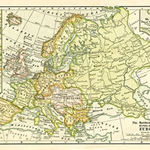
Europe map 1867

Europe map 1867
Sold 2
In Stock
We accept all major credit cards

Fine Art Storehouse Photo Prints and Wall Art

Europe map 1867

Mitchellas Modern Atlas - Published by E.H. Butler and Co - Philadelphia 1867. Unleash your creativity and transform your space into a visual masterpiece. © This content is subject to copyright

THEPALMER

Media ID 13609213

Austria Denmark Norway Portugal Russia Sweden

FEATURES IN THESE COLLECTIONS

> Arts > Modern art pieces

> Europe > Austria > Maps

> Europe > Austria > Posters

> Europe > Austria > Related Images

> Europe > Denmark > Maps

> Europe > Denmark > Posters

> Europe > Denmark > Related Images

> Europe > France > Maps

> Europe > Germany > Maps

> Europe > Germany > Posters

> Fine Art Storehouse > Map > Denmark Maps

> Fine Art Storehouse > Map > Historical Maps

> Fine Art Storehouse > Map > Italian Maps

> Fine Art Storehouse > Map

SECURE PAYMENTS
We happily accept a wide range of payment options so you can pay for the things you need in the way that is most convenient for you

MADE IN AUSTRALIA
Safe Shipping with 30 Day Money Back Guarantee

FREE PERSONALISATION
We are proud to offer a range of customisation including Cropping, Captions, and Filters. Zoom Cropping can be adjusted in the Basket.


EDITORS COMMENTS

This print takes us back in time to the year 1867, showcasing a meticulously detailed map of Europe. Published by E. H. Butler and Co in Philadelphia, this particular edition is from Mitchellas Modern Atlas - a true testament to the artistry and craftsmanship of cartography during that era. The map itself is an exquisite example of engraving and etching techniques, with every line and contour carefully etched onto the surface. The intricate details depict the physical geography of Europe, highlighting countries such as Portugal, Austria, Denmark, France, Germany, Italy, Norway, Russia, Spain, Sweden and more. As we gaze upon this antique lithograph illustration framed on our walls today, we are transported to a different time when borders were defined differently and nations had distinct identities. It serves as a reminder of how much has changed over the years while also celebrating the timeless beauty of maps as works of art. "The Palmer" an artist known for their passion for historical prints like this one from Fine Art Storehouse collection has skillfully captured not only the essence but also the nostalgia associated with these vintage pieces. This horizontal composition allows us to appreciate every minute detail within its frame. Whether you are an avid collector or simply someone who appreciates history's visual treasures; this extraordinary photograph print will undoubtedly add character and intrigue to any space it graces.


Framed Prints

Introducing the exquisite "Europe Map 1867" Framed Print from the Media Storehouse's Fine Art Storehouse collection. This captivating piece showcases an intricately detailed map of Europe, hailing from the Mitchellas Modern Atlas published by E.H. Butler and Co in Philadelphia during 1867. The vintage charm of this map transports you back in time, making it an extraordinary addition to your home or office decor. The high-quality print is carefully framed, ensuring it remains protected and adds an elegant touch to your space. Travel back in time and explore the historical geography of Europe with this stunning framed print.


Photo Prints

Discover the captivating history of Europe with our exquisite "Europe Map 1867" print from THEPALMER's Fine Art Storehouse collection. This intriguing piece is taken from the Mitchell's Modern Atlas, published by E.H. Butler and Co in Philadelphia during 1867. Travel back in time as you admire the intricate details and accurate representations of Europe's political boundaries, cities, and geographical features during this fascinating era. Add an air of vintage charm and historical depth to your home or office decor with this beautifully preserved piece of cartographic history.


Poster Prints

Discover history with our stunning "Europe Map 1867" print from ThePalmer at Media Storehouse's Fine Art Storehouse. This exquisite piece is taken from Mitchell's Modern Atlas, published by E.H. Butler and Co in Philadelphia in 1867. Travel back in time as you explore the political boundaries and geographical features of Europe during this fascinating era. With intricate detail and vibrant colors, this vintage map print makes a captivating addition to any home or office space. Bring history to life and elevate your decor with this beautiful and educational piece.


Jigsaw Puzzles

Discover the rich history of Europe with our captivating jigsaw puzzle from The Palmer's "Europe Map 1867" collection, exclusively available at Media Storehouse. This intriguing puzzle is taken from the Mitchell's Modern Atlas, published by E.H. Butler and Co in Philadelphia in 1867. Each piece of this meticulously crafted puzzle showcases the intricate details of the map, transporting you back in time to an era of exploration and discovery. With a beautiful and educational theme, this puzzle is perfect for puzzle enthusiasts, history buffs, or anyone looking for a captivating and engaging activity. Immerse yourself in the past as you piece together the European continent as it once was.

diamond
Made With High Grade Materials
thumb_up
Professional Quality Finish
package_2
Carefully Packed To Aid Safe Arrival

You May Also Like


Truro Cathedral / C1910Truro Cathedral / C1910
Add to Basket
Map of Europe, 1870sMap of Europe, 1870s
Add to Basket
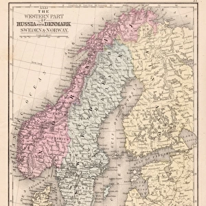
Denmark Sweden Norway map 1867Denmark Sweden Norway map 1867
Add to Basket
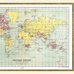
Old Map of the World 1875Old Map of the World 1875
Add to Basket
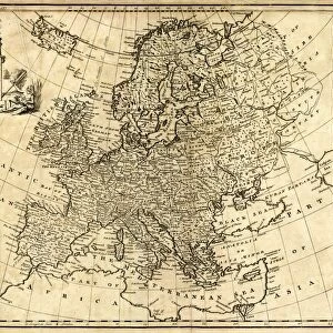
Antique Map of Europe 1744Antique Map of Europe 1744
Add to Basket
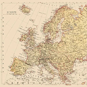
Map of Europe 1881Map of Europe 1881
Add to Basket
Map of EuropeMap of Europe
Add to Basket
Kosovo Vector MapKosovo Vector Map
Add to Basket
Europe map 1898Europe map 1898
Add to Basket
Welwyn Garden City, an example of town planningWelwyn Garden City, an example of town planning
Add to Basket
Avenant and DragonAvenant and Dragon
Add to Basket
Map / Europe / Germany 1871Map / Europe / Germany 1871
Add to Basket

Gallery Wall Inspiration

Italy Map - illustration
Italy country map
Sicily map 1895
Roman Republic and Carthage during the Second Punic War (218-201-BC)
Bosnia, dalmatia, istria, croatia, slavonia
Antquie Map of Italy
Antique Map of Italy, with detail of straits of Messina, 19th Century
Europe Map with France, Portugal, Spain and Netherlands
City map of La Spezia, Italy, and surroundings, published 1897
Antique map of Southern Italy, Sardinia, Sicily, 19th Century
old map of europe
City map of Florence, Italy, lithograph, published in 1897
Map of Venice 1897
Trieste Italy map 1895
Gallery of Maps, Vatican, published in 1878
Map of the German Confederation (1815-1866), lithograph, published in 1897
Rome in the birds eye view, published in 1878
Italy Reference Map
Map of Italy in the times of Augustus 1889
Map of Italy 1889
Old chromolithograph map of Rome, Italy
map of italy 1855
Old chromolithograph map of Italy in 1515
Antique map of Central Italy in Ancient times, Roman, Italiae Antiquae pars media
map of italy during the Roman Empire
map of italy 1863
Map of southern Italy 1895

Discover Our Collections


MapMap
View Collection
Denmark MapsDenmark Maps
View Collection
Austria Related ImagesAustria Related Images
View Collection
Denmark Related ImagesDenmark Related Images
View Collection
MapsMaps
View Collection
MapsMaps
View Collection
MapsMaps
View Collection
MapsMaps
View Collection
PostersPosters
View Collection
PostersPosters
View Collection
PostersPosters
View Collection
Italian MapsItalian Maps
View Collection
Historical MapsHistorical Maps
View Collection
Modern art piecesModern art pieces
View Collection


© Copyright Media Storehouse, All Rights Reserved 2003 - 2024
Facebook     Pinterest     Card Payments     Reviews IO