Fraud Blocker Skip to main content

Home > Animals > Mammals > Muridae > House Mouse

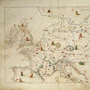
Map of Europe

Map of Europe
Sold 3
In Stock
We accept all major payment options so you can pay for the things you need in the way that is most convenient for you

Fine Art Storehouse Photo Prints and Wall Art

Map of Europe

Antique Maps of the World
Map of Europe
Nicolas Visscher
c 1658. Unleash your creativity and transform your space into a visual masterpiece. © This content is subject to copyright

The Map House of London

Media ID 14763523

Map Of Europe

FEATURES IN THESE COLLECTIONS

> Animals > Mammals > Muridae > House Mouse

> Fine Art Storehouse > Map > Historical Maps

> Fine Art Storehouse > Map

> Maps and Charts > Popular Maps

> Maps and Charts > Related Images

> Maps and Charts > World

SECURE PAYMENTS
We accept all major payment options so you can pay for the things you need in the way that is most convenient for you

Made in Australia
Safe Shipping, Easy Returns

FREE PERSONALISATION
We are proud to offer a range of customisation including Cropping, Captions, and Filters. Zoom Cropping can be adjusted in the basket


EDITORS COMMENTS

This print showcases a true treasure from the past, an antique map of Europe created by Nicolas Visscher in approximately 1658. Brought to you by The Map House of London, this stunning piece offers a glimpse into the intricate cartographic artistry of centuries ago. The map itself is a testament to Visscher's skill and attention to detail. With delicate lines and exquisite hand coloring, it presents Europe as it was known during the mid-17th century. From the rugged coastlines of Scandinavia to the sun-drenched shores of Italy, every region is meticulously depicted with accuracy and precision. As we gaze upon this vintage masterpiece, we are transported back in time, imagining how Europeans once navigated their way through vast lands and unknown territories. It serves as a reminder of our rich history and cultural heritage that has shaped our present-day continent. The Map House of London has carefully preserved this remarkable artifact for all enthusiasts who appreciate both art and geography. By offering this photo print, they allow us to bring home a piece of history while adding an air of sophistication to any space. Whether displayed in your study or adorning your living room wall, this antique map invites exploration and sparks curiosity about the world that existed long before us. Let it be a conversation starter among friends or simply an elegant addition to your collection – either way, its timeless beauty will surely captivate all who behold it.


Framed Prints

Discover the rich history and intricate details of Europe with our exquisite Framed Prints from Media Storehouse, featuring the stunning "Map of Europe" by The Map House of London. Dating back to 1658, this antique masterpiece by renowned cartographer Nicolas Visscher offers a captivating glimpse into the past. Each print is meticulously framed to preserve its beauty and authenticity, making it an exceptional addition to any home or office space. Transport yourself back in time and add a touch of history to your décor with our Fine Art Storehouse Framed Prints of Antique Maps, starting with this magnificent Map of Europe.


Photo Prints

Step back in time with our exquisite antique Map of Europe print from The Map House of London, available at Fine Art Storehouse. This stunning piece, created by renowned cartographer Nicolas Visscher around 1658, offers a captivating glimpse into the historical geography of Europe during the 17th century. With intricate detail and beautiful antique aesthetics, this print is not just a map - it's a window into the past. Bring the rich history and classic charm of old European cartography into your home or office with this fine art print from Media Storehouse.


Poster Prints

"Discover the rich history and intricate details of Europe with our stunning antique Map of Europe print from The Map House of London, available in the Media Storehouse Fine Art Storehouse. Dating back to approximately 1658, this exquisite map by Nicolas Visscher transports you back in time, inviting you to explore the old world charm of Europe as it once was. With meticulous attention to detail and vibrant colors, this poster print makes a captivating addition to any room in your home or office. Bring a touch of history and elegance into your space with our authentic and beautifully preserved antique map prints from the Media Storehouse."


Jigsaw Puzzles

Discover the rich history and intricate details of Europe with our exquisite jigsaw puzzle from Media Storehouse and The Map House of London. This Fine Art Storehouse puzzle, featuring a captivating antique map of Europe by Nicolas Visscher from 1658, invites you on a journey to explore the old world. With intricately depicted borders, cities, and geographical features, this puzzle is not just a pastime, but a journey through time. Perfect for map enthusiasts, history buffs, and puzzle lovers alike, this challenging yet rewarding puzzle will transport you to a world of discovery and adventure.

diamond
Made With High Grade Materials
thumb_up
Professional Quality Finish
package_2
Carefully Packed To Aid Safe Arrival

You May Also Like


Europe Map C1914Europe Map C1914
Add to Basket
1706, De La Feuille Map of Europe, topography, cartography, geography, land, illustration1706, De La Feuille Map of Europe, topography, cartography, geography, land, illustration
Add to Basket
MAP OF AFRICA from the 1595 edition of Abraham Ortelius atlas Theatrum Orbis TerrarumMAP OF AFRICA from the 1595 edition of Abraham Ortelius atlas Theatrum Orbis Terrarum
Add to Basket
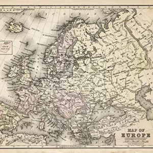
Map of EuropeMap of Europe
Add to Basket
old map of europeold map of europe
Add to Basket
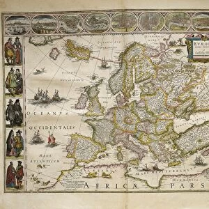
From Theatrum Orbis Terrarum by Willem Bleau, Amsterdam, 1635-1645From Theatrum Orbis Terrarum by Willem Bleau, Amsterdam, 1635-1645
Add to Basket
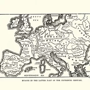
Map of Europe in late 15th CenturyMap of Europe in late 15th Century
Add to Basket
EXPL2A-00352EXPL2A-00352
Add to Basket
Oronce Fines world map, 1531Oronce Fines world map, 1531
Add to Basket
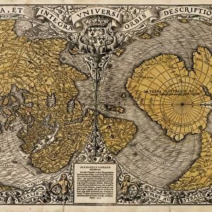
17th century world map17th century world map
Add to Basket
Durers world map, 1515Durers world map, 1515
Add to Basket
Europe, from Atlas of the World in thirty-three Maps, by Battista Agnese, 1553Europe, from Atlas of the World in thirty-three Maps, by Battista Agnese, 1553
Add to Basket

Gallery Wall Inspiration

Map Of New Holland
Antique map of Britain under the Anglo Saxons
Antique map of Britain under the Ancient Romans
Carte du Tendre: imaginary map by a character in the novel Cl├®lie
Map of Exeter in Devon, England Victorian Engraving, 1840
Map of Anglo-Saxon Kingdoms and the Danelaw, 9th Century
England in the Ninth Century
Map of Devon 1883
Newfoundland map 1884
Map of Middle East - illustration
Antique map of the Roman Empire
Old engraved map of Battle of Naseby (14. 06. 1645)
Map of Cyprus, published in 1880
Apostle Pauls Missionary Journeys, lithograph, published in 1886
Battle Of Waterloo
Map of Ireland 1897
Cornwall map 1884
Sicily map 1895
Antique map of Tasmania
Old map of Australia 1899
Ethnological map of the Austro-Hungarian Empire, lithograph, published in 1897
Map of Whitby
Antique map, Scotland, Isle of Skye, South and North Uist
Earth map according to Herodotus
Antique map of Hadrians wall
Antique map of Ireland
Old Caucasus map

Discover Our Collections


MapMap
View Collection
House MouseHouse Mouse
View Collection
Maps and Charts Related ImagesMaps and Charts Related Images
View Collection
WorldWorld
View Collection
Historical MapsHistorical Maps
View Collection
Popular MapsPopular Maps
View Collection


© Copyright Media Storehouse, All Rights Reserved 2003 - 2024
Facebook     Pinterest     100% Payment Secure     Reviews IO