Fraud Blocker Skip to main content

Home > Europe > Germany > Maps

Maps Collection (page 5)

Germany is a country located in Central Europe, and is bordered by nine other countries, including Austria, Belgium, Czech Republic, Denmark, France

5,919 items

Background imageMaps Collection: Map of Prussia, 1870

Map of Prussia, 1870
1574040 Map of Prussia, 1870; (add.info.: Map of Prussia in Germany, circa 1870.); Universal History Archive/UIG

Background imageMaps Collection: Map of the southwestern part of the German Empire, c.1900 (engraving)

Map of the southwestern part of the German Empire, c.1900 (engraving)
532961 Map of the southwestern part of the German Empire, c.1900 (engraving); (add.info.: Map of the southwestern German Empire, circa 1902)

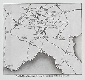
Background imageMaps Collection: Positions of the chief tunnels in the Alps (litho)

Positions of the chief tunnels in the Alps (litho)
8675799 Positions of the chief tunnels in the Alps (litho) by English School, (20th century); Private Collection; (add.info.: Positions of the chief tunnels in the Alps)

Background imageMaps Collection: Battle of Plataea, Greece, 479 BC (engraving)

Battle of Plataea, Greece, 479 BC (engraving)
8635041 Battle of Plataea, Greece, 479 BC (engraving) by German School, (19th century) (after); Private Collection; (add.info.: Plan of the Battle of Plataea, Greece, 479 BC)

Background imageMaps Collection: Part of Germany in Roman times (colour litho)

Part of Germany in Roman times (colour litho)
8672843 Part of Germany in Roman times (colour litho) by German School, (13th century) (after); Private Collection; (add.info.: Part of Germany in Roman times)

Background imageMaps Collection: Map of Germany showing Changes made in 1866 (engraving)

Map of Germany showing Changes made in 1866 (engraving)
8649921 Map of Germany showing Changes made in 1866 (engraving) by European School, (19th century); Private Collection; (add.info.: Map of Germany showing Changes made in 1866)

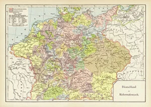
Background imageMaps Collection: Germany at the time of the Reformation (colour litho)

Germany at the time of the Reformation (colour litho)
8664091 Germany at the time of the Reformation (colour litho) by German School, (19th century) (after); Private Collection; (add.info.: Map of Germany at the time of the Reformation)

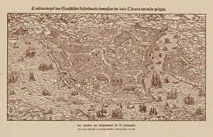
Background imageMaps Collection: Port of Constantinople, 16th century (engraving)

Port of Constantinople, 16th century (engraving)
8663656 Port of Constantinople, 16th century (engraving) by German School, (16th century) (after); Private Collection; (add.info.: Port of Constantinople in the 16th century)

Background imageMaps Collection: Sea Adventure: The hermit of Cocos Island (colour litho)

Sea Adventure: The hermit of Cocos Island (colour litho)
8668771 Sea Adventure: The hermit of Cocos Island (colour litho) by English School, (20th century); Private Collection; (add.info.: The hermit of Cocos Island)

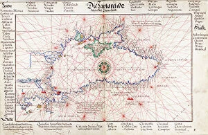
Background imageMaps Collection: Chart of Black Sea, 1554 (vellum)

Chart of Black Sea, 1554 (vellum)
7339645 Chart of Black Sea, 1554 (vellum) by Agnese, Battista (c.1500-64); 26x40 cm; National Maritime Museum, London, UK; (add.info.: Creator: Johan B. Agnese Die Tartareioda'. Scale: 1:15 000 000)

Background imageMaps Collection: Persia, 1554 (vellum)

Persia, 1554 (vellum)
7339640 Persia, 1554 (vellum) by Agnese, Battista (c.1500-64); 26x40 cm; National Maritime Museum, London, UK; (add.info.: Creator: Battista Agnese Bound sheet. Col. ms. Medium: Vellum. Scale: [ca)

Background imageMaps Collection: Pair of maps of the Northern and Southern Celestial Hemispheres, 17th century (engraving)

Pair of maps of the Northern and Southern Celestial Hemispheres, 17th century (engraving)
7337556 Pair of maps of the Northern and Southern Celestial Hemispheres, 17th century (engraving) by Durer or Duerer, Albrecht (1471-1528); National Maritime Museum, London

Background imageMaps Collection: Map of the inland navigation of England and Wales by the canals and principal rivers, 1809

Map of the inland navigation of England and Wales by the canals and principal rivers, 1809
FLO4974709 Map of the inland navigation of England and Wales by the canals and principal rivers, 1809. Copperplate engraving by Mutlow from John Mason Good's Pantologia, a New Encyclopedia, G

Background imageMaps Collection: Plan of the volcano Mt. Vesuvius after an eruption, and path of lava flow through Torre del Greco

Plan of the volcano Mt. Vesuvius after an eruption, and path of lava flow through Torre del Greco, Naples
FLO4574376 Plan of the volcano Mt. Vesuvius after an eruption, and path of lava flow through Torre del Greco, Naples. Handcoloured copperplate engraving from Bertuch's " Bilderbuch fur

Background imageMaps Collection: Map of Arctic trips by Henry Hudson, English explorer (1570-1611) published in 1612 in ' Voyages'

Map of Arctic trips by Henry Hudson, English explorer (1570-1611) published in 1612 in " Voyages"
NWI4849415 Map of Arctic trips by Henry Hudson, English explorer (1570-1611) published in 1612 in " Voyages". Colouring engraving of the 19th century.; (add.info)

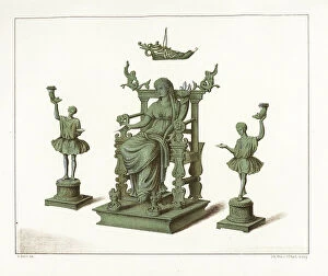
Background imageMaps Collection: Bronze statues of house gods from the Thermae bathhouse at Regio IX, Insula IV, 5

Bronze statues of house gods from the Thermae bathhouse at Regio IX, Insula IV, 5. Chromolithograph by J.G
FLO4687178 Bronze statues of house gods from the Thermae bathhouse at Regio IX, Insula IV, 5. Chromolithograph by J.G. Bach after an illustration by Miss Amy Butts from Emile Presuhn (1844-1878)

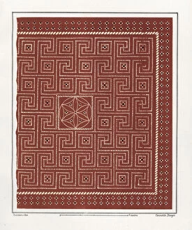
Background imageMaps Collection: Floor mosaic from the House of Epigrams, Regio V, Insula 1, 18

Floor mosaic from the House of Epigrams, Regio V, Insula 1, 18. Chromolithograph by Victor Steeger after an
FLO4687154 Floor mosaic from the House of Epigrams, Regio V, Insula 1, 18. Chromolithograph by Victor Steeger after an illustration by Geremia Discanno from Emile Presuhn (1844-1878)

Background imageMaps Collection: Floor mosaic from the new fullonica (fuller's shop), Regio VI, Insula XIV, 21

Floor mosaic from the new fullonica (fuller's shop), Regio VI, Insula XIV, 21
FLO4687150 Floor mosaic from the new fullonica (fuller's shop), Regio VI, Insula XIV, 21. Chromolithograph by Victor Steeger after an illustration by Geremia Discanno from Emile Presuhn (1844-1878)

Background imageMaps Collection: Marble bust of the owner from the House of Vesonius Primus, a fuller

Marble bust of the owner from the House of Vesonius Primus, a fuller. Chromolithograph by Victor Steeger after an
FLO4687114 Marble bust of the owner from the House of Vesonius Primus, a fuller. Chromolithograph by Victor Steeger after an illustration by Geremia Discanno from Emile Presuhn (1844-1878)

Background imageMaps Collection: Fountain from Regio VII.II.45, House of the Bear, Pompeii. Venus reclines above a blue sea of fishes

Fountain from Regio VII.II.45, House of the Bear, Pompeii. Venus reclines above a blue sea of fishes
FLO4686913 Fountain from Regio VII.II.45, House of the Bear, Pompeii. Venus reclines above a blue sea of fishes, with cupids in attendance

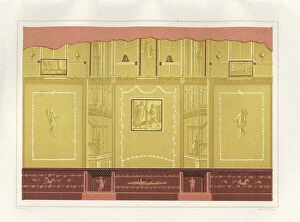
Background imageMaps Collection: Curious wall painting in muted colours from the oecus (salon)

Curious wall painting in muted colours from the oecus (salon) of the Casa del Meleagro or the House of Meleager, Reg
FLO4686886 Curious wall painting in muted colours from the oecus (salon) of the Casa del Meleagro or the House of Meleager, Reg. VI, Ins. IX, No. 2

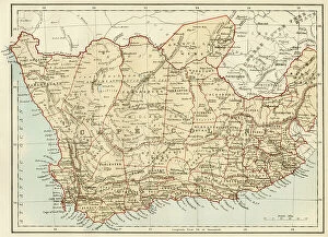
Background imageMaps Collection: South Africa when the country was a British colony, 1870s. Lithograph of the 19th century

South Africa when the country was a British colony, 1870s. Lithograph of the 19th century
NWI4855278 South Africa when the country was a British colony, 1870s. Lithograph of the 19th century.; (add.info.: South Africa when the country was a British colony, 1870s)

Background imageMaps Collection: Geographic map of England and Wales, circa 1870. 19th century colour engraving

Geographic map of England and Wales, circa 1870. 19th century colour engraving
NWI4874357 Geographic map of England and Wales, circa 1870. 19th century colour engraving; (add.info.: Geographic map of England and Wales, circa 1870)

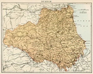
Background imageMaps Collection: Map of the Count of Durham England), circa 1870. 19th century lithography

Map of the Count of Durham England), circa 1870. 19th century lithography
NWI4874845 Map of the Count of Durham England), circa 1870. 19th century lithography.; (add.info.: Map of the Count of Durham England), circa 1870

Background imageMaps Collection: Map of England and Wales, circa 1870. 19th century lithography

Map of England and Wales, circa 1870. 19th century lithography
NWI4874691 Map of England and Wales, circa 1870. 19th century lithography.; (add.info.: Map of England and Wales, circa 1870. 19th century lithography.); Photo © North Wind Pictures

Background imageMaps Collection: Map of the Earl of Middlesex (England), circa 1870. 19th century lithography

Map of the Earl of Middlesex (England), circa 1870. 19th century lithography
NWI4875178 Map of the Earl of Middlesex (England), circa 1870. 19th century lithography.; (add.info.: Map of the Earl of Middlesex (England), circa 1870

Background imageMaps Collection: Map of the Earl of Wiltshire (England), circa 1870. 19th century lithography

Map of the Earl of Wiltshire (England), circa 1870. 19th century lithography
NWI4875514 Map of the Earl of Wiltshire (England), circa 1870. 19th century lithography.; (add.info.: Map of the Earl of Wiltshire (England), circa 1870

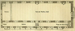
Background imageMaps Collection: Germany, Thuringia, the Wartburg, the so called Landgrafenhaus inside, the third floor

Germany, Thuringia, the Wartburg, the so called Landgrafenhaus inside, the third floor, 1876 (engraving)
UTD4916625 Germany, Thuringia, the Wartburg, the so called Landgrafenhaus inside, the third floor, 1876 (engraving); (add.info.: Germany, Thuringia, the Wartburg, the so called Landgrafenhaus inside)

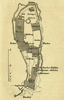
Background imageMaps Collection: Germany, Thuringia, the Wartburg, plan of the castle, 1876 (engraving)

Germany, Thuringia, the Wartburg, plan of the castle, 1876 (engraving)
UTD4916513 Germany, Thuringia, the Wartburg, plan of the castle, 1876 (engraving); (add.info.: Germany, Thuringia, the Wartburg, plan of the castle)

Background imageMaps Collection: Large penguins (Pinguinus impennis) standing at the top of a cliff. This large bird, unable to fly

Large penguins (Pinguinus impennis) standing at the top of a cliff. This large bird, unable to fly
FLO4639319 Large penguins (Pinguinus impennis) standing at the top of a cliff. This large bird, unable to fly, lived on the edge of the Atlantic Ocean

Background imageMaps Collection: Altlantique Limulus polyphemus, arthropod chelicere. Colour illustration by Heinrich Harder

Altlantique Limulus polyphemus, arthropod chelicere. Colour illustration by Heinrich Harder (1858-1935)
FLO4639195 Altlantique Limulus polyphemus, arthropod chelicere. Colour illustration by Heinrich Harder (1858-1935), in " Tiere der Urwelt" (Animals of Prehistory)

Background imageMaps Collection: The pteranodons (wings without teeth) were large flying dinosaurs

The pteranodons (wings without teeth) were large flying dinosaurs, with a wingspan of more than 9 metres
FLO4639182 The pteranodons (wings without teeth) were large flying dinosaurs, with a wingspan of more than 9 metres, and lived in the Upper Cretace period

Background imageMaps Collection: Dinocerata, (Terrible a horn) species of herbivore, resembling rhinoceros

Dinocerata, (Terrible a horn) species of herbivore, resembling rhinoceros
FLO4639842 Dinocerata, (Terrible a horn) species of herbivore, resembling rhinoceros, creature a hoof famous for their paired horns and their canine defenses

Background imageMaps Collection: Two Archeopteryx searching the shore. These missing animals are considered the oldest known animals

Two Archeopteryx searching the shore. These missing animals are considered the oldest known animals
FLO4639193 Two Archeopteryx searching the shore. These missing animals are considered the oldest known animals. They lived in the Upper Jurassic period 150 to 148 million years ago

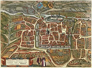
Background imageMaps Collection: Weimar, Germany

Weimar, Germany
2901912 Weimar, Germany; (add.info.: Located on Ilm river; was medieval center; ruled by counts of Weimar-Orlamde from 1247)

Background imageMaps Collection: Map of Hamburg, c.1900 (engraving)

Map of Hamburg, c.1900 (engraving)
532767 Map of Hamburg, c.1900 (engraving); (add.info.: Map of Hamburg, circa 1900, from the 10th edition of Encyclopaedia Britannica.); Encyclopaedia Britannica/UIG

Background imageMaps Collection: Map of Berlin, c.1900 (engraving)

Map of Berlin, c.1900 (engraving)
532708 Map of Berlin, c.1900 (engraving); (add.info.: Map of the city of Berlin and vicinity, Germany, circa 1900, from the 10th edition of Encyclopaedia Britannica.); Encyclopaedia Britannica/UIG

Background imageMaps Collection: The Course of the Danube from its Source to its Mouth, based on the most recent memoires of P

The Course of the Danube from its Source to its Mouth, based on the most recent memoires of P. Coroneli and S
NUL116588 The Course of the Danube from its Source to its Mouth, based on the most recent memoires of P. Coroneli and S. Sanson, Geographer to the King (colour litho) by French School

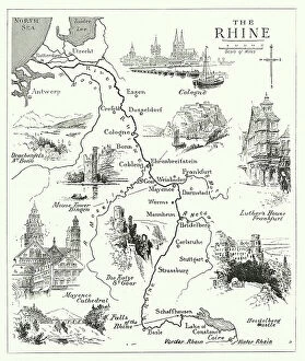
Background imageMaps Collection: Famous rivers: The Rhine (litho)

Famous rivers: The Rhine (litho)
8634758 Famous rivers: The Rhine (litho) by English School, (20th century); Private Collection; (add.info.: The Rhine. Illustration for Chatterbox, 1913.); © Look and Learn

Background imageMaps Collection: Map of the Earth according to Herodotus (engraving)

Map of the Earth according to Herodotus (engraving)
8635073 Map of the Earth according to Herodotus (engraving) by German School, (19th century) (after); Private Collection; (add.info)

Background imageMaps Collection: Potash deposits in Germany (colour litho)

Potash deposits in Germany (colour litho)
8663962 Potash deposits in Germany (colour litho) by German School, (20th century); Private Collection; (add.info.: Geological map of the distribution of potash deposits in Germany)

Background imageMaps Collection: Coast of Prussia with all the havens and rivers from Memel to Heel, 1588 (coloured engraving)

Coast of Prussia with all the havens and rivers from Memel to Heel, 1588 (coloured engraving)
7340016 Coast of Prussia with all the havens and rivers from Memel to Heel, 1588 (coloured engraving) by Janszoon Waghenaer, Lucas (c.1533-c.1606) ; 33x51 cm; National Maritime Museum, London

Background imageMaps Collection: Map of Scandinavia, 1554 (vellum)

Map of Scandinavia, 1554 (vellum)
7339651 Map of Scandinavia, 1554 (vellum) by Agnese, Battista (c.1500-64); 26x40 cm; National Maritime Museum, London, UK; (add.info.: Creator)

Background imageMaps Collection: Chart of Moscow and the Black Sea, 1554 (vellum)

Chart of Moscow and the Black Sea, 1554 (vellum)
7339650 Chart of Moscow and the Black Sea, 1554 (vellum) by Agnese, Battista (c.1500-64); 26x40 cm; National Maritime Museum, London, UK; (add.info.: Creator: Johan B. Agnese Moscaw oder Reuss')

Background imageMaps Collection: Germany: geographical map of Germany and neighbouring States. 1493

Germany: geographical map of Germany and neighbouring States. 1493
FGL5465921 Germany: geographical map of Germany and neighbouring States. 1493.; Fototeca Gilardi

Background imageMaps Collection: United States, State of Pennsylvania: Map of the ' Province of Pennsilvania

United States, State of Pennsylvania: Map of the " Province of Pennsilvania
NWI4967179 United States, State of Pennsylvania: Map of the " Province of Pennsilvania, " when the country was a colony 1756

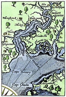
Background imageMaps Collection: United States, Virginia: Jamestown (James river) camp map by Jonh Smith

United States, Virginia: Jamestown (James river) camp map by Jonh Smith, Virginia near the Atlantic coast
NWI4967563 United States, Virginia: Jamestown (James river) camp map by Jonh Smith, Virginia near the Atlantic coast. Colour engraving of the 19th century; (add.info.: United States)

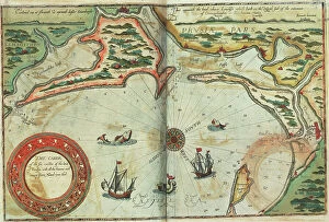
Background imageMaps Collection: A description of the sea coastes of Eyder Ditmers and a part of Jeverland with the rivers of

A description of the sea coastes of Eyder Ditmers and a part of Jeverland with the rivers of Weser, Elve, Eyder
7340017 A description of the sea coastes of Eyder Ditmers and a part of Jeverland with the rivers of Weser, Elve, Eyder, Hever and other entrees sandes and shoaldes


All Professionally Made to Order for Quick Shipping


-

Maps Collection

Germany is a country located in Central Europe, and is bordered by nine other countries, including Austria, Belgium, Czech Republic, Denmark, France, Luxembourg, Netherlands, Poland and Switzerland. Germany has a rich history and culture that can be seen through its many maps. Maps of Germany Europe provide an overview of the country's geography as well as its political divisions and major cities. They also show the location of rivers and lakes throughout the country. Additionally, they often include information about transportation networks such as roads and railways. Maps of Germany Europe are useful for travelers who want to explore this fascinating country or for those who wish to learn more about its history and culture.
+

Our beautiful Wall Art and Photo Gifts include Framed Prints, Photo Prints, Poster Prints, Canvas Prints, Jigsaw Puzzles, Metal Prints and so much more

The Maps of Germany Europe collection from Media Storehouse is a stunning array of wall art and framed prints that showcase the rich history and geography of Germany. Our collection features an extensive range of maps, including antique maps dating back to the 16th century as well as modern-day cartography. These maps offer a unique perspective on the evolution of German territories over time, highlighting changes in borders, cities, and landmarks. Each map is beautifully reproduced using high-quality printing techniques that capture every detail with remarkable clarity. Whether you're looking for a vintage map to add character to your home decor or a contemporary piece to inspire your wanderlust, our collection has something for everyone. With its wide selection of sizes and framing options available at affordable prices, the Maps of Germany Europe collection from Media Storehouse offers an excellent opportunity to own a piece of history while enhancing your living space with beautiful artwork.
+

What are Maps of Germany Europe art prints?

Maps of Germany Europe art prints are high-quality reproductions of vintage or contemporary maps depicting the geography, topography, and political boundaries of Germany and other European countries. These art prints are created using advanced printing techniques that ensure a sharp and vivid image with accurate colors and details. Maps have always been an important tool for navigation, exploration, and education. They provide a visual representation of the world around us, helping us understand our place in it. Maps of Germany Europe art prints offer not only practical information but also aesthetic value as they can be used to decorate homes, offices or public spaces. These art prints come in various sizes and styles to suit different tastes and purposes. Some feature intricate illustrations while others focus on clear lines and labels for easy reading. Whether you're looking for a historical map to display your love for history or a modern one to plan your next trip abroad, Maps of Germany Europe art prints from Media Storehouse offer something for everyone.
+

What Maps of Germany Europe art prints can I buy from Media Storehouse?

We offer a wide range of Maps of Germany Europe art prints that are perfect for decorating your home or office. These maps come in various sizes and styles, including vintage, antique, and modern designs. You can choose from different types of maps such as political maps, physical maps, topographical maps, roadmaps and more. Our collection includes high-quality prints that capture the intricate details of these beautiful maps. Whether you're looking to add some historical charm to your space or want to display your love for geography and travel, their selection has something for everyone. Their Maps of Germany Europe art prints are printed on premium quality paper using state-of-the-art printing technology which ensures they will last a lifetime without fading or losing their vibrancy. So if you're looking for unique wall decor that is both stylish and informative then our Maps of Germany Europe art prints are definitely worth checking out.
+

How do I buy Maps of Germany Europe art prints?

To buy Maps of Germany Europe art prints from Media Storehouse, you can browse our extensive collection online. Simply search for the specific map or location you are interested in and select the print size and format that suits your needs. You can choose from a range of high-quality paper options to ensure your print looks its best. Once you have made your selection, add it to your cart and proceed to checkout. You will be prompted to enter your shipping information and payment details. We accept a variety of payment methods including credit cards, PayPal, and Apple Pay. After completing your purchase, Media Storehouse will process your order and ship it directly to you. Your Map of Germany Europe art print will arrive ready for framing or display as desired. We offer a wide selection of maps from different regions around the world so if you're looking for other locations beyond Germany Europe they may have what you need too.
+

How much do Maps of Germany Europe art prints cost?

We offer a wide range of Maps of Germany and Europe art prints at varying prices. The cost of these prints depends on various factors such as the size, quality, and type of paper used for printing. Our collection includes vintage maps, contemporary designs, and artistic interpretations that cater to different tastes and preferences. We take pride in providing high-quality art prints that are affordable yet visually appealing. Our selection is carefully curated to ensure that customers have access to unique pieces that add character to their homes or offices. We also offer framing options for those who prefer ready-to-hang artwork. The cost of our Maps of Germany and Europe art prints varies depending on several factors. However, we strive to provide our customers with value for money by offering competitive prices without compromising on quality.
+

How will my Maps of Germany Europe art prints be delivered to me?

We take great care in delivering your Maps of Germany Europe art prints to you. We use high-quality packaging materials to ensure that your artwork arrives in perfect condition. Your print will be carefully rolled and placed inside a sturdy tube for protection during transit. We work with trusted shipping partners who offer reliable and secure delivery services worldwide. Once your order is dispatched, you will receive an email notification with tracking information so that you can monitor the progress of your delivery. We understand the importance of timely delivery and strive to ensure that all orders are processed promptly. However, please note that delivery times may vary depending on your location and other factors beyond our control. Rest assured that when you order from us, you can expect a hassle-free experience from start to finish. We pride ourselves on providing excellent customer service and look forward to serving you soon.