Fraud Blocker Skip to main content

Home > Europe > Greece > Maps

Maps Collection (page 5)

Maps of Greece Europe are essential tools for travelers, historians, and anyone interested in the region

1,416 items

Background imageMaps Collection: 1853 Mitchell Map Of Turkey In Europe And Greece

1853 Mitchell Map Of Turkey In Europe And Greece
1853, Mitchell Map of Turkey in Europe and Greece, Greece, Balkans, Macedonia

Background imageMaps Collection: 1827 Finley Map Of Turkey In Europe Greece And The Balkans

1827 Finley Map Of Turkey In Europe Greece And The Balkans
1827, Finley Map of Turkey in Europe, Greece and the Balkans, Anthony Finley mapmaker of the United States in the 19th century

Background imageMaps Collection: 1818 Pinkerton Map Of Turkey In Europe Greece Andamp

1818 Pinkerton Map Of Turkey In Europe Greece Andamp
1818, Pinkerton Map of Turkey in Europe, Greece andamp, the Balkans, John Pinkerton, 1758 - 1826, Scottish antiquarian, cartographer, UK

Background imageMaps Collection: 1815 Thomson Map Of Attica Anthens And Vicinity Greece

1815 Thomson Map Of Attica Anthens And Vicinity Greece
1815, Thomson Map of Attica, Anthens and Vicinity Greece, John Thomson, 1777 - 1840, was a Scottish cartographer from Edinburgh, UK

Background imageMaps Collection: 1814 Thomson Map Of Greece Turkey In Europe And The Balkans

1814 Thomson Map Of Greece Turkey In Europe And The Balkans
1814, Thomson Map of Greece, Turkey, in Europe and the Balkans, John Thomson, 1777 - 1840, was a Scottish cartographer from Edinburgh, UK

Background imageMaps Collection: 1801 Cary Map Of Turkey In Europe Greece And The Balkan

1801 Cary Map Of Turkey In Europe Greece And The Balkan
1801, Cary Map of Turkey in Europe, Greece, and the Balkan, John Cary, 1754 - 1835, English cartographer

Background imageMaps Collection: 1794 Laurie And Whittle Map Of Greece Turkey Andamp

1794 Laurie And Whittle Map Of Greece Turkey Andamp
1794, Laurie and Whittle Map of Greece, Turkey andamp, the Balkans

Background imageMaps Collection: 1785 Bocage Map Of Athens And Environs Including Piraeus

1785 Bocage Map Of Athens And Environs Including Piraeus
1785, Bocage Map of Athens and Environs, including Piraeus, in Ancient Greece

Background imageMaps Collection: 1784 Bocage Map Of Athens Greece Topography Cartography

1784 Bocage Map Of Athens Greece Topography Cartography
1784, Bocage Map of Athens, Greece

Background imageMaps Collection: 1794 Delisle Map Of Northern Ancient Greece Balkans

1794 Delisle Map Of Northern Ancient Greece Balkans
1794, Delisle Map of Northern Ancient Greece, Balkans, Macedonia

Background imageMaps Collection: 1794 Delisle Map Of Southern Ancient Greece Greeks Isles

1794 Delisle Map Of Southern Ancient Greece Greeks Isles
1794, Delisle Map of Southern Ancient Greece, Greeks Isles, and Crete

Background imageMaps Collection: 1794 Anville Map Of The Eastern Roman Empire

1794 Anville Map Of The Eastern Roman Empire
1794, Anville Map of the Eastern Roman Empire, inclues Greece

Background imageMaps Collection: 1784 Map Of The Battle Of Plataea Greece Topography

1784 Map Of The Battle Of Plataea Greece Topography
1784, Map of the Battle of Plataea, Greece

Background imageMaps Collection: 1783 Bocage Map Of The Topography Of Sparta Ancient Greece

1783 Bocage Map Of The Topography Of Sparta Ancient Greece
1783, Bocage Map of the Topography of Sparta, Ancient Greece, and Environs

Background imageMaps Collection: 1771 Janvier Map Of Greece Turkey Macedonia Andamp

1771 Janvier Map Of Greece Turkey Macedonia Andamp
1771, Janvier Map of Greece, Turkey, Macedonia andamp, the Balkans

Background imageMaps Collection: 1752 Homann Heirs Map Of Hungary The Balkans

1752 Homann Heirs Map Of Hungary The Balkans
1752, Homann Heirs Map of Hungary, the Balkans, and Northern Greece

Background imageMaps Collection: 1752 Vaugondy Map Of Greece Macedonia And Albania

1752 Vaugondy Map Of Greece Macedonia And Albania
1752, Vaugondy Map of Greece, Macedonia and Albania

Background imageMaps Collection: 1741 Homann Heirs Map Of Ancient Greece And The Eastern Mediterranean

1741 Homann Heirs Map Of Ancient Greece And The Eastern Mediterranean
1741, Homann Heirs Map of Ancient Greece and the Eastern Mediterranean

Background imageMaps Collection: 1584 Ortelius Map Of Crete Candia And 10 Greek Islands

1584 Ortelius Map Of Crete Candia And 10 Greek Islands
1584, Ortelius Map of Crete, Candia and 10 Greek Islands, Abraham Ortelius, also Orthellius, 1527 - 1598, Flemish, Netherlandish cartographer and geographer

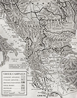
Background imageMaps Collection: Map German Advance Greece 6-30 April 1941 Greek Campaign

Map German Advance Greece 6-30 April 1941 Greek Campaign
Map showing the German advance in Greece, 6-30 April, 1941. From The War in Pictures, Sixth Year

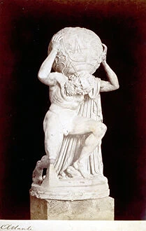
Background imageMaps Collection: Statue of greco-roman origin of Atlas with the world on his shoulders

Statue of greco-roman origin of Atlas with the world on his shoulders. In the Museo Nazionale of Naples Naples Statue Hellenistic, Greek Art, Greece, Europe, Ancient Civilization

Background imageMaps Collection: Sea area of the State of the Veneto: Greece, divided into its Provinces, engraving by G

Sea area of the State of the Veneto: Greece, divided into its Provinces, engraving by G. Zuliani taken from Tome III of the "Newest Atlas" published in Venice in 1781 by Antonio Zatta

Background imageMaps Collection: 'Sala dell'Atlante', Hall of National Archaeological Museum in Naples

"Sala dell'Atlante", Hall of National Archaeological Museum in Naples
"Sala dell'Atlante", Hall of National Archaeological Museum in Naples Naples The National Archaeological Museum Statue Hellenistic, Greek Art, Greece, Europe, Ancient Civilization

Background imageMaps Collection: Farnese Atlas, statue located at the National Archaeological Musem in Naples

Farnese Atlas, statue located at the National Archaeological Musem in Naples. Naples National Archaeological Musem Statue Hellenistic, Greek Art, Greece, Europe, Ancient Civilization

Background imageMaps Collection: Statue of Atlas with the celestial globe called the Farnese Atlas, marble

Statue of Atlas with the celestial globe called the Farnese Atlas, marble, Greek art of the second century. A.D. National Archaeological Museum

Background imageMaps Collection: Wall painting of Orpheus with lyre from the viridarium (garden) of the House of Vesonius Primus

Wall painting of Orpheus with lyre from the viridarium (garden) of the House of Vesonius Primus, a fuller
FLO4686859 Wall painting of Orpheus with lyre from the viridarium (garden) of the House of Vesonius Primus, a fuller. He is surrounded by animals including a lion, cougar, boar, stag, rabbit

Background imageMaps Collection: Ariadne watching Theseus's boat depart from the island of Naxos

Ariadne watching Theseus's boat depart from the island of Naxos. Mural from a triclinium in a shop/dwelling at
FLO4686919 Ariadne watching Theseus's boat depart from the island of Naxos. Mural from a triclinium in a shop/dwelling at Regio IX.II.5, Pompeii

Background imageMaps Collection: Marriage of Alexander the Great and Stateira II in Susa, Persia, 324 BC (engraving)

Marriage of Alexander the Great and Stateira II in Susa, Persia, 324 BC (engraving)
7157369 Marriage of Alexander the Great and Stateira II in Susa, Persia, 324 BC (engraving) by German School, (19th century); Private Collection; (add.info)

Background imageMaps Collection: Statue of Artemis, goddess of the hunt in Greek mythology, from Ephesus (engraving)

Statue of Artemis, goddess of the hunt in Greek mythology, from Ephesus (engraving)
7147480 Statue of Artemis, goddess of the hunt in Greek mythology, from Ephesus (engraving) by German School, (19th century); Private Collection; (add.info.: Statue of Artemis)

Background imageMaps Collection: Statue of Adonis (marble)

Statue of Adonis (marble)
YOU4419173 Statue of Adonis (marble) by Duquesnoy, Francois (1597-1643); Louvre, Paris, France; (add.info.: Statue of Adonis, in Greek mythology, divinite symbolizing death and renewal of nature)

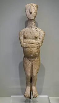
Background imageMaps Collection: Minoan art. Cycladic-typed marble figurine, 2600-2300 BC

Minoan art. Cycladic-typed marble figurine, 2600-2300 BC
7145073 Minoan art. Cycladic-typed marble figurine, 2600-2300 BC by Minoan; Archaeological Museum of Heraklion, Crete, Greece; (add.info.: Cycladic-typed marble figurine of a standing pregnant woman)

Background imageMaps Collection: Detail of the Statue of the godess Persephone, 2nd century

Detail of the Statue of the godess Persephone, 2nd century
7145302 Detail of the Statue of the godess Persephone, 2nd century by Roman, (2nd century AD); Archaeological Museum of Heraklion, Crete

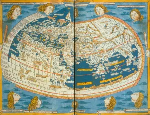
Background imageMaps Collection: Map of the world, based on descriptions and co-ordinates given in Geographia

Map of the world, based on descriptions and co-ordinates given in Geographia
NBY259407 Map of the world, based on descriptions and co-ordinates given in Geographia first published in Ulm, Germany, 1482 (colour litho) by Ptolemy (Claudius Ptolemaeus of Alexandria)(c.90-168)

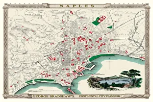
Background imageMaps Collection: George Bradshaws Plan of Naples, Greece 1896

George Bradshaws Plan of Naples, Greece 1896
This is a detailed Plan of the Port and City of Naples showing the streets, canals, principal buildings, railways and railway stations

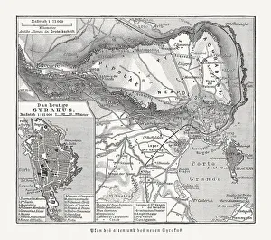
Background imageMaps Collection: Maps of the ancient and new Syracuse, Italy, published 1897

Maps of the ancient and new Syracuse, Italy, published 1897
Historical maps of the ancient and new (left) Syracuse, Sicily, Italy. Wood engraving, published in 1897

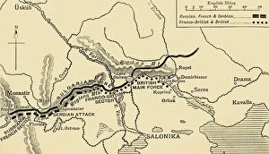
Background imageMaps Collection: The Allies Line facing the Bulgarians in the closing Campaign of 1916, (c1920)

The Allies Line facing the Bulgarians in the closing Campaign of 1916, (c1920). Map of Salonika (Thessaloniki) in Greece, showing Allied positions during the First World War: Russian, French

Background imageMaps Collection: Modern Night Sky Constellation - Canis Major

Modern Night Sky Constellation - Canis Major
Simple, modern depiction of a celestial constellation. The constellation Canis Major is located in the southern hemisphere of the sky

Background imageMaps Collection: Modern Night Sky Constellation - Leo

Modern Night Sky Constellation - Leo
Simple, modern depiction of a celestial constellation on a navy backdrop. Leo constellation lies in the northern sky and is one of the zodiac constellations

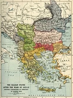
Background imageMaps Collection: The Balkan States After the Wars of 1912-13, (c1920). Creator: John Bartholomew & Son

The Balkan States After the Wars of 1912-13, (c1920). Creator: John Bartholomew & Son
The Balkan States After the Wars of 1912-13, (c1920). Showing Acquisitions of Territory in Darker Tints. Map of the Balkans: Bosnia, Montenegro, Servia (Serbia), Albania, Roumania (Romania)

Background imageMaps Collection: Map of Assyria, Chaldea and Adjacent Countries, 1890. Creator: Unknown

Map of Assyria, Chaldea and Adjacent Countries, 1890. Creator: Unknown
Map of Assyria, Chaldea and Adjacent Countries, 1890. Assyria was a Mesopotamian kingdom from 25th century BC to 612 BC- 609 BC

Background imageMaps Collection: Map of Greece in the Heroic age 1889

Map of Greece in the Heroic age 1889
Comprehensive Geography by James Monteith - American Book Company 1882, 1889

Background imageMaps Collection: North Africa, from a nautical atlas, 1520 (ink on vellum) (detail from 330916)

North Africa, from a nautical atlas, 1520 (ink on vellum) (detail from 330916)
XOT330918 North Africa, from a nautical atlas, 1520 (ink on vellum) (detail from 330916) by Giovanni Xenodocus da Corfu (fl. 16th Century); Museo Correr, Venice, Italy; Greek, out of copyright

Background imageMaps Collection: Antique map of Ancient Italy and Greece

Antique map of Ancient Italy and Greece
Vintage engraving of a Antique map of Ancient Italy and Greece

Background imageMaps Collection: Map of Greece 1900

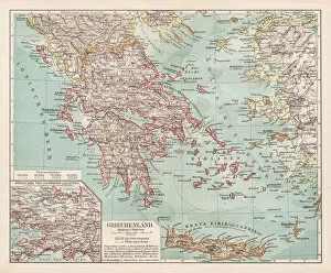
Map of Greece 1900
Meyers hand-Atlas Leipzig und Wien Verlag des Bibliographischen Instituts 1900

Background imageMaps Collection: Antique Map of the Assyrian Empire

Antique Map of the Assyrian Empire
Antique Map from 1862 of Assyrian Empire also showing Phoenician and Greek colonies circa 627 BC. Maps text is written in Latin

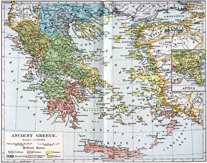
Background imageMaps Collection: Map of Ancient Greece, 1902

Map of Ancient Greece, 1902. Illustration from The Worlds History, The Mediterranean Nations, by Dr H F Helmolt, Volume IV, published by William Heinemann, (London, 1902)

Background imageMaps Collection: Bull-leaping fresco from Knossos

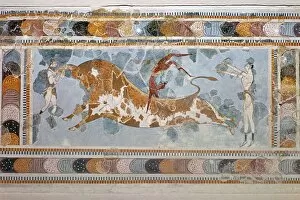
Bull-leaping fresco from Knossos
Bull-leaping fresco from the palace of Knossos, from the Archaeological Museums collection, Heraclion, Crete

Background imageMaps Collection: Statue of Atlas with the celestial globe called the Farnese Atlas, marble

Statue of Atlas with the celestial globe called the Farnese Atlas, marble, Greek art of the 2nd century AD, National Archaeological Museum


All Professionally Made to Order for Quick Shipping


-

Maps Collection

Maps of Greece Europe are essential tools for travelers, historians, and anyone interested in the region. They provide an overview of the country's geography, cities, and regions, and are be used to plan trips, locate points of interest such as archaeological sites or beaches, and to gain a better understanding of the area's cultural heritage. They also show roads and other transportation routes that connect cities and towns throughout Greece. Additionally they can help visitors find their way around unfamiliar areas by providing detailed information about streets and landmarks. By using maps of Greece Europe travelers can make informed decisions about where to go during their visit.
+

Our beautiful pictures are available as Framed Prints, Photos, Wall Art and Photo Gifts

The Maps of Greece Europe collection from Media Storehouse is a stunning compilation of vintage and contemporary maps that showcase the beauty and history of Greece. Our collection includes a wide range of maps, from ancient Greek city-states to modern-day Greece, highlighting the country's rich cultural heritage. Each map in our collection is carefully curated and printed on high-quality paper or canvas, ensuring that every detail is captured with precision. The Maps of Greece Europe collection offers a variety of sizes and framing options to suit any decor style. Whether you're looking for a unique piece to add to your home or office, or you're an avid collector interested in historical cartography, the Maps of Greece Europe collection has something for everyone. With its beautiful designs and exceptional quality, it's no wonder why our collection is so popular among art enthusiasts around the world.
+

What are Maps of Greece Europe art prints?

Maps of Greece Europe art prints are high-quality reproductions of maps that depict the geography, topography and political boundaries of Greece and other European countries. These prints showcase intricate details such as major cities, rivers, mountains, coastlines and islands in a visually appealing manner. They are available in various sizes to suit different spaces and can be framed or mounted for display. These art prints serve multiple purposes including educational use in classrooms or offices, decorative use in homes or hotels, as well as gifting options for history buffs or travel enthusiasts. The Maps of Greece Europe art prints are printed on premium quality paper using advanced printing technology to ensure vibrant colours and sharp images that last long without fading. These art prints offer an excellent way to explore the rich cultural heritage of Greece and other European nations while adding a touch of sophistication to any space they adorn.
+

What Maps of Greece Europe art prints can I buy from Media Storehouse?

We offer a wide range of Maps of Greece Europe art prints that you can purchase. These maps are perfect for those who love history, geography or simply want to decorate their homes with unique and interesting pieces. The collection includes antique maps dating back to the 16th century as well as modern-day maps that showcase the country's topography, cities and landmarks. You can choose from different styles such as vintage, retro or contemporary depending on your preference. Some of the popular options include detailed city maps like Athens, Thessaloniki and Crete while others feature Greece's islands like Santorini, Mykonos and Corfu. The quality of these prints is exceptional with high-resolution images printed on premium paper using state-of-the-art printing technology. You can also select various sizes to fit your space requirements. Whether you're looking for a gift for someone special or just want to add some character to your home decor, we have an extensive selection of Maps of Greece Europe art prints that will suit any taste or budget.

+

How do I buy Maps of Greece Europe art prints?

To buy maps of Greece Europe art prints from Media Storehouse, you can browse our extensive collection online. We offer a wide range of map designs and sizes to choose from, so you can find the perfect print for your needs. Once you have found the artwork that you want to purchase, simply add it to your cart and proceed to checkout. At checkout, you will be prompted to enter your shipping information and payment details. You can pay using a variety of methods including credit card or PayPal. After completing your order, Media Storehouse will process it and ship it out as soon as possible. Buying maps of Greece Europe art prints from Media Storehouse is an easy and convenient way to decorate your home or office with beautiful artwork. With their high-quality printing techniques and attention to detail, these prints are sure to impress anyone who sees them. So why wait? Start browsing today.
+

How much do Maps of Greece Europe art prints cost?

We offer a wide range of Maps of Greece Europe art prints that are available at varying prices. The cost of these prints depends on several factors such as the size, quality, and type of paper used for printing. Our collection includes vintage maps, contemporary designs, and artistic interpretations that cater to different tastes and preferences. We understand the importance of providing affordable options without compromising on quality. Therefore, our pricing is competitive while ensuring that each print meets our high standards. We also offer various framing options to enhance the overall aesthetic appeal of your chosen artwork. Whether you're looking for a unique gift or want to decorate your home or office space with beautiful Maps of Greece Europe art prints, we have something for everyone's budget. You can browse through our extensive collection online and choose from a variety of sizes and styles that suit your needs best.
+

How will my Maps of Greece Europe art prints be delivered to me?

We take great care in ensuring that your Maps of Greece Europe art prints are delivered to you safely and securely. We use high-quality packaging materials to protect your artwork during transit, including sturdy cardboard tubes for rolled prints and flat cardboard boxes for framed prints. Our delivery partners are reliable and experienced couriers who will handle your package with care. They will deliver your artwork directly to the address provided at checkout, so please ensure that it is accurate and up-to-date. Once you receive your Maps of Greece Europe art print, we recommend handling it with care to avoid any damage or creases. If you have ordered a framed print, be sure to hang it in a suitable location away from direct sunlight or moisture. We hope that you enjoy your new artwork and appreciate the effort we put into delivering it safely to you.