
Maps Greetings Card Collection
Discover the rich history and beauty of Greece with our Maps of Greece Europe collection of greeting cards from Media Storehouse. These thoughtfully designed cards feature intricate and detailed maps of Greece and its surrounding European regions, making them the perfect way to express your fondness for travel, history, or geography. Ideal for birthdays, anniversaries, or just to brighten someone's day, these cards come in a variety of sizes and are printed on high-quality paper to ensure a stunning visual experience. Add a touch of adventure and education to your correspondence with our Maps of Greece Europe greeting cards.
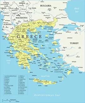
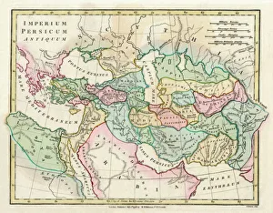
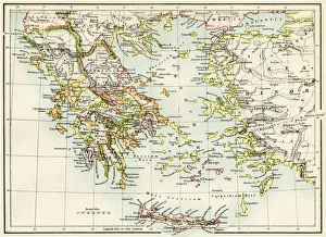
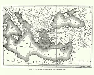
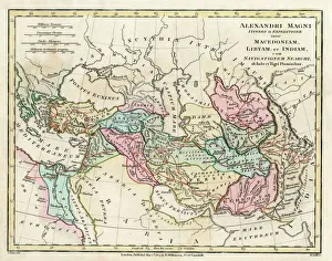
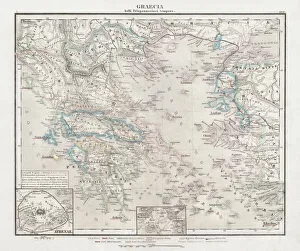
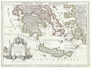
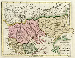
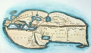
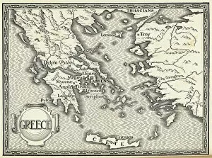
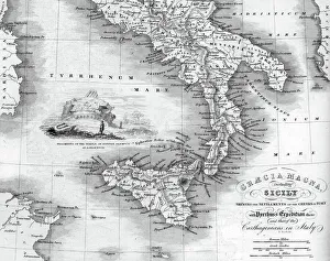
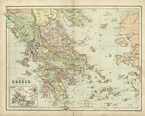
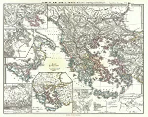
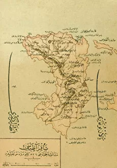
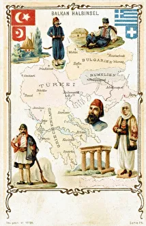
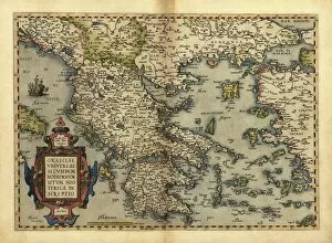
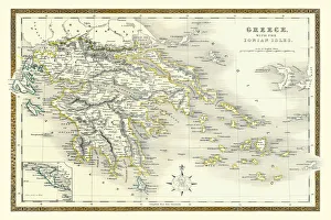
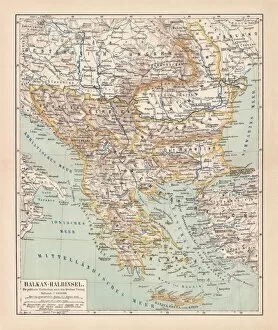
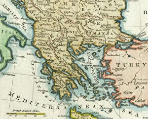
Maps of Greece Europe are essential tools for travelers, historians, and anyone interested in the region
Choose a picture from our Maps Greetings Card Collection for your Wall Art and Photo Gifts
1,416 Greetings Cards


All Professionally Made to Order for Quick Shipping
-
Maps Greetings Card Collection
Maps of Greece Europe are essential tools for travelers, historians, and anyone interested in the region. They provide an overview of the country's geography, cities, and regions, and are be used to plan trips, locate points of interest such as archaeological sites or beaches, and to gain a better understanding of the area's cultural heritage. They also show roads and other transportation routes that connect cities and towns throughout Greece. Additionally they can help visitors find their way around unfamiliar areas by providing detailed information about streets and landmarks. By using maps of Greece Europe travelers can make informed decisions about where to go during their visit.
+
Our beautiful pictures are available as Framed Prints, Photos, Wall Art and Photo Gifts
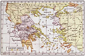
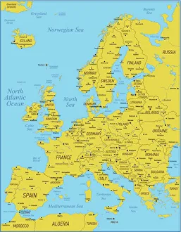
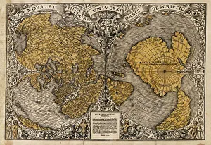
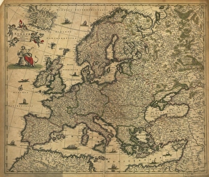
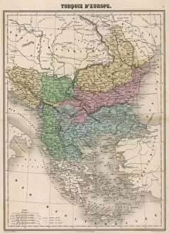
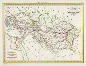
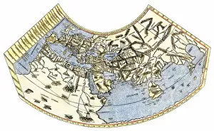
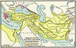
The Maps of Greece Europe collection from Media Storehouse is a stunning compilation of vintage and contemporary maps that showcase the beauty and history of Greece. Our collection includes a wide range of maps, from ancient Greek city-states to modern-day Greece, highlighting the country's rich cultural heritage. Each map in our collection is carefully curated and printed on high-quality paper or canvas, ensuring that every detail is captured with precision. The Maps of Greece Europe collection offers a variety of sizes and framing options to suit any decor style. Whether you're looking for a unique piece to add to your home or office, or you're an avid collector interested in historical cartography, the Maps of Greece Europe collection has something for everyone. With its beautiful designs and exceptional quality, it's no wonder why our collection is so popular among art enthusiasts around the world.
+
What are Maps of Greece Europe art prints?
Maps of Greece Europe art prints are high-quality reproductions of maps that depict the geography, topography and political boundaries of Greece and other European countries. These prints showcase intricate details such as major cities, rivers, mountains, coastlines and islands in a visually appealing manner. They are available in various sizes to suit different spaces and can be framed or mounted for display. These art prints serve multiple purposes including educational use in classrooms or offices, decorative use in homes or hotels, as well as gifting options for history buffs or travel enthusiasts. The Maps of Greece Europe art prints are printed on premium quality paper using advanced printing technology to ensure vibrant colours and sharp images that last long without fading. These art prints offer an excellent way to explore the rich cultural heritage of Greece and other European nations while adding a touch of sophistication to any space they adorn.
+
What Maps of Greece Europe art prints can I buy from Media Storehouse?
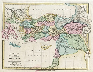
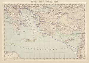
We offer a wide range of Maps of Greece Europe art prints that you can purchase. These maps are perfect for those who love history, geography or simply want to decorate their homes with unique and interesting pieces. The collection includes antique maps dating back to the 16th century as well as modern-day maps that showcase the country's topography, cities and landmarks. You can choose from different styles such as vintage, retro or contemporary depending on your preference. Some of the popular options include detailed city maps like Athens, Thessaloniki and Crete while others feature Greece's islands like Santorini, Mykonos and Corfu. The quality of these prints is exceptional with high-resolution images printed on premium paper using state-of-the-art printing technology. You can also select various sizes to fit your space requirements. Whether you're looking for a gift for someone special or just want to add some character to your home decor, we have an extensive selection of Maps of Greece Europe art prints that will suit any taste or budget.
+
How do I buy Maps of Greece Europe art prints?
To buy maps of Greece Europe art prints from Media Storehouse, you can browse our extensive collection online. We offer a wide range of map designs and sizes to choose from, so you can find the perfect print for your needs. Once you have found the artwork that you want to purchase, simply add it to your cart and proceed to checkout. At checkout, you will be prompted to enter your shipping information and payment details. You can pay using a variety of methods including credit card or PayPal. After completing your order, Media Storehouse will process it and ship it out as soon as possible. Buying maps of Greece Europe art prints from Media Storehouse is an easy and convenient way to decorate your home or office with beautiful artwork. With their high-quality printing techniques and attention to detail, these prints are sure to impress anyone who sees them. So why wait? Start browsing today.
+
How much do Maps of Greece Europe art prints cost?
We offer a wide range of Maps of Greece Europe art prints that are available at varying prices. The cost of these prints depends on several factors such as the size, quality, and type of paper used for printing. Our collection includes vintage maps, contemporary designs, and artistic interpretations that cater to different tastes and preferences. We understand the importance of providing affordable options without compromising on quality. Therefore, our pricing is competitive while ensuring that each print meets our high standards. We also offer various framing options to enhance the overall aesthetic appeal of your chosen artwork. Whether you're looking for a unique gift or want to decorate your home or office space with beautiful Maps of Greece Europe art prints, we have something for everyone's budget. You can browse through our extensive collection online and choose from a variety of sizes and styles that suit your needs best.
+
How will my Maps of Greece Europe art prints be delivered to me?
We take great care in ensuring that your Maps of Greece Europe art prints are delivered to you safely and securely. We use high-quality packaging materials to protect your artwork during transit, including sturdy cardboard tubes for rolled prints and flat cardboard boxes for framed prints. Our delivery partners are reliable and experienced couriers who will handle your package with care. They will deliver your artwork directly to the address provided at checkout, so please ensure that it is accurate and up-to-date. Once you receive your Maps of Greece Europe art print, we recommend handling it with care to avoid any damage or creases. If you have ordered a framed print, be sure to hang it in a suitable location away from direct sunlight or moisture. We hope that you enjoy your new artwork and appreciate the effort we put into delivering it safely to you.