Fraud Blocker Skip to main content

Home > Europe > Italy > Maps

Maps Collection (page 2)

Maps of Italy Europe are invaluable resources for anyone looking to explore the country

3,130 items

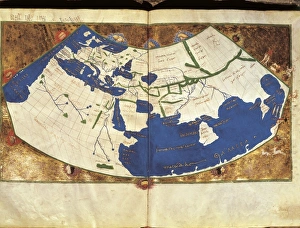
Background imageMaps Collection: PTOLEMY, Claudius Ptolemaeus ( c. AD 100 - c

PTOLEMY, Claudius Ptolemaeus ( c. AD 100 - c
" PTOLEMY, Claudius Ptolemaeus ( c. AD 100 - c. AD 170). Egyptian astronomer, mathematician and geographer. Map of the Ancient World. From the work " Ptolomeus Geographicorum Libri"

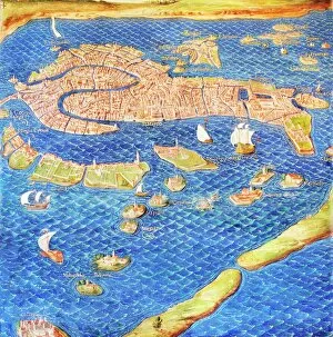
Background imageMaps Collection: 16th century map of Venice

16th century map of Venice showing the lagoon. Venice is a coastal city in the north-east of Italy. The main bulk of Venice is in the upper frame of the image

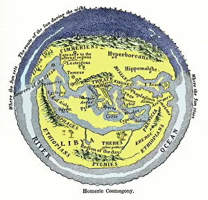
Background imageMaps Collection: Homeric cosmogony

Homeric cosmogony. Map of the Earth based on the myths and knowledge of the Ancient Greeks at the time of Homer (1st or 2nd millennium BC)

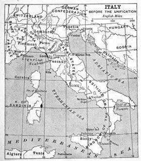
Background imageMaps Collection: Italy Map Pre-Unity

Italy Map Pre-Unity
A map of Italy prior to unification

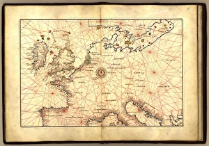
Background imageMaps Collection: Europe, 16th century nautical map

Europe, 16th century nautical map
Nautical map of Europe, 1544 copy of Agnese Atlas. Several copies of this atlas were produced between 1536 and 1564, in Venice, by the Italian mapmaker Battista Agnese

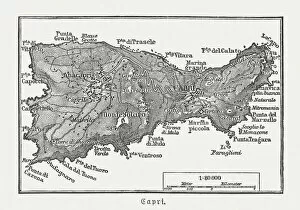
Background imageMaps Collection: Map of Capri, Italian island, wood engraving published in 1897

Map of Capri, Italian island, wood engraving published in 1897
Map of Capri, Italian island. Wood engraving, published in 1897

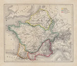
Background imageMaps Collection: Gaul in the time of Julius Caesar, published in 1867

Gaul in the time of Julius Caesar, published in 1867
Gaul in the time of Roman politican Gaius Iulius Caesar (100 - 44 BC). Steel engraving with hand-colored borderlines and Latin legend, published in 1867

Background imageMaps Collection: Map of ancient Abruzzo, by Giovan Battista Pacichelli, engraving, 1702

Map of ancient Abruzzo, by Giovan Battista Pacichelli, engraving, 1702
Cartography, Italy, 18th century. Ancient Abruzzo. From The Kingdom of Naples in perspective by Giovan Battista Pacichelli, 1702. Engraving

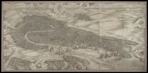
Background imageMaps Collection: View of Venice, 1500 (woodcut)

View of Venice, 1500 (woodcut)
3557439 View of Venice, 1500 (woodcut) by Barbari, Jacopo de (1440/50-a.1515); 132.72x277.5 cm; Minneapolis Institute of Arts, MN

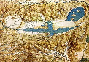
Background imageMaps Collection: Topographic View of the Countryside around the Plain of Arezzo and the Val di Chiana, Early16th cen

Topographic View of the Countryside around the Plain of Arezzo and the Val di Chiana, Early16th cen.. Found in the collection of the Royal Library, Windsor Castle

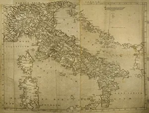
Background imageMaps Collection: Map of Italian Peninsula, Islands of Corsica and Sardinia an

Map of Italian Peninsula, Islands of Corsica and Sardinia and Adriatic coast. Engraving. 16th century

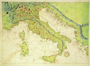
Background imageMaps Collection: Italy, from an Atlas of the World in 33 Maps, Venice, 1st September 1553 (ink on vellum)

Italy, from an Atlas of the World in 33 Maps, Venice, 1st September 1553 (ink on vellum)
XOT330948 Italy, from an Atlas of the World in 33 Maps, Venice, 1st September 1553 (ink on vellum) by Agnese, Battista (1514-64); Museo Correr, Venice, Italy; Italian, out of copyright

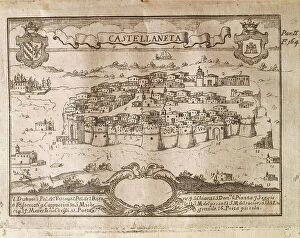
Background imageMaps Collection: Italy, City of Castellaneta (Taranto) by Giovan Battista Pacichelli from Il Regno di Napoli in

Italy, City of Castellaneta (Taranto) by Giovan Battista Pacichelli from Il Regno di Napoli in prospettiva
Cartography, Italy, 18th century. The City of Castellaneta (Taranto). Engraving from Il Regno di Napoli in prospettiva (The Kingdom of Naples in Perspective), by Giovan Battista Pacichelli, 1702

Background imageMaps Collection: Computer graphic of global internet traffic

Computer graphic of global internet traffic
Internet traffic. Computer graphic of global internet traffic. Each line represents the path of sample data sent out to one of 20, 000 pre- selected locations using a system called Skitter

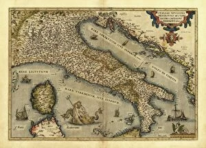
Background imageMaps Collection: Orteliuss map of Italy, 1570

Orteliuss map of Italy, 1570
Orteliuss map of Italy. This map is from the 1570 first edition of Theatrum orbis terrarum ( Theatre of the World ). Drawn by the Flemish mapmaker Abraham Ortelius (1527-1598)

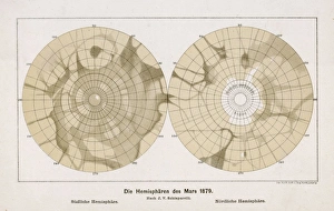
Background imageMaps Collection: Schiaparellis two hemispheres of the planet Mars

Schiaparellis two hemispheres of the planet Mars
The two hemispheres of the planet Mars as drawn by the Italian astronomer and historian of science, Giovanni Schiaparelli

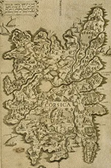
Background imageMaps Collection: Map of Corsica. Italian engraving. 16th century

Map of Corsica. Italian engraving. 16th century

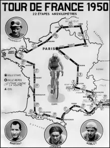
Background imageMaps Collection: Official map of the stage of the Tour de France Cycliste 1950

Official map of the stage of the Tour de France Cycliste 1950
Presentation of the official map of the stage of the Tour de France Cycliste 1950 including 22 stages spread over a total course of 4812 kilometers

Background imageMaps Collection: old map of europe

old map of europe
an old map form 1883, showing european countries

Background imageMaps Collection: Philosophy, self-portrait by Italian artist Salvator Rosa (oil painting)

Philosophy, self-portrait by Italian artist Salvator Rosa (oil painting)
7172079 Philosophy, self-portrait by Italian artist Salvator Rosa (oil painting) by Rosa, Salvator (1615-73) (after); Private Collection; (add.info.: Philosophy)

Background imageMaps Collection: Map of Rome in 1570 - in 'Civitatis Orbis Terranum'

Map of Rome in 1570 - in "Civitatis Orbis Terranum"
GIA4814793 Map of Rome in 1570 - in " Civitatis Orbis Terranum" by Braun and Hogenberg. 1588. by Braun, Georg (1541-1622) and Hogenberg

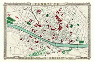
Background imageMaps Collection: George Bradshaws Plan of Florence, Italy 1896

George Bradshaws Plan of Florence, Italy 1896
This is a detailed Plan of Florence showing the streets, canals, principal buildings, railways and railway stations. It has been meticulously recreated in colour and republished without

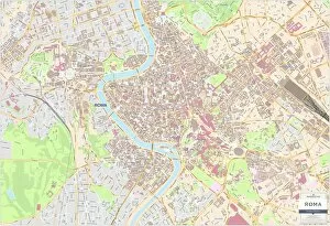
Background imageMaps Collection: Rome City Centre Street Map

Rome City Centre Street Map
A detailed street level map of central Rome. Covers from Pinciano in the north to San Saba in the south and from Viale Pretoriano in the east and includes all of the Vatican city in the west

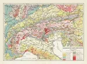
Background imageMaps Collection: Geological map of the European Alps, lithograph, published in 1897

Geological map of the European Alps, lithograph, published in 1897
Geological map of the European Alps. Lithograph, published in 1897

Background imageMaps Collection: Map of central Europe 1889

Map of central Europe 1889
Indiana Educational Series The Complete Geography - Indianapolis 1889

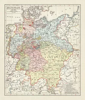
Background imageMaps Collection: Map of the German Confederation (1815-1866), lithograph, published in 1897

Map of the German Confederation (1815-1866), lithograph, published in 1897
Map of the German Confederation between 1815 and 1866. Lithograph, published in 1897

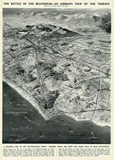
Background imageMaps Collection: Nettuno-Anzio Front, Italy, by G. H. Davis

Nettuno-Anzio Front, Italy, by G. H. Davis
The battle of the beachhead -- an airmans view of the terrain. A pictorial map of the Nettuno-Anzio Front, showing roads, with the Alban Hills in the background

Background imageMaps Collection: Floor plan of Palatine Hill in Rome, published in 1878

Floor plan of Palatine Hill in Rome, published in 1878
Floor plan of the archaeological remains of the Palatine Hill in Rome. The Palatine Hill (Latin: Mons Palatinus, Italian: Monte Palatino)

Background imageMaps Collection: Trieste Italy map 1895

Trieste Italy map 1895
Meyers Konversations-Lexikon. Ein Nachschlagewerk des allgemeinen Wissens, 5th edition 17 volumes Bibliographisches Institut - Leipzig 1895-1897

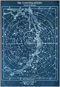
Background imageMaps Collection: Antique colored illustrations: The constellations visible in Britain

Antique colored illustrations: The constellations visible in Britain

Background imageMaps Collection: Map of Europe 1721

Map of Europe 1721

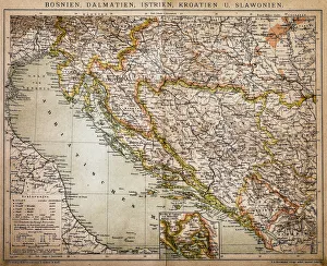
Background imageMaps Collection: Bosnia, dalmatia, istria, croatia, slavonia

Bosnia, dalmatia, istria, croatia, slavonia
Antique illustration of a Bosnia, dalmatia, istria, croatia, slavonia map

Background imageMaps Collection: Comic map of Europe by Frederick Rose, c. 1870 (litho)

Comic map of Europe by Frederick Rose, c. 1870 (litho)
XND76008 Comic map of Europe by Frederick Rose, c.1870 (litho) by English School, (19th century); Private Collection; (add.info)

Background imageMaps Collection: US-JUPITER

US-JUPITER
This true-color simulated view of Jupiter released 30 December, 2000 by NASA is composed of four images taken by NASAs Cassini spacecraft on 07 December, 2000

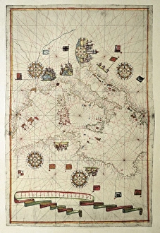
Background imageMaps Collection: Portolan chart, 1582. Map of the central part

Portolan chart, 1582. Map of the central part of the Mediterranean sea. Printed in Messina. Renaissance art. Miniature Painting

Background imageMaps Collection: Italy Before Unification

Italy Before Unification
Antique Maps, TR002313

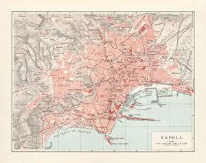
Background imageMaps Collection: City map of Naples (Italian: Napoli), Italy, lithograph, published 1897

City map of Naples (Italian: Napoli), Italy, lithograph, published 1897
City map of Naples (Italian: Napoli), Campania, Italy. Lithograph, published in 1897

Background imageMaps Collection: Gallery of Maps, Vatican, published in 1878

Gallery of Maps, Vatican, published in 1878
The Gallery of Maps (Latin: Galleria delle carte geografiche) in the Vatican. Wood engraving, published in 1878

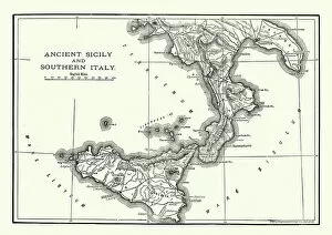
Background imageMaps Collection: Map of Ancient Sicily and Southern Italy

Map of Ancient Sicily and Southern Italy
Vintage engraving of a Map of Ancient Sicily and Southern Italy

Background imageMaps Collection: Antique engraving illustration: Paris Subway Metro map

Antique engraving illustration: Paris Subway Metro map

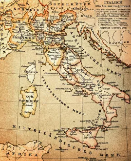
Background imageMaps Collection: Antquie Map of Italy

Antquie Map of Italy
Vintage map of Italy from 1815

Background imageMaps Collection: Siege of Malta, detail from the Galleria delle Carte Geografiche, 1580-83

Siege of Malta, detail from the Galleria delle Carte Geografiche, 1580-83
XIR259885 Siege of Malta, detail from the Galleria delle Carte Geografiche, 1580-83 (fresco) (see also 260199) by Italian School, (16th century); Vatican Museums and Galleries

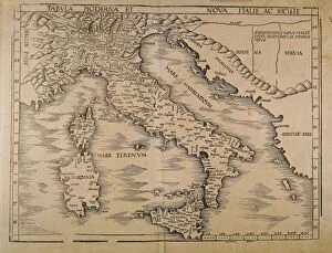
Background imageMaps Collection: Map of Italy, From Geographiae Opus Novissima by Martin Waldseemueller, Woodcut, 1513

Map of Italy, From Geographiae Opus Novissima by Martin Waldseemueller, Woodcut, 1513
Cartography, 16th century. Map of Italy. From Geographiae Opus Novissima by Martin Waldseemueller, 1513. Woodcut

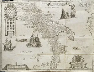
Background imageMaps Collection: Map of The Kingdom of Naples, by Giovan Battista Pacichelli, engraving, 1702

Map of The Kingdom of Naples, by Giovan Battista Pacichelli, engraving, 1702
Cartography, Italy, 18th century. The Kingdom of Naples. From The Kingdom of Naples in perspective by Giovan Battista Pacichelli, 1702. Engraving

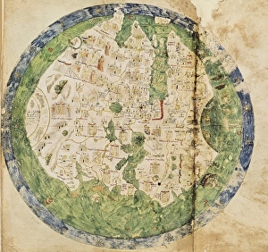
Background imageMaps Collection: Andrea Biancos Atlas, 1436. Page 10, World Map

Andrea Biancos Atlas, 1436. Page 10, World Map
" Andrea Biancos Atlas, 1436. Page 10, World Map, the East is on the upper side. First time Florida coast is depicted as a big peninsula linked to an island called Antillia (legendary island)

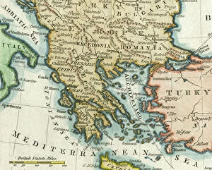
Background imageMaps Collection: Map of Greece, 1792

Map of Greece, 1792
Map of Greece and Greek islands plus Romania (which appears on this map to be incorrectly labelled or positioned south of Bulgaria), Macedonia, Albania and parts of Turkey and Italy

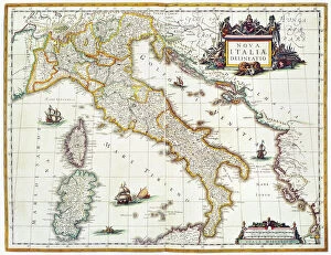
Background imageMaps Collection: MAP OF ITALY, 1631. Map of Italy, 1631, by Johannes Blaeu based on a map by Giovanni Antonio Magini

MAP OF ITALY, 1631. Map of Italy, 1631, by Johannes Blaeu based on a map by Giovanni Antonio Magini (d. 1617)

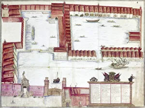
Background imageMaps Collection: VENICE: ARSENALE. The Arsenale of Venice, Italy. Drawing by Antonio di Natale, 18th century

VENICE: ARSENALE. The Arsenale of Venice, Italy. Drawing by Antonio di Natale, 18th century


All Professionally Made to Order for Quick Shipping


-

Maps Collection

Maps of Italy Europe are invaluable resources for anyone looking to explore the country. They provide detailed information about the terrain, roads, cities, and other points of interest, and are be found in a variety of formats such as paper maps, online maps, and apps. Paper they can great for planning trips or getting an overview of the area while online maps provide more detailed information such as street names and directions. Apps are also useful for navigating while on-the-go. Maps of Italy Europe can help travelers find their way around unfamiliar places with ease and make sure they don’t miss out on any must-see attractions along their journey.
+

Our beautiful Wall Art and Photo Gifts include Framed Prints, Photo Prints, Poster Prints, Canvas Prints, Jigsaw Puzzles, Metal Prints and so much more

The Maps of Italy Europe collection from Media Storehouse is a stunning range of wall art and framed prints that showcase the beauty and diversity of Italy. Our collection features an extensive selection of maps, ranging from antique maps dating back to the 16th century to modern-day cartography. Each map has been carefully selected for its historical significance or aesthetic appeal, making it a perfect addition to any home or office space. The Maps of Italy Europe collection offers something for everyone, with maps depicting different regions and cities across Italy. From the rolling hills of Tuscany to the bustling streets of Rome, these maps capture the essence of this beautiful country in intricate detail. Whether you are looking for a unique piece of wall art or a thoughtful gift for someone special, the Maps of Italy Europe collection is sure to impress. With high-quality printing and framing options available, these prints are designed to last a lifetime and bring joy to all who view them.
+

What are Maps of Italy Europe art prints?

Maps of Italy Europe art prints are high-quality reproductions of vintage and contemporary maps that showcase the intricate details and beauty of Italy and other European countries. These prints are perfect for those who love to travel, history enthusiasts, or anyone looking to add a touch of sophistication to their home decor. These art prints come in various sizes and styles, from colorful antique maps depicting the regions of Italy to modern minimalist designs highlighting the country's famous landmarks. They are printed on premium paper using archival inks that ensure long-lasting color vibrancy. Maps of Italy Europe art prints make great gifts for friends or family members who have a special connection with Italy or Europe. They can also be used as educational tools in classrooms or offices. Whether you're looking for a unique piece to decorate your living room wall or want to add some character to your workspace, Maps of Italy Europe art prints offer endless possibilities for personalization and creativity.
+

What Maps of Italy Europe art prints can I buy from Media Storehouse?

We offer a wide range of Maps of Italy Europe art prints that you can buy. These maps are available in various sizes and styles to suit your preferences. You can choose from antique, vintage, or contemporary designs that showcase the beauty and history of Italy and Europe. The collection includes detailed maps of Italian cities such as Rome, Florence, Venice, Milan, Naples, and many others. You can also find regional maps that highlight the diverse landscapes and cultures across Italy's 20 regions. In addition to Italian maps, Media Storehouse also offers European continent maps that feature neighboring countries such as France, Spain, Germany, Switzerland among others. These prints come in different formats including canvas prints or framed wall art for easy display on your walls. Whether you're looking for decorative pieces for your home or office space or educational resources for schools or libraries; Media Storehouse has got you covered with their extensive selection of Maps of Italy Europe art prints.
+

How do I buy Maps of Italy Europe art prints?

To buy Maps of Italy Europe art prints from Media Storehouse, you can browse our extensive collection online. We offer a variety of sizes and framing options to suit your preferences. Once you have found the print that you like, simply add it to your cart and proceed to checkout. You will be prompted to enter your shipping information and payment details before completing the purchase. We offer high-quality prints on premium paper using state-of-the-art printing technology. Their maps are sourced from reputable archives and collections around the world, ensuring accuracy and authenticity. Whether you are looking for a vintage map of Italy or a contemporary interpretation of Europe's geography, we have something for everyone. With our easy-to-use website and secure checkout process, buying Maps of Italy Europe art prints has never been easier.
+

How much do Maps of Italy Europe art prints cost?

We offer a wide range of Maps of Italy Europe art prints at various price points to suit different budgets. Our collection includes vintage maps, contemporary designs, and everything in between. The cost of our Maps of Italy Europe art prints depends on several factors such as the size, framing options, and materials used for printing. We use high-quality paper and ink to ensure that every print is vibrant and long-lasting. Our you can choose from a variety of sizes ranging from small to large formats depending on their preferences. Whether you're looking for a simple poster or an intricately framed piece, we have something for everyone. Our selection also includes canvas prints which provide a unique texture and depth to your artwork. The cost of our Maps of Italy Europe art prints varies based on individual choices but we strive to provide affordable options without compromising quality.
+

How will my Maps of Italy Europe art prints be delivered to me?

We take great care in ensuring that your Maps of Italy Europe art prints are delivered to you safely and securely. Our delivery process is designed to be hassle-free and convenient for our customers. Once you have placed your order with us, your Maps of Italy Europe art prints will be carefully packaged and dispatched from our warehouse. We use reliable courier services to ensure that your artwork arrives at its destination in perfect condition. We offer a range of delivery options depending on the size and weight of your order, as well as the destination address. You can choose standard or express delivery options at checkout. Our team is committed to providing excellent customer service throughout the entire ordering process. If you have any questions about shipping or delivery, please don't hesitate to contact us via email or phone. We're always happy to help.