Fraud Blocker Skip to main content

Home > Europe > Portugal > Maps

Maps Collection (page 5)

Portugal is a country located in the southwest corner of Europe, and is bordered by Spain to the north and east, and the Atlantic Ocean to the south and west

400 items

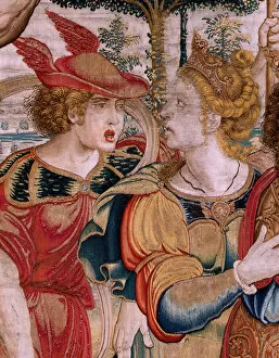
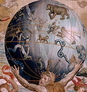
Background imageMaps Collection: Flemish tapestry. Series The Spheres. Hercules supporting the celestial sphere

Flemish tapestry. Series The Spheres. Hercules supporting the celestial sphere (Hercules sostiene la esfera celeste)
7209519 Flemish tapestry. Series The Spheres. Hercules supporting the celestial sphere (Hercules sostiene la esfera celeste). First tapestry in the series

Background imageMaps Collection: Flemish tapestry. Series The Spheres. Hercules supporting the celestrial sphere

Flemish tapestry. Series The Spheres. Hercules supporting the celestrial sphere (Hercules sostiene la esfera celeste)
7209523 Flemish tapestry. Series The Spheres. Hercules supporting the celestrial sphere (Hercules sostiene la esfera celeste). First tapestry in the series

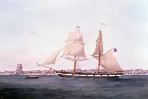
Background imageMaps Collection: The Maria Helena off Lisbon with the Tower of Belem beyond her Bow, 1852 (oil on canvas)

The Maria Helena off Lisbon with the Tower of Belem beyond her Bow, 1852 (oil on canvas)
6431740 The Maria Helena off Lisbon with the Tower of Belem beyond her Bow, 1852 (oil on canvas) by Walters, Samuel (1811-82); Private Collection

Background imageMaps Collection: The fortress of the Moors at Cintra (litho)

The fortress of the Moors at Cintra (litho)
7170958 The fortress of the Moors at Cintra (litho) by American School, (20th century); Private Collection; (add.info.: The fortress of the Moors at Cintra)

Background imageMaps Collection: The Harbor of Oporto (litho)

The Harbor of Oporto (litho)
7170960 The Harbor of Oporto (litho) by American School, (20th century); Private Collection; (add.info.: The Harbor of Oporto)

Background imageMaps Collection: The Christ Chapel at Thomar (litho)

The Christ Chapel at Thomar (litho)
7170959 The Christ Chapel at Thomar (litho) by American School, (20th century); Private Collection; (add.info.: The Christ Chapel at Thomar)

Background imageMaps Collection: Eastern Spain and the Balearic Islands (colour litho)

Eastern Spain and the Balearic Islands (colour litho)
7169495 Eastern Spain and the Balearic Islands (colour litho) by English School, (20th century); Private Collection; (add.info.: Eastern Spain and the Balearic Islands)

Background imageMaps Collection: Tower of Belem, Lisbon, Portugal (b / w photo)

Tower of Belem, Lisbon, Portugal (b / w photo)
7159878 Tower of Belem, Lisbon, Portugal (b/w photo) by American Photographer, (19th century); Private Collection; (add.info.: Tower of Belem, Lisbon, Portugal)

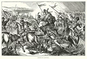
Background imageMaps Collection: Battle of Albuera (engraving)

Battle of Albuera (engraving)
7188168 Battle of Albuera (engraving) by English School, (19th century); Private Collection; (add.info.: Battle of Albuera)

Background imageMaps Collection: Lisbonne bloquee par Ango (engraving)

Lisbonne bloquee par Ango (engraving)
7194153 Lisbonne bloquee par Ango (engraving) by French School, (19th century); Private Collection; (add.info.: Lisbonne bloquee par Ango)

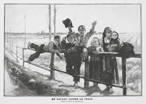
Background imageMaps Collection: Watching the Train Pass (engraving)

Watching the Train Pass (engraving)
7185177 Watching the Train Pass (engraving) by Gallegos Arnosa, Jose (1859-1917); Private Collection; (add.info.: Watching the Train Pass)

Background imageMaps Collection: Extraordinary News: Londoners reacting to the news of the evacuation of Portugal by the French in

Extraordinary News: Londoners reacting to the news of the evacuation of Portugal by the French in 1808 (engraving)
7184991 Extraordinary News: Londoners reacting to the news of the evacuation of Portugal by the French in 1808 (engraving) by Ansell

Background imageMaps Collection: Tower of Belem, Lisbon, Portugal (b / w photo)

Tower of Belem, Lisbon, Portugal (b / w photo)
7180265 Tower of Belem, Lisbon, Portugal (b/w photo) by European Photographer, (19th century); Private Collection; (add.info.: Tower of Belem, Lisbon, Portugal)

Background imageMaps Collection: Flemish tapestry. Series The Spheres. Hercules supporting the celestrial sphere

Flemish tapestry. Series The Spheres. Hercules supporting the celestrial sphere (Hercules sostiene la esfera celeste)
7208762 Flemish tapestry. Series The Spheres. Hercules supporting the celestrial sphere (Hercules sostiene la esfera celeste). First tapestry in the series

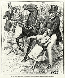
Background imageMaps Collection: 'It was none other than the Duke of Wellington who rescued little Queen Maria'(litho)

"It was none other than the Duke of Wellington who rescued little Queen Maria"(litho)
7168953 " It was none other than the Duke of Wellington who rescued little Queen Maria" (litho) by English School

Background imageMaps Collection: Penha Castle, Cintra (b / w photo)

Penha Castle, Cintra (b / w photo)
7167497 Penha Castle, Cintra (b/w photo) by English Photographer, (19th century); Private Collection; (add.info.: Penha Castle, Cintra)

Background imageMaps Collection: Flags of All Nations (colour litho)

Flags of All Nations (colour litho)
7178721 Flags of All Nations (colour litho) by American School, (19th century); Private Collection; (add.info.: Flags of All Nations)

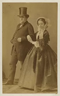
Background imageMaps Collection: Maria Pia of Savoy, daughter of King Victor Emmanuel II of Italy

Maria Pia of Savoy, daughter of King Victor Emmanuel II of Italy and Queen Consort of King Luis I of Portugal
7154026 Maria Pia of Savoy, daughter of King Victor Emmanuel II of Italy and Queen Consort of King Luis I of Portugal (b/w photo) by Italian Photographer

Background imageMaps Collection: Chasse du roi de Portugal dans les reserves du palais de Mafra (engraving)

Chasse du roi de Portugal dans les reserves du palais de Mafra (engraving)
7200028 Chasse du roi de Portugal dans les reserves du palais de Mafra (engraving) by French School, (19th century); Private Collection; (add.info)

Background imageMaps Collection: Le Vocabulaire Illustre: Portugais; Portuguese; Portugieser (engraving)

Le Vocabulaire Illustre: Portugais; Portuguese; Portugieser (engraving)
7197221 Le Vocabulaire Illustre: Portugais; Portuguese; Portugieser (engraving) by European School, (19th century); Private Collection; (add.info.: Portugais; Portuguese; Portugieser)

Background imageMaps Collection: Flemish tapestry. Series The Spheres. Hercules supporting the celestial sphere

Flemish tapestry. Series The Spheres. Hercules supporting the celestial sphere (Hercules sostiene la esfera celeste)
7209521 Flemish tapestry. Series The Spheres. Hercules supporting the celestial sphere (Hercules sostiene la esfera celeste). First tapestry in the series

Background imageMaps Collection: Flemish tapestry. Series The Spheres. Hercules supporting the celestrial sphere

Flemish tapestry. Series The Spheres. Hercules supporting the celestrial sphere (Hercules sostiene la esfera celeste)
7209518 Flemish tapestry. Series The Spheres. Hercules supporting the celestrial sphere (Hercules sostiene la esfera celeste). First tapestry in the series

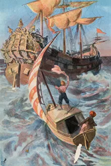
Background imageMaps Collection: Robinson Crusoe: I am rescued by a Portuguese ship (colour litho)

Robinson Crusoe: I am rescued by a Portuguese ship (colour litho)
7182730 Robinson Crusoe: I am rescued by a Portuguese ship (colour litho) by Finnemore, Joseph (1860-1939) (after); Private Collection; (add.info.: I am rescued by a Portuguese ship)

Background imageMaps Collection: Catherine of Braganza, Queen Consort of King Charles II (engraving)

Catherine of Braganza, Queen Consort of King Charles II (engraving)
7185438 Catherine of Braganza, Queen Consort of King Charles II (engraving) by Stoop, Dirck (c.1614-c.83) (after); Private Collection; (add.info.: Catherine of Braganza)

Background imageMaps Collection: Luis I, King of Portugal (b / w photo)

Luis I, King of Portugal (b / w photo)
7154028 Luis I, King of Portugal (b/w photo) by European Photographer, (19th century); Private Collection; (add.info.: Luis I)

Background imageMaps Collection: Members of the League of Nations (colour litho)

Members of the League of Nations (colour litho)
7163177 Members of the League of Nations (colour litho) by English School, (20th century); Private Collection; (add.info.: Members of the League of Nations)

Background imageMaps Collection: Map of Spain and Portugal 1897

Map of Spain and Portugal 1897 Original edition from my own archives Source : " Meyers Konversations-Lexikon" 1897

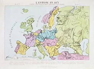
Background imageMaps Collection: L Europe en 1871, 1871 (colour litho)

L Europe en 1871, 1871 (colour litho)
XCF290996 L Europe en 1871, 1871 (colour litho) by Hadol, Paul (1835-1875); Private Collection; French, out of copyright

Background imageMaps Collection: Geographic map of Guinee made by cartographer Luis Teixera (or Teixeira)

Geographic map of Guinee made by cartographer Luis Teixera (or Teixeira)
JLJ4598028 Geographic map of Guinee made by cartographer Luis Teixera (or Teixeira), approximately 1586. At the top right, representation of a dance scene among the indigenous (Africans)

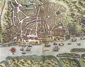
Background imageMaps Collection: Map of Lisbon - Portugal (engraving, 16th century)

Map of Lisbon - Portugal (engraving, 16th century)
LRI4647050 Map of Lisbon - Portugal (engraving, 16th century) by Hogenberg, Franz (1540-c.1590); Private Collection; (add.info)

Background imageMaps Collection: Map of Spain and Portugal, c. 1581 (mural painting)

Map of Spain and Portugal, c. 1581 (mural painting)
LRI4595702 Map of Spain and Portugal, c.1581 (mural painting) by Buonsignori, Stefano (d.1589); Palazzo Vecchio, Florence, Italy; (add.info.: Spain and Portugal Map made by Stefano Bonsignori ()

Background imageMaps Collection: The Kingdoms of Spain and Portugal divided into their provinces, engraving by G

The Kingdoms of Spain and Portugal divided into their provinces, engraving by G
3572514 The Kingdoms of Spain and Portugal divided into their provinces, engraving by G. Zuliani taken from Tome I of the " Newest Atlas" published in Venice in 1775 by Antonio Zatta

Background imageMaps Collection: Drolatic map of Europe for 1870 (litho)

Drolatic map of Europe for 1870 (litho)
PCT4267732 Drolatic map of Europe for 1870 (litho) by Hadol, Paul (1835-1875); (add.info.: England, isolated, plague of rage and almost forgets about Ireland, which it holds on a leash)

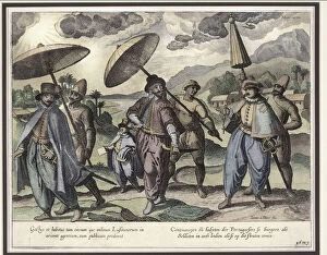
Background imageMaps Collection: Portuguese in Goa, illustration from Jan Huyghen van Linschoten

Portuguese in Goa, illustration from Jan Huyghen van Linschoten
LIT389179 Portuguese in Goa, illustration from Jan Huyghen van Linschoten, His Discourse of Voyages into the East and West Indies, 1579-92 (colour engraving) by Doetechum, Johannes Baptista van

Background imageMaps Collection: Plan of the Bay and City of Rio de Janeiro and the disposition of the French

Plan of the Bay and City of Rio de Janeiro and the disposition of the French
694860 Plan of the Bay and City of Rio de Janeiro and the disposition of the French and Portuguese naval forces during the French attack under Duguay-Trouin in 1711, c.1730 (engraving) by Coquart

Background imageMaps Collection: Family connections between European monarchs (litho)

Family connections between European monarchs (litho)
3094403 Family connections between European monarchs (litho) by French School, (20th century); Private Collection; (add.info.: Family connections between European monarchs)

Background imageMaps Collection: Portulan: Geographic map with the name of the coastline of Cuba, Florida

Portulan: Geographic map with the name of the coastline of Cuba, Florida
AIS5347578 Portulan: Geographic map with the name of the coastline of Cuba, Florida, Central America and North Latin America, Hydrographic Atlas of Fernao VAZ DOURADO (16th century)

Background imageMaps Collection: View of the archipelago of the Acores Islands in the Atlantic Ocean (engraving, 1690)

View of the archipelago of the Acores Islands in the Atlantic Ocean (engraving, 1690)
LRI4648797 View of the archipelago of the Acores Islands in the Atlantic Ocean (engraving, 1690) by Coronelli, Vincenzo Maria (1650-1718); Arquivo historico do exterior, Lisbon

Background imageMaps Collection: Coimbra, Portugal. The two academics seen in learned discussion in the foreground make

Coimbra, Portugal. The two academics seen in learned discussion in the foreground make
LRI4714829 Coimbra, Portugal. The two academics seen in learned discussion in the foreground make further visual reference to the university (engraving, 1598) by Hogenberg

Background imageMaps Collection: Cape Sagres (or Sacred Cape) at the end of Portugal after the portulan of Luca J

Cape Sagres (or Sacred Cape) at the end of Portugal after the portulan of Luca J
GIA4725832 Cape Sagres (or Sacred Cape) at the end of Portugal after the portulan of Luca J. Waghenaer Treesor of zeevaert printed in Leiden in 1592 by Netherlandish School (16th century)

Background imageMaps Collection: Geography: detail of a navigation map of Luis Lazare (16th century

Geography: detail of a navigation map of Luis Lazare (16th century
JLJ4657031 Geography: detail of a navigation map of Luis Lazare (16th century) representing the islands of the Tristan da Cunha archipelago (or Tristan d Acunha)

Background imageMaps Collection: Art Portugal: dance of the indigenous detail of the map of the Guinee by Luis Texeira

Art Portugal: dance of the indigenous detail of the map of the Guinee by Luis Texeira
JLJ4608091 Art Portugal: dance of the indigenous detail of the map of the Guinee by Luis Texeira (1602-1650), Engraving of the 17th century

Background imageMaps Collection: Portulan of the West Coast of Africa with the Canary Islands

Portulan of the West Coast of Africa with the Canary Islands
JLJ4612981 Portulan of the West Coast of Africa with the Canary Islands. Geographic map of Portuguese Luis Lazare (16th century), 1563

Background imageMaps Collection: Map of the City and Portuguese Port of Goa, India, detail of port and merchant shipping

Map of the City and Portuguese Port of Goa, India, detail of port and merchant shipping
STC110751 Map of the City and Portuguese Port of Goa, India, detail of port and merchant shipping, 1595 (engraving) (detail of 110750) by Doetechum, Johannes Baptista van

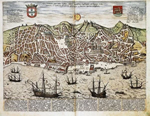
Background imageMaps Collection: Map of Lisbon, from Civitates Orbis Terrarum by Georg Braun (1541-1622

Map of Lisbon, from Civitates Orbis Terrarum by Georg Braun (1541-1622
STC121056 Map of Lisbon, from Civitates Orbis Terrarum by Georg Braun (1541-1622) and Frans Hogenberg (1535-90), c.1572 (coloured engraving) by Hoefnagel

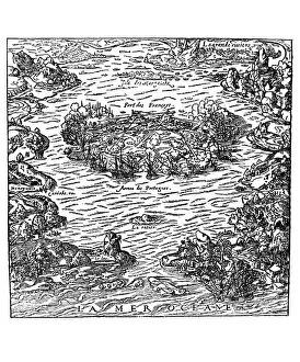
Background imageMaps Collection: The capture of the Fort of Villegagnon from La Cosmographie universelle

The capture of the Fort of Villegagnon from La Cosmographie universelle
CHT157467 The capture of the Fort of Villegagnon from La Cosmographie universelle by Andre Thevet, c.1560 (engraving) by Thevet

Background imageMaps Collection: Map of the Siege of St Sebastian, published by William Blackwood and Sons

Map of the Siege of St Sebastian, published by William Blackwood and Sons
746885 Map of the Siege of St Sebastian, published by William Blackwood and Sons, Edinburgh & London, 1848 (hand-coloured engraving) by Johnston

Background imageMaps Collection: The Island of Saint Helena, illustration from Linschotens Itinerario

The Island of Saint Helena, illustration from Linschotens Itinerario
741395 The Island of Saint Helena, illustration from Linschotens Itinerario, 1596 (engraving) by van Linschoten, J.H. (1563-1611); Bibliotheque Nationale, Paris


All Professionally Made to Order for Quick Shipping


-

Maps Collection

Portugal is a country located in the southwest corner of Europe, and is bordered by Spain to the north and east, and the Atlantic Ocean to the south and west. Maps of Portugal are useful for travelers who wish to explore this beautiful country. They provide an overview of Portugal's geography, including its major cities, rivers, mountain ranges, and coastal areas. Additionally they can show visitors attractions such as museums, monuments, parks, beaches and other points of interest. It also help travelers plan their route around Portugal by providing information on roads and highways as well as public transportation options like buses or trains. With a map in hand travelers can easily navigate their way around this fascinating country with ease.
+

Our beautiful Wall Art and Photo Gifts include Framed Prints, Photo Prints, Poster Prints, Canvas Prints, Jigsaw Puzzles, Metal Prints and so much more

The Maps of Portugal Europe collection is a stunning assortment of wall art and framed prints that showcase the geography, history, and culture of Portugal. This exquisite collection features a wide range of maps that depict different regions, cities, landmarks, and historical events in Portugal. From vintage maps dating back to the 16th century to modern-day cartography, our collection offers something for everyone who loves Portuguese history or wants to add an elegant touch to their home decor. Each map in our collection is carefully selected by our team of experts who ensure that only high-quality prints are included. The Maps of Portugal Europe collection includes various sizes and styles ranging from colorful antique-style maps with intricate details to minimalist black-and-white designs perfect for contemporary interiors. Whether you're looking for a unique gift or want to decorate your living room with beautiful artwork inspired by Portuguese culture and heritage, the Maps of Portugal Europe collection has something special for you.
+

What are Maps of Portugal Europe art prints?

Maps of Portugal Europe art prints are high-quality reproductions of antique and contemporary maps of Portugal, a country located in southwestern Europe. These art prints showcase the geography, topography, cities, towns and landmarks of Portugal with intricate details that make them both informative and decorative. These maps can be used to decorate homes or offices while also serving as educational tools for those interested in Portuguese history or geography. They come in various sizes and styles to suit different tastes and preferences. Some Maps of Portugal Europe art prints feature vintage designs that offer a glimpse into the past while others display modern cartographic techniques that highlight current political boundaries, transportation networks, natural resources among other features. These art prints are perfect for anyone who wants to add some sophistication to their living space or office while also celebrating the rich culture and heritage of Portugal.
+

What Maps of Portugal Europe art prints can I buy from Media Storehouse?

We offer a wide range of Maps of Portugal Europe art prints for purchase. These maps showcase the intricate details and features of Portugal, including its cities, regions, and topography. You can choose from a variety of styles and designs to suit their personal preferences or home decor. Some popular options include antique-style maps that feature hand-drawn illustrations and historical information about Portugal's past. Other contemporary designs showcase vibrant colors and modern typography for a more updated look. In addition to traditional paper prints, Media Storehouse also offers canvas prints that add texture and depth to any room. These high-quality reproductions are perfect for adding a touch of sophistication to your living space or office. Whether you're looking for a unique gift or simply want to decorate your own walls with beautiful artwork, we have plenty of Maps of Portugal Europe art prints available for purchase.
+

How do I buy Maps of Portugal Europe art prints?

To buy Maps of Portugal Europe art prints from Media Storehouse, you can browse our extensive collection of high-quality images online. Simply search for "Maps of Portugal" or "Europe art prints" on our website and select the image that catches your eye. Once you have found the perfect print, choose the size and format that suits your needs best - whether it be a canvas, framed print or poster. After selecting your preferred options, add the item to your cart and proceed to checkout. You will then be prompted to enter your payment details and shipping information before completing the purchase. We offer a wide range of beautiful artwork featuring maps of Portugal and other European countries. Their prints are perfect for adding a touch of sophistication to any room in your home or office, making them an ideal gift for friends and family who love travel or geography.
+

How much do Maps of Portugal Europe art prints cost?

We offer a wide range of Maps of Portugal Europe art prints that are available at different prices. The cost of these prints may vary depending on the size and type of print you choose. We have a selection of high-quality paper prints, canvas prints, and framed prints to suit your preferences. Our Maps of Portugal Europe art prints feature detailed maps showcasing the beautiful country's regions, cities, towns, and landmarks. These pieces make great additions to any home or office decor and can also be used as educational tools for students studying geography or history. We take pride in providing our customers with affordable yet top-notch quality products that meet their needs. Our collection is constantly updated with new designs to ensure that there is always something fresh for everyone. If you're looking for stunning Maps of Portugal Europe art prints without breaking the bank, we have got you covered.
+

How will my Maps of Portugal Europe art prints be delivered to me?

We take great care in delivering your Maps of Portugal Europe art prints to you. Your order will be carefully packaged and shipped using a reliable delivery service. We use high-quality materials to ensure that your print arrives in perfect condition. Once your order has been processed, we will send you an email confirmation with the expected delivery date. You can also track the progress of your shipment online using the tracking number provided. We offer a range of shipping options to suit your needs, including standard and express delivery services. Our team is dedicated to ensuring that your order is delivered on time and in excellent condition. If you have any questions or concerns about the delivery of your Maps of Portugal Europe art prints, please do not hesitate to contact us for assistance. We are always happy to help.