Fraud Blocker Skip to main content

Tote Bag > Europe > Russia > Maps

Maps Tote Bag Collection (#9)

Discover the beauty of Russia and Europe with our Maps of Russia and Europe Tote Bags from Media Storehouse. These stylish and eco-friendly bags are the perfect addition to your daily routine, allowing you to carry your essentials in style while showcasing your love for world geography. Each tote bag features a vivid and intricate map design, making it a unique and thoughtful gift for yourself or a friend. Made from high-quality, durable materials, these totes are built to last and are sure to turn heads wherever you go. Travel in spirit with our Maps of Russia and Europe Tote Bags - explore, learn, and carry on the adventure.

Maps of Russia Europe are a type of map that shows the geographical area of Russia and its surrounding countries

1,334 Tote Bags

Background imageMaps Tote Bag Collection: The Russian discoveries from the map published by the Imperial Academy of St. Petersburg, 1775

The Russian discoveries from the map published by the Imperial Academy of St. Petersburg, 1775. Creator: Unknown
The Russian discoveries from the map published by the Imperial Academy of St. Petersburg, 1775. This map, showing the known geography of Alaska in the late 18th century

Background imageMaps Tote Bag Collection: Kartogramma 'grippa' : [Russia], 1890. Creator: Unknown. Kartogramma 'grippa' : [Russia], 1890

Kartogramma "grippa" : [Russia], 1890. Creator: Unknown. Kartogramma "grippa" : [Russia], 1890
Kartogramma "grippa" : [Russia], 1890. Shows occurrence of influenza by province. Each map has a number at head of title, and a month or months at the end of the title: No. 50

Background imageMaps Tote Bag Collection: E?tnograficheskai?a? karta Azi¯i?a?tskoi? Rossi¯i, (187-?). Creator: Mikhail Veniukov

E?tnograficheskai?a? karta Azi¯i?a?tskoi? Rossi¯i, (187-?). Creator: Mikhail Veniukov
E?tnograficheskai?a? karta Azi¯i?a?tskoi? Rossi¯i, (187-?). Pulkovo meridian

Background imageMaps Tote Bag Collection: Industry of binding building materials on January 1, 1933, 1934

Industry of binding building materials on January 1, 1933, 1934. Creator: Mikhail Alekseevich TSvetkov
Industry of binding building materials on January 1, 1933, 1934. From the atlas "Industry of the USSR at the beginning of the 2nd Five-Year Plan

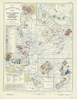
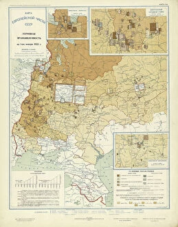
Background imageMaps Tote Bag Collection: Extraction and primary processing of non-metallic minerals as of January 1, 1933, 1934

Extraction and primary processing of non-metallic minerals as of January 1, 1933, 1934. From the atlas "Industry of the USSR at the beginning of the 2nd Five-Year Plan

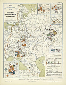
Background imageMaps Tote Bag Collection: Production of refractory products on January 1, 1933, 1934. Creator: Mikhail Alekseevich TSvetkov

Production of refractory products on January 1, 1933, 1934. Creator: Mikhail Alekseevich TSvetkov
Production of refractory products on January 1, 1933, 1934. From the atlas "Industry of the USSR at the beginning of the 2nd Five-Year Plan

Background imageMaps Tote Bag Collection: Chemical industry of the USSR on January 1, 1933, 1934. Creator: Mikhail Alekseevich TSvetkov

Chemical industry of the USSR on January 1, 1933, 1934. Creator: Mikhail Alekseevich TSvetkov
Chemical industry of the USSR on January 1, 1933, 1934. From the atlas "Industry of the USSR at the beginning of the 2nd Five-Year Plan

Background imageMaps Tote Bag Collection: Precision mechanics on January 1, 1933, 1934. Creator: Mikhail Alekseevich TSvetkov

Precision mechanics on January 1, 1933, 1934. Creator: Mikhail Alekseevich TSvetkov
Precision mechanics on January 1, 1933, 1934. From the atlas "Industry of the USSR at the beginning of the 2nd Five-Year Plan

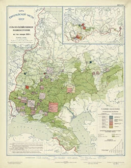
Background imageMaps Tote Bag Collection: Agricultural engineering as of January 1, 1933, 1934. Creator: Mikhail Alekseevich TSvetkov

Agricultural engineering as of January 1, 1933, 1934. Creator: Mikhail Alekseevich TSvetkov
Agricultural engineering as of January 1, 1933, 1934. From the atlas "Industry of the USSR at the beginning of the 2nd Five-Year Plan

Background imageMaps Tote Bag Collection: Automotive and tractor manufacturing on January 1, 1933, 1934. Creator: Mikhail Alekseevich TSvetkov

Automotive and tractor manufacturing on January 1, 1933, 1934. Creator: Mikhail Alekseevich TSvetkov
Automotive and tractor manufacturing on January 1, 1933, 1934. From the atlas "Industry of the USSR at the beginning of the 2nd Five-Year Plan

Background imageMaps Tote Bag Collection: General mechanical engineering on January 1, 1933, 1934. Creator: Mikhail Alekseevich TSvetkov

General mechanical engineering on January 1, 1933, 1934. Creator: Mikhail Alekseevich TSvetkov
General mechanical engineering on January 1, 1933, 1934. From the atlas "Industry of the USSR at the beginning of the 2nd Five-Year Plan

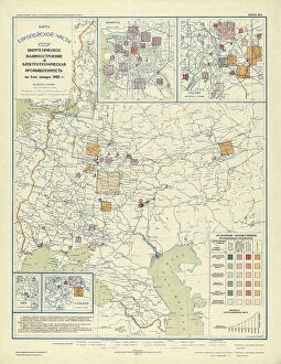
Background imageMaps Tote Bag Collection: Power engineering and electrical industry as of January 1, 1933, 1934

Power engineering and electrical industry as of January 1, 1933, 1934. Creator: Mikhail Alekseevich TSvetkov
Power engineering and electrical industry as of January 1, 1933, 1934. From the atlas "Industry of the USSR at the beginning of the 2nd Five-Year Plan

Background imageMaps Tote Bag Collection: Non-ferrous metallurgy on January 1, 1933, 1934. Creator: Mikhail Alekseevich TSvetkov

Non-ferrous metallurgy on January 1, 1933, 1934. Creator: Mikhail Alekseevich TSvetkov
Non-ferrous metallurgy on January 1, 1933, 1934. From the atlas "Industry of the USSR at the beginning of the 2nd Five-Year Plan

Background imageMaps Tote Bag Collection: Ferrous metallurgy on January 1, 1933, 1934. Creator: Mikhail Alekseevich TSvetkov

Ferrous metallurgy on January 1, 1933, 1934. Creator: Mikhail Alekseevich TSvetkov
Ferrous metallurgy on January 1, 1933, 1934. From the atlas "Industry of the USSR at the beginning of the 2nd Five-Year Plan

Background imageMaps Tote Bag Collection: Peat industry on January 1, 1933, 1934. Creator: Mikhail Alekseevich TSvetkov

Peat industry on January 1, 1933, 1934. Creator: Mikhail Alekseevich TSvetkov
Peat industry on January 1, 1933, 1934. From the atlas "Industry of the USSR at the beginning of the 2nd Five-Year Plan

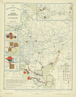
Background imageMaps Tote Bag Collection: Oil industry on January 1, 1933, 1934. Creator: Mikhail Alekseevich TSvetkov

Oil industry on January 1, 1933, 1934. Creator: Mikhail Alekseevich TSvetkov
Oil industry on January 1, 1933, 1934. From the atlas "Industry of the USSR at the beginning of the 2nd Five-Year Plan

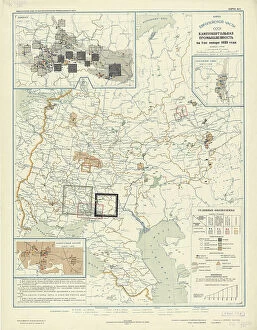
Background imageMaps Tote Bag Collection: Coal industry on January 1, 1933, 1934. Creator: Mikhail Alekseevich TSvetkov

Coal industry on January 1, 1933, 1934. Creator: Mikhail Alekseevich TSvetkov
Coal industry on January 1, 1933, 1934. From the atlas "Industry of the USSR at the beginning of the 2nd Five-Year Plan

Background imageMaps Tote Bag Collection: Power plants on January 1, 1933, 1934. Creator: Mikhail Alekseevich TSvetkov

Power plants on January 1, 1933, 1934. Creator: Mikhail Alekseevich TSvetkov
Power plants on January 1, 1933, 1934. From the atlas "Industry of the USSR at the beginning of the 2nd Five-Year Plan

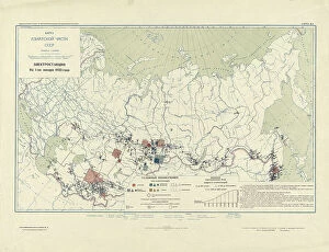
Background imageMaps Tote Bag Collection: Power Plants, 1934. Creator: Mikhail Alekseevich TSvetkov

Power Plants, 1934. Creator: Mikhail Alekseevich TSvetkov
Power Plants, 1934. From the atlas "Industry of the USSR at the beginning of the 2nd Five-Year Plan. Geographical atlas." Conventional signs: borders (5 types), settlements (7 groups)
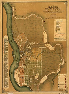
Background imageMaps Tote Bag Collection: Plan goroda Tomskas prilegai?u?shchei? k nemu zheli?e?znodorozhnoi? vi?e?tv'i?u?, 1898

Plan goroda Tomskas prilegai?u?shchei? k nemu zheli?e?znodorozhnoi? vi?e?tv'i?u?, 1898. Creators: M. N
Plan goroda Tomskas prilegai?u?shchei? k nemu zheli?e?znodorozhnoi? vi?e?tv'i?u?, 1898. Scale 1:16, 800; Relief shown by land form drawings. Russian. Shows wards and fire districts
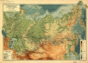
Background imageMaps Tote Bag Collection: Gipsometricheskai?a? karta Rossi¯i?skoi? Imperi¯i : (opyt izobrazheni¯i?a)

Gipsometricheskai?a? karta Rossi¯i?skoi? Imperi¯i : (opyt izobrazheni¯i?a? rel'efa Imperi¯i), (1912)
Gipsometricheskai?a? karta Rossi¯i?skoi? Imperi¯i : (opyt izobrazheni¯i?a? rel'efa Imperi¯i), (1912?). Relief and depths shown by gradient tints. Also shows railroads. In Russian. Pulkovo (St)

Background imageMaps Tote Bag Collection: Atlas of the Yakut ASSR (Autonomous Soviet Socialist Republic). Socialist Yakutia, 1982

Atlas of the Yakut ASSR (Autonomous Soviet Socialist Republic). Socialist Yakutia, 1982. Creator: Soviet Union
Atlas of the Yakut ASSR (Autonomous Soviet Socialist Republic). Socialist Yakutia, 1982. This atlas was published in 1982 for the commemoration of the 60th anniversary of the formation of the Soviet

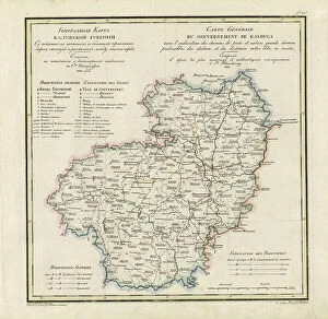
Background imageMaps Tote Bag Collection: General Map of Kaluga Province: Showing Postal and Major Roads, Stations and... 1822

General Map of Kaluga Province: Showing Postal and Major Roads, Stations and... 1822
General Map of Kaluga Province: Showing Postal and Major Roads, Stations and the Distance in Versts between Them, 1822. This 1822 map of Kaluga Province is from a larger work

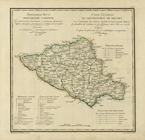
Background imageMaps Tote Bag Collection: General Map of Poltava Province: Showing Postal and Major Roads, Stations and... 1821

General Map of Poltava Province: Showing Postal and Major Roads, Stations and... 1821
General Map of Poltava Province: Showing Postal and Major Roads, Stations and the Distance in Versts between Them, 1821. This 1821 map of Poltava Provinceis from a larger work

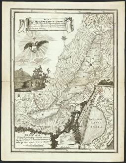
Background imageMaps Tote Bag Collection: Map of Baikal, a Sea, a Lake, or an Angara Gap, Located in the Irkutsk Province... 1814

Map of Baikal, a Sea, a Lake, or an Angara Gap, Located in the Irkutsk Province... 1814. Creator: Unknown
Map of Baikal, a Sea, a Lake, or an Angara Gap, Located in the Irkutsk Province with All the Neighboring [Territory], Whose Mathematical Measurements were Completed and it Became Fully Known in 1806

Background imageMaps Tote Bag Collection: Map of inland waterways under the jurisdiction of the Tomsk district, 1800. Creator: Unknown

Map of inland waterways under the jurisdiction of the Tomsk district, 1800. Creator: Unknown
Map of inland waterways under the jurisdiction of the Tomsk district, 1800

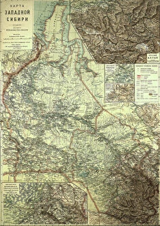
Background imageMaps Tote Bag Collection: Map of Western Siberia, 1899-1914. Creator: Veniamin Petrovich

Map of Western Siberia, 1899-1914. Creator: Veniamin Petrovich
Map of Western Siberia, 1899-1914

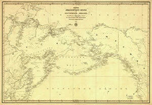
Background imageMaps Tote Bag Collection: Karta Ledovitago mori?a? i Vostochnago okeana, 1844. Creator: Unknown

Karta Ledovitago mori?a? i Vostochnago okeana, 1844. Creator: Unknown
Karta Ledovitago mori?a? i Vostochnago okeana, 1844. Depths shown by soundings in coastal waters. Also covers Russian Far East and Alaska

Background imageMaps Tote Bag Collection: Map of Alaska and adjoining regions, 1882. Creator: Ivan Petrof

Map of Alaska and adjoining regions, 1882. Creator: Ivan Petrof
Map of Alaska and adjoining regions, 1882. This multi-sheet map was produced by Ivan Petroff (also seen as Petroof and Petrof), a U.S

Background imageMaps Tote Bag Collection: General Map of Pskov Province: Showing Postal and Major Roads, Stations and the Distance... 1820

General Map of Pskov Province: Showing Postal and Major Roads, Stations and the Distance... 1820
General Map of Pskov Province: Showing Postal and Major Roads, Stations and the Distance in Versts between Them, 1820. This 1820 map of Pskov Provinceis from a larger work

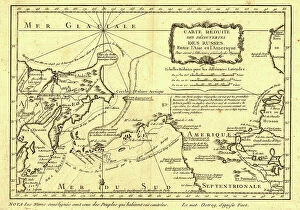
Background imageMaps Tote Bag Collection: Carte re´duite des de´couvertes des Russes, entre l'Asie et l'Amerique, (1747?)

Carte re´duite des de´couvertes des Russes, entre l'Asie et l'Amerique, (1747?)
Carte re´duite des de´couvertes des Russes, entre l'Asie et l'Amerique, (1747?). This French map of Alaska, Siberia, and the North Pacific, published in 1747

Background imageMaps Tote Bag Collection: Plan Vladivostokskago torgovago porta, 1916. Creator: Ministerstvo torgovli i promyshlennosti

Plan Vladivostokskago torgovago porta, 1916. Creator: Ministerstvo torgovli i promyshlennosti
Plan Vladivostokskago torgovago porta, 1916. Karta t?s?vetnai?a?, nakleena na tkan'. Dop. karta: Likhternai?a? gavan na beregu Amurskago zal. u Pervoi? rechki. M. [1:8 400]

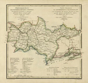
Background imageMaps Tote Bag Collection: General Map of Ekaterinoslav Province: Showing Postal and Major Roads, Stations and the... 1821

General Map of Ekaterinoslav Province: Showing Postal and Major Roads, Stations and the... 1821
General Map of Ekaterinoslav Province: Showing Postal and Major Roads, Stations and the Distance in Versts between Them, 1821

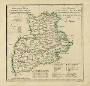
Background imageMaps Tote Bag Collection: General Map of Chernigov Province: Showing Postal and Major Roads, Stations and... 1821

General Map of Chernigov Province: Showing Postal and Major Roads, Stations and... 1821
General Map of Chernigov Province: Showing Postal and Major Roads, Stations and the Distance in Versts between Them, 1821

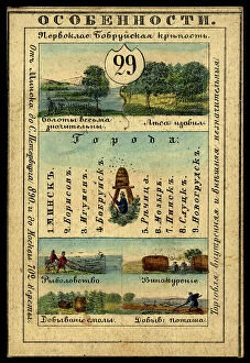
Background imageMaps Tote Bag Collection: Minsk Province, 1856. Creator: Unknown

Minsk Province, 1856. Creator: Unknown
Minsk Province, 1856. This card is one of a souvenir set of 82 illustrated cards-one for each province of the Russian Empire as it existed in 1856

Background imageMaps Tote Bag Collection: Millroy's map of Alaska and the Klondyke gold fields, 1897. Creator: J. J. Millroy

Millroy's map of Alaska and the Klondyke gold fields, 1897. Creator: J. J. Millroy
Millroy's map of Alaska and the Klondyke gold fields, 1897. The Klondike Gold Rush of 1898 began in earnest within 18 months of a major gold strike on Bonanza Creek

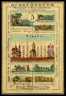
Background imageMaps Tote Bag Collection: Estland Province, 1856. Creator: Unknown

Estland Province, 1856. Creator: Unknown
Estland Province, 1856. This card is one of a souvenir set of 82 illustrated cards-one for each province of the Russian Empire as it existed in 1856

Background imageMaps Tote Bag Collection: View Taken in the Woods, Guam Island, Mariana Islands, 19th century

View Taken in the Woods, Guam Island, Mariana Islands, 19th century. Creators: Alexander Postels, Godefroy Engelmann
View Taken in the Woods, Guam Island, Mariana Islands, 19th century. One of 65 lithographs that were included in the volume of maps published after the round-the-world voyage of the corvette Seniavin

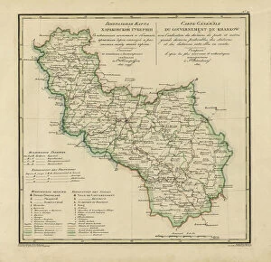
Background imageMaps Tote Bag Collection: General Map of Kharkiv Province: Showing Postal and Major Roads, Stations and the... 1821

General Map of Kharkiv Province: Showing Postal and Major Roads, Stations and the... 1821
General Map of Kharkiv Province: Showing Postal and Major Roads, Stations and the Distance in Versts between Them, 1821. This 1821 map of Kharkiv Provinceis from a larger work

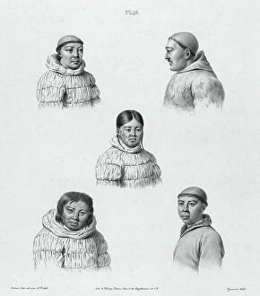
Background imageMaps Tote Bag Collection: Inhabitants of the Country of the Chukchis, Northeast Coast of Asia, 19th century

Inhabitants of the Country of the Chukchis, Northeast Coast of Asia, 19th century. One of 65 lithographs that were included in the volume of maps published after the round-the-world voyage of

Background imageMaps Tote Bag Collection: Carte de Tartarie, 1706. Creator: Guillaume Delisle

Carte de Tartarie, 1706. Creator: Guillaume Delisle
Carte de Tartarie, 1706

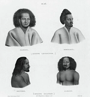
Background imageMaps Tote Bag Collection: Inhabitants of the lower Caroline Islands, 19th century. Creators: Alexander Postels

Inhabitants of the lower Caroline Islands, 19th century. Creators: Alexander Postels, Godefroy Engelmann
Inhabitants of the lower Caroline Islands, 19th century. One of 65 lithographs that were included in the volume of maps published after the round-the-world voyage of the corvette Seniavin

Background imageMaps Tote Bag Collection: General Map of Vladimir Province: Showing Postal and Major Roads, Stations and the... 1822

General Map of Vladimir Province: Showing Postal and Major Roads, Stations and the... 1822
General Map of Vladimir Province: Showing Postal and Major Roads, Stations and the Distance in Versts between Them, 1822. This 1822 map of Vladimir Provinceis from a larger work

Background imageMaps Tote Bag Collection: Kherson Province, 1856. Creator: Unknown

Kherson Province, 1856. Creator: Unknown
Kherson Province, 1856. This card is one of a souvenir set of 82 illustrated cards-one for each province of the Russian Empire as it existed in 1856

Background imageMaps Tote Bag Collection: Russian-American possessions, 1856. Creator: Unknown

Russian-American possessions, 1856. Creator: Unknown
Russian-American possessions, 1856. This card is one of a souvenir set of 82 illustrated cards-one for each province of the Russian Empire as it existed in 1856

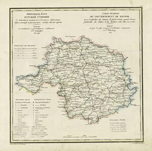
Background imageMaps Tote Bag Collection: General Map of Kursk Province: Showing Postal and Major Roads, Stations and the... 1822

General Map of Kursk Province: Showing Postal and Major Roads, Stations and the... 1822
General Map of Kursk Province: Showing Postal and Major Roads, Stations and the Distance in Versts between Them, 1822. This 1822 map of Kursk Provinceis from a larger work


All Professionally Made to Order for Quick Shipping


-

Maps Tote Bag Collection

Maps of Russia Europe are a type of map that shows the geographical area of Russia and its surrounding countries. They typically include physical features such as rivers, mountains, and lakes, as well as political boundaries between countries. Maps of Russia Europe can also show major cities and towns, transportation networks like roads and railways, airports and ports, national parks or protected areas, and other important landmarks. These they can often used by travelers to plan their trips or by businesses for marketing purposes and can also be used to study the history of the region or to understand current events in the area.
+

Our beautiful Wall Art and Photo Gifts include Framed Prints, Photo Prints, Poster Prints, Canvas Prints, Jigsaw Puzzles, Metal Prints and so much more

Media Storehouse offers a stunning collection of Maps of Russia Europe wall art and framed prints. Our collection features an extensive range of maps that showcase the historical, political, and geographical aspects of the region. These maps are perfect for those who love to explore history or geography enthusiasts. The Maps of Russia Europe collection includes antique maps dating back to the 16th century as well as contemporary ones that highlight modern-day borders and territories. Each map is carefully crafted with intricate details and vivid colors that make them visually appealing. Whether you're looking for a vintage-style map or a more modern one, our collection has something for everyone. You can choose from different sizes and framing options to suit your taste and decor style. Our Maps of Russia Europe collection is an excellent choice if you want to add some unique artwork to your home or office space while also learning about the rich history and culture of this fascinating region.
+

What are Maps of Russia Europe art prints?

Maps of Russia Europe art prints are high-quality reproductions of antique and contemporary maps showcasing the geography, topography, and political boundaries of Russia and Europe. These prints are created using advanced printing techniques that ensure sharp details, vibrant colors, and long-lasting durability. These maps capture the rich history and cultural diversity of Russia and Europe while also serving as valuable educational tools for students, historians, geographers, travelers or anyone interested in exploring these regions. They can be used to decorate homes or offices with a touch of sophistication while also providing an intriguing conversation starter. Whether you're looking for a vintage map from centuries ago or a modern-day representation of the region's current landscape, Maps of Russia Europe art prints offer something for everyone. With their stunning visual appeal and historical significance, they make perfect gifts for any occasion.
+

What Maps of Russia Europe art prints can I buy from Media Storehouse?

We offer a wide range of Maps of Russia Europe art prints that are perfect for those who love history and geography. These maps showcase the different regions, cities, and landmarks in Russia and Europe, providing an informative and decorative addition to any home or office space. Some of the popular options available include antique maps from the 17th century, detailed city plans from major European capitals such as Paris and London, topographical maps highlighting mountain ranges and rivers across the continent, as well as political maps illustrating borders between countries. Whether you're looking for a vintage aesthetic or a contemporary design style, we have something to suit your taste. With high-quality printing techniques on premium paper stock materials used in producing these art prints ensures they will last long without fading or losing their vibrancy over time. There is no shortage of beautiful Maps of Russia Europe art prints to choose from at Media Storehouse.
+

How do I buy Maps of Russia Europe art prints?

To buy Maps of Russia Europe art prints from Media Storehouse, you can browse our extensive collection online. Simply search for the specific map or location you are interested in and select the size and format you prefer. You can choose from a range of materials including paper, canvas, or framed prints. Once you have made your selection, add it to your cart and proceed to checkout. At this point, you will be prompted to enter your shipping information and payment details. We offer a secure online shopping experience with multiple payment options available including credit card and PayPal. Whether you are looking for a vintage map of Russia or a contemporary print of Europe's major cities, we have something to suit every taste and budget. With high-quality printing techniques used on all their products, these maps make great additions to any home or office space.
+

How much do Maps of Russia Europe art prints cost?

As a leading provider of art prints, we offer a wide range of maps of Russia and Europe for purchase. The cost of these prints varies depending on the size and type of print selected. You can choose from various sizes ranging from small to large, as well as different types such as canvas or framed prints. Media Storehouse takes pride in offering high-quality art prints at affordable prices. Our maps of Russia and Europe are no exception, with competitive pricing that ensures customers get value for their money. Whether you're looking for a vintage map or a modern interpretation, we have something to suit every taste and budget. We believe that art should be accessible to everyone. That's why we offer our customers an extensive collection of maps at reasonable prices without compromising on quality. So if you're looking to add some character to your home or office space with beautiful map artwork, check out our selection today.
+

How will my Maps of Russia Europe art prints be delivered to me?

Your Maps of Russia Europe art prints will be delivered to you in a safe and secure manner. We use high-quality packaging materials to ensure that your artwork arrives in pristine condition. Our delivery partners are reliable and efficient, ensuring that your order is delivered on time. We offer various delivery options depending on your location and preferences. Standard shipping is available for most orders, while express shipping can also be arranged for urgent deliveries. You will receive a tracking number once your order has been dispatched so you can track its progress. We take great care to ensure that our customers receive their orders promptly and without any issues. If you have any questions or concerns about the delivery of your Maps of Russia Europe art prints, please do not hesitate to contact us and we'll be happy to assist you in any way we can.