Fraud Blocker Skip to main content

Home > Europe > United Kingdom > England > Maps

Maps Collection (#10)

Maps of England, United Kingdom and Europe are essential tools for navigation and exploration

10,586 Items

Background imageMaps Collection: BRAUN, George (1541-1622). ORTELIUS, Abraham (1527-1598). HOGENBERG, Franz (1535-1590)

BRAUN, George (1541-1622). ORTELIUS, Abraham (1527-1598). HOGENBERG, Franz (1535-1590)
CUL4853334 BRAUN, George (1541-1622). ORTELIUS, Abraham (1527-1598). HOGENBERG, Franz (1535-1590). Civitatis Orbis Terrarum (Theatrum orbis terrarum). 1572-1617. London. Detail. Etching. SPAIN

Background imageMaps Collection: Map of Boston (Massachusetts, USA), with British forces retreats, in 1775

Map of Boston (Massachusetts, USA), with British forces retreats, in 1775
NWI4843670 Map of Boston (Massachusetts, USA), with British forces retreats, in 1775. (War of Independence of the United States, 1776-1783)

Background imageMaps Collection: Map of Scotland, England, Ireland in 1100 (Map of british islands, England)

Map of Scotland, England, Ireland in 1100 (Map of british islands, England)
ELD4930022 Map of Scotland, England, Ireland in 1100 (Map of british islands, England, Scotland and Ireland in 1100) Plate from Houze's Universal Atlas

Background imageMaps Collection: Map of the Count of Sommerset (England), circa 1870. 19th century lithography

Map of the Count of Sommerset (England), circa 1870. 19th century lithography
NWI4875372 Map of the Count of Sommerset (England), circa 1870. 19th century lithography.; (add.info.: Map of the Count of Sommerset (England), circa 1870

Background imageMaps Collection: Map of the Counts of Oxford, Buckingham and Berks (England), circa 1870. 19th century lithography

Map of the Counts of Oxford, Buckingham and Berks (England), circa 1870. 19th century lithography
NWI4875323 Map of the Counts of Oxford, Buckingham and Berks (England), circa 1870. 19th century lithography.; (add.info.: Map of the Counts of Oxford, Buckingham and Berks (England), circa 1870

Background imageMaps Collection: Map of the Earl of Worcester (England), circa 1870. 19th century lithography

Map of the Earl of Worcester (England), circa 1870. 19th century lithography
NWI4875595 Map of the Earl of Worcester (England), circa 1870. 19th century lithography.; (add.info.: Map of the Earl of Worcester (England), circa 1870

Background imageMaps Collection: Map of the Earl of Sussex (England), circa 1870. 19th century lithography

Map of the Earl of Sussex (England), circa 1870. 19th century lithography
NWI4875444 Map of the Earl of Sussex (England), circa 1870. 19th century lithography.; (add.info.: Map of the Earl of Sussex (England), circa 1870

Background imageMaps Collection: Map of the Earl of Yorkshire (England), circa 1870. 19th century lithography

Map of the Earl of Yorkshire (England), circa 1870. 19th century lithography
NWI4875608 Map of the Earl of Yorkshire (England), circa 1870. 19th century lithography.; (add.info.: Map of the Earl of Yorkshire (England), circa 1870

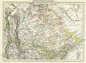
Background imageMaps Collection: Geographic map of the British-Dominion Territories of North America, c. 1870

Geographic map of the British-Dominion Territories of North America, c. 1870. Colour engraving, 19th century
NWI4867633 Geographic map of the British-Dominion Territories of North America, c. 1870. Colour engraving, 19th century.; (add.info)

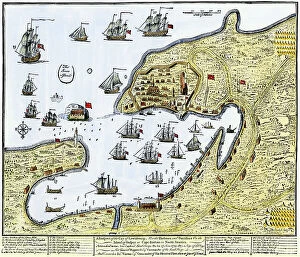
Background imageMaps Collection: Map showing Louisbourg, a Canadian city in the province of Nova Scotia, Canada

Map showing Louisbourg, a Canadian city in the province of Nova Scotia, Canada, under the British flag, 1745
NWI4867370 Map showing Louisbourg, a Canadian city in the province of Nova Scotia, Canada, under the British flag, 1745. Colouring engraving of the 19th century.; (add.info.: Map showing Louisbourg)

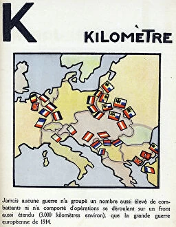
Background imageMaps Collection: First World War 1914-1918 (14-18): Letter K as kilometre. Map of countries at war extending over

First World War 1914-1918 (14-18): Letter K as kilometre. Map of countries at war extending over 3000 km
DUV4201478 First World War 1914-1918 (14-18): Letter K as kilometre. Map of countries at war extending over 3000 km. Engraving in " Alphabet of the Great War 1914-1916

Background imageMaps Collection: 16th Century map of Norwich

16th Century map of Norwich
3329550 16th Century map of Norwich; (add.info.: 16th Century map of Norwich, England. Dated 16th Century.); Universal History Archive/UIG

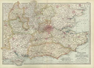
Background imageMaps Collection: Map of England, c.1900 (engraving)

Map of England, c.1900 (engraving)
532917 Map of England, c.1900 (engraving); (add.info.: Map of England, with Oxford, Buckingham, Hertford, Essex, Middlesex, Berkshire, Hampshire, parts of Bedford and Wiltshire, circa 1902)

Background imageMaps Collection: Panorama of harbor showing siege of Curacao by English sailors and soldiers in 1800

Panorama of harbor showing siege of Curacao by English sailors and soldiers in 1800
2902887 Panorama of harbor showing siege of Curacao by English sailors and soldiers in 1800; (add.info.: Panorama of harbor showing siege of Curacao by English sailors and soldiers in 1800)

Background imageMaps Collection: Tudor country woman with basket. c.1612 (engraving)

Tudor country woman with basket. c.1612 (engraving)
2911217 Tudor country woman with basket. c.1612 (engraving); (add.info.: Tudor country woman with basket, (detail), from a map of England and wales by John Speed; C1612

Background imageMaps Collection: Tudor noblewoman (detail), from a map of England and wales by John Speed, c.1612 (engraving)

Tudor noblewoman (detail), from a map of England and wales by John Speed, c.1612 (engraving)
2911210 Tudor noblewoman (detail), from a map of England and wales by John Speed, c.1612 (engraving); Universal History Archive/UIG

Background imageMaps Collection: Queen Elizabeth I, (detail), from a map of England and wales by John Speed, c.1612 (engraving)

Queen Elizabeth I, (detail), from a map of England and wales by John Speed, c.1612 (engraving)
2911209 Queen Elizabeth I, (detail), from a map of England and wales by John Speed, c.1612 (engraving); Universal History Archive/UIG

Background imageMaps Collection: A Map of British - French Settlements in America, 1755

A Map of British - French Settlements in America, 1755
2902786 A Map of British - French Settlements in America, 1755; (add.info.: A Map of British - French Settlements in America, 1755.); Buyenlarge Archive/UIG

Background imageMaps Collection: Map showing the settlements in the New England Colonies, North America in the 17th century

Map showing the settlements in the New England Colonies, North America in the 17th century
2956605 Map showing the settlements in the New England Colonies, North America in the 17th century. From The History of Our Country, published 1899; Private Collection

Background imageMaps Collection: Map of European odds on the Atlantic Ocean, including Gibraltar, Portugal, Spain, England

Map of European odds on the Atlantic Ocean, including Gibraltar, Portugal, Spain, England, Ireland and Iceland
AIS5350370 Map of European odds on the Atlantic Ocean, including Gibraltar, Portugal, Spain, England, Ireland and Iceland, as well as North Africa

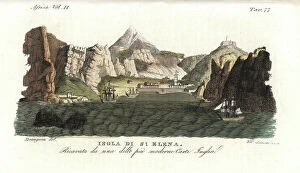
Background imageMaps Collection: View of the Island of Saint Helena, early 19th century, taken from a recent English map

View of the Island of Saint Helena, early 19th century, taken from a recent English map
FLO4620909 View of the Island of Saint Helena, early 19th century, taken from a recent English map. Handcoloured copperplate engraving by Andrea Bernieri after an illustration by Beaugean from Giulio

Background imageMaps Collection: Map of proposed railway lines to run through Britain

Map of proposed railway lines to run through Britain
3733987 Map of proposed railway lines to run through Britain.; (add.info.: Map of proposed railway lines to run through Britain. Dated 19th century.); Universal History Archive/UIG

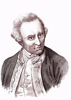
Background imageMaps Collection: James COOK (1728-1779), English navigator, explorer and cartographer

James COOK (1728-1779), English navigator, explorer and cartographer
JAB4121236 James COOK (1728-1779), English navigator, explorer and cartographer.; (add.info.: James COOK (1728-1779), English navigator, explorer and cartographer.); Photo ©Jaime Abecasis

Background imageMaps Collection: First World War: France, Patriotic Map showing a hairy and Tommy toasting in a village

First World War: France, Patriotic Map showing a hairy and Tommy toasting in a village on the front, 1917
LUX4741577 First World War: France, Patriotic Map showing a hairy and Tommy toasting in a village on the front, 1917; (add.info.: World War I - War 14-18 (1914-1918) - World War I (WWI or WW1)

Background imageMaps Collection: First World War: Patriotic map showing life in the trench with a French soldier

First World War: Patriotic map showing life in the trench with a French soldier
LUX4744794 First World War: Patriotic map showing life in the trench with a French soldier, Belgian soldier and an English soldier sitting in a buccolic trench entitled Dans les trchees, 1916

Background imageMaps Collection: Elevations and plans of the Eddystone Rock lighthouse, built with dovetailed granite

Elevations and plans of the Eddystone Rock lighthouse, built with dovetailed granite
FLO4591503 Elevations and plans of the Eddystone Rock lighthouse, built with dovetailed granite and blocks by John Smeaton in 1759. Copperplate engraving by Wilson Lowry after a drawing by J

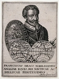
Background imageMaps Collection: Portrait of Francis Drake (Franciscus Draco Nobilissimus Angliae Eques)

Portrait of Francis Drake (Franciscus Draco Nobilissimus Angliae Eques, Rei Nauticae ac Bellicae Peritissimus)
MMM5478531 Portrait of Francis Drake (Franciscus Draco Nobilissimus Angliae Eques, Rei Nauticae ac Bellicae Peritissimus) (1542-1596)

Background imageMaps Collection: Map showing the placings in Canada of The Tolpuddle Martyrs, a group of 19th-century Dorset

Map showing the placings in Canada of The Tolpuddle Martyrs, a group of 19th-century Dorset agricultural labourers who
5614436 Map showing the placings in Canada of The Tolpuddle Martyrs, a group of 19th-century Dorset agricultural labourers who were arrested for

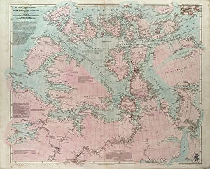
Background imageMaps Collection: The Arctic shores of America from Baffin Bay to Cape Bathurst, showing the coasts

The Arctic shores of America from Baffin Bay to Cape Bathurst, showing the coasts
7295391 The Arctic shores of America from Baffin Bay to Cape Bathurst, showing the coasts and rivers explored by the officers of the several British expeditions, between 1818 & 1859

Background imageMaps Collection: A general chart for the purpose of picking off a ship's track, 1860 (print)

A general chart for the purpose of picking off a ship's track, 1860 (print)
7337585 A general chart for the purpose of picking off a ship's track, 1860 (print) by British School, (19th century); 820 cm; National Maritime Museum, London

Background imageMaps Collection: Dutch geographic map of eastern North America, Great Lakes region, with description of colonies

Dutch geographic map of eastern North America, Great Lakes region, with description of colonies
NWI4846151 Dutch geographic map of eastern North America, Great Lakes region, with description of colonies: New Holland and New England, New France, 1670

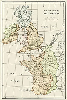
Background imageMaps Collection: Geographic map of England and France during the Angevins dynasty, 12th-15th century

Geographic map of England and France during the Angevins dynasty, 12th-15th century. Lithograph of the 19th century
NWI4874543 Geographic map of England and France during the Angevins dynasty, 12th-15th century. Lithograph of the 19th century.; (add.info)

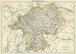
Background imageMaps Collection: Map of the Earl of Westmorland (England), circa 1870. 19th century lithography

Map of the Earl of Westmorland (England), circa 1870. 19th century lithography
NWI4875494 Map of the Earl of Westmorland (England), circa 1870. 19th century lithography.; (add.info.: Map of the Earl of Westmorland (England), circa 1870

Background imageMaps Collection: Map of Scotland in the 1520s, showing Highland (Highlander) territories

Map of Scotland in the 1520s, showing Highland (Highlander) territories. Colouring engraving of the 19th century
NWI4874428 Map of Scotland in the 1520s, showing Highland (Highlander) territories. Colouring engraving of the 19th century.; (add.info.: Map of Scotland in the 1520s)

Background imageMaps Collection: Map of the Counts of Leicester and Rutland (England), circa 1870. 19th century lithography

Map of the Counts of Leicester and Rutland (England), circa 1870. 19th century lithography
NWI4875099 Map of the Counts of Leicester and Rutland (England), circa 1870. 19th century lithography.; (add.info.: Map of the Counts of Leicester and Rutland (England), circa 1870

Background imageMaps Collection: Map of the Count of Dorset (England), circa 1870. 19th century lithography

Map of the Count of Dorset (England), circa 1870. 19th century lithography
NWI4874816 Map of the Count of Dorset (England), circa 1870. 19th century lithography.; (add.info.: Map of the Count of Dorset (England), circa 1870

Background imageMaps Collection: Geographic map of Brittany after saxon invasion, 500 AD Engraving from 'Atlas Universel' by Houze

Geographic map of Brittany after saxon invasion, 500 AD Engraving from "Atlas Universel" by Houze
ELD4925007 Geographic map of Brittany after saxon invasion, 500 AD Engraving from "Atlas Universel" by Houze, 1851 Private collection; (add.info)

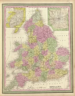
Background imageMaps Collection: England

England
2902836 England; (add.info.: England, 1849.); Buyenlarge Archive/UIG

Background imageMaps Collection: London

London
2902834 London; (add.info.: London, England, 1682.); Buyenlarge Archive/UIG

Background imageMaps Collection: British - French Claims to North America, 1756

British - French Claims to North America, 1756
2902790 British - French Claims to North America, 1756; (add.info.: British - French Claims to North America, 1756.); Buyenlarge Archive/UIG

Background imageMaps Collection: Isometrical plan of Mr. Grainger's proposed concentration of the termini of the several railways

Isometrical plan of Mr. Grainger's proposed concentration of the termini of the several railways from London
7426778 Isometrical plan of Mr. Grainger's proposed concentration of the termini of the several railways from London, Edinburgh, Carlisle, Shields and Sunderland, at a General Depot at Elswick T

Background imageMaps Collection: A map of the most inhabited part of New England, containing the provinces of Massachusetts Bay

A map of the most inhabited part of New England, containing the provinces of Massachusetts Bay
7339414 A map of the most inhabited part of New England, containing the provinces of Massachusetts Bay and New Hampshire with the colonies of Connecticut and Rhode Island, 1774 (paper) by Jefferys

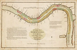
Background imageMaps Collection: Mr Ogle's plan, for mooring vessels, in the River Thames, from London Bridge to Deptford

Mr Ogle's plan, for mooring vessels, in the River Thames, from London Bridge to Deptford, on an improved system
7339403 Mr Ogle's plan, for mooring vessels, in the River Thames, from London Bridge to Deptford, on an improved system, 1796 (coloured engraving) by Ogle

Background imageMaps Collection: A chart of the sea coasts of England, Flanders and Holland, c.1672 (print)

A chart of the sea coasts of England, Flanders and Holland, c.1672 (print)
7340614 A chart of the sea coasts of England, Flanders and Holland, c.1672 (print) by Seller, John (1632-97); National Maritime Museum, London

Background imageMaps Collection: Map of Streatham, Croydon and Sydenham, 1746 (coloured engraving)

Map of Streatham, Croydon and Sydenham, 1746 (coloured engraving)
7340510 Map of Streatham, Croydon and Sydenham, 1746 (coloured engraving) by Rocque, John (c.1704-d.1762); 51x67 cm; National Maritime Museum, London

Background imageMaps Collection: England East Coast. Sheet 3, late 19th century (print)

England East Coast. Sheet 3, late 19th century (print)
7340596 England East Coast. Sheet 3, late 19th century (print) by Imray, James & Son (19th century); National Maritime Museum, London

Background imageMaps Collection: A military chart of the marches and encampments of the grand army commanded by Major General

A military chart of the marches and encampments of the grand army commanded by Major General Medows from the 26th May
7340494 A military chart of the marches and encampments of the grand army commanded by Major General Medows from the 26th May to the 14th December 1790, 1791 (manuscript) by Mackenzie, C

Background imageMaps Collection: Plymouth Citadel, 1667 (paper, linen)

Plymouth Citadel, 1667 (paper, linen)
7340485 Plymouth Citadel, 1667 (paper, linen) by Gomme, Bernard de (1620-85); 51.5x73.5 cm; National Maritime Museum, London


All Professionally Made to Order for Quick Shipping


-

Maps Collection

Maps of England, United Kingdom and Europe are essential tools for navigation and exploration. They provide a visual representation of the geography, topography and political boundaries of these regions, and are be used to plan routes, identify landmarks, locate cities and towns, measure distances between locations and understand the physical features of an area. They also help to illustrate historical events such as wars or migrations, and are be printed in various formats such as paper or digital versions which can be accessed on computers or mobile devices. With the help we can gain a better understanding about our environment and its history which is invaluable for both educational purposes as well as practical applications.
+

Our beautiful Wall Art and Photo Gifts include Framed Prints, Photo Prints, Poster Prints, Canvas Prints, Jigsaw Puzzles, Metal Prints and so much more

The Maps of England United Kingdom Europe collection from Media Storehouse is a stunning array of wall art, framed prints, photo prints, canvas prints, jigsaw puzzles and greeting cards that showcase the beauty and history of these regions. Our collection features an extensive range of maps dating back to the 16th century up to modern times. These maps are not only visually appealing but also provide valuable insights into the geography, topography and political boundaries of these areas. Whether you're looking for a vintage map to add character to your home or want a contemporary piece that reflects current borders and landmarks, our collection has something for everyone. The high-quality printing techniques used by Media Storehouse ensure that each piece is vibrant in color and detail-rich. From antique world maps to detailed street plans of London or Paris, there's no shortage of options when it comes to choosing your perfect print. With its wide variety of sizes and formats available at affordable prices, our collection provides an excellent opportunity for anyone interested in exploring the rich history and culture encapsulated within these regions through beautiful artwork.
+

What are Maps of England United Kingdom Europe art prints?

Maps of England, United Kingdom, and Europe art prints are high-quality reproductions of historical maps that depict the geography and topography of these regions. These maps showcase the evolution of cartography over time, from early hand-drawn sketches to more detailed and accurate depictions created with modern technology. These art prints are not only visually stunning but also serve as a valuable educational resource for historians, geographers, and anyone interested in exploring the history and culture of these regions. They can be used to trace the development of cities, transportation networks, political boundaries, natural resources, and other important features that have shaped these areas throughout history. Whether you're looking to decorate your home or office with a unique piece of artwork or want to add an educational element to your collection, Maps of England United Kingdom Europe art prints offer something for everyone. With their timeless appeal and rich historical significance, they are sure to be cherished by generations to come.
+

What Maps of England United Kingdom Europe art prints can I buy from Media Storehouse?

We offer a wide range of Maps of England, United Kingdom and Europe art prints that are perfect for decorating your home or office. You can choose from a variety of styles, including antique maps, modern maps, political maps and topographical maps. These prints are available in different sizes to suit your needs and preferences. If you're looking for something specific, we have an extensive collection of city maps such as London, Paris or Rome which will add sophistication to any room. They also have country-specific maps like Scotland or Wales which would be great for those who love travelling. In addition to traditional paper prints, Media Storehouse also offers canvas prints which give the artwork a more textured look. The canvas print is stretched over a wooden frame making it ready-to-hang on your wall. There's no shortage of options when it comes to Maps of England United Kingdom Europe art prints at Media Storehouse.
+

How do I buy Maps of England United Kingdom Europe art prints?

To buy Maps of England, United Kingdom, and Europe art prints from Media Storehouse, you can browse our extensive collection of maps on their website. You can search for specific locations or browse by category to find the perfect map print for your needs. Once you have found a map that you like, simply select the size and format that you prefer. We offer a range of printing options including canvas prints, framed prints, and poster prints. We also offer customization options such as adding text or choosing different color schemes to make your map print unique. When purchasing your map print from Media Storehouse, be sure to check out their secure checkout process which accepts various payment methods. Additionally, we offer international shipping so no matter where you are in the world; you can enjoy beautiful maps of England and Europe in your home or office.
+

How much do Maps of England United Kingdom Europe art prints cost?

The cost of Maps of England, United Kingdom and Europe art prints can vary depending on various factors such as the size, quality, and type of print. The prices may also differ from one seller to another. However, we offer a wide range of Map art prints that are affordable for everyone. Our collection includes vintage maps, contemporary maps, antique maps among others. The price range is reasonable and caters to different budgets without compromising on the quality of the print. Whether you're looking for a small or large map print to decorate your home or office space with an artistic touch or gift someone special with something unique and meaningful - there's something for everyone at Media Storehouse. Their selection features some stunning pieces that capture the beauty and history of England, United Kingdom and Europe in intricate detail making them perfect conversation starters too. So why not browse our collection today?
+

How will my Maps of England United Kingdom Europe art prints be delivered to me?

Your Maps of England United Kingdom Europe art prints will be delivered to you in a secure and protective packaging. The prints are carefully rolled and placed inside a sturdy tube to ensure that they arrive at your doorstep in pristine condition. The package will also include instructions on how to unroll the print without damaging it. Media Storehouse takes great care in delivering your artwork, ensuring that it is handled with utmost care during transit. Your package can be tracked online so you can monitor its progress until it reaches you. The delivery service used by Media Storehouse varies depending on your location and the size of the print ordered. However, rest assured that all deliveries are made using reputable courier services known for their reliability and efficiency. Your Maps of England United Kingdom Europe art prints will be delivered safely and securely to your doorstep via a trusted courier service in protective packaging designed specifically for artwork transportation.