Fraud Blocker Skip to main content

Framed Print > Europe > United Kingdom > England > Maps

Maps Framed Print Collection

Discover the beauty and rich history of England, United Kingdom, and Europe with our exquisite collection of Framed Prints from Media Storehouse. Each map is meticulously crafted to bring you the most accurate and detailed representation of these intriguing regions. Explore the intricacies of the British Isles, follow the winding rivers of Europe, or trace the borders of historic kingdoms. These stunning maps are not only perfect for adding a touch of sophistication to your home or office, but also make for thoughtful and unique gifts for history buffs, travel enthusiasts, or anyone with a love for cartography. Let our Framed Prints transport you on a journey of discovery, one map at a time.

Maps of England, United Kingdom and Europe are essential tools for navigation and exploration

Choose a picture from our Maps Framed Print Collection for your Wall Art and Photo Gifts

10,598 Framed Prints

Background imageMaps Framed Print Collection: Norfolk County Road Map

Norfolk County Road Map
A detailed map of the glorious county of Norfolk in England. Derived from high quality Collins Bartholomew map data showing larger villages

Background imageMaps Framed Print Collection: West Sussex County Road Map

West Sussex County Road Map
A detailed map of the glorious county of West Sussex in England. Derived from high quality Collins Bartholomew map data showing larger villages

Background imageMaps Framed Print Collection: William Smith Geological Map

William Smith Geological Map

Background imageMaps Framed Print Collection: Antique map of Britain under the Anglo Saxons

Antique map of Britain under the Anglo Saxons

Background imageMaps Framed Print Collection: Imperial Airways poster

Imperial Airways poster
Advertising poster for Imperial Airways, The British Air Line : a weekly service between Africa, India, Egypt and England. A passenger biplane flies over a map of Europe, Africa and Asia

Background imageMaps Framed Print Collection: Battle of Waterloo map J020089

Battle of Waterloo map J020089
WALMER CASTLE, Kent. " Battle of Waterloo &c" map " Exhibiting the Situation of the Armies on the 16th, 17th & 18th of June 1815"

Background imageMaps Framed Print Collection: Birds Eye View of Bristol, 1887 (colour litho)

Birds Eye View of Bristol, 1887 (colour litho)
2829302 Birds Eye View of Bristol, 1887 (colour litho) by Lavars, Edward Colston (1842-1917); Bristol Museum and Art Gallery, UK; eBristol Museums, Galleries & Archives; English, out of copyright

Background imageMaps Framed Print Collection: Map of England in 1066

Map of England in 1066
England at the time of the Norman conquest, 1066-1081. Color lithograph of a 19th-century illustration

Background imageMaps Framed Print Collection: Devon County Road Map

Devon County Road Map
A detailed map of the glorious county of Devon in England. Derived from high quality Collins Bartholomew map data showing larger villages

Background imageMaps Framed Print Collection: Map of England, 1800s

Map of England, 1800s
Map of England and Wales, 1870s. Color lithograph reproduction of a 19th-century illustration

Background imageMaps Framed Print Collection: Northumberland County Road Map

Northumberland County Road Map
A detailed map of the glorious county of Northumberland in England. Derived from high quality Collins Bartholomew map data showing larger villages

Background imageMaps Framed Print Collection: London Zoo 1929 MD93_07025

London Zoo 1929 MD93_07025
London Zoo, Regents Park, Westminster. Line drawing entitled " The Gardens of the Zoological Society of London 1929" and " the Gardens 1829" (inset)

Background imageMaps Framed Print Collection: Map of Britain in 597 AD

Map of Britain in 597 AD
Map of territory controlled by Celts, Picts, Anglos, Saxons, and other tribes in Britain in 597 AD. Printed color lithograph of a 19th-century illustration

Background imageMaps Framed Print Collection: Cornwall County Road Map

Cornwall County Road Map
A detailed map of the glorious county of Cornwall in England. Derived from high quality Collins Bartholomew map data showing larger villages

Background imageMaps Framed Print Collection: Map of Welwyn Garden City, Hertfordshire, England, 1926

Map of Welwyn Garden City, Hertfordshire, England, 1926. From An Outline of Christianity, The Story of Our Civilisation, volume 5: Christianity Today and Tomorrow, edited by RG Parsons and AS Peake

Background imageMaps Framed Print Collection: PONTEFRACT CASTLE, Yorkshire

PONTEFRACT CASTLE, Yorkshire
Bird s-eye view of Pontefract Castle, Yorkshire, as it appeared during the Civil War. Date: 1648

Background imageMaps Framed Print Collection: Viking Britain Map

Viking Britain Map
A map of the British Isles (including Ireland) during the time of the Vikings

Background imageMaps Framed Print Collection: Map / Isle of Wight C1857

Map / Isle of Wight C1857
Map of the Isle of Wight (County series)

Background imageMaps Framed Print Collection: Map / Norfolk C1857

Map / Norfolk C1857
Map of Norfolk

Background imageMaps Framed Print Collection: Map of Whitby

Map of Whitby
Vintage map from 1880 of Whitby a town in North Yorkshire, England.++Inspector: Info about source material uploaded as property release++

Background imageMaps Framed Print Collection: Map / Cornwall C1857

Map / Cornwall C1857
Map of Cornwall Date: circa 1857

Background imageMaps Framed Print Collection: Map / Derbyshire C1857

Map / Derbyshire C1857
Map of Derbyshire

Background imageMaps Framed Print Collection: Map of the world with annotations by Darwin J970111

Map of the world with annotations by Darwin J970111
DOWN HOUSE, Kent. A map of the World with annotations by Charles Darwin

Background imageMaps Framed Print Collection: Old Map of The Isle of Wight 1836 by Thomas Moule

Old Map of The Isle of Wight 1836 by Thomas Moule
This is a fine decorative reproduction Map of The Isle of Wight from the First Edition series of Thomas Moule Maps, originally Published in 1836

Background imageMaps Framed Print Collection: Antique map, Liverpool and Birkenhead, England, 19th Century

Antique map, Liverpool and Birkenhead, England, 19th Century
Vintage engraving of a Antique map, Liverpool and Birkenhead, England, 19th Century

Background imageMaps Framed Print Collection: Map of Malvern Hills in Worcestershire, England Victorian Engraving, 1840

Map of Malvern Hills in Worcestershire, England Victorian Engraving, 1840
Very Rare, Beautifully Illustrated Antique Engraving of Map of Malvern Hills in Worcestershire, England Victorian Engraving, 1840. Source: Original edition from my own archives

Background imageMaps Framed Print Collection: Great Britain and Ireland map 1867

Great Britain and Ireland map 1867
Mitchell's Modern Atlas - Published by E.H. Butler and Co - Philadelphia 1867

Background imageMaps Framed Print Collection: Pictorial History Railway Map of Britain

Pictorial History Railway Map of Britain
This is a wonderful large format pictorial map illustrating the history of the Railways of Britain up to its original publication date of 1974

Background imageMaps Framed Print Collection: British Empire world map, 19th century

British Empire world map, 19th century
British Empire world map. This world map shows the 19th-century British Empire (pink) and its indigenous peoples. Five illustrations (clockwise from upper left) show the people of Australia

Background imageMaps Framed Print Collection: Avebury / Stukeley Map

Avebury / Stukeley Map
A beautifully drawn overhead plan of the stone circles and embankment ditches at Avebury. Stukeleys accuracy is impressive, charting every stone, pasture and building

Background imageMaps Framed Print Collection: Map of South East England, Hampshire, Dorset, Wiltshire 1891

Map of South East England, Hampshire, Dorset, Wiltshire 1891
Antique Map of Map of South East England, showing Hampshire, Dorset, Wiltshire, and the Isle of Wight 1891

Background imageMaps Framed Print Collection: Antique colored illustrations: Geological map of England and Wales

Antique colored illustrations: Geological map of England and Wales

Background imageMaps Framed Print Collection: Map of the City of Dublin, 1797

Map of the City of Dublin, 1797
Map of the City of Dublin, Ireland. Published in 1797, this map includes details of the canals being built at the time. Canal Harbour (lower right)

Background imageMaps Framed Print Collection: Map / Manchester 1878

Map / Manchester 1878
Map of Manchester and its environs

Background imageMaps Framed Print Collection: Kent County Road Map

Kent County Road Map
A detailed map of the glorious county of Kent in England. Derived from high quality Collins Bartholomew map data showing larger villages

Background imageMaps Framed Print Collection: East Sussex County Road Map

East Sussex County Road Map
A detailed map of the glorious county of East Sussex in England. Derived from high quality Collins Bartholomew map data showing larger villages

Background imageMaps Framed Print Collection: England in the Ninth Century

England in the Ninth Century
An antique map from 1875 showing the different kingdoms of England in the 9th century

Background imageMaps Framed Print Collection: Map of Malvern Hills in Worcestershire, England Victorian Engraving, 1840

Map of Malvern Hills in Worcestershire, England Victorian Engraving, 1840
Very Rare, Beautifully Illustrated Antique Engraving of Map of Malvern Hills in Worcestershire, England Victorian Engraving, 1840. Source: Original edition from my own archives

Background imageMaps Framed Print Collection: Map of England Showing the Anglo-Saxon Kingdoms and Danish Districts

Map of England Showing the Anglo-Saxon Kingdoms and Danish Districts

Background imageMaps Framed Print Collection: Map of Europe under the Roman Empire

Map of Europe under the Roman Empire
Map of Europe in the time of the Roman Empire. Printed color lithograph of a 19th-century illustration

Background imageMaps Framed Print Collection: Map / Somerset C1857

Map / Somerset C1857
Map of Somerset

Background imageMaps Framed Print Collection: Map / Suffolk C1857

Map / Suffolk C1857
Map of Suffolk

Background imageMaps Framed Print Collection: 'Kings Head, 'Roehampton (litho)

"Kings Head, "Roehampton (litho)
7188489 " Kings Head, " Roehampton (litho) by Luker, William (1820-92); Private Collection; (add.info.: " Kings Head, " Roehampton)

Background imageMaps Framed Print Collection: Old Map of Brighton 1898 from the Royal Atlas by Bartholomew

Old Map of Brighton 1898 from the Royal Atlas by Bartholomew
A fine very detailed plan of the Seaside Town of Brighton from 1898 remastered from an original contained within " The Royal Atlas of England and Wales" ; edited by J.G

Background imageMaps Framed Print Collection: Scilly Isles

Scilly Isles
A map of the Scilly Isles, circa 1639. (Photo by Fox Photos/Hulton Archive/Getty Images)

Background imageMaps Framed Print Collection: 1838 Geological Map of England by Mantell

1838 Geological Map of England by Mantell
From Gideon Mantells " Wonders of Geology" 1839, drawn by his daughter Ellen

Background imageMaps Framed Print Collection: Map of England and France, 1154

Map of England and France, 1154
England and France at the accession of Henry II, 1154. Color lithograph reproduction of a 19th-century illustration

Background imageMaps Framed Print Collection: MAP / LONDON 1878

MAP / LONDON 1878
Map of London and its suburbs


All Professionally Made to Order for Quick Shipping


-

Maps Framed Print Collection

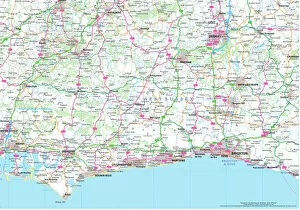
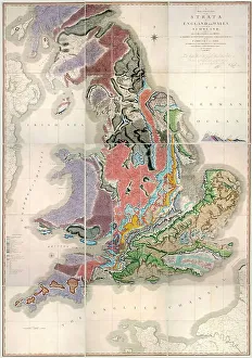
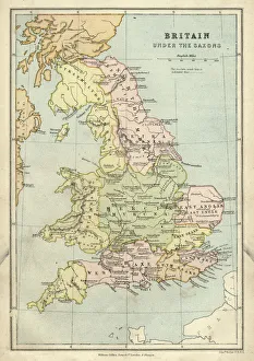
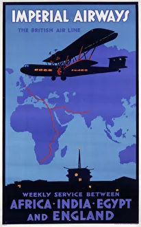
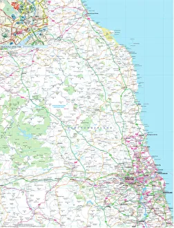
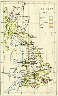
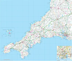
Maps of England, United Kingdom and Europe are essential tools for navigation and exploration. They provide a visual representation of the geography, topography and political boundaries of these regions, and are be used to plan routes, identify landmarks, locate cities and towns, measure distances between locations and understand the physical features of an area. They also help to illustrate historical events such as wars or migrations, and are be printed in various formats such as paper or digital versions which can be accessed on computers or mobile devices. With the help we can gain a better understanding about our environment and its history which is invaluable for both educational purposes as well as practical applications.
+

Our beautiful pictures are available as Framed Prints, Photos, Wall Art and Photo Gifts

The Maps of England United Kingdom Europe collection from Media Storehouse is a stunning array of wall art, framed prints, photo prints, canvas prints, jigsaw puzzles and greeting cards that showcase the beauty and history of these regions. Our collection features an extensive range of maps dating back to the 16th century up to modern times. These maps are not only visually appealing but also provide valuable insights into the geography, topography and political boundaries of these areas. Whether you're looking for a vintage map to add character to your home or want a contemporary piece that reflects current borders and landmarks, our collection has something for everyone. The high-quality printing techniques used by Media Storehouse ensure that each piece is vibrant in color and detail-rich. From antique world maps to detailed street plans of London or Paris, there's no shortage of options when it comes to choosing your perfect print. With its wide variety of sizes and formats available at affordable prices, our collection provides an excellent opportunity for anyone interested in exploring the rich history and culture encapsulated within these regions through beautiful artwork.
+

What are Maps of England United Kingdom Europe art prints?

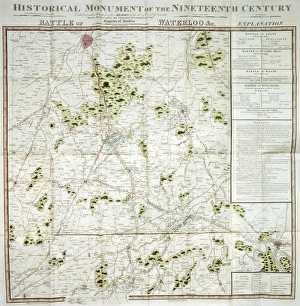
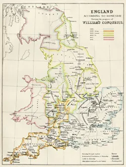
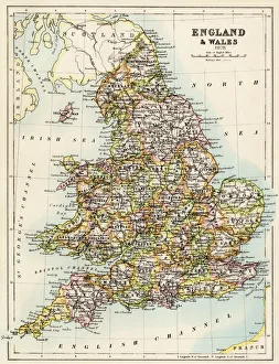
Maps of England, United Kingdom, and Europe art prints are high-quality reproductions of historical maps that depict the geography and topography of these regions. These maps showcase the evolution of cartography over time, from early hand-drawn sketches to more detailed and accurate depictions created with modern technology. These art prints are not only visually stunning but also serve as a valuable educational resource for historians, geographers, and anyone interested in exploring the history and culture of these regions. They can be used to trace the development of cities, transportation networks, political boundaries, natural resources, and other important features that have shaped these areas throughout history. Whether you're looking to decorate your home or office with a unique piece of artwork or want to add an educational element to your collection, Maps of England United Kingdom Europe art prints offer something for everyone. With their timeless appeal and rich historical significance, they are sure to be cherished by generations to come.
+

What Maps of England United Kingdom Europe art prints can I buy from Media Storehouse?

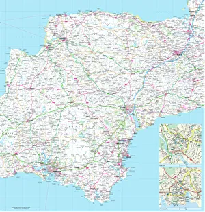
We offer a wide range of Maps of England, United Kingdom and Europe art prints that are perfect for decorating your home or office. You can choose from a variety of styles, including antique maps, modern maps, political maps and topographical maps. These prints are available in different sizes to suit your needs and preferences. If you're looking for something specific, we have an extensive collection of city maps such as London, Paris or Rome which will add sophistication to any room. They also have country-specific maps like Scotland or Wales which would be great for those who love travelling. In addition to traditional paper prints, Media Storehouse also offers canvas prints which give the artwork a more textured look. The canvas print is stretched over a wooden frame making it ready-to-hang on your wall. There's no shortage of options when it comes to Maps of England United Kingdom Europe art prints at Media Storehouse.
+

How do I buy Maps of England United Kingdom Europe art prints?

To buy Maps of England, United Kingdom, and Europe art prints from Media Storehouse, you can browse our extensive collection of maps on their website. You can search for specific locations or browse by category to find the perfect map print for your needs. Once you have found a map that you like, simply select the size and format that you prefer. We offer a range of printing options including canvas prints, framed prints, and poster prints. We also offer customization options such as adding text or choosing different color schemes to make your map print unique. When purchasing your map print from Media Storehouse, be sure to check out their secure checkout process which accepts various payment methods. Additionally, we offer international shipping so no matter where you are in the world; you can enjoy beautiful maps of England and Europe in your home or office.
+

How much do Maps of England United Kingdom Europe art prints cost?

The cost of Maps of England, United Kingdom and Europe art prints can vary depending on various factors such as the size, quality, and type of print. The prices may also differ from one seller to another. However, we offer a wide range of Map art prints that are affordable for everyone. Our collection includes vintage maps, contemporary maps, antique maps among others. The price range is reasonable and caters to different budgets without compromising on the quality of the print. Whether you're looking for a small or large map print to decorate your home or office space with an artistic touch or gift someone special with something unique and meaningful - there's something for everyone at Media Storehouse. Their selection features some stunning pieces that capture the beauty and history of England, United Kingdom and Europe in intricate detail making them perfect conversation starters too. So why not browse our collection today?
+

How will my Maps of England United Kingdom Europe art prints be delivered to me?

Your Maps of England United Kingdom Europe art prints will be delivered to you in a secure and protective packaging. The prints are carefully rolled and placed inside a sturdy tube to ensure that they arrive at your doorstep in pristine condition. The package will also include instructions on how to unroll the print without damaging it. Media Storehouse takes great care in delivering your artwork, ensuring that it is handled with utmost care during transit. Your package can be tracked online so you can monitor its progress until it reaches you. The delivery service used by Media Storehouse varies depending on your location and the size of the print ordered. However, rest assured that all deliveries are made using reputable courier services known for their reliability and efficiency. Your Maps of England United Kingdom Europe art prints will be delivered safely and securely to your doorstep via a trusted courier service in protective packaging designed specifically for artwork transportation.