Fraud Blocker Skip to main content

Old Map of Brighton 1898 from the Royal Atlas by Bartholomew

Old Map of Brighton 1898 from the Royal Atlas by Bartholomew
Sold 2
In Stock
We accept all major payment options so you can pay for the things you need in the way that is most convenient for you

MapSeeker Photo Prints and Wall Art

Old Map of Brighton 1898 from the Royal Atlas by Bartholomew

A fine very detailed plan of the Seaside Town of Brighton from 1898 remastered from an original contained within " The Royal Atlas of England and Wales" ; edited by J.G. Bartholomew, published by George Newnes, Limited, London. Welcome to the Mapseeker Image library and enter an historic gateway to one of the largest on-line collections of Historic Maps, Nostalgic Views, Vista's and Panorama's from a World gone by.

Media ID 20347624

Bartholomew Bartholomew Map Historic Map Old Town Plan Royal Atlas Royal Atlas Map Brighton

SECURE PAYMENTS
We accept all major payment options so you can pay for the things you need in the way that is most convenient for you

Made in Australia
Safe Shipping, Easy Returns

FREE PERSONALISATION
We are proud to offer a range of customisation including Cropping, Captions, and Filters. Zoom Cropping can be adjusted in the basket


EDITORS COMMENTS

Step back in time with this exquisite print of the 'Old Map of Brighton 1898' from the renowned Royal Atlas by Bartholomew. This meticulously remastered plan offers a fascinating glimpse into the seaside town's rich history, capturing its charm and character as it stood over a century ago. The level of detail showcased in this map is truly remarkable, allowing you to explore every nook and cranny of Brighton with precision. From the bustling streets lined with Victorian architecture to the iconic landmarks that have shaped its identity, this print encapsulates the essence of a bygone era. Originally featured within 'The Royal Atlas of England and Wales, ' edited by J. G. Bartholomew and published by George Newnes, Limited in London, this historic map holds immense historical value. It serves as a testament to Brighton's evolution throughout time while offering an invaluable resource for researchers, historians, or anyone captivated by cartography. Whether you're a proud resident seeking to connect with your city's past or an avid collector fascinated by vintage maps, this authentic reproduction promises to transport you back to 1898 Brighton.


Framed Prints

Step back in time with our exquisite Framed Prints from Media Storehouse. This particular piece showcases an Old Map of Brighton from 1898, meticulously remastered from the original in "The Royal Atlas of England and Wales" by J.G. The intricate details of this Old Map of Brighton, published by Bartholomew, provide a fascinating glimpse into the history of the popular seaside town. Each print is carefully framed to preserve its antique charm and adds a touch of timeless elegance to any room. Bring history into your home with our Framed Prints collection.


Photo Prints

Step back in time with our exquisite Media Storehouse Photographic Print of an Old Map of Brighton from the Royal Atlas by Bartholomew, dated 1898. This intricately detailed plan of the iconic Seaside Town brings the history of Brighton to life. Meticulously remastered from the original contained within "The Royal Atlas of England and Wales," this print is a must-have for history enthusiasts, locals, and anyone who appreciates the beauty of vintage maps. Add a touch of nostalgia to your home or office decor with this stunning and authentic piece.


Poster Prints

"Step back in time with our Old Map of Brighton 1898 from the Royal Atlas by Bartholomew. This beautifully detailed poster print, remastered from the original contained within "The Royal Atlas of England and Wales," offers a captivating glimpse into the history of the beloved seaside town. Discover the intricacies of Brighton's layout as it appeared over a century ago, brought to life by the exquisite craftsmanship of the Bartholomew mapmakers. Add a touch of nostalgia and historical charm to your space with this vintage map print from Media Storehouse."


Jigsaw Puzzles

Discover the charm of the past with our Old Map of Brighton 1898 from the Royal Atlas by Bartholomew, now available as a captivating jigsaw puzzle from Media Storehouse. This intricately detailed puzzle, remastered from an original map contained within "The Royal Atlas of England and Wales," invites you on a journey back in time to the Seaside Town of Brighton as it looked over a century ago. Experience the joy of piecing together this beautiful, historically significant image and bringing the rich history of Brighton to life in your own home.

diamond
Made With High Grade Materials
thumb_up
Professional Quality Finish
package_2
Carefully Packed To Aid Safe Arrival

You May Also Like


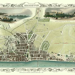
Old Map of Brighton 1851 by John TallisOld Map of Brighton 1851 by John Tallis
Add to Basket
CM16 7325 Jason Plato, Subaru Levorg GTCM16 7325 Jason Plato, Subaru Levorg GT
Add to Basket
PWA Windsurfing Maui 2013PWA Windsurfing Maui 2013
Add to Basket
Australia, New South Wales, SydneyAustralia, New South Wales, Sydney
Add to Basket
Stoke City Football Club: Swinging for Success at 2015 Golf Day - April 15thStoke City Football Club: Swinging for Success at 2015 Golf Day - April 15th
Add to Basket
Elizabeth II - Queen of the United Kingdom and CommonwealthElizabeth II - Queen of the United Kingdom and Commonwealth
Add to Basket
Anne BoleynAnne Boleyn
Add to Basket
John Hancoxs Map of the Birmingham Canal Navigations 1864John Hancoxs Map of the Birmingham Canal Navigations 1864
Add to Basket
Ian Wright, Arsenal PhotocallIan Wright, Arsenal Photocall
Add to Basket
1913 Day: Free Arsenal FC Prints for Fans - Download Now1913 Day: Free Arsenal FC Prints for Fans - Download Now
Add to Basket
ShelterShelter
Add to Basket
Scott Murray Dressing Room-PromotionScott Murray Dressing Room-Promotion
Add to Basket

Gallery Wall Inspiration

Old Map of Gloucester 1805 by Cole and Roper
Old Street Map of The Isle of Dogs and River Thames at Greenwich 1908
Old Map of Bristol 1893 from the Comprehensive Gazetteer Atlas of England and Wales
Old Street Map of Bethnal Green and Hackney 1908
Old Map of Derby 1806 by Cole and Roper
Old Map of West Bromwich in the West Midlands 1837
Old Map of Sutton Park near Sutton Coldfield 1885
Old Map of Wolverhampton 1750 by Isaac Taylor
Old Map of the City of Cambridge 1836 by Thomas Moule
Old Map of Cheltenham 1825 by Griffith s
Old Map of Stoke on Trent and the Potteries 1831
Old Map of Dudley 1835
Old Map of Plymouth Devonport and Stonehouse 1851 by John Tallis
Old Map of Leicester 1903
Old Map of Manchester and Salford 1898 from the Royal Atlas by Bartholomew
A Conjectural Picture Map of Birmingham In 1730
Old Map of Brighton 1851 by John Tallis
Old Map of Sheffield 1851 by John Tallis
Old Map of St Albans 1810 by Cole and Roper
Old Map of Exeter 1851 by John Tallis
Old Map of Bath 1851 by John Tallis
Old Map of Brighton 1898 from the Royal Atlas by Bartholomew
Old Map of Bristol 1903
Old Map of the Village of Streetly near Sutton Coldfield 1918
Old Map of the Town of Bromsgrove in Worcestershire 1884
Old Map of the Village of Little Aston in the West Midlands 1886
Old Map of the District of Sutton Coldfield in the West Midlands 1887


© Copyright Media Storehouse, All Rights Reserved 2003 - 2024
Facebook     Pinterest     100% Payment Secure     Reviews IO