Fraud Blocker Skip to main content

Poster Print > Europe > United Kingdom > England > Maps

Maps Poster Print Collection (page 8)

Discover the beauty and rich history of England, the United Kingdom, and Europe with our exquisite collection of Maps Prints from Media Storehouse. These detailed and vibrant posters are perfect for adding a touch of geographical charm to any room. Explore the intricate lines and borders that define these fascinating regions, and let your imagination wander as you trace the paths of historic landmarks and iconic landmarks. Each map is meticulously designed to showcase the unique character of the places it represents, making it an essential addition to any home or office. Order yours today and embark on a journey of discovery from the comfort of your own space.

Maps of England, United Kingdom and Europe are essential tools for navigation and exploration

10,590 Poster Prints

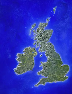
Background imageMaps Poster Print Collection: Illustration of a relief map of the British Isles

Illustration of a relief map of the British Isles

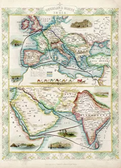
Background imageMaps Poster Print Collection: World Map / Overland India

World Map / Overland India
The overland routes from England to India, compared with sea routes

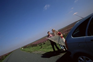
Background imageMaps Poster Print Collection: Motorists looking at the map, North Yorkshire Moors, Yorkshire, England

Motorists looking at the map, North Yorkshire Moors, Yorkshire, England, United Kingdom, Europe

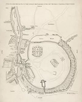
Background imageMaps Poster Print Collection: Oxford Castel C16th ?

Oxford Castel C16th ?
Plan of the motte and bailey castle of William the Conqueror showing the ditch, surrounding houses & their gardens, the Session House & St Georges Tower & the keep

Background imageMaps Poster Print Collection: 1746 Rocque Map

1746 Rocque Map

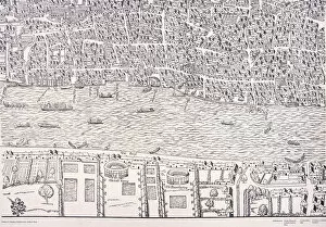
Background imageMaps Poster Print Collection: Agas Map of London, c1561

Agas Map of London, c1561
Agas map of London c1561, sheet 8; showing the bull baiting pit and bear baiting garden in Southwark. Also showing the River Thames and City of London

Background imageMaps Poster Print Collection: Agas Map of London, c1561

Agas Map of London, c1561
Agas map of London c1561, sheet 9; showing part of the City of London, London Wall and fields to the north east

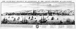
Background imageMaps Poster Print Collection: The South West Prospect of Liverpool, in the County Palatine of Lancaster, 1728

The South West Prospect of Liverpool, in the County Palatine of Lancaster, 1728
XJF497296 The South West Prospect of Liverpool, in the County Palatine of Lancaster, 1728 (engraving) by Buck, Nathaniel (fl.1727-53) and Samuel (1696-1779); Private Collection; English

Background imageMaps Poster Print Collection: Yorkshire County Road Map

Yorkshire County Road Map
A detailed map of the glorious county of Yorkshire in England covering the entire of the Three Ridings. Derived from high quality Collins Bartholomew map data showing larger villages

Background imageMaps Poster Print Collection: Map of the City of Durham, England Victorian Engraving, 1840

Map of the City of Durham, England Victorian Engraving, 1840
Very Rare, Beautifully Illustrated Antique Engraving of Map of the City of Durham, England Victorian Engraving, 1840. Source: Original edition from my own archives

Background imageMaps Poster Print Collection: Map of Exeter in Devon, England Victorian Engraving, 1840

Map of Exeter in Devon, England Victorian Engraving, 1840
Very Rare, Beautifully Illustrated Antique Engraving of Map of Exeter in Devon, England Victorian Engraving, 1840. Source: Original edition from my own archives

Background imageMaps Poster Print Collection: 'Scale' in Maps (colour litho)

"Scale" in Maps (colour litho)
8658789 "Scale" in Maps (colour litho) by English School, (20th century); Private Collection; (add.info.: "Scale" in Maps)

Background imageMaps Poster Print Collection: A general chart on Mercators projection to show the track of the Lion

A general chart on Mercators projection to show the track of the Lion and Hindostan from England to the Gulph of Pekin
7339422 A general chart on Mercators projection to show the track of the Lion and Hindostan from England to the Gulph of Pekin in China and their return back to England, 1796 (print) by Barrow

Background imageMaps Poster Print Collection: Sheet 16 from: An exact survey of the cities of London and Westminster, the Borough of Southwark

Sheet 16 from: An exact survey of the cities of London and Westminster, the Borough of Southwark
7340520 Sheet 16 from: An exact survey of the cities of London and Westminster, the Borough of Southwark, with the country near ten miles round

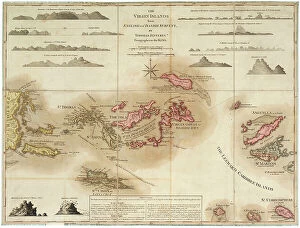
Background imageMaps Poster Print Collection: The Virgin Islands from English and Danish surveys, 1775 (engraving)

The Virgin Islands from English and Danish surveys, 1775 (engraving)
7340498 The Virgin Islands from English and Danish surveys, 1775 (engraving) by Jefferys, Thomas (c.1719-71); 46.5x62 cm; National Maritime Museum, London

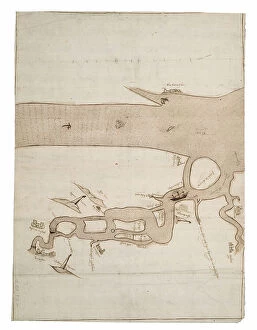
Background imageMaps Poster Print Collection: Chart of River Medway and part of the Thames: no.24 Sheerness, c.1590 (ink and wash)

Chart of River Medway and part of the Thames: no.24 Sheerness, c.1590 (ink and wash)
7340493 Chart of River Medway and part of the Thames: no.24 Sheerness, c.1590 (ink and wash) by Unknown Artist, (16th century); 40x30 cm; National Maritime Museum, London

Background imageMaps Poster Print Collection: Chart of Dover Strait, c.1587-88 (watercolour on vellum)

Chart of Dover Strait, c.1587-88 (watercolour on vellum)
7340491 Chart of Dover Strait, c.1587-88 (watercolour on vellum) by Teixeira, Luis (fl.1564-1612); 40x52 cm; National Maritime Museum, London, UK; (add.info.: Creator: Luis Teixeira Single sheet)

Background imageMaps Poster Print Collection: Plate from Edward Barlow's journal of his life at sea in king's ships

Plate from Edward Barlow's journal of his life at sea in king's ships
7340651 Plate from Edward Barlow's journal of his life at sea in king's ships, East & West Indiamen & other merchantmen from 1659 to 1703. 1814 (print) by Heather, W

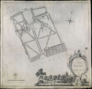
Background imageMaps Poster Print Collection: Plan of Greenwich Park, showing the Royal Observatory, One Tree Hill and the Ranger's House

Plan of Greenwich Park, showing the Royal Observatory, One Tree Hill and the Ranger's House, 1790 (pen, wash)
7340660 Plan of Greenwich Park, showing the Royal Observatory, One Tree Hill and the Ranger's House, 1790 (pen, wash, vellum) by Morton, John (18th century); 55.5x53.5 cm; National Maritime Museum

Background imageMaps Poster Print Collection: Map of Greenford, Osterley, Ealing and Kew, 1746 (coloured engraving)

Map of Greenford, Osterley, Ealing and Kew, 1746 (coloured engraving)
7340517 Map of Greenford, Osterley, Ealing and Kew, 1746 (coloured engraving) by Rocque, John (c.1704-d.1762); 51x67 cm; National Maritime Museum, London

Background imageMaps Poster Print Collection: Map of Wimbledon and Tooting, 1746 (coloured engraving)

Map of Wimbledon and Tooting, 1746 (coloured engraving)
7340512 Map of Wimbledon and Tooting, 1746 (coloured engraving) by Rocque, John (c.1704-d.1762); 51x67 cm; National Maritime Museum, London

Background imageMaps Poster Print Collection: England East Coast. Sheet 1, late 19th century (print)

England East Coast. Sheet 1, late 19th century (print)
7340593 England East Coast. Sheet 1, late 19th century (print) by Imray, James & Son (19th century); National Maritime Museum, London

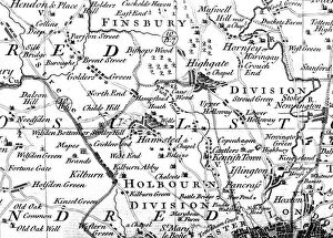
Background imageMaps Poster Print Collection: Map of Highgate, Kentish Town, Holloway, Tottenham and Newington, 1746 (coloured engraving)

Map of Highgate, Kentish Town, Holloway, Tottenham and Newington, 1746 (coloured engraving)
7340507 Map of Highgate, Kentish Town, Holloway, Tottenham and Newington, 1746 (coloured engraving) by Rocque, John (c.1704-d.1762); 51x67 cm; National Maritime Museum, London

Background imageMaps Poster Print Collection: Plymouth, 1672 (Ink, watercolour, paper, linen )

Plymouth, 1672 (Ink, watercolour, paper, linen )
7340487 Plymouth, 1672 (Ink, watercolour, paper, linen ) by Gomme, Bernard de (1620-85); 92x1015 cm; National Maritime Museum, London

Background imageMaps Poster Print Collection: Royal Victoria and Albert and King George V Docks 1934, c.1934 (print)

Royal Victoria and Albert and King George V Docks 1934, c.1934 (print)
7340370 Royal Victoria and Albert and King George V Docks 1934, c.1934 (print) by Vincent Brooks, Day & Son (1867-1940); National Maritime Museum, London

Background imageMaps Poster Print Collection: A chart of the entrance into the Channel containing the west coast of Cornwall

A chart of the entrance into the Channel containing the west coast of Cornwall
7340130 A chart of the entrance into the Channel containing the west coast of Cornwall and Scilly Islands with all the soundings, 1779 (copperplate engraving) by British School

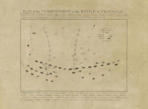
Background imageMaps Poster Print Collection: Plan of the Commencement of the Battle of Trafalgar, 19th century (etching)

Plan of the Commencement of the Battle of Trafalgar, 19th century (etching)
7342311 Plan of the Commencement of the Battle of Trafalgar, 19th century (etching) by Unknown Artist, (19th century); 29.5x35.8 cm; National Maritime Museum, London

Background imageMaps Poster Print Collection: Chart of area from Dover and Calais to Orfordness, 1906-10 (manuscript)

Chart of area from Dover and Calais to Orfordness, 1906-10 (manuscript)
7340551 Chart of area from Dover and Calais to Orfordness, 1906-10 (manuscript) by British School, (20th century) ; 69.6x103.1 cm; National Maritime Museum, London

Background imageMaps Poster Print Collection: Map of Hounslow, Twickenham and Richmond, 1746 (coloured engraving)

Map of Hounslow, Twickenham and Richmond, 1746 (coloured engraving)
7340518 Map of Hounslow, Twickenham and Richmond, 1746 (coloured engraving) by Rocque, John (c.1704-d.1762); 51x67 cm; National Maritime Museum, London

Background imageMaps Poster Print Collection: Chart of Yarmouth and the sands about it, c.1700 (coloured engraving)

Chart of Yarmouth and the sands about it, c.1700 (coloured engraving)
7340607 Chart of Yarmouth and the sands about it, c.1700 (coloured engraving) by Collins, Greenvile (1643-94); National Maritime Museum, London

Background imageMaps Poster Print Collection: England East Coast: Harwich to Kingston Upon Hull, 1857 (print)

England East Coast: Harwich to Kingston Upon Hull, 1857 (print)
7340600 England East Coast: Harwich to Kingston Upon Hull, 1857 (print) by Hobbs, J.S. (19th century); 81x65.5 cm; National Maritime Museum, London, UK; (add.info.: Creator: J.S)

Background imageMaps Poster Print Collection: England-East Coast. Outer Gabbard to Outer Dowsing, 1919 (engraving)

England-East Coast. Outer Gabbard to Outer Dowsing, 1919 (engraving)
7340581 England-East Coast. Outer Gabbard to Outer Dowsing, 1919 (engraving) by British School, (20th century) ; 98.5x66 cm; National Maritime Museum, London

Background imageMaps Poster Print Collection: Map of Bow, Stratford, Blackwall and Plaistow, 1746 (coloured engraving)

Map of Bow, Stratford, Blackwall and Plaistow, 1746 (coloured engraving)
7340506 Map of Bow, Stratford, Blackwall and Plaistow, 1746 (coloured engraving) by Rocque, John (c.1704-d.1762); 51x67 cm; National Maritime Museum, London

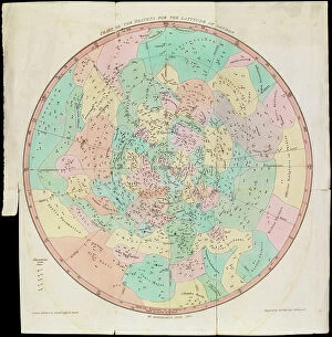
Background imageMaps Poster Print Collection: Chart of the Heavens for the Latitude of London, Urania's Mirror or a View of the Heavens

Chart of the Heavens for the Latitude of London, Urania's Mirror or a View of the Heavens, c.1825 (card, paper)
7340086 Chart of the Heavens for the Latitude of London, Urania's Mirror or a View of the Heavens, c.1825 (card, paper, tissue, engraving) by Hall

Background imageMaps Poster Print Collection: A Dutch map showing areas devastated by the Great Fire of London, 1666, 17th century (manuscript)

A Dutch map showing areas devastated by the Great Fire of London, 1666, 17th century (manuscript)
7340111 A Dutch map showing areas devastated by the Great Fire of London, 1666, 17th century (manuscript) by Unknown Artist, (17th century); National Maritime Museum, London

Background imageMaps Poster Print Collection: A new mappe of the sea coasts of England, France and Holland, wherein the English names, situation

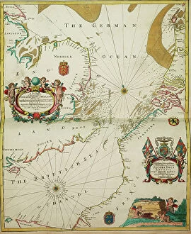
A new mappe of the sea coasts of England, France and Holland, wherein the English names, situation
7340046 A new mappe of the sea coasts of England, France and Holland, wherein the English names, situation, point of the compass, and distance of the several ports, harbours, havens, creeks, sands

Background imageMaps Poster Print Collection: The coast of England from the Southforeland to Orfordness, 1675 (coloured engraving)

The coast of England from the Southforeland to Orfordness, 1675 (coloured engraving)
7340045 The coast of England from the Southforeland to Orfordness, 1675 (coloured engraving) by Seller, John (1632-97); 43.5x54 cm; National Maritime Museum, London

Background imageMaps Poster Print Collection: A new chart of the coast from Lowestoff to Hasbrough including Yarmouth Roads and Sands

A new chart of the coast from Lowestoff to Hasbrough including Yarmouth Roads and Sands, Hasbrough Gatt
7340040 A new chart of the coast from Lowestoff to Hasbrough including Yarmouth Roads and Sands, Hasbrough Gatt, and the new lights, 1797 (technical drawing) by Diston

Background imageMaps Poster Print Collection: Title page to Expeditionis Hispanorum in Angliam vera descriptio anno domini MDLXXXVIII

Title page to Expeditionis Hispanorum in Angliam vera descriptio anno domini MDLXXXVIII, 1590 (engraving)
7340022 Title page to Expeditionis Hispanorum in Angliam vera descriptio anno domini MDLXXXVIII, 1590 (engraving) by Adams, Robert (1540-95) (after); 43x53.5 cm; National Maritime Museum, London

Background imageMaps Poster Print Collection: The sea coastes of England between the Isle of Wight and Dover

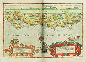
The sea coastes of England between the Isle of Wight and Dover, with the principal havens thereof according to their
7340013 The sea coastes of England between the Isle of Wight and Dover, with the principal havens thereof according to their situation and appearing, c.1588 (chart) by Janszoon Waghenaer

Background imageMaps Poster Print Collection: A survey of the entrance to the River Humber by Commander Williamm Hewett, R.N

A survey of the entrance to the River Humber by Commander Williamm Hewett, R.N
7339966 A survey of the entrance to the River Humber by Commander Williamm Hewett, R.N. made by order of the Lords Commisioners of the Admiralty 1828, 1830-41 (technical drawing) by Walker, J. & C

Background imageMaps Poster Print Collection: Battle of Copenhagen, 2 April 1801, 1801 (engraving)

Battle of Copenhagen, 2 April 1801, 1801 (engraving)
7339858 Battle of Copenhagen, 2 April 1801, 1801 (engraving) by Gibson, Francis (19th century); 40x45.5 cm; National Maritime Museum, London

Background imageMaps Poster Print Collection: River Thames from London to Gravesend, 1830-33 (print)

River Thames from London to Gravesend, 1830-33 (print)
7337575 River Thames from London to Gravesend, 1830-33 (print) by Bullock, F. & Burstal, E. (fl.c.1830); National Maritime Museum, London, UK; (add.info.: Creator: Captain F. Bullock; Lieutenant E)

Background imageMaps Poster Print Collection: Plan Of Stonehenge As If Restored, Left. Plan Of Stonehenge As It Was

Plan Of Stonehenge As If Restored, Left. Plan Of Stonehenge As It Was. Both Plans From The Late 19Th Century
UIG5420285 Plan Of Stonehenge As If Restored, Left. Plan Of Stonehenge As It Was. Both Plans From The Late 19Th Century. From Our Own Country Published 1898 ©UIG/Leemage

Background imageMaps Poster Print Collection: Plan of Deptford Dockyard, 1774 (technical drawing)

Plan of Deptford Dockyard, 1774 (technical drawing)
7340916 Plan of Deptford Dockyard, 1774 (technical drawing) by Unknown artist, (18th century); National Maritime Museum, London, UK; (add.info.: Creator: unknown); © National Maritime Museum

Background imageMaps Poster Print Collection: Chart of Plymouth Sound, from Greenville Collins's 1693 chart of the English Channel

Chart of Plymouth Sound, from Greenville Collins's 1693 chart of the English Channel, 1695 (coloured engraving)
7339508 Chart of Plymouth Sound, from Greenville Collins's 1693 chart of the English Channel, 1695 (coloured engraving) by Keulen, Gerard van (1678-1726); 51x60 cm; National Maritime Museum, London

Background imageMaps Poster Print Collection: A chart of the islands in the China Sea near the Straits of Malacca with the positions of

A chart of the islands in the China Sea near the Straits of Malacca with the positions of the English fleet
7339495 A chart of the islands in the China Sea near the Straits of Malacca with the positions of the English fleet and the squadron of Admiral Linois on the 14 & 15th February 1804

Background imageMaps Poster Print Collection: Chart of Milford Haven in St Georges and Bristol Channel, 1595 (pencil, ink and watercolour)

Chart of Milford Haven in St Georges and Bristol Channel, 1595 (pencil, ink and watercolour)
7339469 Chart of Milford Haven in St Georges and Bristol Channel, 1595 (pencil, ink and watercolour) by Ive, Paul (16th century); 44x58 cm; National Maritime Museum, London


All Professionally Made to Order for Quick Shipping


-

Maps Poster Print Collection

Maps of England, United Kingdom and Europe are essential tools for navigation and exploration. They provide a visual representation of the geography, topography and political boundaries of these regions, and are be used to plan routes, identify landmarks, locate cities and towns, measure distances between locations and understand the physical features of an area. They also help to illustrate historical events such as wars or migrations, and are be printed in various formats such as paper or digital versions which can be accessed on computers or mobile devices. With the help we can gain a better understanding about our environment and its history which is invaluable for both educational purposes as well as practical applications.
+

Our beautiful Wall Art and Photo Gifts include Framed Prints, Photo Prints, Poster Prints, Canvas Prints, Jigsaw Puzzles, Metal Prints and so much more

The Maps of England United Kingdom Europe collection from Media Storehouse is a stunning array of wall art, framed prints, photo prints, canvas prints, jigsaw puzzles and greeting cards that showcase the beauty and history of these regions. Our collection features an extensive range of maps dating back to the 16th century up to modern times. These maps are not only visually appealing but also provide valuable insights into the geography, topography and political boundaries of these areas. Whether you're looking for a vintage map to add character to your home or want a contemporary piece that reflects current borders and landmarks, our collection has something for everyone. The high-quality printing techniques used by Media Storehouse ensure that each piece is vibrant in color and detail-rich. From antique world maps to detailed street plans of London or Paris, there's no shortage of options when it comes to choosing your perfect print. With its wide variety of sizes and formats available at affordable prices, our collection provides an excellent opportunity for anyone interested in exploring the rich history and culture encapsulated within these regions through beautiful artwork.
+

What are Maps of England United Kingdom Europe art prints?

Maps of England, United Kingdom, and Europe art prints are high-quality reproductions of historical maps that depict the geography and topography of these regions. These maps showcase the evolution of cartography over time, from early hand-drawn sketches to more detailed and accurate depictions created with modern technology. These art prints are not only visually stunning but also serve as a valuable educational resource for historians, geographers, and anyone interested in exploring the history and culture of these regions. They can be used to trace the development of cities, transportation networks, political boundaries, natural resources, and other important features that have shaped these areas throughout history. Whether you're looking to decorate your home or office with a unique piece of artwork or want to add an educational element to your collection, Maps of England United Kingdom Europe art prints offer something for everyone. With their timeless appeal and rich historical significance, they are sure to be cherished by generations to come.
+

What Maps of England United Kingdom Europe art prints can I buy from Media Storehouse?

We offer a wide range of Maps of England, United Kingdom and Europe art prints that are perfect for decorating your home or office. You can choose from a variety of styles, including antique maps, modern maps, political maps and topographical maps. These prints are available in different sizes to suit your needs and preferences. If you're looking for something specific, we have an extensive collection of city maps such as London, Paris or Rome which will add sophistication to any room. They also have country-specific maps like Scotland or Wales which would be great for those who love travelling. In addition to traditional paper prints, Media Storehouse also offers canvas prints which give the artwork a more textured look. The canvas print is stretched over a wooden frame making it ready-to-hang on your wall. There's no shortage of options when it comes to Maps of England United Kingdom Europe art prints at Media Storehouse.
+

How do I buy Maps of England United Kingdom Europe art prints?

To buy Maps of England, United Kingdom, and Europe art prints from Media Storehouse, you can browse our extensive collection of maps on their website. You can search for specific locations or browse by category to find the perfect map print for your needs. Once you have found a map that you like, simply select the size and format that you prefer. We offer a range of printing options including canvas prints, framed prints, and poster prints. We also offer customization options such as adding text or choosing different color schemes to make your map print unique. When purchasing your map print from Media Storehouse, be sure to check out their secure checkout process which accepts various payment methods. Additionally, we offer international shipping so no matter where you are in the world; you can enjoy beautiful maps of England and Europe in your home or office.
+

How much do Maps of England United Kingdom Europe art prints cost?

The cost of Maps of England, United Kingdom and Europe art prints can vary depending on various factors such as the size, quality, and type of print. The prices may also differ from one seller to another. However, we offer a wide range of Map art prints that are affordable for everyone. Our collection includes vintage maps, contemporary maps, antique maps among others. The price range is reasonable and caters to different budgets without compromising on the quality of the print. Whether you're looking for a small or large map print to decorate your home or office space with an artistic touch or gift someone special with something unique and meaningful - there's something for everyone at Media Storehouse. Their selection features some stunning pieces that capture the beauty and history of England, United Kingdom and Europe in intricate detail making them perfect conversation starters too. So why not browse our collection today?
+

How will my Maps of England United Kingdom Europe art prints be delivered to me?

Your Maps of England United Kingdom Europe art prints will be delivered to you in a secure and protective packaging. The prints are carefully rolled and placed inside a sturdy tube to ensure that they arrive at your doorstep in pristine condition. The package will also include instructions on how to unroll the print without damaging it. Media Storehouse takes great care in delivering your artwork, ensuring that it is handled with utmost care during transit. Your package can be tracked online so you can monitor its progress until it reaches you. The delivery service used by Media Storehouse varies depending on your location and the size of the print ordered. However, rest assured that all deliveries are made using reputable courier services known for their reliability and efficiency. Your Maps of England United Kingdom Europe art prints will be delivered safely and securely to your doorstep via a trusted courier service in protective packaging designed specifically for artwork transportation.