Fraud Blocker Skip to main content

Home > Europe > United Kingdom > Maps

Maps Collection (page 6)

Maps of the United Kingdom and Europe are essential tools for travelers, businesses, and researchers

12,649 items

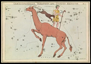
Background imageMaps Collection: Camelopadalis, Tarandus and Custos Messium, c.1825 (card, paper, tissue )

Camelopadalis, Tarandus and Custos Messium, c.1825 (card, paper, tissue )
7340873 Camelopadalis, Tarandus and Custos Messium, c.1825 (card, paper, tissue ) by Hall, Sydney (fl.1826); 20.3x14 cm; National Maritime Museum, London

Background imageMaps Collection: Urania's Mirror or a View of the Heavens (Constellation cards), c.1825 (card, paper, tissue)

Urania's Mirror or a View of the Heavens (Constellation cards), c.1825 (card, paper, tissue)
7340871 Urania's Mirror or a View of the Heavens (Constellation cards), c.1825 (card, paper, tissue) by Hall, Sydney (fl.1826); National Maritime Museum, London, UK; (add.info.: Box lid)

Background imageMaps Collection: Plan of Eagle Island and Bird Island, late 18th to early 19th century (paper)

Plan of Eagle Island and Bird Island, late 18th to early 19th century (paper)
7340731 Plan of Eagle Island and Bird Island, late 18th to early 19th century (paper) by Dalrymple, Alexander (18th-19th century); National Maritime Museum, London

Background imageMaps Collection: Map of Africa, 1564 - 1 of 8 sheets, 1564 (technical drawing)

Map of Africa, 1564 - 1 of 8 sheets, 1564 (technical drawing)
7340677 Map of Africa, 1564 - 1 of 8 sheets, 1564 (technical drawing) by Gastaldi, Giacomo (c.1500-66); National Maritime Museum, London

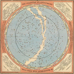
Background imageMaps Collection: The celestial planisphere or transparent star director, c.1850 (card, paper, tissue)

The celestial planisphere or transparent star director, c.1850 (card, paper, tissue)
7340555 The celestial planisphere or transparent star director, c.1850 (card, paper, tissue) by British School, (19th century); 34.5x34.5 cm; National Maritime Museum, London

Background imageMaps Collection: Sheet 16 from: An exact survey of the cities of London and Westminster, the Borough of Southwark

Sheet 16 from: An exact survey of the cities of London and Westminster, the Borough of Southwark
7340520 Sheet 16 from: An exact survey of the cities of London and Westminster, the Borough of Southwark, with the country near ten miles round

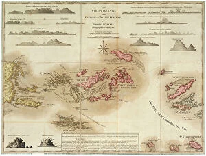
Background imageMaps Collection: The Virgin Islands from English and Danish surveys, 1775 (engraving)

The Virgin Islands from English and Danish surveys, 1775 (engraving)
7340498 The Virgin Islands from English and Danish surveys, 1775 (engraving) by Jefferys, Thomas (c.1719-71); 46.5x62 cm; National Maritime Museum, London

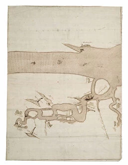
Background imageMaps Collection: Chart of River Medway and part of the Thames: no.24 Sheerness, c.1590 (ink and wash)

Chart of River Medway and part of the Thames: no.24 Sheerness, c.1590 (ink and wash)
7340493 Chart of River Medway and part of the Thames: no.24 Sheerness, c.1590 (ink and wash) by Unknown Artist, (16th century); 40x30 cm; National Maritime Museum, London

Background imageMaps Collection: Chart of Dover Strait, c.1587-88 (watercolour on vellum)

Chart of Dover Strait, c.1587-88 (watercolour on vellum)
7340491 Chart of Dover Strait, c.1587-88 (watercolour on vellum) by Teixeira, Luis (fl.1564-1612); 40x52 cm; National Maritime Museum, London, UK; (add.info.: Creator: Luis Teixeira Single sheet)

Background imageMaps Collection: The south part of Virginia, 1657 (vellum)

The south part of Virginia, 1657 (vellum)
7340490 The south part of Virginia, 1657 (vellum) by Comberford, Nicholas (d.1673); 39x25 cm; National Maritime Museum, London

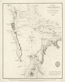
Background imageMaps Collection: Bay of Navarino, 1830 (print)

Bay of Navarino, 1830 (print)
7340652 Bay of Navarino, 1830 (print) by Smyth, William Henry (1788-1865); 32.5x25.5 cm; National Maritime Museum, London

Background imageMaps Collection: Plate from Edward Barlow's journal of his life at sea in king's ships

Plate from Edward Barlow's journal of his life at sea in king's ships
7340651 Plate from Edward Barlow's journal of his life at sea in king's ships, East & West Indiamen & other merchantmen from 1659 to 1703. 1814 (print) by Heather, W

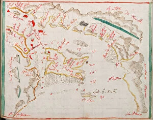
Background imageMaps Collection: Guayaquil, 1682 (coloured manuscript)

Guayaquil, 1682 (coloured manuscript)
7339327 Guayaquil, 1682 (coloured manuscript) by Ringrose, Basil (c.1653-83); 16x20 cm; National Maritime Museum, London, UK; (add.info.: Creator)

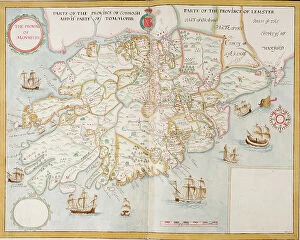
Background imageMaps Collection: The province of Munster, Ireland, c.1595 (manuscript)

The province of Munster, Ireland, c.1595 (manuscript)
7339307 The province of Munster, Ireland, c.1595 (manuscript) by Unknown Artist, (16th century); 45x59 cm; National Maritime Museum, London, UK; (add.info.: Creator: unknown Scale: [ca)

Background imageMaps Collection: A complete map of the West Indies containing the coasts of Florida, Louisiana

A complete map of the West Indies containing the coasts of Florida, Louisiana
7339476 A complete map of the West Indies containing the coasts of Florida, Louisiana, New Spain and Terra Firma with all the islands, 1794 (print) by Dunn

Background imageMaps Collection: Map of Nagasaki, Japan, c.1868 (coloured woodcut)

Map of Nagasaki, Japan, c.1868 (coloured woodcut)
7339464 Map of Nagasaki, Japan, c.1868 (coloured woodcut) by Japanese School, (19th century); 44x65 cm; National Maritime Museum, London

Background imageMaps Collection: Bootes Canes Venatici, Coma Berenices and Quadrans Muralis, c.1825 (card, paper, tissue)

Bootes Canes Venatici, Coma Berenices and Quadrans Muralis, c.1825 (card, paper, tissue)
7339260 Bootes Canes Venatici, Coma Berenices and Quadrans Muralis, c.1825 (card, paper, tissue) by Hall, Sydney (fl.1826); 38.5x37.3x33.4 cm; National Maritime Museum, London

Background imageMaps Collection: Inscription in North Pacific Ocean, c.1860 (papier mache, wood, metal, plaster, paper, varnish)

Inscription in North Pacific Ocean, c.1860 (papier mache, wood, metal, plaster, paper, varnish, hand-coloured)
7339254 Inscription in North Pacific Ocean, c.1860 (papier mache, wood, metal, plaster, paper, varnish, hand-coloured, copper plate engraved) by Newton

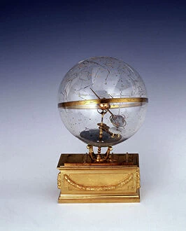
Background imageMaps Collection: Planetarium, c.1825 (brass, glass, gilt brass, enamel, engraved)

Planetarium, c.1825 (brass, glass, gilt brass, enamel, engraved)
7339249 Planetarium, c.1825 (brass, glass, gilt brass, enamel, engraved) by Unknown Artist, (19th century); 28x17 cm; National Maritime Museum, London

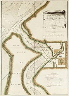
Background imageMaps Collection: Map of Hoogly River, c.1777 (engraving)

Map of Hoogly River, c.1777 (engraving)
7339428 Map of Hoogly River, c.1777 (engraving) by British School, (18th Century); 20.5x32.5 cm; National Maritime Museum, London, UK; (add.info.: Creator: Lacam, Benjamin Single sheet. Hand col)

Background imageMaps Collection: Section plate from Francesco Camocio's Cosmographia Universalis, 1567

Section plate from Francesco Camocio's Cosmographia Universalis, 1567
7339211 Section plate from Francesco Camocio's Cosmographia Universalis, 1567, taken from the atlas Tavole Moderne di Geografia, 1567 (engraving) by Unknown Artist

Background imageMaps Collection: Section plate from Francesco Camocio's Cosmographia Universalis, 1567

Section plate from Francesco Camocio's Cosmographia Universalis, 1567
7339210 Section plate from Francesco Camocio's Cosmographia Universalis, 1567, taken from the atlas Tavole Moderne di Geografia, 1567 (engraving) by Unknown Artist

Background imageMaps Collection: Section plate from Francesco Camocio's Cosmographia Universalis, 1567

Section plate from Francesco Camocio's Cosmographia Universalis, 1567
7339208 Section plate from Francesco Camocio's Cosmographia Universalis, 1567, taken from the atlas Tavole Moderne di Geografia, 1567 (engraving) by Unknown Artist

Background imageMaps Collection: Map of Asia from the Blaeu Atlas, 1662-65 (print)

Map of Asia from the Blaeu Atlas, 1662-65 (print)
7339178 Map of Asia from the Blaeu Atlas, 1662-65 (print) by Unknown Artist, (17th century); National Maritime Museum, London, UK; (add.info.: Creator: unknown Map of Asia from the Blaeu Atlas)

Background imageMaps Collection: Greece, the Peiraeus or Port Drako surveyed by Commander Thomas Graves, H.M.S

Greece, the Peiraeus or Port Drako surveyed by Commander Thomas Graves, H.M.S. Beacon 1840, [Detail], 1843 (print)
7342579 Greece, the Peiraeus or Port Drako surveyed by Commander Thomas Graves, H.M.S. Beacon 1840, [Detail], 1843 (print) by Walker, J. & C

Background imageMaps Collection: Greece, the Peiraeus or Port Drako surveyed by Commander Thomas Graves, H.M.S

Greece, the Peiraeus or Port Drako surveyed by Commander Thomas Graves, H.M.S. Beacon 1840, 1843 (print)
7342578 Greece, the Peiraeus or Port Drako surveyed by Commander Thomas Graves, H.M.S. Beacon 1840, 1843 (print) by Walker, J. & C

Background imageMaps Collection: Claudii Ptholemaei Alexandrini liber geographiae cum tabulis et universali figura et cum additione

Claudii Ptholemaei Alexandrini liber geographiae cum tabulis et universali figura et cum additione locorum quae a
7342516 Claudii Ptholemaei Alexandrini liber geographiae cum tabulis et universali figura et cum additione locorum quae a recentioribus reperta sunt diligenti cura emendatus et impressus

Background imageMaps Collection: Archipeligo, Rhodes Island, town and ports of Rhodes surveyed by Commander Thomas Graves

Archipeligo, Rhodes Island, town and ports of Rhodes surveyed by Commander Thomas Graves, HMS Beacon 1838, 1844 (print)
7342500 Archipeligo, Rhodes Island, town and ports of Rhodes surveyed by Commander Thomas Graves, HMS Beacon 1838, 1844 (print) by Walker, J. & C

Background imageMaps Collection: Chart of the Archipelago to the Northward ot Mauritius laid down in 1776 by M le Victe Grenier

Chart of the Archipelago to the Northward ot Mauritius laid down in 1776 by M le Victe Grenier Lieut in the French Navy
7342593 Chart of the Archipelago to the Northward ot Mauritius laid down in 1776 by M le Victe Grenier Lieut in the French Navy [Includes Seychelles

Background imageMaps Collection: Polar projection map with Arctic Circle, c.1680 (coloured engraving)

Polar projection map with Arctic Circle, c.1680 (coloured engraving)
7295393 Polar projection map with Arctic Circle, c.1680 (coloured engraving) by Seller, John (1632-97); 44x55 cm; National Maritime Museum, London

Background imageMaps Collection: Chart showing the North West Passage discovered by Captain R. Le M. McClure, HMS Investigator

Chart showing the North West Passage discovered by Captain R. Le M. McClure, HMS Investigator
7295388 Chart showing the North West Passage discovered by Captain R. Le M. McClure, HMS Investigator, 1853 (coloured engraving) by Inglefield

Background imageMaps Collection: Globus terrestris (Chart), 1564 (engraving)

Globus terrestris (Chart), 1564 (engraving)
7295387 Globus terrestris (Chart), 1564 (engraving) by Amman, Jost (1539-91); 30x20 cm; National Maritime Museum, London, UK; (add.info.: Creator: Jost Amman Single sheet)

Background imageMaps Collection: Nova & Acurata Totius Asiae Tabula, auct G. Blaeu, c.1673 (coloured engraving)

Nova & Acurata Totius Asiae Tabula, auct G. Blaeu, c.1673 (coloured engraving)
7337544 Nova & Acurata Totius Asiae Tabula, auct G. Blaeu, c.1673 (coloured engraving) by Blaeu, Joan (1596-1673); 109.5x149.2x5 cm; National Maritime Museum, London

Background imageMaps Collection: Linschoten's voyage to the East Indies, 1583-1595, 1599-1601 (etching)

Linschoten's voyage to the East Indies, 1583-1595, 1599-1601 (etching)
7341892 Linschoten's voyage to the East Indies, 1583-1595, 1599-1601 (etching) by Unknown Artist, (16th century); 39.5x44.5 cm; National Maritime Museum, London, UK; (add.info.: Unknown Artist)

Background imageMaps Collection: Volvelle illustrating the magnitude, start time and duration of eclipses

Volvelle illustrating the magnitude, start time and duration of eclipses, 1540 (hand-coloured engraving)
7340904 Volvelle illustrating the magnitude, start time and duration of eclipses, 1540 (hand-coloured engraving) by Apianus, Petrus (1495-1552); National Maritime Museum, London

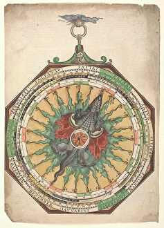
Background imageMaps Collection: Volvelle giving the rules for predicting solar and lunar eclipses

Volvelle giving the rules for predicting solar and lunar eclipses. One of the volvelles features a dragon with multiple
7340903 Volvelle giving the rules for predicting solar and lunar eclipses. One of the volvelles features a dragon with multiple heads and a partial solar eclipse

Background imageMaps Collection: Monoceros, Canis Minor and Atelier Typographique, c.1825 (card, paper, tissue )

Monoceros, Canis Minor and Atelier Typographique, c.1825 (card, paper, tissue )
7340894 Monoceros, Canis Minor and Atelier Typographique, c.1825 (card, paper, tissue ) by Hall, Sydney (fl.1826); 20.3x14 cm; National Maritime Museum, London

Background imageMaps Collection: Pisces, c.1825 (card, paper, tissue )

Pisces, c.1825 (card, paper, tissue )
7340892 Pisces, c.1825 (card, paper, tissue ) by Hall, Sydney (fl.1826); 20.3x14 cm; National Maritime Museum, London, UK; (add.info.: Creator: Sidney Hall Plate 27)

Background imageMaps Collection: Capricornus, c.1825 (card, paper, tissue )

Capricornus, c.1825 (card, paper, tissue )
7340890 Capricornus, c.1825 (card, paper, tissue ) by Hall, Sydney (fl.1826); 20.3x14 cm; National Maritime Museum, London, UK; (add.info.: Creator: Sidney Hall Plate 25)

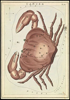
Background imageMaps Collection: Cancer, c.1825 (card, paper, tissue )

Cancer, c.1825 (card, paper, tissue )
7340885 Cancer, c.1825 (card, paper, tissue ) by Hall, Sydney (fl.1826); 20.3x14 cm; National Maritime Museum, London, UK; (add.info.: Creator: Sidney Hall Plate 19)

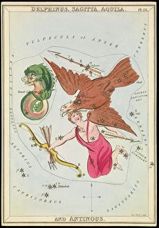
Background imageMaps Collection: Delphinus, Sagitta, Aquila and Antinous, c.1825 (card, paper, tissue)

Delphinus, Sagitta, Aquila and Antinous, c.1825 (card, paper, tissue)
7340881 Delphinus, Sagitta, Aquila and Antinous, c.1825 (card, paper, tissue) by Hall, Sydney (fl.1826); 20.3x14 cm; National Maritime Museum, London, UK; (add.info.: Creator: Sidney Hall Plate 13)

Background imageMaps Collection: Gloria Frederich, Andromeda and Triangula, c.1825 (card, paper, tissue )

Gloria Frederich, Andromeda and Triangula, c.1825 (card, paper, tissue )
7340876 Gloria Frederich, Andromeda and Triangula, c.1825 (card, paper, tissue ) by Hall, Sydney (fl.1826); 20.3x14 cm; National Maritime Museum, London, UK; (add.info.: Creator: Sidney Hall Plate 5)

Background imageMaps Collection: Plans of Ports, Dalrymple, Alexander published in 1791. A plane chart of the Gulf of Persia

Plans of Ports, Dalrymple, Alexander published in 1791. A plane chart of the Gulf of Persia, by Lieut
7340868 Plans of Ports, Dalrymple, Alexander published in 1791. A plane chart of the Gulf of Persia, by Lieut. John Cant 1773, 1791 (print) by Dalrymple

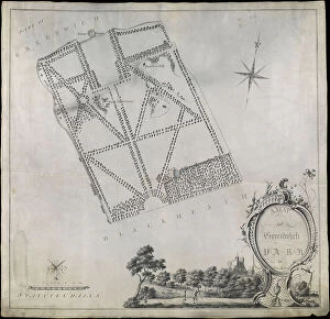
Background imageMaps Collection: Plan of Greenwich Park, showing the Royal Observatory, One Tree Hill and the Ranger's House

Plan of Greenwich Park, showing the Royal Observatory, One Tree Hill and the Ranger's House, 1790 (pen, wash)
7340660 Plan of Greenwich Park, showing the Royal Observatory, One Tree Hill and the Ranger's House, 1790 (pen, wash, vellum) by Morton, John (18th century); 55.5x53.5 cm; National Maritime Museum

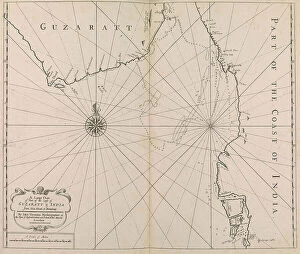
Background imageMaps Collection: A Large Chart of Part of the Coast of GUZARATT & INDIA from Diu Head to Bombay. (print)

A Large Chart of Part of the Coast of GUZARATT & INDIA from Diu Head to Bombay. (print)
7340646 A Large Chart of Part of the Coast of GUZARATT & INDIA from Diu Head to Bombay. (print) by Thornton, John (1641-1708); National Maritime Museum, London, UK; (add.info.: Creator: Thornton)

Background imageMaps Collection: Chart of the North Sea and Dutch coast, 1661 (coloured engraving)

Chart of the North Sea and Dutch coast, 1661 (coloured engraving)
7340609 Chart of the North Sea and Dutch coast, 1661 (coloured engraving) by British School, (17th century); 42x52 cm; National Maritime Museum, London

Background imageMaps Collection: Map of Greenford, Osterley, Ealing and Kew, 1746 (coloured engraving)

Map of Greenford, Osterley, Ealing and Kew, 1746 (coloured engraving)
7340517 Map of Greenford, Osterley, Ealing and Kew, 1746 (coloured engraving) by Rocque, John (c.1704-d.1762); 51x67 cm; National Maritime Museum, London

Background imageMaps Collection: Map of Wimbledon and Tooting, 1746 (coloured engraving)

Map of Wimbledon and Tooting, 1746 (coloured engraving)
7340512 Map of Wimbledon and Tooting, 1746 (coloured engraving) by Rocque, John (c.1704-d.1762); 51x67 cm; National Maritime Museum, London


All Professionally Made to Order for Quick Shipping


-

Maps Collection

Maps of the United Kingdom and Europe are essential tools for travelers, businesses, and researchers. They provide an overview of the physical landscape as well as political boundaries. Maps of the UK include detailed road maps, topographic maps, and tourist maps. Maps of Europe show countries, cities, rivers and mountains in great detail. In addition to traditional paper maps there are digital versions available online that can be used on mobile devices or computers. With these digital versions users can zoom in to get a closer look at any area they wish to explore or research further and can an invaluable resource for understanding geography and planning trips around the world.
+

Our beautiful Wall Art and Photo Gifts include Framed Prints, Photo Prints, Poster Prints, Canvas Prints, Jigsaw Puzzles, Metal Prints and so much more

The Maps of United Kingdom Europe collection from Media Storehouse is a stunning range of wall art and framed prints that showcase the beauty and diversity of the European continent. Our collection features an extensive selection of maps, including antique maps, modern maps, topographical maps, and political maps. Each map has been carefully curated to provide a unique perspective on the geography and history of Europe. Whether you're looking for a vintage-style map to add character to your home decor or a contemporary map that showcases the latest geographic data, our collection has something for everyone. The Maps of United Kingdom Europe collection is perfect for anyone who loves travel, geography or history. These high-quality prints are available in various sizes and formats to suit any space. They make excellent gifts for friends and family members who share your passion for exploring new places or learning about different cultures. With its vast array of options, our collection is sure to inspire wanderlust in all those who view it.
+

What are Maps of United Kingdom Europe art prints?

Maps of United Kingdom Europe art prints are high-quality reproductions of antique and contemporary maps depicting the geography, topography, and landmarks of the UK and Europe. These prints showcase intricate details such as borders, cities, rivers, mountains, forests, and other natural features that make up these regions. These art prints are perfect for history buffs or anyone interested in exploring the rich cultural heritage of the UK and Europe. They can be used to decorate homes or offices with a unique touch of sophistication while also serving as educational tools for students studying geography or history. We offer a wide range of Maps of United Kingdom Europe art prints from various sources including museums, archives, libraries and private collections. The collection includes vintage maps dating back centuries ago to modern-day digital cartography created by skilled artists. Whether you're looking for an antique map to add character to your living room or a contemporary print for your office space Media Storehouse has something suitable for every taste.
+

What Maps of United Kingdom Europe art prints can I buy from Media Storehouse?

We offer a wide range of Maps of United Kingdom Europe art prints that are perfect for decorating your home or office. You can choose from vintage maps, modern maps, and even satellite images of the UK and Europe. These art prints come in various sizes to fit any space you have in mind. Some popular options include antique-style world maps with intricate details, colourful political maps showing country borders and capital cities, as well as topographic maps highlighting mountain ranges and rivers. Additionally, Media Storehouse also offers city street maps featuring London's famous landmarks or Paris' charming streets. Whether you're looking for a unique gift or want to add some character to your living space, we have plenty of Maps of United Kingdom Europe art prints to choose from. With high-quality printing on premium paper stock, these art prints will make a stunning addition to any room.
+

How do I buy Maps of United Kingdom Europe art prints?

To purchase Maps of United Kingdom Europe art prints from Media Storehouse, you can browse our extensive collection online. We offer a range of maps in different styles and sizes to suit your preferences. Once you have found the map that you would like to buy, simply add it to your cart and proceed to checkout. During the checkout process, you will be prompted to enter your payment details and shipping address. You can choose from a variety of payment options including credit card, PayPal or Apple Pay. We offer high-quality prints on premium paper using state-of-the-art printing technology. Their prints are produced using archival quality ink which ensures long-lasting color vibrancy. Once your order has been processed, it will be carefully packaged and shipped directly to your doorstep. If you have any questions about the ordering process or need assistance with selecting a print, our customer service team is available to help via email or phone.
+

How much do Maps of United Kingdom Europe art prints cost?

The cost of Maps of United Kingdom Europe art prints can vary depending on a number of factors. The size, quality, and type of paper used for printing are all factors that can affect the price. Additionally, the artist or publisher who created the print may also influence its cost. Generally speaking, smaller prints will be less expensive than larger ones. Prints made with lower-quality materials may also be cheaper than those made with higher-quality materials. However, it's important to note that some collectors and enthusiasts may place a premium on certain types of prints or artists. Ultimately, the best way to determine how much a Maps of United Kingdom Europe art print will cost is to research different options from various sources. By comparing prices and features across different retailers and publishers, you'll be able to find a print that fits your budget while still meeting your needs in terms of style and quality.
+

How will my Maps of United Kingdom Europe art prints be delivered to me?

Your Maps of United Kingdom Europe art prints will be delivered to you in a safe and secure manner. The prints are carefully packaged using high-quality materials to ensure that they arrive at your doorstep in pristine condition. Depending on the size and quantity of your order, the prints may be rolled up and shipped in a sturdy tube or flat-packed with additional protection. Media Storehouse takes great care when handling your artwork, so you can rest assured that it will arrive safely. Once dispatched, you will receive an email confirmation along with tracking information so that you can monitor the progress of your delivery. The company works with trusted shipping partners who have years of experience delivering fragile items such as artwork. They aim to deliver all orders promptly and efficiently while keeping their customers informed throughout the process. Media Storehouse ensures that your Maps of United Kingdom Europe art prints are delivered securely and reliably, giving you peace of mind knowing that your purchase is in good hands.