Fraud Blocker Skip to main content

Home > Europe > United Kingdom > Maps

Maps Collection (page 8)

Maps of the United Kingdom and Europe are essential tools for travelers, businesses, and researchers

12,649 items

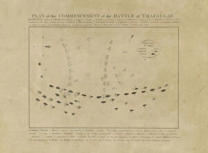
Background imageMaps Collection: Plan of the Commencement of the Battle of Trafalgar, 19th century (etching)

Plan of the Commencement of the Battle of Trafalgar, 19th century (etching)
7342311 Plan of the Commencement of the Battle of Trafalgar, 19th century (etching) by Unknown Artist, (19th century); 29.5x35.8 cm; National Maritime Museum, London

Background imageMaps Collection: A new and correct sea chart of the whole world showing the variations of the compass as they were

A new and correct sea chart of the whole world showing the variations of the compass as they were found in the year
7340787 A new and correct sea chart of the whole world showing the variations of the compass as they were found in the year 1700, 1702 (engraving) by British School

Background imageMaps Collection: A chart of the easternmost part of the East Indies with all the adjacent islands from Cape Comorin

A chart of the easternmost part of the East Indies with all the adjacent islands from Cape Comorin to Japan
7340780 A chart of the easternmost part of the East Indies with all the adjacent islands from Cape Comorin to Japan, 1675 (Hand coloured engraving) by Seller

Background imageMaps Collection: Celestial Globe Gores, 1636-95 (paper, copper plate, engraving)

Celestial Globe Gores, 1636-95 (paper, copper plate, engraving)
7340779 Celestial Globe Gores, 1636-95 (paper, copper plate, engraving) by Rossi, Domenico de (1659-1730); 44x19 cm; National Maritime Museum, London

Background imageMaps Collection: Pocket atlas and nautical almanac, c.1546 (vellum)

Pocket atlas and nautical almanac, c.1546 (vellum)
7340753 Pocket atlas and nautical almanac, c.1546 (vellum) by Brouscon, Guillaume (16th century); National Maritime Museum, London

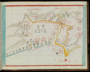
Background imageMaps Collection: San Miguel, 1682 (paper)

San Miguel, 1682 (paper)
7340747 San Miguel, 1682 (paper) by Ringrose, Basil (c.1653-83); 16x20 cm; National Maritime Museum, London, UK; (add.info.: Creator: Basil Ringrose From a book of sailing directions of 110ff)

Background imageMaps Collection: Sonsonate, 1682 (paper)

Sonsonate, 1682 (paper)
7340746 Sonsonate, 1682 (paper) by Ringrose, Basil (c.1653-83); 16x20 cm; National Maritime Museum, London, UK; (add.info.: Creator: Basil Ringrose From a book of sailing directions of 110ff)

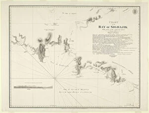
Background imageMaps Collection: Chart of the Bay of Sighajik, 1819 (paper)

Chart of the Bay of Sighajik, 1819 (paper)
7340734 Chart of the Bay of Sighajik, 1819 (paper) by British School, (19th century); 66.8x50.5 cm; National Maritime Museum, London, UK; (add.info.: Creator: British Admiralty; J)

Background imageMaps Collection: Plan of the harbour of Praslin, late 18th to early 19th century (paper)

Plan of the harbour of Praslin, late 18th to early 19th century (paper)
7340729 Plan of the harbour of Praslin, late 18th to early 19th century (paper) by Dalrymple, Alexander (18th-19th century); National Maritime Museum, London

Background imageMaps Collection: Map of Africa, 1564 - 1 of 8 sheets, 1564 (technical drawing)

Map of Africa, 1564 - 1 of 8 sheets, 1564 (technical drawing)
7340672 Map of Africa, 1564 - 1 of 8 sheets, 1564 (technical drawing) by Gastaldi, Giacomo (c.1500-66); National Maritime Museum, London

Background imageMaps Collection: Chart of area from Dover and Calais to Orfordness, 1906-10 (manuscript)

Chart of area from Dover and Calais to Orfordness, 1906-10 (manuscript)
7340551 Chart of area from Dover and Calais to Orfordness, 1906-10 (manuscript) by British School, (20th century) ; 69.6x103.1 cm; National Maritime Museum, London

Background imageMaps Collection: Chart of Sindh and Kutch coasts, 1848-50 (print)

Chart of Sindh and Kutch coasts, 1848-50 (print)
7340643 Chart of Sindh and Kutch coasts, 1848-50 (print) by British School, (19th century); 76.5x61.5 cm; National Maritime Museum, London

Background imageMaps Collection: A chart of Broach Bar and river surveyed by Lieut WIlliam Augustus Skynner 1773, 1775 (print)

A chart of Broach Bar and river surveyed by Lieut WIlliam Augustus Skynner 1773, 1775 (print)
7340638 A chart of Broach Bar and river surveyed by Lieut WIlliam Augustus Skynner 1773, 1775 (print) by British School, (18th Century); 18.8x35.6 cm; National Maritime Museum, London

Background imageMaps Collection: Chart of part of the coasts of Cutch and Guzarat by J G Richardson

Chart of part of the coasts of Cutch and Guzarat by J G Richardson... communicated by Capt Archibald Blair to whom this
7340637 Chart of part of the coasts of Cutch and Guzarat by J G Richardson... communicated by Capt Archibald Blair to whom this plate is inscribed by his most obliged A Dalrymple

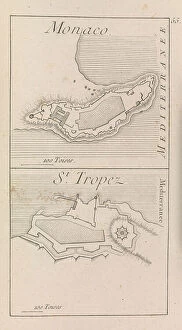
Background imageMaps Collection: The fortifications of Monaco and St. Tropez, c.1760? (print)

The fortifications of Monaco and St. Tropez, c.1760? (print)
7340632 The fortifications of Monaco and St. Tropez, c.1760? (print) by French School, (18th century); National Maritime Museum, London, UK; (add.info.: Georges-Louis Le Rouge (c)

Background imageMaps Collection: Map of Hounslow, Twickenham and Richmond, 1746 (coloured engraving)

Map of Hounslow, Twickenham and Richmond, 1746 (coloured engraving)
7340518 Map of Hounslow, Twickenham and Richmond, 1746 (coloured engraving) by Rocque, John (c.1704-d.1762); 51x67 cm; National Maritime Museum, London

Background imageMaps Collection: Chart of Yarmouth and the sands about it, c.1700 (coloured engraving)

Chart of Yarmouth and the sands about it, c.1700 (coloured engraving)
7340607 Chart of Yarmouth and the sands about it, c.1700 (coloured engraving) by Collins, Greenvile (1643-94); National Maritime Museum, London

Background imageMaps Collection: England East Coast: Harwich to Kingston Upon Hull, 1857 (print)

England East Coast: Harwich to Kingston Upon Hull, 1857 (print)
7340600 England East Coast: Harwich to Kingston Upon Hull, 1857 (print) by Hobbs, J.S. (19th century); 81x65.5 cm; National Maritime Museum, London, UK; (add.info.: Creator: J.S)

Background imageMaps Collection: England-East Coast. Outer Gabbard to Outer Dowsing, 1919 (engraving)

England-East Coast. Outer Gabbard to Outer Dowsing, 1919 (engraving)
7340581 England-East Coast. Outer Gabbard to Outer Dowsing, 1919 (engraving) by British School, (20th century) ; 98.5x66 cm; National Maritime Museum, London

Background imageMaps Collection: Map of Bow, Stratford, Blackwall and Plaistow, 1746 (coloured engraving)

Map of Bow, Stratford, Blackwall and Plaistow, 1746 (coloured engraving)
7340506 Map of Bow, Stratford, Blackwall and Plaistow, 1746 (coloured engraving) by Rocque, John (c.1704-d.1762); 51x67 cm; National Maritime Museum, London

Background imageMaps Collection: A new and exact map of the island of Antigua in America, according to a survey made in the years

A new and exact map of the island of Antigua in America, according to a survey made in the years 1746-1748
7340454 A new and exact map of the island of Antigua in America, according to a survey made in the years 1746-1748, c.1749 (coloured engraving) by Baker

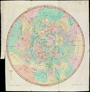
Background imageMaps Collection: Chart of the Heavens for the Latitude of London, Urania's Mirror or a View of the Heavens

Chart of the Heavens for the Latitude of London, Urania's Mirror or a View of the Heavens, c.1825 (card, paper)
7340086 Chart of the Heavens for the Latitude of London, Urania's Mirror or a View of the Heavens, c.1825 (card, paper, tissue, engraving) by Hall

Background imageMaps Collection: A Dutch map showing areas devastated by the Great Fire of London, 1666, 17th century (manuscript)

A Dutch map showing areas devastated by the Great Fire of London, 1666, 17th century (manuscript)
7340111 A Dutch map showing areas devastated by the Great Fire of London, 1666, 17th century (manuscript) by Unknown Artist, (17th century); National Maritime Museum, London

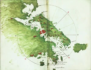
Background imageMaps Collection: Chart of Negroponte, c.1485 (Vellum)

Chart of Negroponte, c.1485 (Vellum)
7340068 Chart of Negroponte, c.1485 (Vellum) by Sonetti, Bartolomeo da li (fl.1485); 27.5x19 cm; National Maritime Museum, London

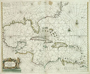
Background imageMaps Collection: Pascaerte vande Caribische eylanden, vande Barbados tot aende Bocht van Mexico

Pascaerte vande Caribische eylanden, vande Barbados tot aende Bocht van Mexico, 1661 (technical drawing)
7340062 Pascaerte vande Caribische eylanden, vande Barbados tot aende Bocht van Mexico, 1661 (technical drawing) by Doncker, Hendrick (c.1626-99); 43.5x53 cm; National Maritime Museum, London

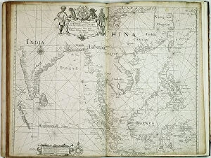
Background imageMaps Collection: A chart of the trading part of the East Indies and China, with the adjacent islands

A chart of the trading part of the East Indies and China, with the adjacent islands, from Surrat to Japan, 1677 (print)
7340055 A chart of the trading part of the East Indies and China, with the adjacent islands, from Surrat to Japan, 1677 (print) by Seller, John (1632-97); 44.5x56 cm; National Maritime Museum

Background imageMaps Collection: The windward passage from Jamaica, betwene the east end of Cuba, and the west end of Hispaniola

The windward passage from Jamaica, betwene the east end of Cuba, and the west end of Hispaniola, 1675 (engraving)
7340052 The windward passage from Jamaica, betwene the east end of Cuba, and the west end of Hispaniola, 1675 (engraving) by Seller, John (1632-97); 43x54 cm; National Maritime Museum, London

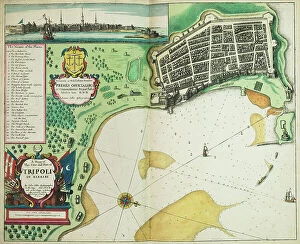
Background imageMaps Collection: A map of the city and port of Tripoli in Barbary, 1675 (coloured engraving)

A map of the city and port of Tripoli in Barbary, 1675 (coloured engraving)
7340047 A map of the city and port of Tripoli in Barbary, 1675 (coloured engraving) by Seller, John (1632-97); 42x53 cm; National Maritime Museum, London

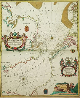
Background imageMaps Collection: A new mappe of the sea coasts of England, France and Holland, wherein the English names, situation

A new mappe of the sea coasts of England, France and Holland, wherein the English names, situation
7340046 A new mappe of the sea coasts of England, France and Holland, wherein the English names, situation, point of the compass, and distance of the several ports, harbours, havens, creeks, sands

Background imageMaps Collection: The coast of England from the Southforeland to Orfordness, 1675 (coloured engraving)

The coast of England from the Southforeland to Orfordness, 1675 (coloured engraving)
7340045 The coast of England from the Southforeland to Orfordness, 1675 (coloured engraving) by Seller, John (1632-97); 43.5x54 cm; National Maritime Museum, London

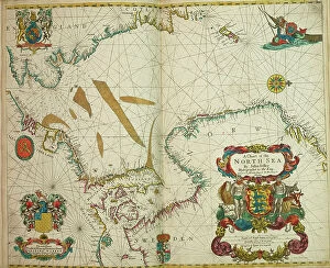
Background imageMaps Collection: A chart of the North Sea, 1675 (coloured engraving)

A chart of the North Sea, 1675 (coloured engraving)
7340044 A chart of the North Sea, 1675 (coloured engraving) by Seller, John (1632-97); 43.5x54 cm; National Maritime Museum, London

Background imageMaps Collection: A correct chart of the east coast, from Hasbrough or Haisbrough Sand to Kingston upon Hull

A correct chart of the east coast, from Hasbrough or Haisbrough Sand to Kingston upon Hull, 1797 (print)
7340042 A correct chart of the east coast, from Hasbrough or Haisbrough Sand to Kingston upon Hull, 1797 (print) by Diston, John (fl.1797); 53.5x75 cm; National Maritime Museum, London

Background imageMaps Collection: World map by John Seller, 1675 (coloured engraving)

World map by John Seller, 1675 (coloured engraving)
7340041 World map by John Seller, 1675 (coloured engraving) by Seller, John (1632-97); 44x55 cm; National Maritime Museum, London

Background imageMaps Collection: A new chart of the coast from Lowestoff to Hasbrough including Yarmouth Roads and Sands

A new chart of the coast from Lowestoff to Hasbrough including Yarmouth Roads and Sands, Hasbrough Gatt
7340040 A new chart of the coast from Lowestoff to Hasbrough including Yarmouth Roads and Sands, Hasbrough Gatt, and the new lights, 1797 (technical drawing) by Diston

Background imageMaps Collection: Title page to Expeditionis Hispanorum in Angliam vera descriptio anno domini MDLXXXVIII

Title page to Expeditionis Hispanorum in Angliam vera descriptio anno domini MDLXXXVIII, 1590 (engraving)
7340022 Title page to Expeditionis Hispanorum in Angliam vera descriptio anno domini MDLXXXVIII, 1590 (engraving) by Adams, Robert (1540-95) (after); 43x53.5 cm; National Maritime Museum, London

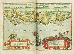
Background imageMaps Collection: The sea coastes of England between the Isle of Wight and Dover

The sea coastes of England between the Isle of Wight and Dover, with the principal havens thereof according to their
7340013 The sea coastes of England between the Isle of Wight and Dover, with the principal havens thereof according to their situation and appearing, c.1588 (chart) by Janszoon Waghenaer

Background imageMaps Collection: A survey of the entrance to the River Humber by Commander Williamm Hewett, R.N

A survey of the entrance to the River Humber by Commander Williamm Hewett, R.N
7339966 A survey of the entrance to the River Humber by Commander Williamm Hewett, R.N. made by order of the Lords Commisioners of the Admiralty 1828, 1830-41 (technical drawing) by Walker, J. & C

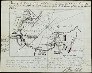
Background imageMaps Collection: Plan of the Bay of St Jean D'Acre and environs sent to the Admiralty from thence on 23 March 1799

Plan of the Bay of St Jean D'Acre and environs sent to the Admiralty from thence on 23 March 1799 by Sir Sidney
7339861 Plan of the Bay of St Jean D'Acre and environs sent to the Admiralty from thence on 23 March 1799 by Sir Sidney Smith Kt

Background imageMaps Collection: Battle of Copenhagen, 2 April 1801, 1801 (engraving)

Battle of Copenhagen, 2 April 1801, 1801 (engraving)
7339858 Battle of Copenhagen, 2 April 1801, 1801 (engraving) by Gibson, Francis (19th century); 40x45.5 cm; National Maritime Museum, London

Background imageMaps Collection: The south west coast of Ireland from the Staggs of Castle Haven to Dursey I

The south west coast of Ireland from the Staggs of Castle Haven to Dursey I. Surveyed and navigated by M
7339857 The south west coast of Ireland from the Staggs of Castle Haven to Dursey I. Surveyed and navigated by M. Mackenzie Sen. 1775

Background imageMaps Collection: A crop image of Malby's globe covering the areas explored before Franklin's 1845 Erebus

A crop image of Malby's globe covering the areas explored before Franklin's 1845 Erebus and Terror expedition
7295646 A crop image of Malby's globe covering the areas explored before Franklin's 1845 Erebus and Terror expedition. 1845 (cardboard, plaster, paper, varnish, brass, wood, hand-coloured)

Background imageMaps Collection: A general chart exhibiting the discoveries made by Captain James Cook in this

A general chart exhibiting the discoveries made by Captain James Cook in this
7295409 A general chart exhibiting the discoveries made by Captain James Cook in this and his two preceeding voyages with the tracks of the ships under his command

Background imageMaps Collection: Chart of the Southern Hemisphere showing pre-Cook journeys and discoveries, 1777 (engraving)

Chart of the Southern Hemisphere showing pre-Cook journeys and discoveries, 1777 (engraving)
7295408 Chart of the Southern Hemisphere showing pre-Cook journeys and discoveries, 1777 (engraving) by Cook, James (1728-79); 56x54 cm; National Maritime Museum, London

Background imageMaps Collection: Rear-Admiral Sir John Jervis, 1st Earl of St Vincent (1735-1823), 1806 (oil on canvas)

Rear-Admiral Sir John Jervis, 1st Earl of St Vincent (1735-1823), 1806 (oil on canvas)
7338043 Rear-Admiral Sir John Jervis, 1st Earl of St Vincent (1735-1823), 1806 (oil on canvas) by Pellegrini, Domenico (1759-1840); 237.5x147.5 cm; National Maritime Museum, London

Background imageMaps Collection: Formerly called Nevil Maskelyne, Astronomer Royal (1732-1811), 1779 (oil painting)

Formerly called Nevil Maskelyne, Astronomer Royal (1732-1811), 1779 (oil painting)
7337966 Formerly called Nevil Maskelyne, Astronomer Royal (1732-1811), 1779 (oil painting) by Downman, John (c.1750-1824); 91.4x71.1 cm; National Maritime Museum, London

Background imageMaps Collection: River Thames from London to Gravesend, 1830-33 (print)

River Thames from London to Gravesend, 1830-33 (print)
7337575 River Thames from London to Gravesend, 1830-33 (print) by Bullock, F. & Burstal, E. (fl.c.1830); National Maritime Museum, London, UK; (add.info.: Creator: Captain F. Bullock; Lieutenant E)

Background imageMaps Collection: Pair of maps of the Northern and Southern Celestial Hemispheres, 17th century (engraving)

Pair of maps of the Northern and Southern Celestial Hemispheres, 17th century (engraving)
7337557 Pair of maps of the Northern and Southern Celestial Hemispheres, 17th century (engraving) by Durer or Duerer, Albrecht (1471-1528); National Maritime Museum, London

Background imageMaps Collection: Trade in Holland: the salting of herring. Detail of a geographical map of Claes Jansz, 1608

Trade in Holland: the salting of herring. Detail of a geographical map of Claes Jansz, 1608
FGL5469929 Trade in Holland: the salting of herring. Detail of a geographical map of Claes Jansz, 1608; Fototeca Gilardi


All Professionally Made to Order for Quick Shipping


-

Maps Collection

Maps of the United Kingdom and Europe are essential tools for travelers, businesses, and researchers. They provide an overview of the physical landscape as well as political boundaries. Maps of the UK include detailed road maps, topographic maps, and tourist maps. Maps of Europe show countries, cities, rivers and mountains in great detail. In addition to traditional paper maps there are digital versions available online that can be used on mobile devices or computers. With these digital versions users can zoom in to get a closer look at any area they wish to explore or research further and can an invaluable resource for understanding geography and planning trips around the world.
+

Our beautiful Wall Art and Photo Gifts include Framed Prints, Photo Prints, Poster Prints, Canvas Prints, Jigsaw Puzzles, Metal Prints and so much more

The Maps of United Kingdom Europe collection from Media Storehouse is a stunning range of wall art and framed prints that showcase the beauty and diversity of the European continent. Our collection features an extensive selection of maps, including antique maps, modern maps, topographical maps, and political maps. Each map has been carefully curated to provide a unique perspective on the geography and history of Europe. Whether you're looking for a vintage-style map to add character to your home decor or a contemporary map that showcases the latest geographic data, our collection has something for everyone. The Maps of United Kingdom Europe collection is perfect for anyone who loves travel, geography or history. These high-quality prints are available in various sizes and formats to suit any space. They make excellent gifts for friends and family members who share your passion for exploring new places or learning about different cultures. With its vast array of options, our collection is sure to inspire wanderlust in all those who view it.
+

What are Maps of United Kingdom Europe art prints?

Maps of United Kingdom Europe art prints are high-quality reproductions of antique and contemporary maps depicting the geography, topography, and landmarks of the UK and Europe. These prints showcase intricate details such as borders, cities, rivers, mountains, forests, and other natural features that make up these regions. These art prints are perfect for history buffs or anyone interested in exploring the rich cultural heritage of the UK and Europe. They can be used to decorate homes or offices with a unique touch of sophistication while also serving as educational tools for students studying geography or history. We offer a wide range of Maps of United Kingdom Europe art prints from various sources including museums, archives, libraries and private collections. The collection includes vintage maps dating back centuries ago to modern-day digital cartography created by skilled artists. Whether you're looking for an antique map to add character to your living room or a contemporary print for your office space Media Storehouse has something suitable for every taste.
+

What Maps of United Kingdom Europe art prints can I buy from Media Storehouse?

We offer a wide range of Maps of United Kingdom Europe art prints that are perfect for decorating your home or office. You can choose from vintage maps, modern maps, and even satellite images of the UK and Europe. These art prints come in various sizes to fit any space you have in mind. Some popular options include antique-style world maps with intricate details, colourful political maps showing country borders and capital cities, as well as topographic maps highlighting mountain ranges and rivers. Additionally, Media Storehouse also offers city street maps featuring London's famous landmarks or Paris' charming streets. Whether you're looking for a unique gift or want to add some character to your living space, we have plenty of Maps of United Kingdom Europe art prints to choose from. With high-quality printing on premium paper stock, these art prints will make a stunning addition to any room.
+

How do I buy Maps of United Kingdom Europe art prints?

To purchase Maps of United Kingdom Europe art prints from Media Storehouse, you can browse our extensive collection online. We offer a range of maps in different styles and sizes to suit your preferences. Once you have found the map that you would like to buy, simply add it to your cart and proceed to checkout. During the checkout process, you will be prompted to enter your payment details and shipping address. You can choose from a variety of payment options including credit card, PayPal or Apple Pay. We offer high-quality prints on premium paper using state-of-the-art printing technology. Their prints are produced using archival quality ink which ensures long-lasting color vibrancy. Once your order has been processed, it will be carefully packaged and shipped directly to your doorstep. If you have any questions about the ordering process or need assistance with selecting a print, our customer service team is available to help via email or phone.
+

How much do Maps of United Kingdom Europe art prints cost?

The cost of Maps of United Kingdom Europe art prints can vary depending on a number of factors. The size, quality, and type of paper used for printing are all factors that can affect the price. Additionally, the artist or publisher who created the print may also influence its cost. Generally speaking, smaller prints will be less expensive than larger ones. Prints made with lower-quality materials may also be cheaper than those made with higher-quality materials. However, it's important to note that some collectors and enthusiasts may place a premium on certain types of prints or artists. Ultimately, the best way to determine how much a Maps of United Kingdom Europe art print will cost is to research different options from various sources. By comparing prices and features across different retailers and publishers, you'll be able to find a print that fits your budget while still meeting your needs in terms of style and quality.
+

How will my Maps of United Kingdom Europe art prints be delivered to me?

Your Maps of United Kingdom Europe art prints will be delivered to you in a safe and secure manner. The prints are carefully packaged using high-quality materials to ensure that they arrive at your doorstep in pristine condition. Depending on the size and quantity of your order, the prints may be rolled up and shipped in a sturdy tube or flat-packed with additional protection. Media Storehouse takes great care when handling your artwork, so you can rest assured that it will arrive safely. Once dispatched, you will receive an email confirmation along with tracking information so that you can monitor the progress of your delivery. The company works with trusted shipping partners who have years of experience delivering fragile items such as artwork. They aim to deliver all orders promptly and efficiently while keeping their customers informed throughout the process. Media Storehouse ensures that your Maps of United Kingdom Europe art prints are delivered securely and reliably, giving you peace of mind knowing that your purchase is in good hands.