Fraud Blocker Skip to main content

Home > Europe > United Kingdom > Northern Ireland > Maps

Maps Collection (page 7)

Maps of Northern Ireland, United Kingdom and Europe are essential tools for navigating the region

548 items

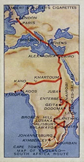
Background imageMaps Collection: Empire Air Routes: Map of England, South Africa Route (colour litho)

Empire Air Routes: Map of England, South Africa Route (colour litho)
8659267 Empire Air Routes: Map of England, South Africa Route (colour litho) by English School, (20th century); Private Collection; (add.info.: Map of England, South Africa Route)

Background imageMaps Collection: India, Physical Map (colour litho)

India, Physical Map (colour litho)
8658798 India, Physical Map (colour litho) by English School, (20th century); Private Collection; (add.info.: India, Physical Map)

Background imageMaps Collection: North Britain, Scotland, Saxon Period (colour litho)

North Britain, Scotland, Saxon Period (colour litho)
8652276 North Britain, Scotland, Saxon Period (colour litho) by English School, (19th century); Private Collection; (add.info.: North Britain, Scotland, Saxon Period)

Background imageMaps Collection: Map of Chelsea (b/w photo)

Map of Chelsea (b/w photo)
8626988 Map of Chelsea (b/w photo) by English School, (19th century); Private Collection; (add.info.: Map of Chelsea, London, showing places of interest for visitors)

Background imageMaps Collection: Map of the Royal Hospital, Chelsea, 1900 (b/w photo)

Map of the Royal Hospital, Chelsea, 1900 (b/w photo)
8626987 Map of the Royal Hospital, Chelsea, 1900 (b/w photo) by English School, (19th century); Private Collection; (add.info.: Map of the Royal Hospital, Chelsea, 1900)

Background imageMaps Collection: The Battle off Gravelines, 8 August 1588, 1590 (hand coloured engraving)

The Battle off Gravelines, 8 August 1588, 1590 (hand coloured engraving)
7340035 The Battle off Gravelines, 8 August 1588, 1590 (hand coloured engraving) by Adams, Robert (1540-95) (after); 43x55 cm; National Maritime Museum, London

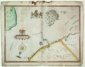
Background imageMaps Collection: Dover to Sandwich and Blacknerse to Gravelines - The Spanish Armada

Dover to Sandwich and Blacknerse to Gravelines - The Spanish Armada and the English Fleet off Calais, c
7340034 Dover to Sandwich and Blacknerse to Gravelines - The Spanish Armada and the English Fleet off Calais, c. 1590 (manuscript) by Adams, Robert (1540-95) (after); National Maritime Museum
Background imageMaps Collection: The English and Spanish fleets between Portland Bill and the Isle of Wight on 2 - 3 August 1588

The English and Spanish fleets between Portland Bill and the Isle of Wight on 2 - 3 August 1588
7340030 The English and Spanish fleets between Portland Bill and the Isle of Wight on 2 - 3 August 1588, 1590 (coloured engraving) by Adams

Background imageMaps Collection: The English pursue the Spanish fleet east of Plymouth on 31 July - 1 August, 1588

The English pursue the Spanish fleet east of Plymouth on 31 July - 1 August, 1588, c.1590 (coloured engraving)
7340025 The English pursue the Spanish fleet east of Plymouth on 31 July - 1 August, 1588, c.1590 (coloured engraving) by Adams, Robert (1540-95) (after); 38x50 cm; National Maritime Museum, London

Background imageMaps Collection: The route track of the Spanish Armada through the English Channel, into the North Sea

The route track of the Spanish Armada through the English Channel, into the North Sea
7340023 The route track of the Spanish Armada through the English Channel, into the North Sea, around Northern Scotland and into the Atlantic Ocean to return to Spain

Background imageMaps Collection: England, East coast, entrance to the River Humber surveyed by Captain G.E

England, East coast, entrance to the River Humber surveyed by Captain G.E
7339969 England, East coast, entrance to the River Humber surveyed by Captain G.E. Richards HM surveying ship Triton (1899-1900), 1902 (technical drawing) by British School

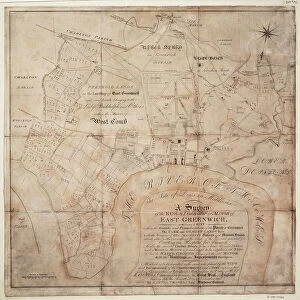
Background imageMaps Collection: A survey of the Kings lordship or manor of East Greenwich, 1695-1812 (technical drawing, paper)

A survey of the Kings lordship or manor of East Greenwich, 1695-1812 (technical drawing, paper)
7339538 A survey of the Kings lordship or manor of East Greenwich, 1695-1812 (technical drawing, paper) by Travers, Samuel (17th century); 53x54 cm; National Maritime Museum, London

Background imageMaps Collection: A general chart exhibiting the discoveries made by Captain James Cook in this

A general chart exhibiting the discoveries made by Captain James Cook in this
7295697 A general chart exhibiting the discoveries made by Captain James Cook in this and his two preceeding voyages with the tracks of the ships under his command, 1794 by Roberts

Background imageMaps Collection: Captain James Cook (1728-1779), 18th century (engraving)

Captain James Cook (1728-1779), 18th century (engraving)
7295541 Captain James Cook (1728-1779), 18th century (engraving) by Sherwin, John Keyse (1751-90); National Maritime Museum, London, UK; (add.info.: Dance-Holland)

Background imageMaps Collection: Harwich Dockyard, 1722 (drawing)

Harwich Dockyard, 1722 (drawing)
7337578 Harwich Dockyard, 1722 (drawing) by Unknown artist, (18th century); National Maritime Museum, London, UK; © National Maritime Museum, Greenwich, London

Background imageMaps Collection: Course of Spanish Armada, British Isles and Ireland, 1588 (print)

Course of Spanish Armada, British Isles and Ireland, 1588 (print)
7419890 Course of Spanish Armada, British Isles and Ireland, 1588 (print); (add.info.: Ornamental map, decorated allegorically)

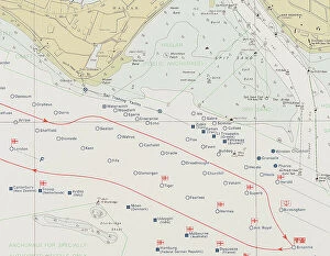
Background imageMaps Collection: Spithead, 1977 (unknown)

Spithead, 1977 (unknown)
7339302 Spithead, 1977 (unknown) by British School, (20th century) ; 83x60 cm; National Maritime Museum, London, UK; (add.info.: Creator)

Background imageMaps Collection: The tower of St. Aubin, 1680 (coloured engraving)

The tower of St. Aubin, 1680 (coloured engraving)
7339125 The tower of St. Aubin, 1680 (coloured engraving) by Phillips, Thomas (fl.1660-75); 49x70.5 cm; National Maritime Museum, London

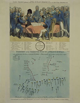
Background imageMaps Collection: Nelson explains the Trafalgar battle plan, 1806 (coloured engraving)

Nelson explains the Trafalgar battle plan, 1806 (coloured engraving)
7341898 Nelson explains the Trafalgar battle plan, 1806 (coloured engraving) by Craig, William Marshall (fl.1788-1828) (after); 50.5x34.9 cm; National Maritime Museum, London

Background imageMaps Collection: Sir W Herschell, 1822-23 (engraving, stipple)

Sir W Herschell, 1822-23 (engraving, stipple)
7341639 Sir W Herschell, 1822-23 (engraving, stipple) by Scriven, Edward (1775-1841); 27.6x19 cm; National Maritime Museum, London

Background imageMaps Collection: Map showing the French dominions of Henry II King of england (print)

Map showing the French dominions of Henry II King of england (print)
1000965 Map showing the French dominions of Henry II King of england (print); Private Collection; (add.info.: From Illustrated Easy Stories from English History.)

Background imageMaps Collection: Plan of the Battle of Copenhagen (Denmark) (1801)

Plan of the Battle of Copenhagen (Denmark) (1801)
MMM5484862 Plan of the Battle of Copenhagen (Denmark) (1801); National Maritime Museum, London, UK; (add.info.: Plan of the Battle of Copenhagen (Denmark) (1801)

Background imageMaps Collection: Plan of the positions of the Franco-Spanish fleets at the start of the Battle of Trafalgar (1805)

Plan of the positions of the Franco-Spanish fleets at the start of the Battle of Trafalgar (1805)
MMM5482391 Plan of the positions of the Franco-Spanish fleets at the start of the Battle of Trafalgar (1805). 19th century watercolor.; National Maritime Museum, London

Background imageMaps Collection: First World War: Patriotic map showing a little boy and a little girl sends to their father at

First World War: Patriotic map showing a little boy and a little girl sends to their father at the forehead a wooden
LUX4744189 First World War: Patriotic map showing a little boy and a little girl sends to their father at the forehead a wooden crate with a card and kitten

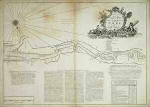
Background imageMaps Collection: A new and correct chart from the Isle of Dogs, to Prittlewell, and the Nore

A new and correct chart from the Isle of Dogs, to Prittlewell, and the Nore, 1797 (technical drawing)
7340037 A new and correct chart from the Isle of Dogs, to Prittlewell, and the Nore, 1797 (technical drawing) by Diston, John (fl.1797); 50.5x71 cm; National Maritime Museum, London

Background imageMaps Collection: River Thames from London Bridge to the Isle of Dogs. A late survey by John Diston of Lowestoff

River Thames from London Bridge to the Isle of Dogs. A late survey by John Diston of Lowestoff, pilot
7340036 River Thames from London Bridge to the Isle of Dogs. A late survey by John Diston of Lowestoff, pilot, master & mariner, 1797 (technical drawing) by Diston

Background imageMaps Collection: An exact survey of the cities of London and Westminster, the borough of Southwark

An exact survey of the cities of London and Westminster, the borough of Southwark
7339846 An exact survey of the cities of London and Westminster, the borough of Southwark, with the country near ten miles round, c.1746 (engraving) by Rocque

Background imageMaps Collection: Chart of the coast of England with the sea decorated with ships and monster, 1584 (paper)

Chart of the coast of England with the sea decorated with ships and monster, 1584 (paper)
7340808 Chart of the coast of England with the sea decorated with ships and monster, 1584 (paper) by Janszoon Waghenaer, Lucas (c.1533-c.1606) ; 40x55 cm; National Maritime Museum, London

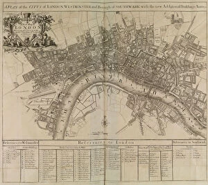
Background imageMaps Collection: A plan of the city of London, Westminster, borough of Southwark & the river Thames, 1721 (print)

A plan of the city of London, Westminster, borough of Southwark & the river Thames, 1721 (print)
7340744 A plan of the city of London, Westminster, borough of Southwark & the river Thames, 1721 (print) by Unknown artist, (18th century); National Maritime Museum, London

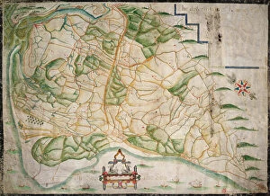
Background imageMaps Collection: Chart of Romney Marsh, 1617 (vellum)

Chart of Romney Marsh, 1617 (vellum)
7340486 Chart of Romney Marsh, 1617 (vellum) by Tucker, Elhanan (17th century); 64x92 cm; National Maritime Museum, London, UK; (add.info.: Creator: Elhanan Tucker Covers the areas of Hythe)

Background imageMaps Collection: England, east coast, Spurn Head to South Foreland, 1667 (vellum, oak board)

England, east coast, Spurn Head to South Foreland, 1667 (vellum, oak board)
7340462 England, east coast, Spurn Head to South Foreland, 1667 (vellum, oak board) by Burston, John (17th century); 69x54 cm; National Maritime Museum, London

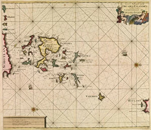
Background imageMaps Collection: Chart of Orcades Eylande (Orkneys) from van Keulen's Great and Newly Enlarged Sea Atlas

Chart of Orcades Eylande (Orkneys) from van Keulen's Great and Newly Enlarged Sea Atlas, 1682 (coloured engraving)
7340608 Chart of Orcades Eylande (Orkneys) from van Keulen's Great and Newly Enlarged Sea Atlas, 1682 (coloured engraving) by Keulen, Johannes van (1654-1715); 51x58 cm; National Maritime Museum

Background imageMaps Collection: England East Coast. Sheet 4, late 19th century (print)

England East Coast. Sheet 4, late 19th century (print)
7340597 England East Coast. Sheet 4, late 19th century (print) by Imray, James & Son (19th century); National Maritime Museum, London

Background imageMaps Collection: England East Coast. Sheet 2, late 19th century (print)

England East Coast. Sheet 2, late 19th century (print)
7340595 England East Coast. Sheet 2, late 19th century (print) by Imray, James & Son (19th century); National Maritime Museum, London

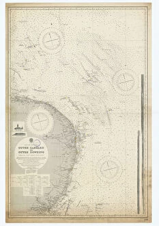
Background imageMaps Collection: England-East Coast. Outer Gabbard to Outer Dowsing, 1916 (engraving)

England-East Coast. Outer Gabbard to Outer Dowsing, 1916 (engraving)
7340585 England-East Coast. Outer Gabbard to Outer Dowsing, 1916 (engraving) by British School, (20th century) ; 98x64.5 cm; National Maritime Museum, London

Background imageMaps Collection: England-East Coast. Outer Gabbard to Outer Dowsing, 1938 (engraving)

England-East Coast. Outer Gabbard to Outer Dowsing, 1938 (engraving)
7340583 England-East Coast. Outer Gabbard to Outer Dowsing, 1938 (engraving) by British School, (20th century) ; 99x66 cm; National Maritime Museum, London

Background imageMaps Collection: England-East Coast. Outer Gabbard to Outer Dowsing, 1912 (engraving)

England-East Coast. Outer Gabbard to Outer Dowsing, 1912 (engraving)
7340580 England-East Coast. Outer Gabbard to Outer Dowsing, 1912 (engraving) by British School, (20th century) ; 99x66 cm; National Maritime Museum, London

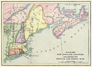
Background imageMaps Collection: New England colonies just before the French and Indian War

New England colonies just before the French and Indian War
NWI4853909 New England colonies just before the French and Indian War.; (add.info.: New England colonies just before the French and Indian War.); Photo © North Wind Pictures

Background imageMaps Collection: Allegory of the British Empire as the Colossus of Rhodes, 19th century

Allegory of the British Empire as the Colossus of Rhodes, 19th century
CUL4940269 Allegory of the British Empire as the Colossus of Rhodes, 19th century; (add.info.: Il Colosso di Rodi. Allegory of the British Empire as the Colossus of Rhodes" monitoring)

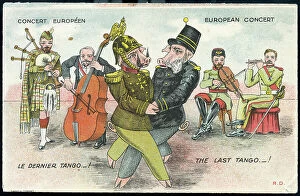
Background imageMaps Collection: First World War: France, Humorous map showing the two Austrian

First World War: France, Humorous map showing the two Austrian and German emperors in pig on a dance imposed by
LUX4736554 First World War: France, Humorous map showing the two Austrian and German emperors in pig on a dance imposed by the allies and nicknamed "the last tango"

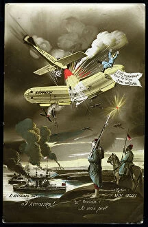
Background imageMaps Collection: First World War: France, Patriotic Map showing the plane of the distruding triple agreement

First World War: France, Patriotic Map showing the plane of the distruding triple agreement and German Zeppelin, 1914
LUX4740514 First World War: France, Patriotic Map showing the plane of the distruding triple agreement and German Zeppelin

Background imageMaps Collection: Map of Scotland showing Telford's and military roads, 1850

Map of Scotland showing Telford's and military roads, 1850
3359154 Map of Scotland showing Telford's and military roads, 1850; (add.info.: Map of Scotland showing Telford's roads (dotted lines) and military roads (solid lines)

Background imageMaps Collection: Tudor nobleman (detail), from a map of England and wales by John Speed, c.1612 (engraving)

Tudor nobleman (detail), from a map of England and wales by John Speed, c.1612 (engraving)
2911212 Tudor nobleman (detail), from a map of England and wales by John Speed, c.1612 (engraving); Universal History Archive/UIG

Background imageMaps Collection: Tudor nobleman (detail), from a map of England and wales by John Speed, c.1612 (engraving)

Tudor nobleman (detail), from a map of England and wales by John Speed, c.1612 (engraving)
2911211 Tudor nobleman (detail), from a map of England and wales by John Speed, c.1612 (engraving); Universal History Archive/UIG

Background imageMaps Collection: English Claims to North America, 1755

English Claims to North America, 1755
2902802 English Claims to North America, 1755; (add.info.: The English empire in North America; Representing their rightful claim as confirmed by charters)

Background imageMaps Collection: London: The City Churches (litho)

London: The City Churches (litho)
8629747 London: The City Churches (litho) by English Photographer, (20th century); Private Collection; (add.info.: The City Churches)

Background imageMaps Collection: London: The Palace of Westminster (litho)

London: The Palace of Westminster (litho)
8629745 London: The Palace of Westminster (litho) by English Photographer, (20th century); Private Collection; (add.info.: The Palace of Westminster)

Background imageMaps Collection: The Grand National course, Aintree (litho)

The Grand National course, Aintree (litho)
8664071 The Grand National course, Aintree (litho) by English School, (20th century); Private Collection; (add.info.: The Grand National course, Aintree, Merseyside)


All Professionally Made to Order for Quick Shipping


-

Maps Collection

Maps of Northern Ireland, United Kingdom and Europe are essential tools for navigating the region. They provide a detailed overview of the area, including roads, rivers, cities and towns, and are be used to plan trips and explore new places and can also help identify landmarks such as historic sites or natural features like mountains or lakes and can available in various formats such as paper maps, digital maps or online mapping services. These maps provide an invaluable resource for those travelling in the region and allow them to make informed decisions about their journey.
+

Our beautiful Wall Art and Photo Gifts include Framed Prints, Photo Prints, Poster Prints, Canvas Prints, Jigsaw Puzzles, Metal Prints and so much more

The Maps of Northern Ireland United Kingdom Europe collection from Media Storehouse is a stunning assortment of wall art, framed prints, photo prints, canvas prints, jigsaw puzzles and greeting cards that showcase the beauty and diversity of Northern Ireland. Our collection features an array of maps depicting different regions in Northern Ireland and their unique characteristics. From the rugged coastline to the rolling hillsides dotted with sheep farms, these maps capture the essence of this enchanting land. Each piece in our collection is expertly crafted using high-quality materials to ensure long-lasting durability and exceptional visual appeal. Whether you're looking for a statement piece to adorn your living room or a thoughtful gift for someone special, there's something here for everyone. With its rich history and breathtaking landscapes, Northern Ireland has long been a source of inspiration for artists and photographers alike. The Maps of Northern Ireland United Kingdom Europe collection celebrates this legacy by bringing together some of the most beautiful images from across the region into one stunning collection that will be cherished for years to come.
+

What are Maps of Northern Ireland United Kingdom Europe art prints?

Maps of Northern Ireland United Kingdom Europe art prints are high-quality reproductions of maps that depict the geographical features, landmarks, and boundaries of Northern Ireland, the United Kingdom, and Europe. These prints are created using advanced printing technology to ensure that every detail is captured accurately. These maps are not only useful for navigation but also serve as beautiful pieces of art that can be displayed in homes or offices. They come in a variety of sizes and styles to suit different preferences and decor themes. Whether you're a history buff, geography enthusiast or simply looking for an elegant way to decorate your space, Maps of Northern Ireland United Kingdom Europe art prints offer something for everyone. With their intricate details and vibrant colors, they make great conversation starters while adding character to any room. These art prints provide both aesthetic appeal and practical value making them a must-have for anyone interested in cartography or seeking unique wall decor options.
+

What Maps of Northern Ireland United Kingdom Europe art prints can I buy from Media Storehouse?

We offer a wide range of Maps of Northern Ireland, United Kingdom and Europe art prints that are perfect for decorating your home or office. These maps come in various sizes and styles, including vintage, modern and antique designs. You can choose from different types of maps such as political, physical or topographical maps. Our collection includes detailed street maps of cities like Belfast, Dublin and London as well as country-wide road atlases. There are also historical maps dating back to the 16th century that show how borders have changed over time. In addition to traditional paper prints, Media Storehouse also offers canvas prints which give a more textured look to the artwork. The canvas is stretched over a wooden frame which makes it ready-to-hang straight out of the box. Whether you're looking for an educational tool or just want to add some visual interest to your walls, we have something for everyone with their extensive selection of Maps of Northern Ireland United Kingdom Europe art prints.
+

How do I buy Maps of Northern Ireland United Kingdom Europe art prints?

To buy Maps of Northern Ireland United Kingdom Europe art prints from Media Storehouse, you can browse our extensive collection online. We offer a wide range of maps in various sizes and styles to suit your preferences. You can search for specific locations or themes using their search function or browse through the categories provided. Once you have found the map(s) you wish to purchase, simply add them to your cart and proceed to checkout. At this stage, you will be prompted to enter your payment and shipping details. We offer high-quality art prints that are perfect for home decor or as gifts for friends and family. Their maps are printed on premium paper using state-of-the-art printing technology, ensuring that they look stunning and last a lifetime. Buying Maps of Northern Ireland United Kingdom Europe art prints from Media Storehouse is easy and convenient, allowing you to bring beautiful artwork into your home with just a few clicks.
+

How much do Maps of Northern Ireland United Kingdom Europe art prints cost?

As a leading provider of art prints, we offer a wide range of maps of Northern Ireland, the United Kingdom and Europe. The cost of these prints varies depending on several factors such as size, framing options, and materials used. However, we strive to offer competitive pricing that is affordable for all our customers. Our maps are printed using high-quality materials that ensure durability and longevity. We use state-of-the-art printing technology to produce vibrant colors and sharp details that capture the essence of each map accurately. Our collection includes antique-style maps as well as modern designs that cater to different tastes. Whether you're looking for a gift or want to decorate your home or office space with beautiful artwork, our selection of maps is sure to impress. With our commitment to quality and affordability, you can be confident in your purchase from Media Storehouse.
+

How will my Maps of Northern Ireland United Kingdom Europe art prints be delivered to me?

We take great care in ensuring that your Maps of Northern Ireland United Kingdom Europe art prints are delivered to you safely and securely. We use high-quality packaging materials to protect your artwork during transit, so it arrives in perfect condition. Your art print will be carefully rolled and placed inside a sturdy cardboard tube for shipping. This ensures that the print is not damaged or creased during transportation. The tube will then be sealed with tape to prevent any moisture or dust from getting inside. We work with trusted courier partners who offer reliable delivery services across the UK and internationally. Once your order has been dispatched, you will receive a tracking number via email so you can keep an eye on its progress. We pride ourselves on providing excellent customer service and delivering high-quality products. If you have any questions about your order or delivery, please don't hesitate to get in touch with our friendly team who are always happy to help.