Home > Europe > United Kingdom > Scotland > East Lothian > Prestonpans
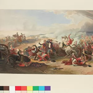
Map to illustrate The Battles of Pinkie 1547 and Prestonpans 1745 (engraving)
")
![]()
Wall Art and Photo Gifts from Fine Art Finder
Map to illustrate The Battles of Pinkie 1547 and Prestonpans 1745 (engraving)
2814709 Map to illustrate The Battles of Pinkie 1547 and Prestonpans 1745 (engraving) by English School, (19th century); Private Collection; (add.info.: Map to illustrate The Battles of Pinkie 1547 and Prestonpans 1745. Illustration for Tytlers History of Scotland (new edn, William Mackenzie, c 1880).); © Look and Learn
Media ID 22895990
© Look and Learn / Bridgeman Images
1547 1745 Battles Scot Scotch Pinkie Prestonpans
FEATURES IN THESE COLLECTIONS
> Arts
> Artists
> Related Images
> Europe
> United Kingdom
> Scotland
> East Lothian
> Prestonpans
> Europe
> United Kingdom
> Scotland
> Maps
> Fine Art Finder
> Artists
> Achille Beltrame
> Fine Art Finder
> Artists
> English School
> Maps and Charts
> Early Maps
EDITORS COMMENTS
This engraving, titled "Map to illustrate The Battles of Pinkie 1547 and Prestonpans 1745" takes us on a historical journey through the tumultuous past of Scotland. Created by an English School in the 19th century, this print offers a detailed depiction of two significant battles that shaped Scottish history. The first battle depicted is the Battle of Pinkie in 1547. This clash between England and Scotland was part of the wider conflict known as the Rough Wooing, where King Henry VIII sought to force a marriage alliance between his son Edward VI and Mary, Queen of Scots. The map showcases the strategic positioning and movements of both armies during this fierce encounter. Moving forward almost two centuries later, we are transported to the Battle of Prestonpans in 1745. This battle marked a pivotal moment in the Jacobite Rising led by Charles Edward Stuart, also known as Bonnie Prince Charlie. The map provides insight into how this confrontation unfolded and highlights key locations involved. Through this intricate engraving, we gain a deeper understanding of these historic events that have left an indelible mark on Scottish identity. It serves as a reminder not only of Scotland's rich heritage but also its resilience in times of conflict. With every detail meticulously captured within this artwork, it invites us to explore further into these fascinating chapters from Scotland's past.
MADE IN AUSTRALIA
Safe Shipping with 30 Day Money Back Guarantee
FREE PERSONALISATION*
We are proud to offer a range of customisation features including Personalised Captions, Color Filters and Picture Zoom Tools
SECURE PAYMENTS
We happily accept a wide range of payment options so you can pay for the things you need in the way that is most convenient for you
* Options may vary by product and licensing agreement. Zoomed Pictures can be adjusted in the Cart.