Home > Europe > Germany > Maps
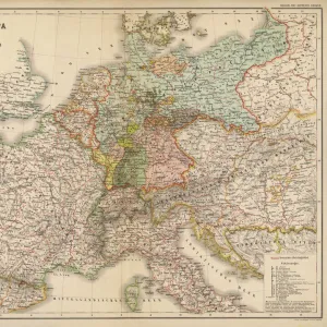
The United Kingdom, the United States, Germany and France compared (colour litho)
")
![]()
Wall Art and Photo Gifts from Fine Art Finder
The United Kingdom, the United States, Germany and France compared (colour litho)
3648957 The United Kingdom, the United States, Germany and France compared (colour litho) by English School, (20th century); Private Collection; (add.info.: The United Kingdom, the United States, Germany and France compared. Illustration for Philips Chamber of Commerce Atlas, A Graphic Survey of the Worlds Trade (George Philip, 1912).); © Look and Learn
Media ID 23146876
© Look and Learn / Bridgeman Images
Chart Charts Commercial Compared Economics Economy Global Trading
FEATURES IN THESE COLLECTIONS
> Arts
> Artists
> Related Images
> Europe
> United Kingdom
> Maps
> Fine Art Finder
> Artists
> English School
> Maps and Charts
> World
The United Kingdom, the United States, Germany and France Compared - A Historical Snapshot of Global Trade
EDITORS COMMENTS
. This print captures a fascinating comparison between four influential nations - the United Kingdom, the United States, Germany, and France. Taken from an English School's colour lithograph dating back to the 20th century, this image offers a glimpse into the economic landscapes of these powerful countries. Originally created as an illustration for Philips Chamber of Commerce Atlas in 1912 by George Philip, this graphic survey provides valuable insights into world trade during that era. The intricate charts and maps showcased here highlight each nation's commercial prowess and their significant roles in shaping global economics. The visual representation showcases not only their economic might but also sheds light on historical trading patterns and cultural influences. From Great Britain's vast empire encompassing British Isles to France's overseas departments and territories scattered across different continents; every detail tells a story of power dynamics and interconnectedness. As we explore this print further, it becomes evident that it is more than just a map or chart; it is a testament to the rich history shared among these nations. It reminds us of how economies have evolved over time while emphasizing their enduring impact on global commerce. This print serves as both an educational resource for historians and economists alike while offering viewers an opportunity to appreciate the beauty found within data visualization.
MADE IN AUSTRALIA
Safe Shipping with 30 Day Money Back Guarantee
FREE PERSONALISATION*
We are proud to offer a range of customisation features including Personalised Captions, Color Filters and Picture Zoom Tools
SECURE PAYMENTS
We happily accept a wide range of payment options so you can pay for the things you need in the way that is most convenient for you
* Options may vary by product and licensing agreement. Zoomed Pictures can be adjusted in the Cart.