Home > Europe > United Kingdom > Wales > Gwent > Newport
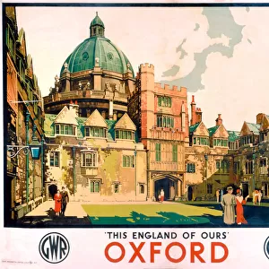
Map of Newport, Rhode Island, 1780 (pen, ink, watercolor)
")
![]()
Wall Art and Photo Gifts from Fine Art Finder
Map of Newport, Rhode Island, 1780 (pen, ink, watercolor)
7408031 Map of Newport, Rhode Island, 1780 (pen, ink, watercolor) by French School, (18th century); 58 x 61 cm; (add.info.: Map of the city, port, and harbor of Newport, with part of Rhode Island, occupied by the French army under the command of Monsieur le comte de Rochambeau and the French squadron commanded by Monsieur le Chevalier Destouches))
Media ID 32104716
© Bridgeman Images
American Revolution American Revolutionary War American Revolutionary War 1775 1783 American War Of Independence Amerikanischer Unabhangigkeitstag Rhode Island War Of Independance For America War Of Independence A America Continent Americae
FEATURES IN THESE COLLECTIONS
> Arts
> Artists
> C
> Chevalier Chevalier
> Europe
> United Kingdom
> Wales
> Gwent
> Newport
> Europe
> United Kingdom
> Wales
> Pembrokeshire
> Newport
> Fine Art Finder
> Artists
> French School
> Fine Art Finder
> Artists
> Ohara Koson
> North America
> United States of America
> Maps
> North America
> United States of America
> Rhode Island
> Related Images
EDITORS COMMENTS
This print showcases a beautifully detailed map of Newport, Rhode Island in the year 1780. Created by an anonymous French School artist from the 18th century, this pen, ink, and watercolor masterpiece measures 58 x 61 cm. The map provides a fascinating glimpse into the city's layout during a crucial time in history. The map specifically highlights not only Newport's cityscape but also its port and harbor. It depicts part of Rhode Island that was occupied by the French army under Monsieur le comte de Rochambeau's command and the French squadron led by Monsieur le Chevalier Destouches. This connection to the American Revolutionary War adds significant historical value to this artwork. As we explore this intricate piece, it becomes evident that it serves as both an informative document and a work of art. The attention to detail is remarkable; every street, building, and landmark is meticulously rendered with precision and care. Through this print, viewers are transported back in time to witness Newport's role during one of America's most pivotal periods – the fight for independence from British rule. It offers us insight into how cities were organized at that time while reminding us of the sacrifices made by those who fought for freedom. Whether you're an avid history enthusiast or simply appreciate fine artistry, this Map of Newport will undoubtedly captivate your imagination with its rich historical significance and stunning visual appeal.
MADE IN AUSTRALIA
Safe Shipping with 30 Day Money Back Guarantee
FREE PERSONALISATION*
We are proud to offer a range of customisation features including Personalised Captions, Color Filters and Picture Zoom Tools
SECURE PAYMENTS
We happily accept a wide range of payment options so you can pay for the things you need in the way that is most convenient for you
* Options may vary by product and licensing agreement. Zoomed Pictures can be adjusted in the Cart.