Home > Europe > France > Maps
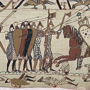
Map of France at the times of King Philip I of France death, 1108 Engraving from "" Atlas Universel"" by Houze 1851 Private collection

![]()
Wall Art and Photo Gifts from Fine Art Finder
Map of France at the times of King Philip I of France death, 1108 Engraving from "" Atlas Universel"" by Houze 1851 Private collection
ELD4921663 Map of France at the times of King Philip I of France death, 1108 Engraving from "" Atlas Universel"" by Houze 1851 Private collection; (add.info.: Map of France at the times of King Philip I of France death, 1108 Engraving from "" Atlas Universel"" by Houze 1851 Private collection); Photo © The Holbarn Archive
Media ID 38267786
© Photo © The Holbarn Archive / Bridgeman Images
12 12th Xii Xiith Century 12 Century 12th Century 13 Century C12th Geographical Map Thirteenth Century Twelfth Century Xii Century Xiii Century Xiiith Century Xiith Century
FEATURES IN THESE COLLECTIONS
> Fine Art Finder
> Artists
> Pasquier (workshop of) Grenier
EDITORS COMMENTS
This stunning engraving from the "Atlas Universel" by Houze in 1851 captures a detailed map of France during the time of King Philip I's death in 1108. The intricate lines and vibrant colors bring to life the geography and history of this pivotal moment in the 12th century.
As we gaze upon this historical artifact, we are transported back to a time of knights, castles, and feudal lords. The borders of France are clearly defined, showing us the extent of King Philip I's domain during his reign. It is fascinating to see how different regions were divided and ruled centuries ago.
The craftsmanship of this engraving is truly remarkable, with each city, river, and mountain meticulously depicted. The attention to detail speaks volumes about the dedication and skill of the cartographers who created this masterpiece.
Through this map, we can gain a deeper understanding of medieval France and its political landscape. It serves as a valuable resource for historians and enthusiasts alike who wish to explore the past through cartography.
Overall, this print is not just a visual representation but also a gateway to another era – one filled with intrigue, power struggles, and royal dynasties. It is a testament to human ingenuity and curiosity about our world throughout history.
MADE IN AUSTRALIA
Safe Shipping with 30 Day Money Back Guarantee
FREE PERSONALISATION*
We are proud to offer a range of customisation features including Personalised Captions, Color Filters and Picture Zoom Tools
SECURE PAYMENTS
We happily accept a wide range of payment options so you can pay for the things you need in the way that is most convenient for you
* Options may vary by product and licensing agreement. Zoomed Pictures can be adjusted in the Cart.