Home > Oceania > New Zealand > Maps
Antique charts of New Zealand
![]()

Wall Art and Photo Gifts from Fine Art Storehouse
Antique charts of New Zealand
Unleash your creativity and transform your space into a visual masterpiece!
Hemera Technologies
Media ID 13609547
© Getty Images
Border Chart Document Geographical Locations Geography Latitude Legend Locations Longitude Maps New Zealand Places Scale Scene Charts
FEATURES IN THESE COLLECTIONS
> Fine Art Storehouse
> Map
> Historical Maps
> Maps and Charts
> Early Maps
> Oceania
> New Zealand
> Maps
Antique Charts of New Zealand - A Glimpse into the Rich History and Geography of a Beautiful Land
EDITORS COMMENTS
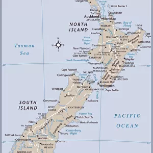
. This print showcases a collection of antique charts of New Zealand, providing a fascinating glimpse into the historical cartography and geography of this stunning country. With its rich archival quality, this print from Hemera Technologies transports us back in time to an era when explorers meticulously mapped out the vast landscapes and intricate coastlines. The chart's exquisite engravings depict key locations, rivers, bays, and borders with remarkable precision. The detailed legend offers insights into latitude and longitude coordinates, allowing viewers to navigate through the diverse regions that make up New Zealand. The scale provided ensures accuracy in understanding distances between different places. As we delve deeper into this horizontal color image, we are reminded of the immense significance these maps held for early adventurers who sought to uncover new territories. This scene evokes a sense of wonder as we contemplate how these ancient documents shaped our understanding of physical geography over time. With no people present in this photograph, it allows us to focus solely on the history embedded within each chart. It serves as a reminder that beyond its breathtaking natural beauty lies a profound story waiting to be discovered by those willing to explore further. Whether you are an avid collector or simply appreciate the allure of vintage maps, this fine art print is sure to captivate your imagination while honoring New Zealand's past.
MADE IN AUSTRALIA
Safe Shipping with 30 Day Money Back Guarantee
FREE PERSONALISATION*
We are proud to offer a range of customisation features including Personalised Captions, Color Filters and Picture Zoom Tools
SECURE PAYMENTS
We happily accept a wide range of payment options so you can pay for the things you need in the way that is most convenient for you
* Options may vary by product and licensing agreement. Zoomed Pictures can be adjusted in the Cart.


