
Wall Art and Photo Gifts from Fine Art Storehouse
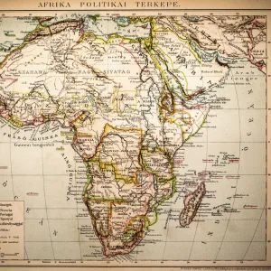
Map of the World 1881
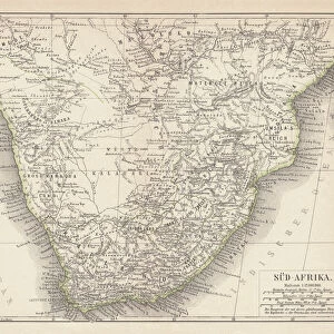
Harpers School Geography, New York, Harpers and Brothers, 1881
Unleash your creativity and transform your space into a visual masterpiece!
THEPALMER
Media ID 14756078
© This content is subject to copyright
Atlantic Ocean
Australia
Indian Ocean
North America
Pacific Ocean
South Africa
World
FEATURES IN THESE COLLECTIONS
> Africa
> South Africa
> Maps
> Asia
> Related Images
> Europe
> Related Images
> Fine Art Storehouse
> Map
> Historical Maps
> Fine Art Storehouse
> Map
> Maps and Charts
> Africa
> Maps and Charts
> Americas
> Maps and Charts
> Australia
> Maps and Charts
> Early Maps
> Maps and Charts
> World
> North America
> United States of America
> New York
> New York
> Maps
> Oceania
> Australia
> Maps
MADE IN AUSTRALIA
Safe Shipping with 30 Day Money Back Guarantee
FREE PERSONALISATION*
We are proud to offer a range of customisation features including Personalised Captions, Color Filters and Picture Zoom Tools
SECURE PAYMENTS
We happily accept a wide range of payment options so you can pay for the things you need in the way that is most convenient for you
* Options may vary by product and licensing agreement. Zoomed Pictures can be adjusted in the Cart.
redeem
Beautiful Photo Prints and Gifts
image
Professionally Printed
thumb_up
Professional quality finish
diamond
Made with high-grade materials
inventory_2
Carefully packed to aid safe arrival
Related Images
Lawrence Dallaglio and Richard Hill during the 2003 World Cup Final

6N: Scotland 19 England 13

Jan Webster kicks ahead for the Barbarians
Jan Webster dive-passes against Wales - 1972 Five Nations

England forwards shield scrum-half Jan Webster - 1972 Five Nations

Referee Jim Fleming - 1999 Five Nations

Francois Pienaar lifts the World Cup for South Africa as Nelson Mandela cheers

Francois Pienaar receives the Webb Ellis Cup from Nelson Mandela

South Africa, 1st Test - 1994 England Tour of SA
Africa Political Map
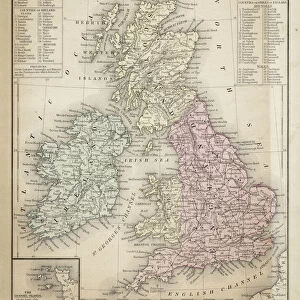
Great Britain and Ireland map 1867
Ancient map of South Africa, lithograph, published in 1876
Related Collections

Early Maps
Browse 24,907 Prints

Map
Browse 9,856 Prints

Asia Related Images
Browse 15,009 Prints

Europe Related Images
Browse 33,474 Prints

Maps
Browse 306 Prints

Maps
Browse 638 Prints

Maps
Browse 2,519 Prints

Africa
Browse 1,288 Prints

Americas
Browse 4,747 Prints

Australia
Browse 448 Prints

World
Browse 6,163 Prints

Historical Maps
Browse 3,307 Prints

