Fraud Blocker Skip to main content

Arizona map 1893

Arizona map 1893
Sold 2
In Stock
We accept all major payment options so you can pay for the things you need in the way that is most convenient for you

Fine Art Storehouse Photo Prints and Wall Art

Arizona map 1893

Johnsonas Universal Cyclopedia - Charles Kendall - New York 1893. Unleash your creativity and transform your space into a visual masterpiece. © This content is subject to copyright

THEPALMER

Media ID 14756590

Arizona

SECURE PAYMENTS
We accept all major payment options so you can pay for the things you need in the way that is most convenient for you

Made in Australia
Safe Shipping, Easy Returns

FREE PERSONALISATION
We are proud to offer a range of customisation including Cropping, Captions, and Filters. Zoom Cropping can be adjusted in the basket


EDITORS COMMENTS

In this print titled "Arizona map 1893" we are transported back in time to the vast and untamed landscapes of the American Southwest. The image showcases a meticulously detailed map, originally published in Johnson's Universal Cyclopedia by Charles Kendall in New York, 1893. As we delve into its intricate lines and contours, we gain insight into Arizona's rich history and geographical features. The map serves as a visual portal to an era when Arizona was still emerging as a state, with rugged terrain waiting to be explored. From the towering peaks of the Grand Canyon to the sprawling deserts that stretch endlessly across the horizon, every inch of this territory is beautifully rendered on paper. The craftsmanship evident in this print speaks volumes about the dedication and precision required during cartographic endeavors at that time. It reminds us of how maps were once cherished possessions, guiding pioneers through uncharted territories and offering glimpses into unknown worlds. "The Palmer" known for their exceptional collection at Fine Art Storehouse, has expertly preserved this historical artifact for our appreciation today. Through their careful curation and attention to detail, they allow us to connect with past generations while celebrating both artistry and knowledge. As we gaze upon this remarkable piece from THEPALMER's collection, let us marvel at its ability to transport us through time – reminding us of Arizona's enduring beauty while honoring those who came before us.


Framed Prints

Introducing the captivating Arizona Map 1893 from our Media Storehouse Framed Prints collection. This exquisite piece of historical cartography is brought to you by THEPALMER, originally published in Johnson's Universal Cyclopedia from Charles Kendall in New York, 1893. Travel back in time with this intricately detailed map, showcasing the territorial expanse of Arizona as it appeared over a century ago. The vintage charm of this map is beautifully preserved in our high-quality framed print, making it a stunning addition to any home or office decor. Embrace the rich history and intrigue of the American Southwest with this unique and captivating piece.


Photo Prints

Discover the rich history of Arizona with our exquisite "Arizona Map 1893" photographic print from ThePalmer collection at Media Storehouse. This stunning piece, sourced from the Johnson's Universal Cyclopedia published in New York in 1893, transports you back in time. The intricate details of the map reveal the territorial boundaries, cities, and towns of Arizona during this era. Bring history into your home or office and add a unique touch to your decor with this captivating and authentic vintage map print.


Poster Prints

Discover the rich history of Arizona with our stunning poster print, "Arizona Map 1893" from ThePalmer collection at Media Storehouse. This captivating piece is taken from the renowned Johnson's Universal Cyclopedia published in New York in 1893. Travel back in time as you examine the intricate details of this vintage map, which beautifully illustrates the territorial boundaries and geographical features of Arizona during that era. Bring a piece of the past into your home or office and add an authentic touch to your decor. Order now and let this vintage map ignite your imagination and transport you to a time long past.


Jigsaw Puzzles

Discover the rich history of Arizona with our captivating jigsaw puzzle from Media Storehouse's Fine Art Storehouse collection. This intricately detailed puzzle features an authentic 1893 Arizona map by THEPALMER, as originally published in Johnson's Universal Cyclopedia from New York. Immerse yourself in the past as you piece together this vivid representation of Arizona's early territorial boundaries. A perfect activity for history enthusiasts, families, or anyone seeking a challenging and rewarding puzzle experience. Unleash your inner explorer and embark on a journey through time with Media Storehouse's Arizona map 1893 puzzle.

diamond
Made With High Grade Materials
thumb_up
Professional Quality Finish
package_2
Carefully Packed To Aid Safe Arrival

You May Also Like


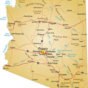
Map of Arizona, USA highways, major roads, and riversMap of Arizona, USA highways, major roads, and rivers
Add to Basket
Arizona MapArizona Map
Add to Basket
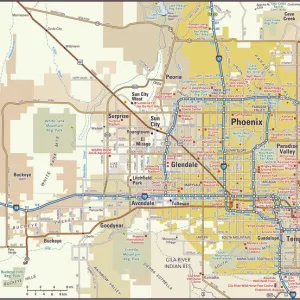
Phoenix, Arizona area mapPhoenix, Arizona area map
Add to Basket
Arizona road mapArizona road map
Add to Basket
California condor (Gymnogyps californianus) landing, forest in backgroundCalifornia condor (Gymnogyps californianus) landing, forest in background
Add to Basket
Mez"Mez"
Add to Basket
USA Political MapUSA Political Map
Add to Basket
Sir David Attenborough with a cockatooSir David Attenborough with a cockatoo
Add to Basket
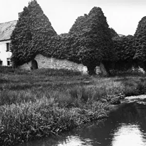
Kilve Chantry, North Somerset, Early 20th CenturyKilve Chantry, North Somerset, Early 20th Century
Add to Basket
Map of AustraliaMap of Australia
Add to Basket
1313114713131147
Add to Basket
Malcolm Uphill (Triumph) 1969 Production TTMalcolm Uphill (Triumph) 1969 Production TT
Add to Basket

Gallery Wall Inspiration

USA Map - illustration
Map of New York city 1896
Arizona map 1893
Cartoon map of USA
Map of Southern States USA 1895
Irvine California US City Street Map
Highly detailed USA Road Map
Antique map of USA in the 19th Century, 1873
Antique Map of Western USA
Map of Maine USA 1883
Map of Texas 1867
Squier Map of Hopewell Culture National Historical Park in Ross County, Ohio, USA
United States South West Central map 1897
Old map of California 1855
England and Wales map 1875
Holland map 1881
USA indian territories map 1881
Huntingdon and Cambridge map 1881
Map of Maine 1883
Map of the Battle of Hampton Roads
Vermont USA map 1885
Map of Kentucky and Tennessee 1855
Map of Texas 1856
Iowa 1852 Map
Map of California 1878
Great Britain and England map 1895
Map of Yellowstone National Park, USA


© Copyright Media Storehouse, All Rights Reserved 2003 - 2024
Facebook     Pinterest     100% Payment Secure     Reviews IO