Home > Europe > Lithuania > Maps
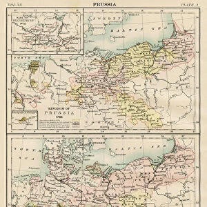
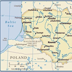
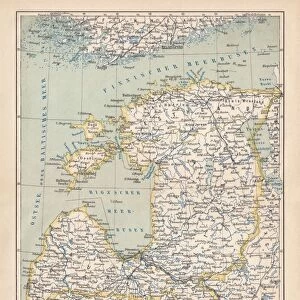
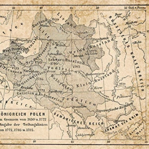
Historical maps of Poland, Prussia, Lithuania and Western Russia

![]()
Wall Art and Photo Gifts from Fine Art Storehouse
Historical maps of Poland, Prussia, Lithuania and Western Russia
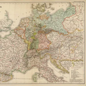
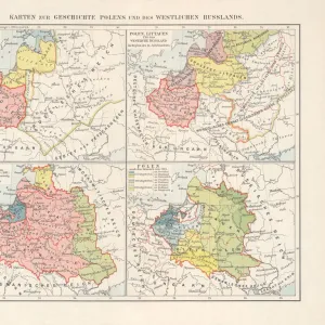
Maps of the historical development of Poland, Prussia (Teutonic Order), Lithuania and Western Russia from the 10th to the 18th century. Lithograph, published in 1897
Unleash your creativity and transform your space into a visual masterpiece!
ZU_09
Media ID 18292215
FEATURES IN THESE COLLECTIONS
> Fine Art Storehouse
> Map
> Historical Maps
> Maps and Charts
> Early Maps
EDITORS COMMENTS
This print showcases a collection of historical maps that take us on a journey through the intricate development of Poland, Prussia, Lithuania, and Western Russia. Dating back from the 10th to the 18th century, these meticulously crafted lithographs offer a glimpse into the rich tapestry of this region's past. The maps featured in this print shed light on the shifting borders and political dynamics that shaped these lands over centuries. Each map tells its own story, revealing conquests, alliances, and territorial disputes that have left an indelible mark on history. Published in 1897 by ZU_09, this print captures not only the beauty but also the educational value of these historical artifacts. It serves as a reminder of how geography has played a crucial role in shaping nations and cultures throughout time. Whether you are an avid history enthusiast or simply appreciate fine art with intellectual depth, this print is sure to captivate your imagination. Its intricate details invite closer inspection while offering an opportunity for reflection on our shared human heritage. Displaying "Historical maps of Poland, Prussia, Lithuania and Western Russia" in your home or office will undoubtedly spark conversations about geopolitics and cultural identity. Let it transport you back in time as you explore the fascinating stories embedded within each carefully drawn line.
MADE IN AUSTRALIA
Safe Shipping with 30 Day Money Back Guarantee
FREE PERSONALISATION*
We are proud to offer a range of customisation features including Personalised Captions, Color Filters and Picture Zoom Tools
SECURE PAYMENTS
We happily accept a wide range of payment options so you can pay for the things you need in the way that is most convenient for you
* Options may vary by product and licensing agreement. Zoomed Pictures can be adjusted in the Cart.