Fraud Blocker Skip to main content

Home > Europe > France > Canton > Landes

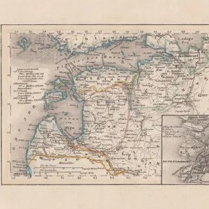
Map of Baltic states, lithograph, published in 1877

Map of Baltic states, lithograph, published in 1877
Sold 1
In Stock
We accept all major credit cards
Framed Photos
Buy from AU$119.99
Photo Prints
Buy from AU$12.99
Jigsaw Puzzles
Buy from AU$89.99
Poster Prints
Buy from AU$24.99
Canvas Prints
Buy from AU$124.99
Fine Art Prints
Buy from AU$92.53
Metal Prints
Buy from AU$43.99
Cards
Buy from AU$12.99
Home Decor
Buy from AU$24.99

Fine Art Storehouse Photo Prints and Wall Art

Map of Baltic states, lithograph, published in 1877

Historic map of Baltic states: Lithuania, Estonia, Latvia. Lithograph, published in 1877. Unleash your creativity and transform your space into a visual masterpiece. © ZU_09

Media ID 13666751

78279 Baltic Countries Baltic Sea Contour Drawing Country Geographic Area Estonia European Culture Finland Image Date Land Latvia Lithuania Riga Topographic Map Topography Gulf Of Finland Image Created 19th Century

FEATURES IN THESE COLLECTIONS

> Europe > Estonia > Maps

> Europe > Estonia > Related Images

> Europe > Finland > Maps

> Europe > Finland > Posters

> Europe > Finland > Related Images

> Europe > France > Canton > Landes

> Europe > Latvia > Maps

> Europe > Latvia > Posters

> Europe > Latvia > Related Images

> Europe > Latvia > Riga

> Fine Art Storehouse > Map > Historical Maps

> Fine Art Storehouse > Map

SECURE PAYMENTS
We happily accept a wide range of payment options so you can pay for the things you need in the way that is most convenient for you

MADE IN AUSTRALIA
Safe Shipping with 30 Day Money Back Guarantee

FREE PERSONALISATION
We are proud to offer a range of customisation including Cropping, Captions, and Filters. Zoom Cropping can be adjusted in the Basket.


EDITORS COMMENTS

This lithograph, published in 1877, showcases a historic map of the Baltic states - Lithuania, Estonia, and Latvia. A true testament to European culture and cartography of the time, this antique engraved image offers a glimpse into the topography and land formations of these countries nestled along the Baltic Sea. The intricate details highlight key features such as the Gulf of Finland and Riga, while also encompassing smaller islands within this region. With its vertical composition and contour drawing style, this lithograph exudes an air of ancient history. Its creation in the 19th century adds to its allure as a valuable piece that captures not only geographical information but also reflects upon cultural significance. Each country's unique identity is subtly represented through symbols associated with Lithuanian, Latvian, and Estonian cultures. As we gaze at this remarkable print from 1877 - preserved beautifully even in modern times - it serves as a visual portal to explore the past. It reminds us of how these Baltic countries have evolved over time while retaining their distinct characteristics. This map holds immense historical value for scholars studying European geography or those seeking insight into bygone eras.


Framed Prints

Step back in time with our exquisite Framed Prints from the Media Storehouse Fine Art collection. This historic piece showcases a beautifully detailed lithograph map of the Baltic states, featuring Lithuania, Estonia, and Latvia. Published in 1877, this captivating work of art transports you to a bygone era with its intricate lines and rich colors. Add a touch of history and sophistication to your home or office with this unique and intriguing addition to your decor. Each Framed Print is carefully crafted with museum-quality materials and comes ready to hang, ensuring a stunning presentation. Elevate your space and start your own art collection with this historic map from the Media Storehouse Fine Art Storehouse.


Photo Prints

Step back in time with our exquisite antique print from the Media Storehouse Fine Art collection. This historic lithograph, published in 1877, showcases a detailed map of the Baltic states, featuring Lithuania, Estonia, and Latvia. Each line and contour is meticulously rendered, transporting you to a bygone era. Add an air of sophistication and history to your space with this stunning piece of decorative art.


Poster Prints

Step back in time with our exquisite Map of the Baltic States print from the Media Storehouse Fine Art collection. This beautifully preserved 1877 lithograph showcases an intriguing historical representation of Europe, featuring the regions of Lithuania, Estonia, and Latvia. Add a touch of vintage charm to your home or office decor, and transport yourself on a journey through history with every glance. Order now and immerse yourself in the rich cultural heritage of the Baltic States.


Jigsaw Puzzles

Step back in time with our exquisite jigsaw puzzle from the Media Storehouse Map of Baltic States collection. This intricately detailed puzzle features a historic lithograph of the Baltic region, published in 1877. Featuring the beautiful and historic countries of Lithuania, Estonia, and Latvia, this puzzle is a must-have for history enthusiasts and puzzle lovers alike. The high-quality pieces fit seamlessly together, providing hours of enjoyable and rewarding puzzle-solving experience. Bring a piece of history into your home with this stunning and captivating puzzle.

diamond
Made With High Grade Materials
thumb_up
Professional Quality Finish
package_2
Carefully Packed To Aid Safe Arrival

You May Also Like


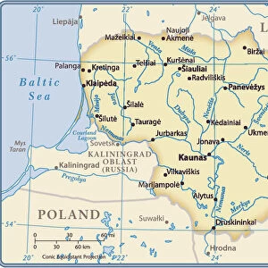
Lithuania country mapLithuania country map
Add to Basket
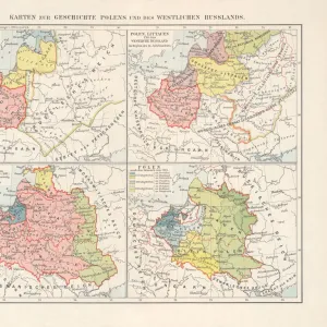
Historical maps of Poland, Prussia, Lithuania and Western RussiaHistorical maps of Poland, Prussia, Lithuania and Western Russia
Add to Basket
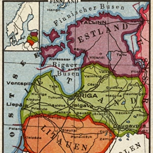
Old map of Russia and the Baltic States, published 1857Old map of Russia and the Baltic States, published 1857
Add to Basket
Passenger Pigeon-ExtinctPassenger Pigeon-Extinct
Add to Basket
Tanks Near TobrukTanks Near Tobruk
Add to Basket
Lightning Strikes ShipLightning Strikes Ship
Add to Basket
Karl Marx / Ils 1871Karl Marx / Ils 1871
Add to Basket
Pirogue, Adjoukron fishing village on lagoon, Tiegba, Ivory Coast, AfricaPirogue, Adjoukron fishing village on lagoon, Tiegba, Ivory Coast, Africa
Add to Basket
Lincoln Cathedral, Lincoln, England, UKLincoln Cathedral, Lincoln, England, UK
Add to Basket
Port, Saint-Pierre quay and Le Suquet, Cannes, Alpes Maritimes, ProvencePort, Saint-Pierre quay and Le Suquet, Cannes, Alpes Maritimes, Provence
Add to Basket
Negril, JamaicaNegril, Jamaica
Add to Basket
Dexter Fletcher in Derek Jarmans Caravaggio (1986)Dexter Fletcher in Derek Jarmans Caravaggio (1986)
Add to Basket

Gallery Wall Inspiration

Map Of New Holland
Antique map of Britain under the Anglo Saxons
Antique map of Britain under the Ancient Romans
Carte du Tendre: imaginary map by a character in the novel Cl├®lie
Map of Exeter in Devon, England Victorian Engraving, 1840
Map of Anglo-Saxon Kingdoms and the Danelaw, 9th Century
England in the Ninth Century
Map of Devon 1883
Newfoundland map 1884
Map of Middle East - illustration
Antique map of the Roman Empire
Old engraved map of Battle of Naseby (14. 06. 1645)
Map of Cyprus, published in 1880
Apostle Pauls Missionary Journeys, lithograph, published in 1886
Battle Of Waterloo
Map of Ireland 1897
Cornwall map 1884
Sicily map 1895
Antique map of Tasmania
Old map of Australia 1899
Ethnological map of the Austro-Hungarian Empire, lithograph, published in 1897
Map of Whitby
Antique map, Scotland, Isle of Skye, South and North Uist
Earth map according to Herodotus
Antique map of Hadrians wall
Antique map of Ireland
Old Caucasus map

Discover Our Collections


MapMap
View Collection
Estonia Related ImagesEstonia Related Images
View Collection
Finland Related ImagesFinland Related Images
View Collection
RigaRiga
View Collection
Latvia Related ImagesLatvia Related Images
View Collection
MapsMaps
View Collection
MapsMaps
View Collection
MapsMaps
View Collection
LandesLandes
View Collection
PostersPosters
View Collection
PostersPosters
View Collection
Historical MapsHistorical Maps
View Collection


© Copyright Media Storehouse, All Rights Reserved 2003 - 2024
Facebook     Pinterest     Card Payments     Reviews IO