Home > North America > United States of America > New York > New York > Maps
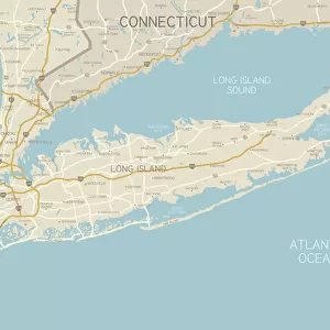
Connecticut map 1893

![]()
Wall Art and Photo Gifts from Fine Art Storehouse
Connecticut map 1893
Johnsonas Universal Cyclopedia - Charles Kendall - New York 1893 vol 2
Unleash your creativity and transform your space into a visual masterpiece!
THEPALMER
Media ID 14756552
© This content is subject to copyright
FEATURES IN THESE COLLECTIONS
> Fine Art Storehouse
> Map
> Historical Maps
> Fine Art Storehouse
> Map
> USA Maps
> Maps and Charts
> Early Maps
> North America
> United States of America
> Connecticut
> Related Images
> North America
> United States of America
> Maps
> North America
> United States of America
> New York
> New York
> Maps
EDITORS COMMENTS
This print titled "Connecticut Map 1893" takes us on a journey back in time to the late 19th century. The image showcases an intricately detailed map of Connecticut, sourced from Johnson's Universal Cyclopedia by Charles Kendall, published in New York in 1893. With its vintage charm and historical significance, this piece offers a glimpse into the past and allows us to explore the state's geography as it was over a century ago. The map itself is beautifully rendered, featuring delicate lines that trace every river, road, and town within Connecticut's borders. Its elegant typography adds an air of sophistication while providing valuable information about the various counties and cities scattered across the region. This print serves as both a decorative artwork for any space and an educational tool for history enthusiasts or those interested in cartography. "The Palmer" known for their exceptional curation of fine art prints, has meticulously preserved this remarkable piece from Fine Art Storehouse's collection. As we gaze upon this stunning reproduction, we are transported to a time when maps were crafted with meticulous care and served as essential tools for exploration. Whether displayed in a home office or showcased in a classroom setting, this print invites viewers to appreciate the beauty of vintage cartography while fostering curiosity about Connecticut's rich history.
MADE IN AUSTRALIA
Safe Shipping with 30 Day Money Back Guarantee
FREE PERSONALISATION*
We are proud to offer a range of customisation features including Personalised Captions, Color Filters and Picture Zoom Tools
SECURE PAYMENTS
We happily accept a wide range of payment options so you can pay for the things you need in the way that is most convenient for you
* Options may vary by product and licensing agreement. Zoomed Pictures can be adjusted in the Cart.