Framed Print > Maps and Charts > British Empire Maps
Framed Print : British Empire Map 1902


![]()
Framed Photos from Mary Evans Picture Library
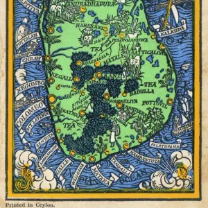
British Empire Map 1902
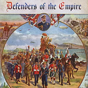
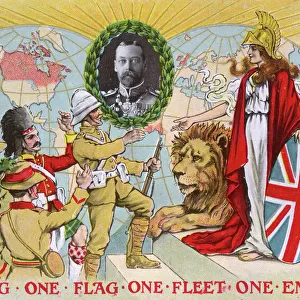
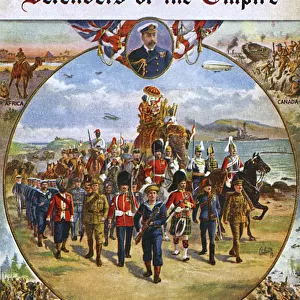
Map showing the extent of the British Empire in 1902 - the Empire on which the sun never sets
Mary Evans Picture Library makes available wonderful images created for people to enjoy over the centuries
Media ID 4322812
© Mary Evans Picture Library 2015 - https://copyrighthub.org/s0/hub1/creation/maryevans/MaryEvansPictureID/10025389
A2 Premium Frame with A3 Poster
Introducing the captivating "British Empire Map 1902" from Media Storehouse's Framed Prints collection, brought to you in partnership with Mary Evans Prints Online. This exquisite piece of historical cartography showcases the vast expanse of the British Empire at the turn of the 20th century, often referred to as the "Empire on which the sun never sets." The intricate details of this map transport you back in time, illustrating the remarkable reach of the British Empire during its zenith. Adorn your walls with this striking and thought-provoking representation of a bygone era.
Premium Paradise Wooden Range A2 Premium Poster Frame (62x45cm) with A3 Poster (42x30cm) and mounted behind a white matt board to make your photo really stand out. FSC Certified and Rainforest Alliance Certified for environmental, social, and economic sustainably. High transparency tempered glass window with a smooth finished frame. Great for filling empty walls, decorating blank spaces, or creating eye-catching gallery walls. Frames arrive ready to hang. Sent with secure, protective packaging. Smooth wooden veneer mimics the real wood look and feel with ultra-durable scratch resistance tempered glass.
Contemporary Framed and Mounted Prints - Professionally Made and Ready to Hang
Estimated Image Size (if not cropped) is 40.4cm x 40.4cm (15.9" x 15.9")
Estimated Product Size is 44.6cm x 62cm (17.6" x 24.4")
These are individually made so all sizes are approximate
Artwork printed orientated as per the preview above, with landscape (horizontal) or portrait (vertical) orientation to match the source image.
FEATURES IN THESE COLLECTIONS
> Maps and Charts
> British Empire Maps
> Maps and Charts
> Early Maps
> Maps and Charts
> Related Images
EDITORS COMMENTS
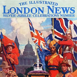
This striking print of the British Empire Map from 1902 showcases the vast extent of one of history's most powerful empires. The map illustrates the reach of British imperialism at its peak, with territories spanning across continents and oceans. Known as the empire on which the sun never sets, this map is a visual representation of Britain's dominance and influence during this time.
The intricate details on the map provide a glimpse into the historical significance and political power that characterized the British Empire in 1902. From India to Africa to Australia, each region under British rule is clearly demarcated, highlighting the sheer magnitude of their global presence.
As we reflect on this piece of history, it serves as a reminder of both the achievements and controversies associated with imperialism. The legacy left behind by the British Empire continues to shape geopolitics and international relations to this day.
Whether you are a history enthusiast or simply appreciate fine art, this print offers a unique perspective on a pivotal moment in world history. Displaying it in your home or office will not only add an element of sophistication but also spark conversations about colonialism, power dynamics, and cultural exchange.
MADE IN AUSTRALIA
Safe Shipping with 30 Day Money Back Guarantee
FREE PERSONALISATION*
We are proud to offer a range of customisation features including Personalised Captions, Color Filters and Picture Zoom Tools
SECURE PAYMENTS
We happily accept a wide range of payment options so you can pay for the things you need in the way that is most convenient for you
* Options may vary by product and licensing agreement. Zoomed Pictures can be adjusted in the Cart.