Fraud Blocker Skip to main content

Chart Collection (page 7)

"Unlocking the Secrets: Exploring the Fascinating World of Charts" Dive into the realm of reflexology with a detailed foot map chart

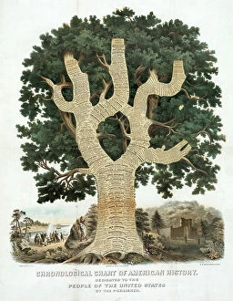
Background imageChart Collection: Chronological Chart of American History, New York, 1881. At foot of tree is Columbus

Chronological Chart of American History, New York, 1881. At foot of tree is Columbus, then Virginia, New York
528331 Chronological Chart of American History, New York, 1881. At foot of tree is Columbus, then Virginia, New York, Landing of Pilgrim Fathers

Background imageChart Collection: Fluctuations of the Weekly Mortality in London from Scarlet Fever during the recent Epidemic

Fluctuations of the Weekly Mortality in London from Scarlet Fever during the recent Epidemic (engraving)
8647827 Fluctuations of the Weekly Mortality in London from Scarlet Fever during the recent Epidemic (engraving) by English School

Background imageChart Collection: Famous rivers: The Euphrates and Tigris (litho)

Famous rivers: The Euphrates and Tigris (litho)
8634762 Famous rivers: The Euphrates and Tigris (litho) by English School, (20th century); Private Collection; (add.info.: The Euphrates and Tigris)

Background imageChart Collection: Famous rivers: The Thames (litho)

Famous rivers: The Thames (litho)
8634757 Famous rivers: The Thames (litho) by English School, (20th century); Private Collection; (add.info.: The Thames. Illustration for Chatterbox, 1913.); © Look and Learn.

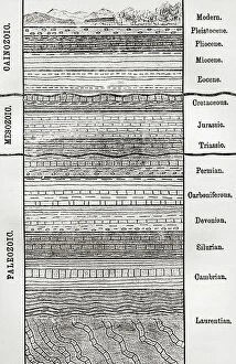
Background imageChart Collection: A chart of strata, layers of sedimentary rock or soil

A chart of strata, layers of sedimentary rock or soil
5614336 A chart of strata, layers of sedimentary rock or soil; (add.info.: A chart of strata, layers of sedimentary rock or soil)

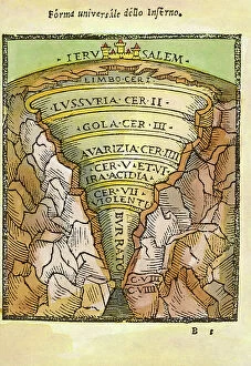
Background imageChart Collection: Universal Form Of Hell, 1544 (engraving)

Universal Form Of Hell, 1544 (engraving)
7272458 Universal Form Of Hell, 1544 (engraving); (add.info.: DIVINE COMEDY universal form of hell. From 'situated De'l)

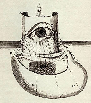
Background imageChart Collection: ANAMORPHOSIS, 1642 (engraving)

ANAMORPHOSIS, 1642 (engraving)
7272508 ANAMORPHOSIS, 1642 (engraving); (add.info.: ANAMORPHOSIS the eye of the Cardinal Column, anamorphosis for cylindrical mirror)

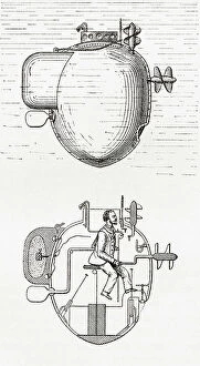
Background imageChart Collection: Turtle (also called American Turtle), the world's first submersible vessel, showing the elevation

Turtle (also called American Turtle), the world's first submersible vessel, showing the elevation, top
6867175 Turtle (also called American Turtle), the world's first submersible vessel, showing the elevation, top, and the cross section, bottom

Background imageChart Collection: Marine diagram of flowers, c.1810 (engraving & etching)

Marine diagram of flowers, c.1810 (engraving & etching)
7340667 Marine diagram of flowers, c.1810 (engraving & etching) by Benard, Robert (fl.1734); 24.7x17.7 cm; National Maritime Museum, London

Background imageChart Collection: Planesphaeri Coelestis Hemisphaerium Meridionale, 1700 (coloured print)

Planesphaeri Coelestis Hemisphaerium Meridionale, 1700 (coloured print)
7340115 Planesphaeri Coelestis Hemisphaerium Meridionale, 1700 (coloured print) by Allard, Carel (c.1648-1709); 63x55 cm; National Maritime Museum, London

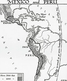
Background imageChart Collection: Map of Mexico and Peru, showing the Aztec Empire and the Inca Empire. (print)

Map of Mexico and Peru, showing the Aztec Empire and the Inca Empire. (print)
7420055 Map of Mexico and Peru, showing the Aztec Empire and the Inca Empire. (print); (add.info.: Map of Mexico and Peru, showing the Aztec Empire and the Inca Empire)

Background imageChart Collection: Map of Europe and Asia circa 1200 AD. (print)

Map of Europe and Asia circa 1200 AD. (print)
7420049 Map of Europe and Asia circa 1200 AD. (print); (add.info.: Map of Europe and Asia circa 1200 AD. From the book Outline of History by H.G. Wells, published 1920.); Photo © Ken Welsh

Background imageChart Collection: Map showing the distribution of the Hellenic Races, 1000 - 800 BC. (print)

Map showing the distribution of the Hellenic Races, 1000 - 800 BC. (print)
7420095 Map showing the distribution of the Hellenic Races, 1000 - 800 BC. (print); (add.info.: Map showing the distribution of the Hellenic Races, 1000 - 800 BC)

Background imageChart Collection: Diagram of Miocene Mammals (print)

Diagram of Miocene Mammals (print)
7420077 Diagram of Miocene Mammals (print); (add.info.: Diagram of Miocene Mammals including, Oxcydactylus, Dicrorerus, Merycodus, Neohipparion, Tetrabelodon and Dinothere)

Background imageChart Collection: Mesozoic reptiles (print)

Mesozoic reptiles (print)
7420071 Mesozoic reptiles (print); (add.info.: Mesozoic reptiles. Brontosaurus, Pterodactyl, Campotosaurus, Stegosaurus, Diplodocus)

Background imageChart Collection: Map of Africa in 1914. (print)
Map of Africa in 1914. (print)
7420065 Map of Africa in 1914. (print); (add.info.: Map of Africa in 1914. From the book Outline of History by H.G. Wells, published 1920.); Photo © Ken Welsh. All rights reserved 2024.

Background imageChart Collection: Map illustrating the route of the crusaders during the First Crusade, 11th century (print)

Map illustrating the route of the crusaders during the First Crusade, 11th century (print)
7420048 Map illustrating the route of the crusaders during the First Crusade, 11th century (print); (add.info.: Map illustrating the route of the crusaders during the First Crusade, 11th century)

Background imageChart Collection: Map of Asia Minor, Syria, and Mesopotamia during the first centuries of the Christian era (print)

Map of Asia Minor, Syria, and Mesopotamia during the first centuries of the Christian era (print)
7420041 Map of Asia Minor, Syria, and Mesopotamia during the first centuries of the Christian era (print); (add.info.: Map of Asia Minor, Syria)

Background imageChart Collection: Map of Roman Britain c. 410. From Historical Atlas, published 1923 (print)

Map of Roman Britain c. 410. From Historical Atlas, published 1923 (print)
2603520 Map of Roman Britain c. 410. From Historical Atlas, published 1923 (print).

Background imageChart Collection: Map of the Portuguese Colonial Dominions in India and the Malay Archipelago, 1498 -1580

Map of the Portuguese Colonial Dominions in India and the Malay Archipelago, 1498 -1580, 1923 (engraving)
2603519 Map of the Portuguese Colonial Dominions in India and the Malay Archipelago, 1498 -1580, 1923 (engraving); (add.info.: From Historical Atlas, published 1923.).

Background imageChart Collection: A chart of Mars prepared by Giovanni Schiaparelli, based on his observations between 1877-1888

A chart of Mars prepared by Giovanni Schiaparelli, based on his observations between 1877-1888
5311389 A chart of Mars prepared by Giovanni Schiaparelli, based on his observations between 1877-1888. Giovanni Schiaparelli (1835-1910) an Italian astronomer and science historian

Background imageChart Collection: A Geomancy Shield Chart

A Geomancy Shield Chart
5307276 A Geomancy Shield Chart.; (add.info.: Engraving depicting a Geomancy Shield Chart, which illustrates the recursive processes reminiscent of the Cantor set that form the figures)

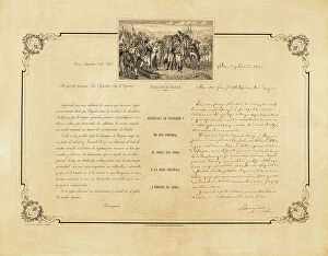
Background imageChart Collection: BONAPARTE, Joseph (1768-1844). King of Naples (1806-1808) and Spain (1808-1813)

BONAPARTE, Joseph (1768-1844). King of Naples (1806-1808) and Spain (1808-1813).; NAPOLEON I Bonaparte (1769-1821)
CUL4870745 BONAPARTE, Joseph (1768-1844). King of Naples (1806-1808) and Spain (1808-1813).; NAPOLEON I Bonaparte (1769-1821). French military man and politician, Emperor of France (1804-1815)

Background imageChart Collection: Map showing the area in the North Sea mined by the British during WWI

Map showing the area in the North Sea mined by the British during WWI, from The War Illustrated Album Deluxe, pub.1915
3502686 Map showing the area in the North Sea mined by the British during WWI, from The War Illustrated Album Deluxe, pub.1915; (add.info)

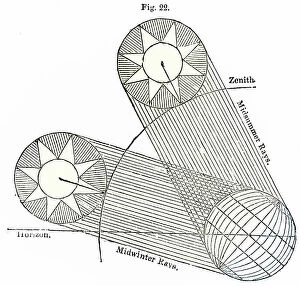
Background imageChart Collection: The altitude of the sun over London in summer and winter, 1838

The altitude of the sun over London in summer and winter, 1838
3480255 The altitude of the sun over London in summer and winter, 1838; (add.info.: Diagram showing the altitude of the sun over London in summer and winter. From The Saturday Magazine)

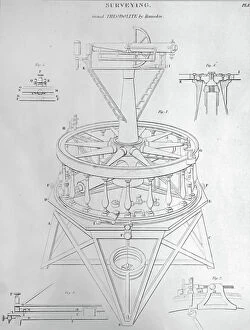
Background imageChart Collection: The Grand Theodolite, 1850

The Grand Theodolite, 1850
3480118 The Grand Theodolite, 1850; (add.info.: Diagram depicting the Grand Theodolite; a surveying instrument with a rotating telescope for measuring horizontal and vertical angles)

Background imageChart Collection: Synoptic Chart of Anatomy

Synoptic Chart of Anatomy
2625388 Synoptic Chart of Anatomy; (add.info.: Synoptic charts concerning the anatomy of the upper and lower jaw (fakk), from the second chapter (bab) of the second book (kit)

Background imageChart Collection: Acupuncture chart for rear of the body. 19th century (Japanese wood block)

Acupuncture chart for rear of the body. 19th century (Japanese wood block)
536297 Acupuncture chart for rear of the body. 19th century (Japanese wood block); Universal History Archive/UIG.

Background imageChart Collection: Chart compiled from London Bills of Mortality for 1796-1800, showing the number of deaths

Chart compiled from London Bills of Mortality for 1796-1800, showing the number of deaths from various causes
527510 Chart compiled from London Bills of Mortality for 1796-1800, showing the number of deaths from various causes and the number of deaths at differenct ages

Background imageChart Collection: Famous rivers: The Congo (litho)

Famous rivers: The Congo (litho)
8634761 Famous rivers: The Congo (litho) by English School, (20th century); Private Collection; (add.info.: The Congo. Illustration for Chatterbox, 1913.); © Look and Learn.

Background imageChart Collection: Roman Bath, Bath (litho)

Roman Bath, Bath (litho)
8634655 Roman Bath, Bath (litho) by Taylor, Alfred John (1878-1938); Private Collection; (add.info.: Roman Bath, Bath. Plan prepared by Alfred J Taylor.); © Look and Learn.

Background imageChart Collection: Cross section diagram of the Mersey Tunnel, Liverpool (litho)

Cross section diagram of the Mersey Tunnel, Liverpool (litho)
8675793 Cross section diagram of the Mersey Tunnel, Liverpool (litho) by English School, (20th century); Private Collection; (add.info.: Cross section diagram of the Mersey Tunnel)

Background imageChart Collection: Map of the settlements of Angles, Saxons and Jutes in Britain c. 600 (print)

Map of the settlements of Angles, Saxons and Jutes in Britain c. 600 (print)
2603521 Map of the settlements of Angles, Saxons and Jutes in Britain c. 600 (print); (add.info.: From Historical Atlas, published 1923.).

Background imageChart Collection: Map of Acadia, 17th century colony of New France in northeastern North America

Map of Acadia, 17th century colony of New France in northeastern North America, and the water highway to Canada
2603482 Map of Acadia, 17th century colony of New France in northeastern North America, and the water highway to Canada. From The History of Our Country, published 1899.

Background imageChart Collection: Portion of the Hauslab Globe based on the Martin Hylacomylus Waltzemu¨ller map of 1507

Portion of the Hauslab Globe based on the Martin Hylacomylus Waltzemu¨ller map of 1507
2915319 Portion of the Hauslab Globe based on the Martin Hylacomylus Waltzemu¨ller map of 1507. From the book Life of Christopher Columbus by Clements R

Background imageChart Collection: Plan of an English mediaeval manor ddated 14th century (print)

Plan of an English mediaeval manor ddated 14th century (print)
2603530 Plan of an English mediaeval manor ddated 14th century (print); (add.info.: From Historical Atlas, published 1923.).

Background imageChart Collection: A map of Spain after the invasion of the Visigoths in the 5th century

A map of Spain after the invasion of the Visigoths in the 5th century
3253072 A map of Spain after the invasion of the Visigoths in the 5th century; (add.info.: A map of Spain after the invasion of the Visigoths in the 5th century)

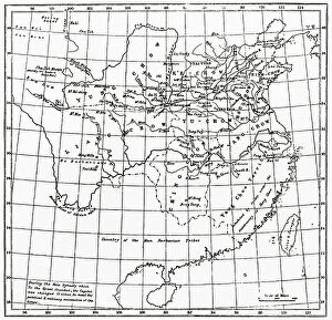
Background imageChart Collection: A map of China under the Hsia Dynasty, 2205 BC. From Hutchinson's History of the Nations

A map of China under the Hsia Dynasty, 2205 BC. From Hutchinson's History of the Nations, published 1915
3033759 A map of China under the Hsia Dynasty, 2205 BC. From Hutchinson's History of the Nations, published 1915.; Private Collection.

Background imageChart Collection: Martin Behaim´s Globe, 1492. From the book Life of Christopher Columbus by Clements R

Martin Behaim´s Globe, 1492. From the book Life of Christopher Columbus by Clements R. Markham published 1892
2915312 Martin Behaim´s Globe, 1492. From the book Life of Christopher Columbus by Clements R. Markham published 1892.; Photo © Hilary Morgan.

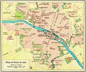
Background imageChart Collection: Plan of Paris, France in 1789. From Historical Atlas, published 1923 (print)

Plan of Paris, France in 1789. From Historical Atlas, published 1923 (print)
2603517 Plan of Paris, France in 1789. From Historical Atlas, published 1923 (print).

Background imageChart Collection: Title page from 'The First Six Books of the elements of Euclid' by Oliver Byrne published in 1847

Title page from 'The First Six Books of the elements of Euclid' by Oliver Byrne published in 1847
5668983 Title page from 'The First Six Books of the elements of Euclid' by Oliver Byrne published in 1847; (add.info.: Photograph of title page from original 1847 first edition)

Background imageChart Collection: COSA, Juan de la (1460-1510). Cartographer. Chart by Juan de la Cosa (1500). SPAIN

COSA, Juan de la (1460-1510). Cartographer. Chart by Juan de la Cosa (1500). SPAIN. MADRID (AUTONOMOUS COMMUNITY)
CUL4869240 COSA, Juan de la (1460-1510). Cartographer. Chart by Juan de la Cosa (1500). SPAIN. MADRID (AUTONOMOUS COMMUNITY). Madrid. Navy Museum; (add.info.: COSA, Juan de la (1460-1510)

Background imageChart Collection: Kepler's illustration to explain his discovery of the elliptical orbit of Mars

Kepler's illustration to explain his discovery of the elliptical orbit of Mars
541697 Kepler's illustration to explain his discovery of the elliptical orbit of Mars. From Johannes Kepler Astronomia Nova ... de Motibus Stellae Martis 1609

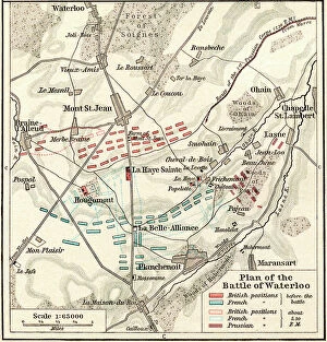
Background imageChart Collection: Plan of the Battle of Waterloo, June 16-18, 1815. From Historical Atlas, published 1923

Plan of the Battle of Waterloo, June 16-18, 1815. From Historical Atlas, published 1923
2603479 Plan of the Battle of Waterloo, June 16-18, 1815. From Historical Atlas, published 1923..

Background imageChart Collection: Zheng He (1371-1435) Chinese mariner, explorer and naval commander

Zheng He (1371-1435) Chinese mariner, explorer and naval commander. His sailing charts were published in in 1628 in
528880 Zheng He (1371-1435) Chinese mariner, explorer and naval commander. His sailing charts were published in in 1628 in 'Wubei Zhi' (Treatise on Armament Technology)

Background imageChart Collection: Anatomy chart by Galen

Anatomy chart by Galen
3892962 Anatomy chart by Galen; Private Collection; (add.info.: 2nd century); Photo © Derek Bayes. All rights reserved 2022.

Background imageChart Collection: The Moluccas, page from a portolan atlas by Lopo Homem and Pedro Reinel, c.1519 (vellum)

The Moluccas, page from a portolan atlas by Lopo Homem and Pedro Reinel, c.1519 (vellum)
XZL151165 The Moluccas, page from a portolan atlas by Lopo Homem and Pedro Reinel, c.1519 (vellum); Bibliotheque Nationale, Paris, France; out of copyright.

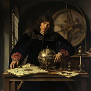
Background imageChart Collection: AI IMAGE - Portrait of Nicolaus Copernicus, early 16th century, (2023). Creator: Heritage Images

AI IMAGE - Portrait of Nicolaus Copernicus, early 16th century, (2023). Creator: Heritage Images
AI IMAGE - Portrait of Nicolaus Copernicus, early 16th century, (2023). Copernicus (1473-1543) was a Polish Renaissance polymath, active as a mathematician, astronomer, and Catholic canon


All Professionally Made to Order for Quick Shipping

"Unlocking the Secrets: Exploring the Fascinating World of Charts" Dive into the realm of reflexology with a detailed foot map chart, revealing hidden connections between pressure points and overall well-being. Immerse yourself in breathtaking artwork as "Kiss of the Oceans" captures the meeting point between Atlantic and Pacific through a mesmerizing chart inspired by the Panama Canal. Travel back in time with a captivating map showcasing the vast Ancient Persian Empire, unraveling its grandeur and historical significance. Follow in the footsteps of greatness as you trace King Alexander the Great's conquests on an intricate chart mapping his empire's expansion across continents. Join forces with The Salvation Army Campaign through their emblematic chart, highlighting their noble mission to bring hope and aid to those in need. Unveil Masonic mysteries through an enchanting chart that delves into both symbolic imagery and rich history surrounding Free and Accepted Masons. Embark on a journey through time with a remarkable Masonic chart, shedding light on ancient rituals, traditions, and brotherhood within this enigmatic society. Explore distant lands from centuries past as an Anglo-Saxon 10th-century world map unfolds before your eyes, offering insights into early cartography techniques. Discover rugged beauty amidst towering peaks with an old map of the Alps; let it guide you through nature's wonders while tracing historic routes taken by explorers long ago. Gain strategic insight during WWII using a military-focused map of Beirut, Lebanon; uncover hidden locations crucial for wartime operations throughout this historically significant cityscape. Step back in time to 1768 Edinburgh as James Craig's Map reveals New Town's first plan—a testament to meticulous topography shaping Scotland's capital cityscape over centuries. Test your vision acuity against an eye-catching eyesight test chart; decipher letters or symbols while appreciating the importance of visual health in our daily lives.