Fraud Blocker Skip to main content

Counties Collection (page 7)

"Exploring the rich tapestry of counties through captivating maps and historical landmarks" Scotland Road Map

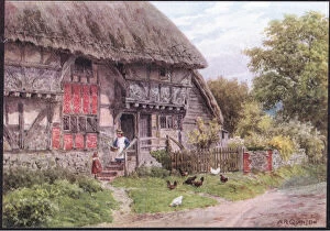
Background imageCounties Collection: The Cottage Door, Elmley Castle, Worcester, from The Cottages

The Cottage Door, Elmley Castle, Worcester, from The Cottages
2637711 The Cottage Door, Elmley Castle, Worcester, from The Cottages and the Village Life of Rural England published by Dent & Sons Limited, 1912 (colour litho) by Quinton

Background imageCounties Collection: Cropthorne, Nr Evesham, Worcester, from The Cottages and the Village Life of Rural

Cropthorne, Nr Evesham, Worcester, from The Cottages and the Village Life of Rural
2637683 Cropthorne, Nr Evesham, Worcester, from The Cottages and the Village Life of Rural England published by Dent & Sons Limited, 1912 (colour litho) by Quinton

Background imageCounties Collection: Old Cottage, Bignor, Sussex, from The Cottages and the Village Life of Rural England

Old Cottage, Bignor, Sussex, from The Cottages and the Village Life of Rural England
2637675 Old Cottage, Bignor, Sussex, from The Cottages and the Village Life of Rural England published by Dent & Sons Limited, 1912 (colour litho) by Quinton

Background imageCounties Collection: Dunster, Somerset, from The Cottages and the Village Life of Rural England published by

Dunster, Somerset, from The Cottages and the Village Life of Rural England published by
2637674 Dunster, Somerset, from The Cottages and the Village Life of Rural England published by Dent & Sons Limited, 1912 (colour litho) by Quinton

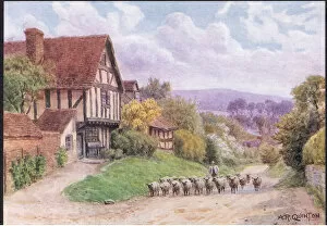
Background imageCounties Collection: Evening, Elmley Castle, Worcester, from The Cottages and the Village Life of Rural

Evening, Elmley Castle, Worcester, from The Cottages and the Village Life of Rural
2637673 Evening, Elmley Castle, Worcester, from The Cottages and the Village Life of Rural England published by Dent & Sons Limited, 1912 (colour litho) by Quinton

Background imageCounties Collection: Map of the state of Massachusetts, 1801 (engraving)

Map of the state of Massachusetts, 1801 (engraving)
AQS256858 Map of the state of Massachusetts, 1801 (engraving) by American School, (19th century); American Antiquarian Society, Worcester, Massachusetts, USA; eCourtesy

Background imageCounties Collection: Map of Hampshire (colour engraving)

Map of Hampshire (colour engraving)
979804 Map of Hampshire (colour engraving) by Morden, Robert (fl.1682-1703); Private Collection; (add.info.: Map of Hampshire, by Robert Morden)

Background imageCounties Collection: Map of Sussex (colour engraving)

Map of Sussex (colour engraving)
979828 Map of Sussex (colour engraving) by Morden, Robert (fl.1682-1703); Private Collection; (add.info.: Map of Sussex, by Robert Morden)

Background imageCounties Collection: Map of the North Riding of Yorkshire (colour engraving)

Map of the North Riding of Yorkshire (colour engraving)
979823 Map of the North Riding of Yorkshire (colour engraving) by Morden, Robert (fl.1682-1703); Private Collection; (add.info.: Map of the North Riding of Yorkshire, by Robert Morden)

Background imageCounties Collection: Map of Philadelphia County, 1819 (colour litho)

Map of Philadelphia County, 1819 (colour litho)
3058567 Map of Philadelphia County, 1819 (colour litho) by American School, (19th century); Free Library of Philadelphia; eFree Library of Philadelphia; American, out of copyright

Background imageCounties Collection: Cheshire, Making Block Salt (chromolitho)

Cheshire, Making Block Salt (chromolitho)
2799213 Cheshire, Making Block Salt (chromolitho) by English School, (20th century); Private Collection; (add.info.: Cheshire, Making Block Salt)

Background imageCounties Collection: Kent, Hop Picking (chromolitho)

Kent, Hop Picking (chromolitho)
2799208 Kent, Hop Picking (chromolitho) by English School, (20th century); Private Collection; (add.info.: Kent, Hop Picking)

Background imageCounties Collection: Leicester, Hosiery (chromolitho)

Leicester, Hosiery (chromolitho)
2799220 Leicester, Hosiery (chromolitho) by English School, (20th century); Private Collection; (add.info.: Leicester, Hosiery)

Background imageCounties Collection: Northumberland, Shipbuilding (chromolitho)

Northumberland, Shipbuilding (chromolitho)
2799215 Northumberland, Shipbuilding (chromolitho) by English School, (20th century); Private Collection; (add.info.: Northumberland, Shipbuilding)

Background imageCounties Collection: Kelso Abbey (engraving)

Kelso Abbey (engraving)
2777214 Kelso Abbey (engraving) by English School, (19th century); Private Collection; (add.info.: Kelso Abbey. Illustration for The History and Legends of Old Castles And Abbeys (John Dicks)

Background imageCounties Collection: West Hagbourne, Berkshire, from The Cottages and the Village Life of Rural England

West Hagbourne, Berkshire, from The Cottages and the Village Life of Rural England
2637712 West Hagbourne, Berkshire, from The Cottages and the Village Life of Rural England published by Dent & Sons Limited, 1912 (colour litho) by Quinton

Background imageCounties Collection: Cottage garden, Selworthy, Somerset, from The Cottages and the Village Life of Rural

Cottage garden, Selworthy, Somerset, from The Cottages and the Village Life of Rural
2637701 Cottage garden, Selworthy, Somerset, from The Cottages and the Village Life of Rural England published by Dent & Sons Limited, 1912 (colour litho) by Quinton

Background imageCounties Collection: Interior of a Surrey cottage, from The Cottages and the Village Life of Rural England

Interior of a Surrey cottage, from The Cottages and the Village Life of Rural England
2637696 Interior of a Surrey cottage, from The Cottages and the Village Life of Rural England published by Dent & Sons Limited, 1912 (litho) by Quinton

Background imageCounties Collection: Farmhouse, Brent Eleigh, Suffolk, from The Cottages and the Village Life of Rural England

Farmhouse, Brent Eleigh, Suffolk, from The Cottages and the Village Life of Rural England
2637692 Farmhouse, Brent Eleigh, Suffolk, from The Cottages and the Village Life of Rural England published by Dent & Sons Limited, 1912 (colour litho) by Quinton

Background imageCounties Collection: The kitchen, Old Sow, Kent, from The Cottages and the Village Life of Rural England

The kitchen, Old Sow, Kent, from The Cottages and the Village Life of Rural England
2637715 The kitchen, Old Sow, Kent, from The Cottages and the Village Life of Rural England published by Dent & Sons Limited, 1912 (litho) by Quinton

Background imageCounties Collection: Almhouses, Selworthy Green, Somerset, from The Cottages

Almhouses, Selworthy Green, Somerset, from The Cottages
2637693 Almhouses, Selworthy Green, Somerset, from The Cottages and the Village Life of Rural England published by Dent & Sons Limited, 1912 (colour litho) by Quinton

Background imageCounties Collection: The Cottage Steps, Ardington, Berkshire, from The Cottages

The Cottage Steps, Ardington, Berkshire, from The Cottages
2637686 The Cottage Steps, Ardington, Berkshire, from The Cottages and the Village Life of Rural England published by Dent & Sons Limited, 1912 (colour litho) by Quinton

Background imageCounties Collection: The Walks, Groombridge, Kent, from The Cottages and the Village Life of Rural England

The Walks, Groombridge, Kent, from The Cottages and the Village Life of Rural England
2637672 The Walks, Groombridge, Kent, from The Cottages and the Village Life of Rural England published by Dent & Sons Limited, 1912 (colour litho) by Quinton

Background imageCounties Collection: A Group of Grasshoppers (colour litho)

A Group of Grasshoppers (colour litho)
5210945 A Group of Grasshoppers (colour litho) by Carreras, Theobald (1829-95); Private Collection; (add.info.: A Group of Grasshoppers)

Background imageCounties Collection: Map of Rutland (colour engraving)

Map of Rutland (colour engraving)
979826 Map of Rutland (colour engraving) by English School, (18th century); Private Collection; (add.info.: Map of Rutland)

Background imageCounties Collection: Map of the East Riding of Yorkshire (colour engraving)

Map of the East Riding of Yorkshire (colour engraving)
979803 Map of the East Riding of Yorkshire (colour engraving) by Morden, Robert (fl.1682-1703); Private Collection; (add.info.: Map of the East Riding of Yorkshire, by Robert Morden)

Background imageCounties Collection: Map of Durham (colour engraving)

Map of Durham (colour engraving)
979802 Map of Durham (colour engraving) by Morden, Robert (fl.1682-1703); Private Collection; (add.info.: Map of Durham (Episdopaius Dunelmensis vulgo the Bishoprick of Durham), by Robert Morden

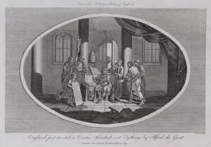
Background imageCounties Collection: England first divided in Counties, Hundreds, and Tythings by Alfred the Great (engraving)

England first divided in Counties, Hundreds, and Tythings by Alfred the Great (engraving)
1108009 England first divided in Counties, Hundreds, and Tythings by Alfred the Great (engraving) by English School, (18th century); Private Collection; (add.info.: England first divided in Counties)

Background imageCounties Collection: Sopwith Gnu G-EAGP

Sopwith Gnu G-EAGP of Southern Counties Aviation Date: 1919

Background imageCounties Collection: READING A ROAD MAP

READING A ROAD MAP
To the adventurous schoolboy there is high romance in following the line of a road, even on paper and the mature motorist delights in following the route correctly. Date: 1940s

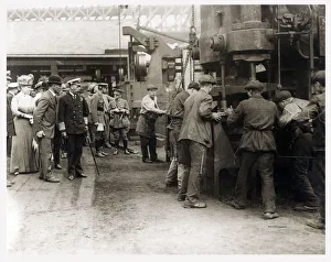
Background imageCounties Collection: King George V (1865-1936) and Queen Mary (1867-1953) visit a factory workshop during

King George V (1865-1936) and Queen Mary (1867-1953) visit a factory workshop during a tour of the North Eastern Counties of England. Date: circa 1916

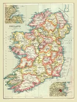
Background imageCounties Collection: Map of Ireland, 1902. Creator: Unknown

Map of Ireland, 1902. Creator: Unknown
Map of Ireland, 1902. Showing the island of Ireland before the partition of the six counties which became Northern Ireland, with insets showing Dublin and Belfast

Background imageCounties Collection: Map of Denmark, 1902. Creator: Unknown

Map of Denmark, 1902. Creator: Unknown
Map of Denmark, 1902. Showing the various counties and islands, and inset of Copenhagen. From The Century Atlas of the World. [John Walker & Co, Ltd. London, 1902]

Background imageCounties Collection: Map of England and Wales, 1902. Creator: Unknown

Map of England and Wales, 1902. Creator: Unknown
Map of England and Wales, 1902. Showing the various counties. From The Century Atlas of the World. [John Walker & Co, Ltd. London, 1902]

Background imageCounties Collection: Letter of Cesario, abbot of Santa Cecilia de Montserrat, notifying the Pope of Rome

Letter of Cesario, abbot of Santa Cecilia de Montserrat, notifying the Pope of Rome, John XIII, thas has been ordained archbishop of Tarragona

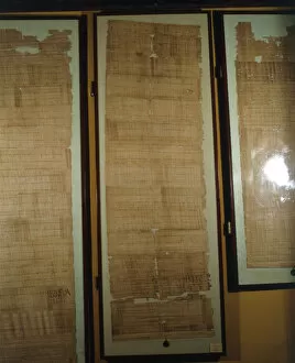
Background imageCounties Collection: Privilege granted by Pope John XIII Dilectioni et Fraternitati to the bishops of Gauls

Privilege granted by Pope John XIII Dilectioni et Fraternitati to the bishops of Gauls, papyrus document issued in Rome, January 971

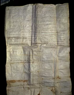
Background imageCounties Collection: Privilege granted by Pope John XIII If pastors ovium Archbishop Ato from Vic

Privilege granted by Pope John XIII If pastors ovium Archbishop Ato from Vic, the document granting the pallium to Ato, badge symbolizing the power of the archbishop within the church

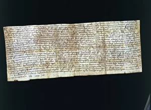
Background imageCounties Collection: Sale to Radulf, son of Count Guifre I el Pelos (Wilfred I the Hairy), of

Sale to Radulf, son of Count Guifre I el Pelos (Wilfred I the Hairy), of a vineyard located in the county of Osona, parchment document, dated May 30, 911

Background imageCounties Collection: Decree of the Synod of Agde, parchment document, dated 907

Decree of the Synod of Agde, parchment document, dated 907

Background imageCounties Collection: Andalusian gold dinar, also called Mancuso, used in Catalan counties during feudal times

Andalusian gold dinar, also called Mancuso, used in Catalan counties during feudal times

Background imageCounties Collection: Sacramental Witness of Count Bernat I of Besalu the Tallaferro (? 970 - 1020)

Sacramental Witness of Count Bernat I of Besalu the Tallaferro (? 970 - 1020), miniature in Liber Feudorum Maior, 12th century manuscript

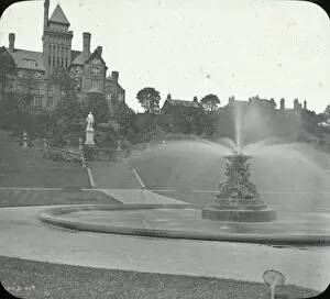
Background imageCounties Collection: The Park Preston

The Park Preston - fountain in centre, large Turreted building on left, houses and parkland. Part of Box 12 Boswell collection. Counties of England. Date: circa 1900

Background imageCounties Collection: Lord and Lady Coventry

Lord and Lady Coventry at the United Counties Show at Camarthen, Wales. Lord Coventry, George William Regionald Victor Coventry

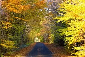
Background imageCounties Collection: Rural Road, Argyll And Bute, Scotland

Rural Road, Argyll And Bute, Scotland

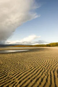
Background imageCounties Collection: Rippled Sand On A Beach, Argyll And Bute, Scotland

Rippled Sand On A Beach, Argyll And Bute, Scotland

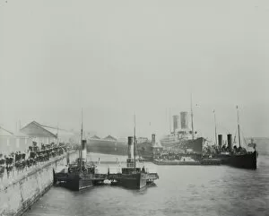
Background imageCounties Collection: Landing Stage, Liverpool

Landing Stage, Liverpool - small ships in foreground - large ships right background Sheds on left and in distance. Part of Box 12 Boswell collection. Counties of England. Date: circa 1900

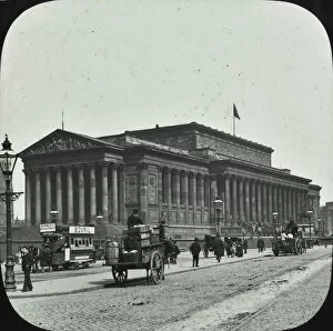
Background imageCounties Collection: St Georges hall Liverpool

St Georges hall Liverpool - St Georges Hall, Trams, carriages, pedestrians in front. Part of Box 12 Boswell collection. Counties of England. Date: circa 1900

Background imageCounties Collection: View of Aston Abbots, in the Whaddon Chase Hunt area

View of Aston Abbots, in the Whaddon Chase Hunt area, Buckinghamshire. Date: 1936


All Professionally Made to Order for Quick Shipping

"Exploring the rich tapestry of counties through captivating maps and historical landmarks" Scotland Road Map: Uncover the enchanting beauty of Scotland's diverse counties, from the stunning Highlands to the vibrant cities. WW2 Poster - Map of the British Army: Discover how county boundaries played a crucial role in strategizing during World War II, as depicted on this historic map. France Administrative Political Map: Delve into France's intricate administrative divisions, showcasing its unique system of departments and regions. Map of England, 1800s: Step back in time with this vintage map, tracing the evolution of England's counties throughout centuries of history. Children's Political British Isles Map: Introduce young minds to geography with this playful yet informative map highlighting Britain's counties and their capital cities. Viking Britain Map: Embark on a journey through time as you explore how Viking invaders shaped the borders and settlements within Britain's ancient counties. Ireland Political Road Map: Navigate your way across Ireland using this detailed road map that showcases its distinct political divisions known as counties. Maps / Australia Post-1876: Witness Australia's transformation post-1876 through an array of maps depicting evolving county lines and territorial changes over time. Carmarthen County Lunatic Asylum, South Wales: Reflect upon a darker chapter in history at Carmarthen County Lunatic Asylum, once home to those suffering from mental illness in South Wales' county system. Guiltcross Union Workhouse, Kenninghall, Norfolk: Gain insight into social welfare practices by exploring Guiltcross Union Workhouse—a testament to Norfolk County’s efforts to support its most vulnerable residents in times past. Map of Scotland 1902 (Creator Unknown): Unearth hidden gems within Scotland’s picturesque landscapes as you trace your way along its fascinating county boundaries captured on this century-old map. England / Wareside.