Fraud Blocker Skip to main content

Counties Collection (page 9)

"Exploring the rich tapestry of counties through captivating maps and historical landmarks" Scotland Road Map

Background imageCounties Collection: Cathedral Chester

Cathedral Chester - Cathedral. Part of Box 12 Boswell collection. Counties of England. Date: circa 1900

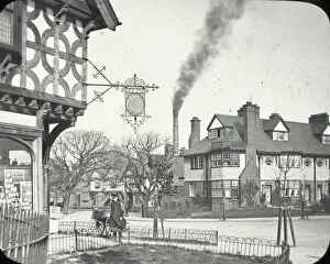
Background imageCounties Collection: Port Sunlight nr Birkenhead

Port Sunlight nr Birkenhead - village Street, timbered inn in foreground, Factory Chimney smoking. Part of Box 12 Boswell collection. Counties of England. Date: circa 1900

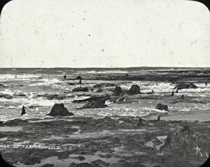
Background imageCounties Collection: Submarine forest, nr Birkenhead

Submarine forest, nr Birkenhead - large areas of scattered fossilised trees.. Part of Box 12 Boswell collection. Counties of England. Date: circa 1900

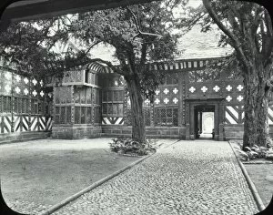
Background imageCounties Collection: Speke Hall

Speke Hall - Elizabethan Building - trees in Foreground. Part of Box 12 Boswell collection. Counties of England. Date: circa 1900

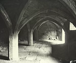
Background imageCounties Collection: Crypt, St Marys Priory, Birkenhead

Crypt, St Marys Priory, Birkenhead - Crypt of St Marys Priory. Part of Box 12 Boswell collection. Counties of England. Date: circa 1900

Background imageCounties Collection: Railway Bridge, Runcorn

Railway Bridge, Runcorn - bridge over river, steamer in front, Spit of land on left. Part of Box 12 Boswell collection. Counties of England. Date: circa 1900

Background imageCounties Collection: Cleetham Hospital Manchester

Cleetham Hospital Manchester - brick Building, Gothic shaped small windows, Fireplace crossed swords. Part of Box 12 Boswell collection. Counties of England. Date: circa 1900

Background imageCounties Collection: Town Hall Manchester

Town Hall Manchester - Town Hall, cobbled Street in foreground. Part of Box 12 Boswell collection. Counties of England. Date: circa 1900

Background imageCounties Collection: Dog show at Hastings

Dog show at Hastings
A number of dogs on show at the Southern Counties Canine Association championship dog show in Hastings, some of them posing with their respective owners

Background imageCounties Collection: View near Shinfield, South Berkshire Hunt area

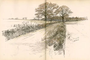
View near Shinfield, South Berkshire Hunt area
Landscape view near Shinfield, in the South Berkshire Hunt area. Date: 1936

Background imageCounties Collection: Six hounds of the South Berkshire Hunt

Six hounds of the South Berkshire Hunt. Date: 1936

Background imageCounties Collection: Saunders Farm, Holyport, in the Garth Hunt area, Berkshire

Saunders Farm, Holyport, in the Garth Hunt area, Berkshire
Landscape view on Saunders Farm, Holyport, in the Garth Hunt area, Berkshire. Date: 1936

Background imageCounties Collection: Hounds of the Grafton Hunt in action

Hounds of the Grafton Hunt in action
Hounds of the Grafton Hunt (operating in Northamptonshire and Buckinghamshire) in action. Date: 1936

Background imageCounties Collection: Balloons taking off near Newquay, Cornwall

Balloons taking off near Newquay, Cornwall. Date: circa 1980s

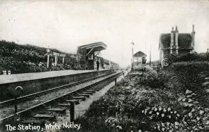
Background imageCounties Collection: The Railway Station, White Notley, Essex

The Railway Station, White Notley, Essex
The Railway Station, White Notley, Witham, near Braintree, Essex, England. Eastern Counties Railway Date: 1910s

Background imageCounties Collection: WW2 Christmas card, DMP

WW2 Christmas card, DMP (Dried Milk Products, Cow & Gate, Home Counties Dairies). Date: 1942

Background imageCounties Collection: British roads damaged by military traffic, WW1

British roads damaged by military traffic, WW1
A map of the Southern counties of Britain prepared by the Automobile Association and the Motor Union to indicate the stretches of road extensively damaged by the passage of military traffic

Background imageCounties Collection: Eastern Counties Railway Saloon

Eastern Counties Railway Saloon
An exterior diagram of a smoking saloon on the Eastern Counties Railway. The enclosed central compartment is bookended by two lobbies for those who prefer to travel in the open air

Background imageCounties Collection: Arrival of the Christmas train, Eastern Counties Railway

Arrival of the Christmas train, Eastern Counties Railway
An engraving showing passengers loading their luggage, preparing to depart for Christmas. Date: 1850

Background imageCounties Collection: Source Size = 3952 x 2714

Source Size = 3952 x 2714
Southern Counties Exhibition of Arts in the New Assembly Rooms, at the Pavilion, Brighton, Uk, 1867

Background imageCounties Collection: Source Size = 1908 x 1738

Source Size = 1908 x 1738
Office of the Midland Counties Insurance Company, Lincoln

Background imageCounties Collection: Map of Scotland in 1290, from A Short History of the English People by J

Map of Scotland in 1290, from A Short History of the English People by J
KW392520 Map of Scotland in 1290, from A Short History of the English People by J. R. Green, published 1893 (colour litho) by English School, (19th century); Private Collection; Ken Welsh; English

Background imageCounties Collection: Map of Britain in 665, from The Northumbrian Kingdom 588 to 685 in A Short History

Map of Britain in 665, from The Northumbrian Kingdom 588 to 685 in A Short History
KW392505 Map of Britain in 665, from The Northumbrian Kingdom 588 to 685 in A Short History of the English People by J. R

Background imageCounties Collection: Map of Britain in 792, from The Three Kingdoms 685 to 828 in A Short History

Map of Britain in 792, from The Three Kingdoms 685 to 828 in A Short History
KW392506 Map of Britain in 792, from The Three Kingdoms 685 to 828 in A Short History of the English People by J. R. Green, published 1893 (litho) by English School

Background imageCounties Collection: Map of Britain in 640, from The Northumbrian Kingdom in A Short History of the

Map of Britain in 640, from The Northumbrian Kingdom in A Short History of the
KW392504 Map of Britain in 640, from The Northumbrian Kingdom in A Short History of the English People by J. R. Green, published 1893 (litho) by English School

Background imageCounties Collection: Map of Britain in 634, from The Northumbrian Kingdom 588 to 685 in A Short History

Map of Britain in 634, from The Northumbrian Kingdom 588 to 685 in A Short History
KW392503 Map of Britain in 634, from The Northumbrian Kingdom 588 to 685 in A Short History of the English People by J. R

Background imageCounties Collection: Map of Britain in 626, from The Northumbrian Kingdom 588 to 685 in A Short History

Map of Britain in 626, from The Northumbrian Kingdom 588 to 685 in A Short History
KW392502 Map of Britain in 626, from The Northumbrian Kingdom 588 to 685 in A Short History of the English People by J. R

Background imageCounties Collection: HEAD-WATERS OF THE CONEMAUGH. John Augustus Hows, 1832 - 1874

HEAD-WATERS OF THE CONEMAUGH. John Augustus Hows, 1832 - 1874. The Conemaugh River is a long tributary of the Kiskiminetas River in Westmoreland, Indiana, and Cambria counties in the U.S

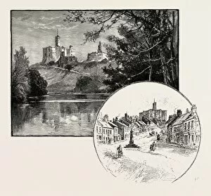
Background imageCounties Collection: Warkworth Castle (Left), the Village of Warkworth (Right)

Warkworth Castle (Left), the Village of Warkworth (Right)
WARKWORTH CASTLE (LEFT), THE VILLAGE OF WARKWORTH (RIGHT). Warkworth Castle is a ruined medieval building in the town of the same name in the English county of Northumberland

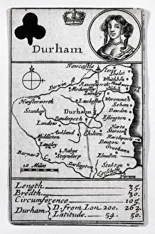
Background imageCounties Collection: Queen of Clubs and Durham map, c. 1675 (etching)

Queen of Clubs and Durham map, c. 1675 (etching)
XJF2906446 Queen of Clubs and Durham map, c.1675 (etching) by English School, (17th century); Private Collection; (add.info)

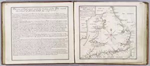
Background imageCounties Collection: Chart showing the sea coast of England and Wales, plate from A Compleat Sett

Chart showing the sea coast of England and Wales, plate from A Compleat Sett
XYC261681 Chart showing the sea coast of England and Wales, plate from A Compleat Sett of Mapps of England and Wales in General

Background imageCounties Collection: Map of Massachusetts, from Historical Collections of Massachusetts, by John Warren Barber

Map of Massachusetts, from Historical Collections of Massachusetts, by John Warren Barber
BAL124933 Map of Massachusetts, from Historical Collections of Massachusetts, by John Warren Barber, 1839 (engraving) by American School, (19th century); Private Collection; American, out of copyright

Background imageCounties Collection: The Kingdome of Scotland, engraved by Jodocus Hondius (1563-1612) from Theatre

The Kingdome of Scotland, engraved by Jodocus Hondius (1563-1612) from Theatre
XCF113485 The Kingdome of Scotland, engraved by Jodocus Hondius (1563-1612) from Theatre of the Empire of Great Britain, pub

Background imageCounties Collection: The Kingdome of England, engraved by Jodocus Hondius (1563-1612) from John Speed s

The Kingdome of England, engraved by Jodocus Hondius (1563-1612) from John Speed s
XCF113483 The Kingdome of England, engraved by Jodocus Hondius (1563-1612) from John Speeds Theatre of the Empire of Great Britain, pub

Background imageCounties Collection: Sheffield Bank

Sheffield Bank
22nd April 1909: The United Counties Bank in Sheffield, England. (Photo by Topical Press Agency/Getty Images)

Background imageCounties Collection: Picture No. 10856611

Picture No. 10856611
HORSE - Rodeo Saddle Bronc Horse Riding Date:

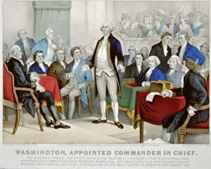
Background imageCounties Collection: American Revolutionary War (American War of Independence) 1775-1783: Washington appointed

American Revolutionary War (American War of Independence) 1775-1783: Washington appointed commander-in-chief by the Continental Congress

Background imageCounties Collection: HEAD-WATERS OF THE CONEMAUGH. John Augustus Hows, 1832 - 1874. The Conemaugh River

HEAD-WATERS OF THE CONEMAUGH. John Augustus Hows, 1832 - 1874. The Conemaugh River is a long tributary of the Kiskiminetas River in Westmoreland, Indiana, and Cambria counties in the U.S

Background imageCounties Collection: Warkworth Castle (Left), the Village of Warkworth (Right). Warkworth Castle is A

Warkworth Castle (Left), the Village of Warkworth (Right). Warkworth Castle is A
WARKWORTH CASTLE (LEFT), THE VILLAGE OF WARKWORTH (RIGHT). Warkworth Castle is a ruined medieval building in the town of the same name in the English county of Northumberland

Background imageCounties Collection: Franco-Prussian War: Map of Alsace and Lorraine, Counties Given to the German Empire 1870

Franco-Prussian War: Map of Alsace and Lorraine, Counties Given to the German Empire 1870

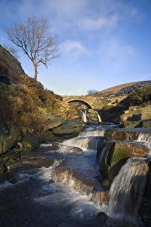
Background imageCounties Collection: Three Shire Head is a place where the borders of Cheshire Derbyshire

Three Shire Head is a place where the borders of Cheshire Derbyshire and Staffordshire meet - England
GUY-247 Three Shire Head is a place where the borders of Cheshire Derbyshire and Staffordshire meet England - UK Guy Rogers Please note that prints are for personal display purposes only

Background imageCounties Collection: Passenger Traffic map

Passenger Traffic map
Plan of licensed stage coaches running between London and the East of England, c.1840 Date: c. 1840

Background imageCounties Collection: Drought refguees from Oklahoma camping by the roadside

Drought refguees from Oklahoma camping by the roadside. They hope to work in the cotton fields. The official at the border (California-Arizona) inspection service said that on this day, August 17

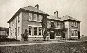
Background imageCounties Collection: Prudhoe Colony for Mental Defectives - Inmates House

Prudhoe Colony for Mental Defectives - Inmates House
" One of the houses for patient inmates at the " Colony for Mental Defectives" established in 1914 at Prudhoe, Northumberland

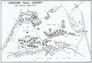
Background imageCounties Collection: Prudhoe Colony for Mental Defectives - Colony Layout Pl

Prudhoe Colony for Mental Defectives - Colony Layout Pl
" A layout plan of the " Colony for Mental Defectives" established in 1914 at Prudhoe, Northumberland, by the Northern Counties Joint Poor Law Committee." Date: 1930

Background imageCounties Collection: Prudhoe Colony for Mental Defectives - Infirmary

Prudhoe Colony for Mental Defectives - Infirmary
" The infirmary block at the " Colony for Mental Defectives" established in 1914 at Prudhoe, Northumberland, by the Northern Counties Joint Poor Law Committee." Date: 1930

Background imageCounties Collection: Prudhoe Colony for Mental Defectives - Birds Eye View

Prudhoe Colony for Mental Defectives - Birds Eye View
" A bird s-eye view illustration of the " Colony for Mental Defectives" established in 1914 at Prudhoe, Northumberland

Background imageCounties Collection: King Alfred defines the county boundaries

King Alfred defines the county boundaries
King Alfred the Great devises administrative reforms, redefining the division of England into Counties, Hundreds and Tithings Date: Circa 885


All Professionally Made to Order for Quick Shipping

"Exploring the rich tapestry of counties through captivating maps and historical landmarks" Scotland Road Map: Uncover the enchanting beauty of Scotland's diverse counties, from the stunning Highlands to the vibrant cities. WW2 Poster - Map of the British Army: Discover how county boundaries played a crucial role in strategizing during World War II, as depicted on this historic map. France Administrative Political Map: Delve into France's intricate administrative divisions, showcasing its unique system of departments and regions. Map of England, 1800s: Step back in time with this vintage map, tracing the evolution of England's counties throughout centuries of history. Children's Political British Isles Map: Introduce young minds to geography with this playful yet informative map highlighting Britain's counties and their capital cities. Viking Britain Map: Embark on a journey through time as you explore how Viking invaders shaped the borders and settlements within Britain's ancient counties. Ireland Political Road Map: Navigate your way across Ireland using this detailed road map that showcases its distinct political divisions known as counties. Maps / Australia Post-1876: Witness Australia's transformation post-1876 through an array of maps depicting evolving county lines and territorial changes over time. Carmarthen County Lunatic Asylum, South Wales: Reflect upon a darker chapter in history at Carmarthen County Lunatic Asylum, once home to those suffering from mental illness in South Wales' county system. Guiltcross Union Workhouse, Kenninghall, Norfolk: Gain insight into social welfare practices by exploring Guiltcross Union Workhouse—a testament to Norfolk County’s efforts to support its most vulnerable residents in times past. Map of Scotland 1902 (Creator Unknown): Unearth hidden gems within Scotland’s picturesque landscapes as you trace your way along its fascinating county boundaries captured on this century-old map. England / Wareside.