
County Map Collection
Step back in time with these fascinating old county maps. 🗺️✨ Travel through history as you explore the intricate details of these ancient cartographic treasures


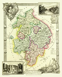
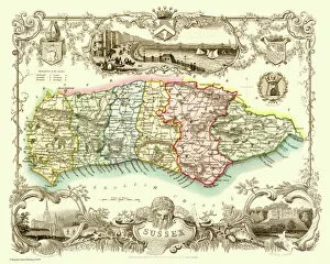
All Professionally Made to Order for Quick Shipping
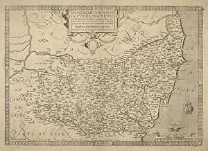
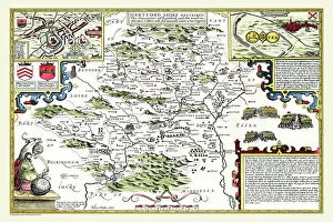
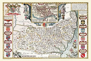
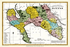
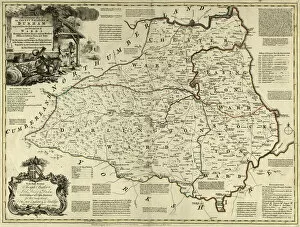
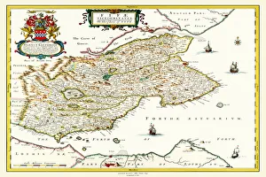
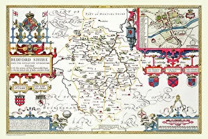
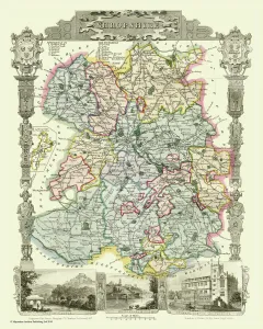
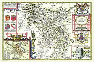
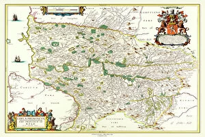
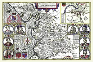
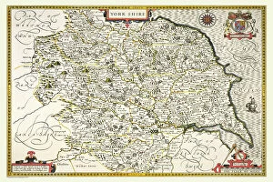
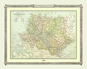
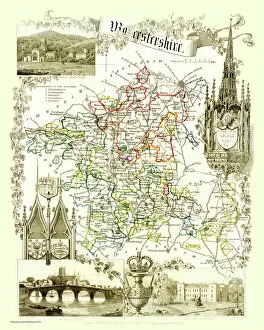
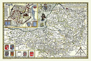
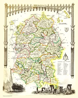
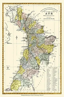
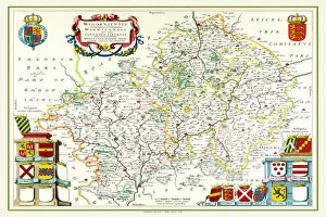
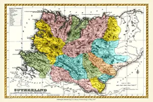
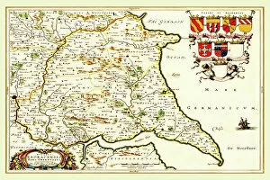
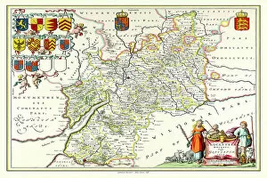
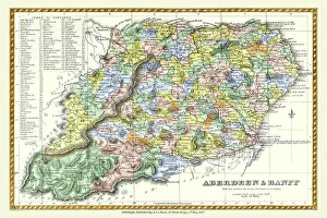
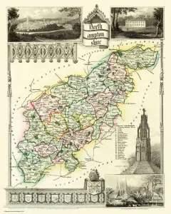
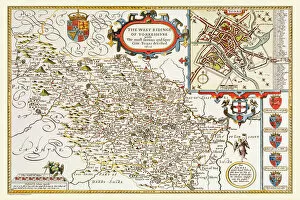
Step back in time with these fascinating old county maps. 🗺️✨ Travel through history as you explore the intricate details of these ancient cartographic treasures. The Old County Map of Fife 1654 by Johan Blaeu from the Atlas Novus takes us on a journey to Scotland, showcasing the region's boundaries and landmarks during that era. Meanwhile, John Speed's Old County Map of Hertfordshire 1611 offers a glimpse into this English county's past, revealing its towns and villages as they were over four centuries ago. Similarly, the County Map of County Durham c. 1777 allows us to immerse ourselves in the historical landscape of this northern English gem. Thomas Moule's Old County Map of Worcestershire 1836 transports us to rural England during the early Victorian period, displaying not only geographical features but also insights into local industries and culture. John Speed makes another appearance with his Old County Maps; this time we venture southwest to Cornwall in 1611. Discover how this picturesque coastal county appeared centuries ago before modern development took hold. Heading further inland, Thomas Moule presents an exquisite depiction of Shropshire in his Old County Map from 1836. Marvel at its charming market towns and rolling countryside that have stood the test of time. Johan Blaeu returns with his detailed map showcasing Kyle and Mid Ayrshire from 1654—another Scottish treasure filled with historical significance waiting to be explored. John Speed continues his legacy by mapping Lancashire in 1611—a window into one of England's most vibrant counties throughout history. From bustling cities like Manchester to serene landscapes like Lake District National Park, Lancashire has it all. Yorkshire comes alive through John Speed's eyes once again in his iconic Old County Map dating back to 1611. Uncover Yorkshire’s rich heritage while tracing its borders across dales, moors, and bustling cities.