Fraud Blocker Skip to main content

Geographical Border Collection (page 3)

"Exploring the Geographical Borders

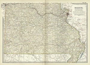
Background imageGeographical Border Collection: Map of the southern part of Missouri, c.1900 (engraving)

Map of the southern part of Missouri, c.1900 (engraving)
533203 Map of the southern part of Missouri, c.1900 (engraving); (add.info.: Map of the southern part of Missouri, United States, circa 1902)

Background imageGeographical Border Collection: Map of France, c.1900 (engraving)

Map of France, c.1900 (engraving)
532946 Map of France, c.1900 (engraving); (add.info.: Map of France with inset map of Vicinity of Marseille and the Mediterranean Coast of France, and Corsica, circa 1902)

Background imageGeographical Border Collection: Map of Florida with insets of cities, c.1900 (engraving)

Map of Florida with insets of cities, c.1900 (engraving)
533142 Map of Florida with insets of cities, c.1900 (engraving); (add.info.: Map of Florida, United States, with inset maps of Jacksonville, Tampa, St)

Background imageGeographical Border Collection: Map of Pennsylvania, with inset map of Pittsburg, c.1900 (engraving)

Map of Pennsylvania, with inset map of Pittsburg, c.1900 (engraving)
533118 Map of Pennsylvania, with inset map of Pittsburg, c.1900 (engraving); (add.info.: Map of Pennsylvania, with inset map of Pittsburg, circa 1902)

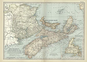
Background imageGeographical Border Collection: New Brunswick, Nova Scotia & Prince Edward Island, c.1900 (engraving)

New Brunswick, Nova Scotia & Prince Edward Island, c.1900 (engraving)
533083 New Brunswick, Nova Scotia & Prince Edward Island, c.1900 (engraving); (add.info.: Map of New Brunswick, Nova Scotia, and Prince Edward Island, Canada, with an inset of Newfoundland)

Background imageGeographical Border Collection: Map of northeastern Africa, c.1900 (engraving)

Map of northeastern Africa, c.1900 (engraving)
533059 Map of northeastern Africa, c.1900 (engraving); (add.info.: Map of northeast Africa, with insets of the Nile Delta and Suez Canal, circa 1902)

Background imageGeographical Border Collection: Map of Idaho and Wyoming, c.1900 (engraving)

Map of Idaho and Wyoming, c.1900 (engraving)
533214 Map of Idaho and Wyoming, c.1900 (engraving); (add.info.: Map of Idaho and Wyoming, United States, with an inset map of Yellowstone National Park, circa 1902)

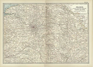
Background imageGeographical Border Collection: Map of France, c.1900 (engraving)

Map of France, c.1900 (engraving)
532949 Map of France, c.1900 (engraving); (add.info.: Map of north central France, in the vicinity of Paris, circa 1902, from the 10th edition of Encyclopaedia Britannica)

Background imageGeographical Border Collection: Map of the southern part of Michigan, c.1900 (engraving)

Map of the southern part of Michigan, c.1900 (engraving)
533184 Map of the southern part of Michigan, c.1900 (engraving); (add.info.: Map of the southern part of Michigan, United States, with inset maps of Detroit and the St)

Background imageGeographical Border Collection: Map of western Tennessee, c.1900 (engraving)

Map of western Tennessee, c.1900 (engraving)
533148 Map of western Tennessee, c.1900 (engraving); (add.info.: Map of the western part of Tennessee, circa 1902, from the 10th edition of Encyclopaedia Britannica.); Encyclopaedia Britannica/UIG

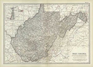
Background imageGeographical Border Collection: Map of West Virginia, c.1900 (engraving)

Map of West Virginia, c.1900 (engraving)
533127 Map of West Virginia, c.1900 (engraving); (add.info.: Map of West Virginia, United States, circa 1902, from the 10th edition of Encyclopaedia Britannica.); Encyclopaedia Britannica/UIG

Background imageGeographical Border Collection: Map of Virginia, c.1900 (engraving)

Map of Virginia, c.1900 (engraving)
533124 Map of Virginia, c.1900 (engraving); (add.info.: Map showing historical boundaries of Virginia, with inset maps of Richmond and Norfolk, circa 1902)

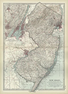
Background imageGeographical Border Collection: Map of New Jersey, c.1900 (engraving)

Map of New Jersey, c.1900 (engraving)
533112 Map of New Jersey, c.1900 (engraving); (add.info.: Map of New Jersey with inset map of Jersey City, Newark and Paterson, circa 1902)

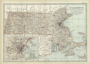
Background imageGeographical Border Collection: Map of Massachusetts, c.1900 (engraving)

Map of Massachusetts, c.1900 (engraving)
533096 Map of Massachusetts, c.1900 (engraving); (add.info.: State map of Massachusetts, United States, with inset map of Boston, circa 1902)

Background imageGeographical Border Collection: Map of Hong Kong, c.1900 (engraving)

Map of Hong Kong, c.1900 (engraving)
532770 Map of Hong Kong, c.1900 (engraving); (add.info.: Map of Hong Kong, circa 1900, from the 10th edition of Encyclopaedia Britannica.); Encyclopaedia Britannica/UIG

Background imageGeographical Border Collection: Map of Gibraltar, c.1900 (engraving)

Map of Gibraltar, c.1900 (engraving)
532764 Map of Gibraltar, c.1900 (engraving); (add.info.: Map of Gibraltar, circa 1900, from the 10th edition of Encyclopaedia Britannica.); Encyclopaedia Britannica/UIG

Background imageGeographical Border Collection: Map of Buffalo and the Niagara Frontier, c.1900 (engraving)

Map of Buffalo and the Niagara Frontier, c.1900 (engraving)
532728 Map of Buffalo and the Niagara Frontier, c.1900 (engraving); (add.info.: Map of Buffalo, New York, and the Niagara Frontier, circa 1900)

Background imageGeographical Border Collection: Map of Sitka and Glacier Bay, Alaska, c.1900 (engraving)

Map of Sitka and Glacier Bay, Alaska, c.1900 (engraving)
533464 Map of Sitka and Glacier Bay, Alaska, c.1900 (engraving); (add.info.: Map of Sitka and Glacier Bay, Alaska, circa 1902)

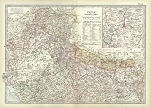
Background imageGeographical Border Collection: Map of northern India with Calcutta, c.1900 (engraving)

Map of northern India with Calcutta, c.1900 (engraving)
533016 Map of northern India with Calcutta, c.1900 (engraving); (add.info.: Map showing the historical boundaries of the northern part of India with an inset map of Calcutta (now Kolkata)

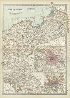
Background imageGeographical Border Collection: Map of the German Empire with Berlin and Hamburg, c.1900 (engraving)

Map of the German Empire with Berlin and Hamburg, c.1900 (engraving)
532964 Map of the German Empire with Berlin and Hamburg, c.1900 (engraving); (add.info.: Map showing the eastern part of the German Empire, with inset maps of Berlin and Hamburg, circa 1902)

Background imageGeographical Border Collection: Map of South Dakota, c.1900 (engraving)

Map of South Dakota, c.1900 (engraving)
533193 Map of South Dakota, c.1900 (engraving); (add.info.: State map of South Dakota, United States, circa 1902, from the 10th edition of Encyclopaedia Britannica.); Encyclopaedia Britannica/UIG

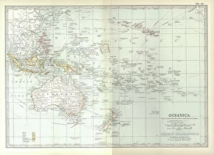
Background imageGeographical Border Collection: Map of Oceania, c.1900 (engraving)

Map of Oceania, c.1900 (engraving)
533039 Map of Oceania, c.1900 (engraving); (add.info.: Map of Oceanica (Oceania): Australia, New Zealand, Polynesia, Melanesia, and Hawaiian Islands, circa 1902

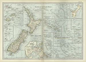
Background imageGeographical Border Collection: Map of Pacific Ocean Islands, c.1900 (engraving)

Map of Pacific Ocean Islands, c.1900 (engraving)
533048 Map of Pacific Ocean Islands, c.1900 (engraving); (add.info.: Map of Pacific Ocean Islands: New Zealand, Samoa, Fiji, Tonga, Guam, Marshall Islands, Solomon Islands, Mariana Islands)

Background imageGeographical Border Collection: Map of Greece with Crete and Samos, c.1900 (engraving)

Map of Greece with Crete and Samos, c.1900 (engraving)
533001 Map of Greece with Crete and Samos, c.1900 (engraving); (add.info.: Map showing detail of Greece with Crete and Samos, with insets of Crete and Athens, circa 1902)

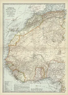
Background imageGeographical Border Collection: Map of northwestern Africa, c.1900 (engraving)

Map of northwestern Africa, c.1900 (engraving)
533056 Map of northwestern Africa, c.1900 (engraving); (add.info.: Map of northwest Africa with Morocco, Algeria, Tunis, Sahara, Senegal, Portuguese Guinea, circa 1902)

Background imageGeographical Border Collection: Map of the southern part of South America, c.1900 (engraving)

Map of the southern part of South America, c.1900 (engraving)
533267 Map of the southern part of South America, c.1900 (engraving); (add.info.: Map of southern South America, with inset maps of Buenos Aires, Montevideo, Valparaiso, and Santiago, circa 1902)

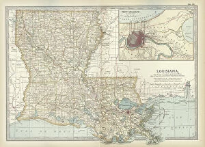
Background imageGeographical Border Collection: Map of Louisiana, c.1900 (engraving)

Map of Louisiana, c.1900 (engraving)
533158 Map of Louisiana, c.1900 (engraving); (add.info.: Map of Louisiana, United States, with inset map of New Orleans and Vicinity, circa 1902)

Background imageGeographical Border Collection: Map of the United States with inset of Alaska, c.1900 (engraving)

Map of the United States with inset of Alaska, c.1900 (engraving)
533086 Map of the United States with inset of Alaska, c.1900 (engraving); (add.info.: Map of United States with inset of Alaska, circa 1902)

Background imageGeographical Border Collection: Map of Manitoba and British Columbia, c.1900 (engraving)

Map of Manitoba and British Columbia, c.1900 (engraving)
533074 Map of Manitoba and British Columbia, c.1900 (engraving); (add.info.: Map of Manitoba, British Columbia, and the Northwest Territories, Canada, circa 1902)

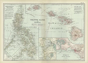
Background imageGeographical Border Collection: Map of Philippine Islands with Hawaii, c.1900 (engraving)

Map of Philippine Islands with Hawaii, c.1900 (engraving)
533033 Map of Philippine Islands with Hawaii, c.1900 (engraving); (add.info.: Map of Philippine Islands and Hawaii, with inset maps of Manila, Honolulu, and Pearl Harbor, circa 1902)

Background imageGeographical Border Collection: Map of colonial Africa with Madagascar, c.1900 (engraving)

Map of colonial Africa with Madagascar, c.1900 (engraving)
533062 Map of colonial Africa with Madagascar, c.1900 (engraving); (add.info.: Map of southern colonial Africa, with an inset of Madagascar, circa 1902)

Background imageGeographical Border Collection: Map of Arizona and New Mexico, c.1900 (engraving)

Map of Arizona and New Mexico, c.1900 (engraving)
533218 Map of Arizona and New Mexico, c.1900 (engraving); (add.info.: Map of Arizona and New Mexico, circa 1902, from the 10th edition of Encyclopaedia Britannica.); Encyclopaedia Britannica/UIG

Background imageGeographical Border Collection: North America map

North America map
Vector illustration of a detailed map of North America. Reference map was created by the US Central Intelligence Agency and is available as a public domain map at the University of Texas Libraries

Background imageGeographical Border Collection: USA, Nebraska, Omaha, Bob Kerry Pedestrian Bridge (Over The Missouri River), Boundry

USA, Nebraska, Omaha, Bob Kerry Pedestrian Bridge (Over The Missouri River), Boundry Line Between Nebraska and Iowa

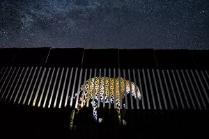
Background imageGeographical Border Collection: An image of a wild Jaguar (Panthera onca) is symbolically projected on to a section of

An image of a wild Jaguar (Panthera onca) is symbolically projected on to a section of the US-Mexico border wall. Jaguars have disappeared from the US in the last century

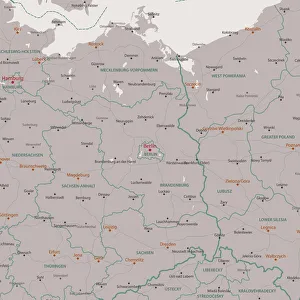
Background imageGeographical Border Collection: Berlin Brandenburg Area Vector Map

Berlin Brandenburg Area Vector Map. All source data is in the public domain. Made with Natural Earth. http://www.naturalearthdata.com/about/terms-of-use/

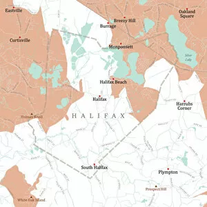
Background imageGeographical Border Collection: MA Plymouth Halifax Vector Road Map

MA Plymouth Halifax Vector Road Map. All source data is in the public domain. U.S. Census Bureau Census Tiger. Used Layers: areawater, linearwater, roads, rails, cousub, pointlm, uac10

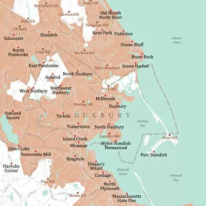
Background imageGeographical Border Collection: MA Plymouth Duxbury Vector Road Map

MA Plymouth Duxbury Vector Road Map. All source data is in the public domain. U.S. Census Bureau Census Tiger. Used Layers: areawater, linearwater, roads, rails, cousub, pointlm, uac10

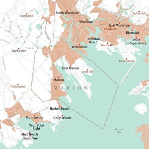
Background imageGeographical Border Collection: MA Plymouth Marion Vector Road Map

MA Plymouth Marion Vector Road Map. All source data is in the public domain. U.S. Census Bureau Census Tiger. Used Layers: areawater, linearwater, roads, rails, cousub, pointlm, uac10

Background imageGeographical Border Collection: MA Plymouth Hingham Vector Road Map

MA Plymouth Hingham Vector Road Map. All source data is in the public domain. U.S. Census Bureau Census Tiger. Used Layers: areawater, linearwater, roads, rails, cousub, pointlm, uac10

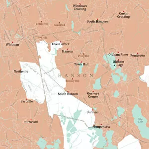
Background imageGeographical Border Collection: MA Plymouth Hanson Vector Road Map

MA Plymouth Hanson Vector Road Map. All source data is in the public domain. U.S. Census Bureau Census Tiger. Used Layers: areawater, linearwater, roads, rails, cousub, pointlm, uac10

Background imageGeographical Border Collection: MA Plymouth Vector Road Map

MA Plymouth Vector Road Map. All source data is in the public domain. U.S. Census Bureau Census Tiger. Used Layers: areawater, linearwater, roads, rails, cousub, pointlm, uac10

Background imageGeographical Border Collection: MA Plymouth Marshfield Vector Road Map

MA Plymouth Marshfield Vector Road Map. All source data is in the public domain. U.S. Census Bureau Census Tiger. Used Layers: areawater, linearwater, roads, rails, cousub, pointlm, uac10

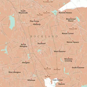
Background imageGeographical Border Collection: MA Plymouth Rockland Vector Road Map

MA Plymouth Rockland Vector Road Map. All source data is in the public domain. U.S. Census Bureau Census Tiger. Used Layers: areawater, linearwater, roads, rails, cousub, pointlm, uac10

Background imageGeographical Border Collection: MA Plymouth Scituate Vector Road Map

MA Plymouth Scituate Vector Road Map. All source data is in the public domain. U.S. Census Bureau Census Tiger. Used Layers: areawater, linearwater, roads, rails, cousub, pointlm, uac10

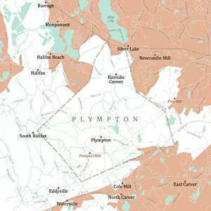
Background imageGeographical Border Collection: MA Plymouth Plympton Vector Road Map

MA Plymouth Plympton Vector Road Map. All source data is in the public domain. U.S. Census Bureau Census Tiger. Used Layers: areawater, linearwater, roads, rails, cousub, pointlm, uac10

Background imageGeographical Border Collection: MA Plymouth Abington Vector Road Map

MA Plymouth Abington Vector Road Map. All source data is in the public domain. U.S. Census Bureau Census Tiger. Used Layers: areawater, linearwater, roads, rails, cousub, pointlm, uac10


All Professionally Made to Order for Quick Shipping

"Exploring the Geographical Borders: From Ancient Jerusalem to Modern Singapore" Embark on a captivating journey through geographical borders as we delve into diverse landscapes and historical realms. 🌍✈️ Starting with China's intricate map, witness the vastness of this ancient civilization that has stood the test of time. πŸ‡¨πŸ‡³ Next, trace the travels of The Apostle Paul through an enchanting map engraving, unraveling his remarkable journey across lands and seas. β›ͺοΈβš“οΈ Marvel at Ancient and Modern Jerusalem's transformation over centuries, depicted in a mesmerizing map engraving that showcases its rich cultural heritage. πŸ•ŒπŸ• Navigate through Massachusetts' Middlesex Westford Vector Road Map and Barnstable Town Vector Road Map to discover charming towns nestled within picturesque landscapes. πŸ—ΊοΈπŸžοΈ Experience the vibrant city-state of Singapore, where tradition meets modernity amidst stunning skyscrapers and lush greenery. πŸ™οΈπŸŒΏ Witness nature's breathtaking artistry as first light illuminates Bonneville Salt Flats near Utah-Nevada border, revealing delicate salt crystal patterns on its surface. β˜€οΈβ„οΈ Travel eastward to Romania, a land steeped in history and natural beauty; explore its hidden gems tucked away within majestic mountainscapes. πŸ°β›°οΈ Continue your expedition with MA Essex Swampscott Vector Road Map - uncover hidden coastal treasures along Massachusetts' scenic shoreline. β›΅πŸŒŠ Uncover Antique India Map's secrets as you traverse this culturally diverse nation brimming with architectural wonders and spiritual enlightenment. πŸ•Œβœ¨ Step back in time with London and Environs Historical Map Engraving from 1892 - immerse yourself in Victorian charm while exploring England's capital city.