Home > Africa > Algeria > Maps
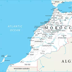
Map of northwestern Africa, c.1900 (engraving)
")
![]()
Wall Art and Photo Gifts from Fine Art Finder
Map of northwestern Africa, c.1900 (engraving)
533056 Map of northwestern Africa, c.1900 (engraving); (add.info.: Map of northwest Africa with Morocco, Algeria, Tunis, Sahara, Senegal, Portuguese Guinea, circa 1902, from the 10th edition of Encyclopaedia Britannica.); Encyclopaedia Britannica/UIG
Media ID 38101948
© Encyclopaedia Britannica/UIG / Bridgeman Images
1902 19th Century Style Algeria Algeria Algerian Algerian Algerians Arab Culture Boundary Cartography Geographical Border Guidance Illustration Technique Maghreb Maghrebi Maghrebian Meridian Morocco Navigational Equipment Old Fashioned Part Of Physical Geography Sahara Senegal The Past Tunis Western Script
FEATURES IN THESE COLLECTIONS
> Africa
> Algeria
> Related Images
> Africa
> Guinea
> Related Images
> Africa
> Morocco
> Related Images
> Africa
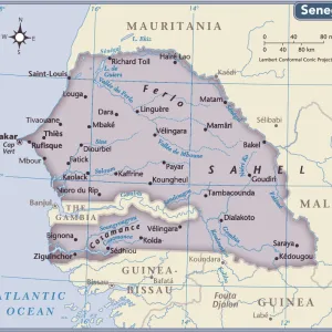
> Senegal
> Related Images
> Africa
> Western Sahara
> Maps
> Africa
> Western Sahara
> Related Images
> Fine Art Finder
> Temp Classification
EDITORS COMMENTS
This stunning engraving from c.1900 showcases a detailed map of northwestern Africa, including countries such as Morocco, Algeria, Tunis, and the Sahara desert. The intricate lines and labels on the map provide a glimpse into the geographical features of this region during that time period.
The Map of northwest Africa is not just a representation of land boundaries but also serves as a historical artifact from the 10th edition of Encyclopaedia Britannica. It offers insight into the exploration and cartography techniques used in the late 19th century.
From Portuguese Guinea to Senegal, this map captures the essence of Arab civilization and culture in North Africa. The vertical orientation adds to its old-fashioned charm while highlighting key navigational points along the coastline.
As we study this piece closely, we can appreciate how maps like these were essential tools for understanding physical geography and guiding explorers through uncharted territories. This engraving is not just an illustration; it's a window into history that allows us to trace back our roots and understand how borders have evolved over time in this part of Africa.
Overall, this print is more than just a decorative piece—it's a valuable historical document that sheds light on the past without any distractions from modern elements or people present in it.
MADE IN AUSTRALIA
Safe Shipping with 30 Day Money Back Guarantee
FREE PERSONALISATION*
We are proud to offer a range of customisation features including Personalised Captions, Color Filters and Picture Zoom Tools
SECURE PAYMENTS
We happily accept a wide range of payment options so you can pay for the things you need in the way that is most convenient for you
* Options may vary by product and licensing agreement. Zoomed Pictures can be adjusted in the Cart.