Fraud Blocker Skip to main content

Illustration And Painting Collection (page 10)

"Journey through Time and Art: Exploring the World of Illustration and Painting" Step into a world where history comes alive

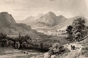
Background imageIllustration And Painting Collection: The Inn at Capel Curig, Snowdonia, North Wales, UK, c.1850 (lithograph)

The Inn at Capel Curig, Snowdonia, North Wales, UK, c.1850 (lithograph)
2603687 The Inn at Capel Curig, Snowdonia, North Wales, UK, c.1850 (lithograph); (add.info.: The Inn at Capel Curig from Moel Siabod near Betws - y - Coed, Snowdonia, North Wales)

Background imageIllustration And Painting Collection: Joseph Rene Bellot

Joseph Rene Bellot
2603663 Joseph Rene Bellot; (add.info.: Joseph Rene Bellot (1826 - 1853) French Arctic explorer, born at Rochefort. In 1851 he joined the Kennedy Franklin Search Expedition

Background imageIllustration And Painting Collection: Title page of 'Architecture Hydraulique'

Title page of "Architecture Hydraulique"
2603661 Title page of "Architecture Hydraulique"; (add.info.: Title page of "Architecture Hydraulique" by Bernard Forest de Belidor (Paris 1737)

Background imageIllustration And Painting Collection: Michael Alberti, 1725 (engraving)

Michael Alberti, 1725 (engraving)
2603645 Michael Alberti, 1725 (engraving); (add.info.: Michael Alberti (1682 - 1757) German physician and a founder of forensic medicine, born in Nuremberg

Background imageIllustration And Painting Collection: Salomon - Auguste Andree (centre)

Salomon - Auguste Andree (centre)
2603625 Salomon - Auguste Andree (centre); (add.info.: Salomon - Auguste Andree (centre) (1854 - 1897), Swedish engineer, with the men who accompanied on the fatal voyage to explore the North Pole

Background imageIllustration And Painting Collection: The Great Khan at Damascus. engraving drawn by W. H. Bartlett, engraved by W. Kelsall. 1836

The Great Khan at Damascus. engraving drawn by W. H. Bartlett, engraved by W. Kelsall. 1836
3665550 The Great Khan at Damascus. engraving drawn by W. H. Bartlett, engraved by W. Kelsall. 1836; (add.info.: The Great Khan at Damascus. engraving drawn by W. H. Bartlett, engraved by W. Kelsall)

Background imageIllustration And Painting Collection: Map of Japan and Korea, c.1900 (engraving)

Map of Japan and Korea, c.1900 (engraving)
533031 Map of Japan and Korea, c.1900 (engraving); (add.info.: Map of Japan and Korea, with insets of Kurile Islands, Liu-Kiu Islands and Formosa, circa 1902)

Background imageIllustration And Painting Collection: Map of southern India with Bombay, c.1900 (engraving)

Map of southern India with Bombay, c.1900 (engraving)
533019 Map of southern India with Bombay, c.1900 (engraving); (add.info.: Map showing historical boundaries of Southern India with inset map of Bombay (now Mumbai) and the Malay Peninsula

Background imageIllustration And Painting Collection: Map of Italy, c.1900 (engraving)

Map of Italy, c.1900 (engraving)
532983 Map of Italy, c.1900 (engraving); (add.info.: Map of Italy, with insets of Rome and Venice, circa 1902, from the 10th edition of Encyclopaedia Britannica.); Encyclopaedia Britannica/UIG

Background imageIllustration And Painting Collection: Map of the Empire of Austria-Hungary, c.1900 (engraving)

Map of the Empire of Austria-Hungary, c.1900 (engraving)
532977 Map of the Empire of Austria-Hungary, c.1900 (engraving); (add.info.: Map of Empire of Austria-Hungary and inset of Budapest and Vicinity, circa 1902)

Background imageIllustration And Painting Collection: Map of the southwestern part of the German Empire, c.1900 (engraving)

Map of the southwestern part of the German Empire, c.1900 (engraving)
532961 Map of the southwestern part of the German Empire, c.1900 (engraving); (add.info.: Map of the southwestern German Empire, circa 1902)

Background imageIllustration And Painting Collection: Map of Netherlands and Belgium, c.1900 (engraving)

Map of Netherlands and Belgium, c.1900 (engraving)
532956 Map of Netherlands and Belgium, c.1900 (engraving); (add.info.: Map showing the historical boundaries of Netherlands, Belgium, Luxemburg, with insets of Amsterdam and Brussels, circa 1902)

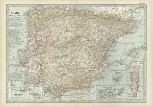
Background imageIllustration And Painting Collection: Map of Spain with Portugal and Andorra, c.1900 (engraving)

Map of Spain with Portugal and Andorra, c.1900 (engraving)
532952 Map of Spain with Portugal and Andorra, c.1900 (engraving); (add.info.: Map of Spain with Portugal and Andorra, with insets of the Azores Islands, Canary Islands, and Madeira Island)

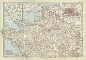
Background imageIllustration And Painting Collection: Map of France, c.1900 (engraving)

Map of France, c.1900 (engraving)
532942 Map of France, c.1900 (engraving); (add.info.: Map of northern France with insets showing the provinces of France and Paris and Vicinity, circa 1902)

Background imageIllustration And Painting Collection: Map of England and Wales, c.1900 (engraving)

Map of England and Wales, c.1900 (engraving)
532924 Map of England and Wales, c.1900 (engraving); (add.info.: Map of England and Wales, with Hereford, Monmouth, Gloucester, Somerset, and parts of Worchester and Wiltshire, circa 1902)

Background imageIllustration And Painting Collection: Map of London, England, c.1900 (engraving)

Map of London, England, c.1900 (engraving)
532921 Map of London, England, c.1900 (engraving); (add.info.: Map of London, England, and vicinity, circa 1902, from the 10th edition of Encyclopaedia Britannica.); Encyclopaedia Britannica/UIG

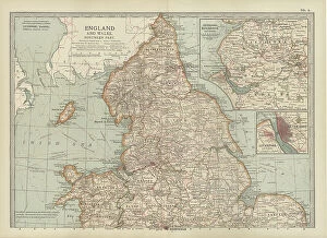
Background imageIllustration And Painting Collection: Map of England and Wales, c.1900 (engraving)

Map of England and Wales, c.1900 (engraving)
532903 Map of England and Wales, c.1900 (engraving); (add.info.: Map showing the historical boundaries of northern England and Wales, including insets of Liverpool, Manchester and Vicinity)

Background imageIllustration And Painting Collection: Map of Central Europe, c.1900 (engraving)

Map of Central Europe, c.1900 (engraving)
532900 Map of Central Europe, c.1900 (engraving); (add.info.: Map of Central Europe, circa 1902, From the 10th edition of Encyclopaedia Britannica.); Encyclopaedia Britannica/UIG

Background imageIllustration And Painting Collection: Map of Iceland, c.1900 (engraving)

Map of Iceland, c.1900 (engraving)
533307 Map of Iceland, c.1900 (engraving); (add.info.: Map of Iceland showing glaciers (Jokull), fjords and other geographical features, circa 1902

Background imageIllustration And Painting Collection: Map of Marseille, France, c.1900 (engraving)

Map of Marseille, France, c.1900 (engraving)
533294 Map of Marseille, France, c.1900 (engraving); (add.info.: Map of Marseille, France, circa 1902, from the 10th edition of Encyclopaedia Britannica.); Encyclopaedia Britannica/UIG

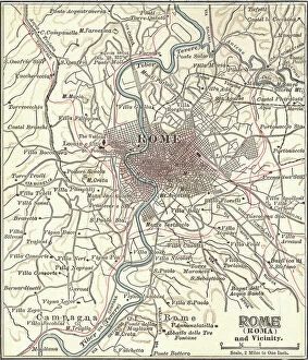
Background imageIllustration And Painting Collection: Map of Rome, c.1900 (engraving)

Map of Rome, c.1900 (engraving)
532848 Map of Rome, c.1900 (engraving); (add.info.: Map of Rome, circa 1900, from the 10th edition of Encyclopaedia Britannica.); Encyclopaedia Britannica/UIG

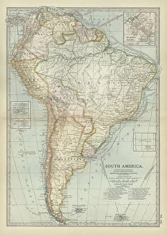
Background imageIllustration And Painting Collection: Map of South America, c.1900 (engraving)

Map of South America, c.1900 (engraving)
533256 Map of South America, c.1900 (engraving); (add.info.: Map of South America with inset maps of Isthmus of Panama, Galapagos Islands and Trinidad, circa 1902)

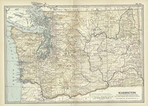
Background imageIllustration And Painting Collection: Map of Washington State, c.1900 (engraving)

Map of Washington State, c.1900 (engraving)
533220 Map of Washington State, c.1900 (engraving); (add.info.: Map of Washington State, United States, circa 1902, from the 10th edition of Encyclopaedia Britannica.); Encyclopaedia Britannica/UIG

Background imageIllustration And Painting Collection: Map of Melbourne, c.1900 (engraving)

Map of Melbourne, c.1900 (engraving)
532791 Map of Melbourne, c.1900 (engraving); (add.info.: Map of Melbourne, Australia, circa 1900, from the 10th edition of Encyclopaedia Britannica.); Encyclopaedia Britannica/UIG

Background imageIllustration And Painting Collection: Map of Galveston Bay, Houston and vicinity, c.1900 (engraving)

Map of Galveston Bay, Houston and vicinity, c.1900 (engraving)
532761 Map of Galveston Bay, Houston and vicinity, c.1900 (engraving); (add.info.: Map of Galveston Bay, Houston, circa 1900)

Background imageIllustration And Painting Collection: Map of the colonial powers, 1902, c.1900 (engraving)

Map of the colonial powers, 1902, c.1900 (engraving)
532894 Map of the colonial powers, 1902, c.1900 (engraving); (add.info.: Map of the world showing "the Chief Countries and their Colonies, " circa 1902)

Background imageIllustration And Painting Collection: Map of Sydney, c.1900 (engraving)

Map of Sydney, c.1900 (engraving)
532872 Map of Sydney, c.1900 (engraving); (add.info.: Map of Sydney, Australia, circa 1900, from the 10th edition of Encyclopaedia Britannica.); Encyclopaedia Britannica/UIG

Background imageIllustration And Painting Collection: Map of France in Provinces, c.1900 (engraving)

Map of France in Provinces, c.1900 (engraving)
533288 Map of France in Provinces, c.1900 (engraving); (add.info.: Map of the provinces of France before the French Revolution in 1789, circa 1902)

Background imageIllustration And Painting Collection: Map of Richmond, c.1900 (engraving)

Map of Richmond, c.1900 (engraving)
532839 Map of Richmond, c.1900 (engraving); (add.info.: Map illustrating battles of the American Civil War held around the Richmond, Virginia, area)

Background imageIllustration And Painting Collection: Map of Minnesota, c.1900 (engraving)

Map of Minnesota, c.1900 (engraving)
533188 Map of Minnesota, c.1900 (engraving); (add.info.: Map of Minnesota, United States, with inset maps of Duluth and Minneapolis, circa 1902)

Background imageIllustration And Painting Collection: Map of eastern Texas, c.1900 (engraving)

Map of eastern Texas, c.1900 (engraving)
533161 Map of eastern Texas, c.1900 (engraving); (add.info.: Map of the eastern part of Texas, circa 1902, from the 10th edition of Encyclopaedia Britannica.); Encyclopaedia Britannica/UIG

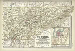
Background imageIllustration And Painting Collection: Map of eastern Tennessee, c.1900 (engraving)

Map of eastern Tennessee, c.1900 (engraving)
533145 Map of eastern Tennessee, c.1900 (engraving); (add.info.: Map of the eastern part of Tennessee with inset map of Chattanooga, circa 1902)

Background imageIllustration And Painting Collection: Map of North Carolina, c.1900 (engraving)

Map of North Carolina, c.1900 (engraving)
533130 Map of North Carolina, c.1900 (engraving); (add.info.: Map of North Carolina, United States, circa 1902, from the 10th edition of Encyclopaedia Britannica.); Encyclopaedia Britannica/UIG

Background imageIllustration And Painting Collection: Map of Canada, c.1900 (engraving)

Map of Canada, c.1900 (engraving)
533072 Map of Canada, c.1900 (engraving); (add.info.: Map showing historical boundaries of Canada and Newfoundland, circa 1902)

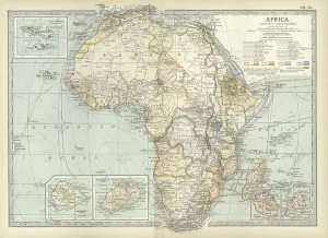
Background imageIllustration And Painting Collection: Map of colonial Africa, c.1900 (engraving)

Map of colonial Africa, c.1900 (engraving)
533053 Map of colonial Africa, c.1900 (engraving); (add.info.: Map of colonial Africa, with insets of Ascension Island, St)

Background imageIllustration And Painting Collection: Map of Australia and Tasmania. c1902 (engraving)

Map of Australia and Tasmania. c1902 (engraving)
533041 Map of Australia and Tasmania. c1902 (engraving); (add.info.: Map showing Australia with insets of Melbourne and Port Phillip, Tasmania, and Sydney and Vicinity, circa 1902)

Background imageIllustration And Painting Collection: Map of Dublin, c.1900 (engraving)

Map of Dublin, c.1900 (engraving)
532758 Map of Dublin, c.1900 (engraving); (add.info.: Map of Dublin, circa 1900, from the 10th edition of Encyclopaedia Britannica.); Encyclopaedia Britannica/UIG

Background imageIllustration And Painting Collection: Map of Brussels, c.1900 (engraving)

Map of Brussels, c.1900 (engraving)
532721 Map of Brussels, c.1900 (engraving); (add.info.: Map of the city of Brussels, Belgium, circa 1900, from the 10th edition of Encyclopaedia Britannica.); Encyclopaedia Britannica/UIG

Background imageIllustration And Painting Collection: Map of Guadeloupe, c.1900 (engraving)

Map of Guadeloupe, c.1900 (engraving)
533480 Map of Guadeloupe, c.1900 (engraving); (add.info.: Map of Guadeloupe, circa 1902, from the 10th edition of Encyclopaedia Britannica.); Encyclopaedia Britannica/UIG

Background imageIllustration And Painting Collection: Map of Dominica, c.1900 (engraving)

Map of Dominica, c.1900 (engraving)
533477 Map of Dominica, c.1900 (engraving); (add.info.: Map of Dominica, circa 1902, from the 10th edition of Encyclopaedia Britannica.); Encyclopaedia Britannica/UIG

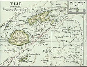
Background imageIllustration And Painting Collection: Map of Fiji Islands, c.1900 (engraving)

Map of Fiji Islands, c.1900 (engraving)
533354 Map of Fiji Islands, c.1900 (engraving); (add.info.: Map of Fiji Islands, South Pacific with inset map of Rotuma Island, circa 1902)

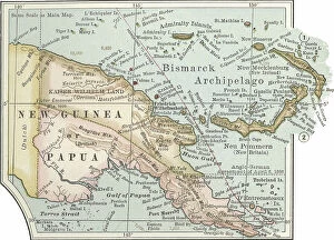
Background imageIllustration And Painting Collection: Map of New Guinea and Bismarck Archipelago, c.1900 (engraving)

Map of New Guinea and Bismarck Archipelago, c.1900 (engraving)
533344 Map of New Guinea and Bismarck Archipelago, c.1900 (engraving); (add.info.: Map of New Guinea and the Bismarck Archipelago, circa 1902)

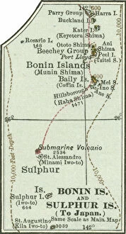
Background imageIllustration And Painting Collection: Map of Bonin Islands and Sulphur Islands, c.1900 (engraving)

Map of Bonin Islands and Sulphur Islands, c.1900 (engraving)
533329 Map of Bonin Islands and Sulphur Islands, c.1900 (engraving); (add.info.: Inset map of Bonin Islands and Sulphur Islands, circa 1902)

Background imageIllustration And Painting Collection: Map of the Malay Peninsula, c.1900 (engraving)

Map of the Malay Peninsula, c.1900 (engraving)
533325 Map of the Malay Peninsula, c.1900 (engraving); (add.info.: Map showing historical boundaries of the Malay Peninsula, Sumatra, and Singapore, circa 1902)

Background imageIllustration And Painting Collection: Map of Crete, c.1900 (engraving)

Map of Crete, c.1900 (engraving)
533320 Map of Crete, c.1900 (engraving); (add.info.: Map of Crete, Greece, circa 1902, From the 10th edition of Encyclopaedia Britannica.); Encyclopaedia Britannica/UIG

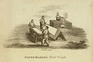
Background imageIllustration And Painting Collection: Paper making, China: forming and drying sheets from pulp. Engraving c1810

Paper making, China: forming and drying sheets from pulp. Engraving c1810
866079 Paper making, China: forming and drying sheets from pulp. Engraving c1810.; Universal History Archive/UIG

Background imageIllustration And Painting Collection: African attendants of David Livingstone

African attendants of David Livingstone
864599 African attendants of David Livingstone; (add.info.: The African attendants of David Livingstone (1813-1873) Scottish missionary and explorer of Africa

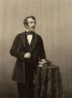
Background imageIllustration And Painting Collection: Portrait of David Livingstone

Portrait of David Livingstone
864597 Portrait of David Livingstone; (add.info.: David Livingstone (1813-1873) Scottish missionary and explorer of Africa. Engraving, c1860.); Universal History Archive/UIG


All Professionally Made to Order for Quick Shipping

"Journey through Time and Art: Exploring the World of Illustration and Painting" Step into a world where history comes alive, as antique maps transport you to different eras. Marvel at an Antique map of Britain under the Anglo Saxons, revealing the ancient roots of this land. Then, let your imagination wander across the vast territories of the Roman Empire with another captivating antique map. Intrigue awaits as Jesus Reaches for a Lost Sheep in an illustration that depicts compassion and redemption. Travel further east with a Map of the Byzantine Empire in the 9th Century, tracing its grandeur and influence. Discover local treasures with an Antique map showcasing Liverpool and Birkenhead in England during the 19th Century. Or set sail towards Scotland's scenic islands - Jura, Mull, Argyll, Islay - through yet another enchanting antique map from that era. Experience profound emotions captured by renowned artist Rembrandt Harmensz van Rijn in The Return of the Prodigal Son; witness his mastery unfold before your eyes. Feel Joan of Arc's bravery radiate from Jules-Eugene Leneuveu's painting as she stands defiantly on her pyre at Pantheon. Embark on a visual journey to distant lands with an Antique map unveiling New Zealand's beauty during the 19th Century. And bask in awe-inspiring stained glass windows adorning St. Vitus Cathedral in Prague – each pane telling its own vibrant story. Finally, immerse yourself in ancient Greece with a Vintage map showcasing Magna Graecia or explore Cyprus' rich heritage through yet another captivating cartographic masterpiece. They have always been powerful mediums to capture moments frozen in time or convey stories that transcend generations. Let these remarkable artworks ignite your curiosity and inspire you to delve deeper into their historical significance while appreciating their artistic brilliance.