
Illustration And Painting Collection (page 6)
"Journey through Time and Art: Exploring the World of Illustration and Painting" Step into a world where history comes alive


All Professionally Made to Order for Quick Shipping
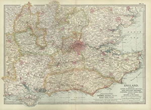
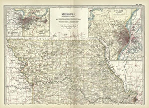
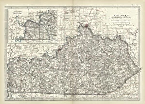
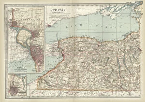
"Journey through Time and Art: Exploring the World of Illustration and Painting" Step into a world where history comes alive, as antique maps transport you to different eras. Marvel at an Antique map of Britain under the Anglo Saxons, revealing the ancient roots of this land. Then, let your imagination wander across the vast territories of the Roman Empire with another captivating antique map. Intrigue awaits as Jesus Reaches for a Lost Sheep in an illustration that depicts compassion and redemption. Travel further east with a Map of the Byzantine Empire in the 9th Century, tracing its grandeur and influence. Discover local treasures with an Antique map showcasing Liverpool and Birkenhead in England during the 19th Century. Or set sail towards Scotland's scenic islands - Jura, Mull, Argyll, Islay - through yet another enchanting antique map from that era. Experience profound emotions captured by renowned artist Rembrandt Harmensz van Rijn in The Return of the Prodigal Son; witness his mastery unfold before your eyes. Feel Joan of Arc's bravery radiate from Jules-Eugene Leneuveu's painting as she stands defiantly on her pyre at Pantheon. Embark on a visual journey to distant lands with an Antique map unveiling New Zealand's beauty during the 19th Century. And bask in awe-inspiring stained glass windows adorning St. Vitus Cathedral in Prague – each pane telling its own vibrant story. Finally, immerse yourself in ancient Greece with a Vintage map showcasing Magna Graecia or explore Cyprus' rich heritage through yet another captivating cartographic masterpiece. They have always been powerful mediums to capture moments frozen in time or convey stories that transcend generations. Let these remarkable artworks ignite your curiosity and inspire you to delve deeper into their historical significance while appreciating their artistic brilliance.