Fraud Blocker Skip to main content

Isles Collection (page 6)

"Exploring the Isles: A Journey through History, Nature, and Resilience" Unfolding history on a WW2 poster: Map of the British Army's strategic isles

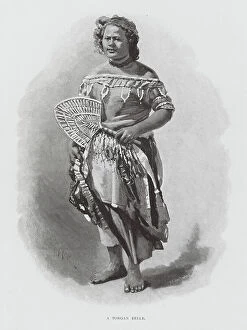
Background imageIsles Collection: A Tongan Belle (engraving)

A Tongan Belle (engraving)
8648111 A Tongan Belle (engraving) by Australian School, (19th century); Private Collection; (add.info.: A Tongan Belle. New Hebrides)

Background imageIsles Collection: Duk Duk (engraving)

Duk Duk (engraving)
8648108 Duk Duk (engraving) by Australian School, (19th century); Private Collection; (add.info.: Duk Duk. New Hebrides. Illustration for Picturesque Atlas of Australasia edited by Andrew Garran)

Background imageIsles Collection: John Adams (engraving)

John Adams (engraving)
8648106 John Adams (engraving) by Australian School, (19th century); Private Collection; (add.info.: John Adams. New Hebrides)

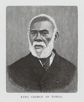
Background imageIsles Collection: King George of Tonga (engraving)

King George of Tonga (engraving)
8648105 King George of Tonga (engraving) by Australian School, (19th century); Private Collection; (add.info.: King George of Tonga. New Hebrides)

Background imageIsles Collection: Havannah Harbour (engraving)

Havannah Harbour (engraving)
8648100 Havannah Harbour (engraving) by Australian School, (19th century); Private Collection; (add.info.: Havannah Harbour. New Hebrides)

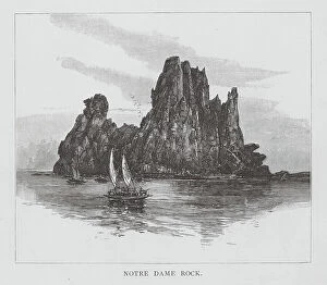
Background imageIsles Collection: Notre Dame Rock (engraving)

Notre Dame Rock (engraving)
8648099 Notre Dame Rock (engraving) by Australian School, (19th century); Private Collection; (add.info.: Notre Dame Rock. New Hebrides)

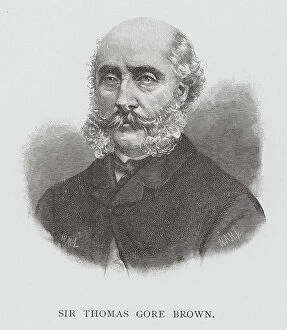
Background imageIsles Collection: Sir Thomas Gore Brown (engraving)

Sir Thomas Gore Brown (engraving)
8648044 Sir Thomas Gore Brown (engraving) by Australian School, (19th century); Private Collection; (add.info.: Sir Thomas Gore Brown)

Background imageIsles Collection: Governor Arthur (engraving)

Governor Arthur (engraving)
8648041 Governor Arthur (engraving) by Australian School, (19th century); Private Collection; (add.info.: Governor Arthur)

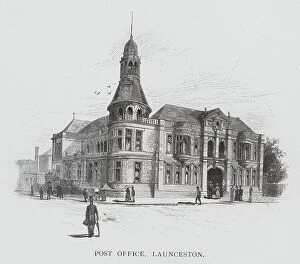
Background imageIsles Collection: Post Office, Launceston (engraving)

Post Office, Launceston (engraving)
8648032 Post Office, Launceston (engraving) by Australian School, (19th century); Private Collection; (add.info.: Post Office, Launceston)

Background imageIsles Collection: Kingston, Jamaica: Titchfield Hotel (colour photo)

Kingston, Jamaica: Titchfield Hotel (colour photo)
8644424 Kingston, Jamaica: Titchfield Hotel (colour photo) by English Photographer, (20th century); Private Collection; (add.info.: Titchfield Hotel)

Background imageIsles Collection: Kingston, Jamaica: Bog Walk, 19 miles from Kingston (colour photo)

Kingston, Jamaica: Bog Walk, 19 miles from Kingston (colour photo)
8644421 Kingston, Jamaica: Bog Walk, 19 miles from Kingston (colour photo) by English Photographer, (20th century); Private Collection; (add.info.: Bog Walk, 19 miles from Kingston)

Background imageIsles Collection: Kingston, Jamaica: Entrance to Port Antonio (colour photo)

Kingston, Jamaica: Entrance to Port Antonio (colour photo)
8644425 Kingston, Jamaica: Entrance to Port Antonio (colour photo) by English Photographer, (20th century); Private Collection; (add.info.: Entrance to Port Antonio)

Background imageIsles Collection: Kingston, Jamaica: Resting after a day's work in Banana Field (colour photo)

Kingston, Jamaica: Resting after a day's work in Banana Field (colour photo)
8644420 Kingston, Jamaica: Resting after a day's work in Banana Field (colour photo) by English Photographer, (20th century); Private Collection; (add.info)

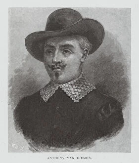
Background imageIsles Collection: Anthony Van Diemen (engraving)

Anthony Van Diemen (engraving)
8651250 Anthony Van Diemen (engraving) by Australian School, (19th century); Private Collection; (add.info.: Anthony Van Diemen)

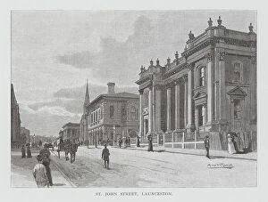
Background imageIsles Collection: St John Street, Launceston (engraving)

St John Street, Launceston (engraving)
8651249 St John Street, Launceston (engraving) by Australian School, (19th century); Private Collection; (add.info.: St John Street, Launceston)

Background imageIsles Collection: Mandeville, Machester (coloured photo)

Mandeville, Machester (coloured photo)
8651410 Mandeville, Machester (coloured photo) by English Photographer, (20th century); Private Collection; (add.info.: Mandeville, Machester)

Background imageIsles Collection: Robinson Crusoe (colour litho)

Robinson Crusoe (colour litho)
8634723 Robinson Crusoe (colour litho) by English School, (19th century); Private Collection; (add.info.: Robinson Crusoe)

Background imageIsles Collection: Photocard, 1930s: Tenerife (coloured photo)

Photocard, 1930s: Tenerife (coloured photo)
8671671 Photocard, 1930s: Tenerife (coloured photo) by English Photographer, (20th century); Private Collection; (add.info.: Tenerife)

Background imageIsles Collection: Real Photographs, c.1939: Singapore (coloured photo)

Real Photographs, c.1939: Singapore (coloured photo)
8671454 Real Photographs, c.1939: Singapore (coloured photo) by English Photographer, (20th century); Private Collection; (add.info.: Singapore)

Background imageIsles Collection: Sea Adventure: The hermit of Cocos Island (colour litho)

Sea Adventure: The hermit of Cocos Island (colour litho)
8668771 Sea Adventure: The hermit of Cocos Island (colour litho) by English School, (20th century); Private Collection; (add.info.: The hermit of Cocos Island)

Background imageIsles Collection: Sea Adventure: Cook in Resolution Cove (colour litho)

Sea Adventure: Cook in Resolution Cove (colour litho)
8668737 Sea Adventure: Cook in Resolution Cove (colour litho) by English School, (20th century); Private Collection; (add.info.: Cook in Resolution Cove)

Background imageIsles Collection: Chart of Galapagos Islands surveyed during voyage of HMS 'Beagle', 1835 (print)

Chart of Galapagos Islands surveyed during voyage of HMS 'Beagle', 1835 (print)
7339479 Chart of Galapagos Islands surveyed during voyage of HMS 'Beagle', 1835 (print) by Fitzroy, Robert (1806-65); 62x47 cm; National Maritime Museum, London

Background imageIsles Collection: A new and accurate chart of the Baltic or East Sea showing the islands

A new and accurate chart of the Baltic or East Sea showing the islands, rocks and shoals with their marks
7340659 A new and accurate chart of the Baltic or East Sea showing the islands, rocks and shoals with their marks, light-houses, soundings and sailing channels, 1779 (print) by Sayer

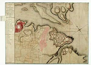
Background imageIsles Collection: A plan of St Philips Castle and fortifications in the island of Minorca, 1780 (paper)

A plan of St Philips Castle and fortifications in the island of Minorca, 1780 (paper)
7340466 A plan of St Philips Castle and fortifications in the island of Minorca, 1780 (paper) by Faden, William (1750-1836); 47.5x63 cm; National Maritime Museum, London

Background imageIsles Collection: A general chart of the islands of Guernsey and Jersey, Sark, Herm, Jethou and Alderney

A general chart of the islands of Guernsey and Jersey, Sark, Herm, Jethou and Alderney
7340131 A general chart of the islands of Guernsey and Jersey, Sark, Herm, Jethou and Alderney, with Cape la Hague and the Caskets, 1779 (print) by Sayer

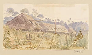
Background imageIsles Collection: Village of the Stang Tribe from West Indies, North American and Borneo scrapbook, 1845 (watercolour)

Village of the Stang Tribe from West Indies, North American and Borneo scrapbook, 1845 (watercolour)
7295673 Village of the Stang Tribe from West Indies, North American and Borneo scrapbook, 1845 (watercolour) by Fanshawe, Admiral Sir Edward Gennys (1814-1906); 16.3x30 cm; National Maritime Museum

Background imageIsles Collection: A bay in Spitzbergen or Spitsbergen, northern Norway, 1882

A bay in Spitzbergen or Spitsbergen, northern Norway, 1882
7125199 A bay in Spitzbergen or Spitsbergen, northern Norway, 1882; (add.info.: A bay in Spitzbergen or Spitsbergen, northern Norway from the La Recherche Expedition of 1838 to 1840)

Background imageIsles Collection: [A] view of Maitavie Bay, [in the island of] Otaheite [Tahiti], 1776 (oil on canvas)

[A] view of Maitavie Bay, [in the island of] Otaheite [Tahiti], 1776 (oil on canvas)
7295308 [A] view of Maitavie Bay, [in the island of] Otaheite [Tahiti], 1776 (oil on canvas) by Hodges, William (1744-97); 137.2x193.2 cm; National Maritime Museum, London

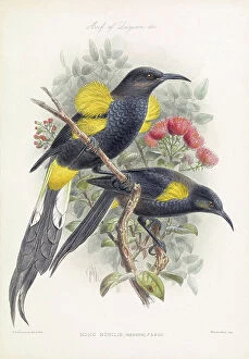
Background imageIsles Collection: Moho Nobilis (male and female adult) or Hawaiʻi ʻōʻō, coloured plate from an illustrated book

Moho Nobilis (male and female adult) or Hawaiʻi ʻōʻō, coloured plate from an illustrated book on the birds of
7214702 Moho Nobilis (male and female adult) or Hawaiʻi ʻōʻō, coloured plate from an illustrated book on the birds of the Hawaiian Islands

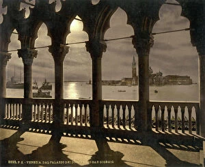
Background imageIsles Collection: San Georgio from Doges' Palace by moonlight, Venice, Italy, c.1890-1900 (photochrom)

San Georgio from Doges' Palace by moonlight, Venice, Italy, c.1890-1900 (photochrom)
8735746 San Georgio from Doges' Palace by moonlight, Venice, Italy, c.1890-1900 (photochrom) by Detroit Publishing Co

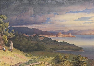
Background imageIsles Collection: 'Corfu, Octr. 12th 1857 [Greece]', 1857 (watercolour)

'Corfu, Octr. 12th 1857 [Greece]', 1857 (watercolour)
7342288 'Corfu, Octr. 12th 1857 [Greece]', 1857 (watercolour) by Fanshawe, Admiral Sir Edward Gennys (1814-1906); 22.8x32.1 cm; National Maritime Museum, London

Background imageIsles Collection: Village of the Stang tribe, Sarawak, Borneo; and a bridge of poles over a river from West Indies

Village of the Stang tribe, Sarawak, Borneo; and a bridge of poles over a river from West Indies
7295680 Village of the Stang tribe, Sarawak, Borneo; and a bridge of poles over a river from West Indies, North American and Borneo scrapbook, c.1845 (lithograph) by Fanshawe

Background imageIsles Collection: Maitea [Mehetia], Augt 20th 1849 [Society Islands], 1849 (graphite, wash)

Maitea [Mehetia], Augt 20th 1849 [Society Islands], 1849 (graphite, wash)
7295591 Maitea [Mehetia], Augt 20th 1849 [Society Islands], 1849 (graphite, wash) by Fanshawe, Admiral Sir Edward Gennys (1814-1906); 11.3x17.6 cm; National Maritime Museum, London

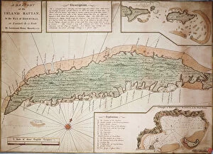
Background imageIsles Collection: Draught of the Island Rattan in the bay of Honduras in latitude 16 degrees 22' north by Lieutenant

Draught of the Island Rattan in the bay of Honduras in latitude 16 degrees 22' north by Lieutenant Henry Barnsley
7339799 Draught of the Island Rattan in the bay of Honduras in latitude 16 degrees 22' north by Lieutenant Henry Barnsley 1742, 1742 (hand coloured engraving single sheet) by Barnsley

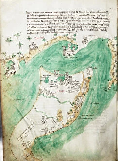
Background imageIsles Collection: Chart of Kos and Bodrum, c.1420 (vellum)

Chart of Kos and Bodrum, c.1420 (vellum)
7339627 Chart of Kos and Bodrum, c.1420 (vellum) by Buondelmonti, Cristoforo (1385-1430); 25x18 cm; National Maritime Museum, London

Background imageIsles Collection: Chart of Negroponte, 1554 (vellum)

Chart of Negroponte, 1554 (vellum)
7339644 Chart of Negroponte, 1554 (vellum) by Agnese, Battista (c.1500-64); 26x40 cm; National Maritime Museum, London, UK; (add.info.: Creator: Battista Agnese Scale: 1)

Background imageIsles Collection: Chart of the Gulf of Mexico and Caribbean islands, 1742 (manuscript)

Chart of the Gulf of Mexico and Caribbean islands, 1742 (manuscript)
7339545 Chart of the Gulf of Mexico and Caribbean islands, 1742 (manuscript) by Polo, Miol (18th century); 8x107 cm; National Maritime Museum, London

Background imageIsles Collection: Map and chart of the Island of Alderney and the Caskets, 1833 (lithograph)

Map and chart of the Island of Alderney and the Caskets, 1833 (lithograph)
7339528 Map and chart of the Island of Alderney and the Caskets, 1833 (lithograph) by Wyld, James the Younger (1812-87); 50x69 cm; National Maritime Museum, London

Background imageIsles Collection: Map of Portoferraio on Elba, c.1790 (manuscript)

Map of Portoferraio on Elba, c.1790 (manuscript)
7339364 Map of Portoferraio on Elba, c.1790 (manuscript) by Unknown artist, (18th century); 66x84 cm; National Maritime Museum, London, UK; (add.info.: Creator: Anonymous Single sheet. Col. ms)

Background imageIsles Collection: A chart of the channel in the Phillippine Islands through which the Manila Galeon passes together

A chart of the channel in the Phillippine Islands through which the Manila Galeon passes together with the adjacent
7339387 A chart of the channel in the Phillippine Islands through which the Manila Galeon passes together with the adjacent islands, 1748 (engraving) by Seale

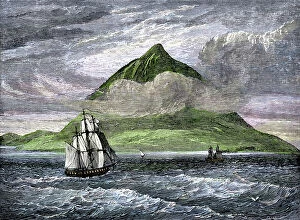
Background imageIsles Collection: Ship passing the Tenerife peak of the Canary Islands in the 19th century

Ship passing the Tenerife peak of the Canary Islands in the 19th century. Colour engraving of the 19th century
NWI4866268 Ship passing the Tenerife peak of the Canary Islands in the 19th century. Colour engraving of the 19th century; (add.info)

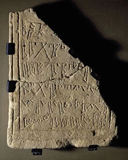
Background imageIsles Collection: Islamic Period

Islamic Period
3499684 Islamic Period; (add.info.: Islamic Period. Tombstone of Aba al Salam ibn Saia. From Algaida (Mallorca, Balearic Islands). Museum of Mallorca

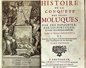
Background imageIsles Collection: The Conquest of the Moluccas Islands

The Conquest of the Moluccas Islands
3499738 The Conquest of the Moluccas Islands; (add.info.: The Conquest of the Moluccas Islands, by Bartolome Juan Leonardo de Argensola (1562-1631). Spanish priest, poet and historian

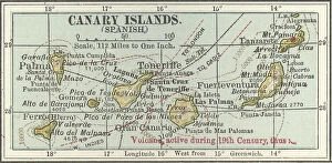
Background imageIsles Collection: Map of the Canary Islands, c.1900 (engraving)

Map of the Canary Islands, c.1900 (engraving)
533299 Map of the Canary Islands, c.1900 (engraving); (add.info.: Map of Canary Islands (Spanish), circa 1902, from the 10th edition of Encyclopaedia Britannica.); Encyclopaedia Britannica/UIG.

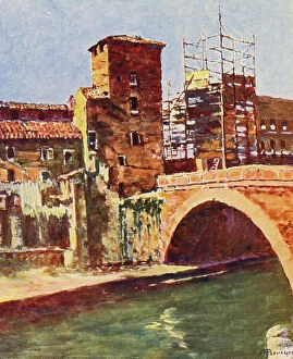
Background imageIsles Collection: Rome: L'Isola sur le Tibre (colour litho)

Rome: L'Isola sur le Tibre (colour litho)
8633004 Rome: L'Isola sur le Tibre (colour litho) by Bouchor, Joseph Felix (1853-1937); Private Collection; (add.info.: L'Isola sur le Tibre)

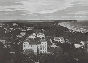
Background imageIsles Collection: Panorama v Gohren a Rugen (b/w photo)

Panorama v Gohren a Rugen (b/w photo)
8675113 Panorama v Gohren a Rugen (b/w photo) by German Photographer, (19th century); Private Collection; (add.info.: Panorama v Gohren a Rugen)

Background imageIsles Collection: Piraten-Schlucht b Sassnitz a Rugen (b/w photo)

Piraten-Schlucht b Sassnitz a Rugen (b/w photo)
8675097 Piraten-Schlucht b Sassnitz a Rugen (b/w photo) by German Photographer, (19th century); Private Collection; (add.info.: Piraten-Schlucht b Sassnitz a Rugen)

Background imageIsles Collection: Sassnitz a Rugen (b/w photo)

Sassnitz a Rugen (b/w photo)
8675166 Sassnitz a Rugen (b/w photo) by German Photographer, (19th century); Private Collection; (add.info.: Sassnitz a Rugen)


All Professionally Made to Order for Quick Shipping

"Exploring the Isles: A Journey through History, Nature, and Resilience" Unfolding history on a WW2 poster: Map of the British Army's strategic isles. Tracing our roots back to Viking Britain with an ancient map of their conquests. Battling against nature's fury at Bishop Rock Lighthouse during a relentless gale. Discovering tranquility amidst the Scilly Isles' breathtaking landscapes and seascapes. Unlocking Earth's secrets with a geological map showcasing the diverse British Islands. Navigating through time with an 18th-century Channel Islands map as our guide. Marveling at the majestic Wolf Rock Lighthouse from above, guarding Cornwall's coast. Immersing in Clan Macdonald's rich heritage that echoes across these storied isles. Reflecting on sacrifice and duty through a poignant WWI poster - "Is your home here? Defend it. " Stepping into Tresco Abbey's old arches, where whispers of Cornwall's past still linger. Witnessing resilience personified at Bishop Rock Lighthouse amidst the Isles of Scilly. Embracing coastal serenity as domestic cattle graze peacefully on Isle of Man’s Bride. Embark on this captivating journey through these remarkable isles; each holds its own tale waiting to be discovered – tales etched by war, shaped by Vikings, guarded by lighthouses, and nurtured by nature’s beauty.