
Positions Collection (page 2)
"Unveiling the Art of Positions: From Fencing to Everest Expeditions" Exploring the intricate dance of strategy and skill in fencing positions


All Professionally Made to Order for Quick Shipping
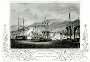
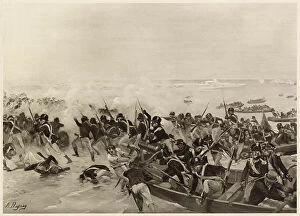
"Unveiling the Art of Positions: From Fencing to Everest Expeditions" Exploring the intricate dance of strategy and skill in fencing positions. Gaining a bird's-eye view of Dublin during the historic Easter Rising, where positions shaped destiny. Witnessing H. M. S. Victory break through enemy lines at the Battle of Trafalgar, showcasing tactical positions that changed history. Tracing the daring positions adopted by the Everest Expedition team in 1924, defying nature's challenges. Rediscovering elegance and precision through ballet dancers' captivating exercise positions. Peering into Westminster Abbey's cutaway during Coronation 1937, revealing hidden ceremonial positions within its grandeur. Unleashing fierce competition as three jockeys fight for victory from a front-view perspective - every position counts. Marveling at Halley's Comet as it appeared in 1910, capturing its celestial position in our collective memory. Navigating treacherous waters with a wreck chart of the British Isles for 1868 - understanding perilous maritime positions. Reflecting on Sikh troops digging trenches during war - their unwavering commitment to strategic defensive positions revealed. In this diverse collection of images and historical moments, we explore how different types of "positions" shape outcomes – be it physical battles or artistic performances – reminding us that positioning ourselves wisely can make all the difference in achieving success or overcoming adversity throughout history and beyond.