Home > Europe > United Kingdom > England > London > Art > Theatre
Map of Ypres, West Flanders, Belgium, First World War, (c1920). Creator: Unknown
. Creator: Unknown")
![]()
Wall Art and Photo Gifts from Heritage Images
Map of Ypres, West Flanders, Belgium, First World War, (c1920). Creator: Unknown
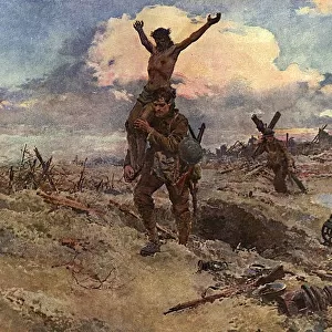
Map of Ypres, West Flanders, Belgium, First World War, (c1920). The Ypres Salient before the Battle of July 31, 1917: map showing the approximate positions of the Franco-British Line. The Third Battle of Ypres, also known as the Battle of Passchendaele, took place on the Western Front from July to November 1917. It was fought between the British, Belgian and French armies against the Germans, and resulted in the deaths of hundreds of thousands of men. From " The Great World War: A History", Volume VII, edited by Frank A Mumby. [The Gresham Publishing Company Ltd, London, c1920]
Heritage Images features heritage image collections
Media ID 19665921
© The Print Collector/Heritage Images
A History Baron Plumer Battle Of Passchendaele Field Marshal Plumer Frank A Frank A Mumby Frank Arthur Frank Arthur Mumby Front Line Frontline General Plumer General Sir Herbert Plumer Gresham Publishing Co Ltd Gresham Publishing Company Hco Plumer Herbert Charles Onslow Plumer Herbert Plumer Herbert Plumer 1st Viscount Plumer Keystone Archives Lines Lord Plumer Mumby Mumby Frank A Mumby Frank Arthur Plumer Herbert Plumer Herbert Charles Onslow Position Positions Sir Herbert Plumer The Great World War The Great World War A History Theatre Of War Third Battle Of Ypres Western Front Ypres Ypres Flanders Belgium 1st World War Battlefield
FEATURES IN THESE COLLECTIONS
> Europe
> Belgium
> Related Images
> Europe
> United Kingdom
> England
> London
> Art
> Theatre
> Historic
> World War I and II
> Battlefields
> Historic
> World War I and II
> Generals and leaders
> Historic
> World War I and II
EDITORS COMMENTS
This print showcases a map of Ypres, West Flanders, Belgium during the First World War. Created by an unknown artist around 1920, this historical artifact provides valuable insight into the events that unfolded in this region. The map specifically depicts the Ypres Salient before the Battle of July 31,1917, illustrating the approximate positions of the Franco-British Line. The Third Battle of Ypres, also known as the Battle of Passchendaele, was fought between British, Belgian, and French forces against German troops on the Western Front from July to November 1917. This devastating battle resulted in immense casualties with hundreds of thousands losing their lives. Taken from "The Great World War: A History", Volume VII edited by Frank A Mumby and published by The Gresham Publishing Company Ltd in London circa 1920s), this print serves as a powerful reminder of the sacrifices made during one of history's most brutal conflicts. It is important to remember those who fought bravely on these battlefields and honor their memory. This image allows us to reflect upon not only the strategic importance but also the human cost associated with such conflicts.
MADE IN AUSTRALIA
Safe Shipping with 30 Day Money Back Guarantee
FREE PERSONALISATION*
We are proud to offer a range of customisation features including Personalised Captions, Color Filters and Picture Zoom Tools
SECURE PAYMENTS
We happily accept a wide range of payment options so you can pay for the things you need in the way that is most convenient for you
* Options may vary by product and licensing agreement. Zoomed Pictures can be adjusted in the Cart.