mail_outline sales@mediastorehouse.com
Framed Print
Canvas Print
Metal Print
Photographic Print
Poster Print
Fine Art Print
Jigsaw Puzzle
Photo Mug
Greetings Card
Cushion
Mouse Mat
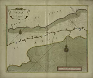
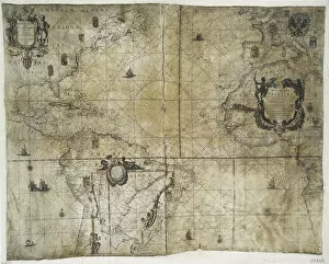
A Large Draught of the Coast of Arabia from Maculla to Dofar, 1703 (colour engraving)5242478 A Large Draught of the Coast of Arabia from Maculla to Dofar, 1703 (colour engraving) by Nicholls, Sutton (fl.1700-40); New York Public Library
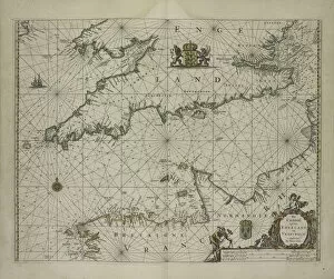
Antique map of Channel, 1666 (colour engraving)5242477 Antique map of Channel, 1666 (colour engraving) by Goos, Pieter (1616-1675); New York Public Library, USA; (add.info.: Het Canaal tusschen Engeland en Vrancriick); Dutch, out of copyright
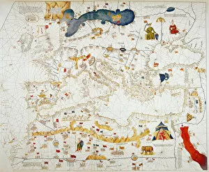
Copy of Catalan Map of Europe, North Africa and the Middle East (hand-coloured engraving)XCF307352 Copy of Catalan Map of Europe, North Africa and the Middle East (hand-coloured engraving) by Cresques, Abraham (1325-87) (after); Private Collection; French, out of copyright
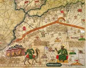
Detail of Copy of a Catalan Map of Europe and North Africa, presented to CharlesXCF291064 Detail of Copy of a Catalan Map of Europe and North Africa, presented to Charles V of France in 1381 (vellum) by Cresques, Abraham (1325-87) (after); British Museum, London
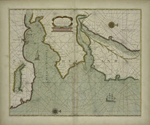
A chart of the East coast of Scotland from a sea-atlas containing an hydrographicalXOS1765726 A chart of the East coast of Scotland from a sea-atlas containing an hydrographical description of most of the sea-coasts of the known parts of the world by Samuel Thornton
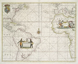
The Atlantic or Western Ocean from the West-India atlas, 1775 (coloured engraving)XOS1765723 The Atlantic or Western Ocean from the West-India atlas, 1775 (coloured engraving) by Jefferys, Thomas (c.1719-71); New York Public Library
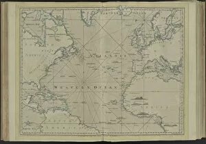
Chart of the Western (now Atlantic) Ocean with rhumb lines by Jeremiah Seller, 1705XOS1765721 Chart of the Western (now Atlantic) Ocean with rhumb lines by Jeremiah Seller, 1705 (hand coloured print) by English School, (18th century); 42x53 cm; New York Public Library
Territorial holdings of the Dutch West India Company, 1710 (hand coloured printXOS1765720 Territorial holdings of the Dutch West India Company, 1710 (hand coloured print on vellum) by Bleau, Guillaume & Jean (17th century); 77.3x95.2 cm; New York Public Library
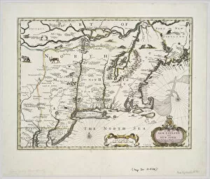
A map of New England and New York from John Speeds Theatre of the Empire of Great BritainXOS1765718 A map of New England and New York from John Speeds Theatre of the Empire of Great Britain, 1676 (colour print) by Speed, John (1552-1629); 38x48 cm; New York Public Library
A new and correct map of the trading part of the West Indies, 1741 (hand coloured print)XOS1765715 A new and correct map of the trading part of the West Indies, 1741 (hand coloured print) by Overton, Henry (18th century); 54x68 cm; New York Public Library