Fraud Blocker Skip to main content

Surveying Collection (page 7)

"Surveying: Unveiling the Past, Charting the Future" Step into a journey of discovery as we delve into the fascinating world of surveying

Background imageSurveying Collection: Military Surveying Instrument - MEK GS Right Instrument

Military Surveying Instrument - MEK GS Right Instrument
Military Surveying Instrument - MEK.GS Right Instrument No. 10490, E. R. Watts & Son, 1916, Includes a leather case. Firearms & Equipment

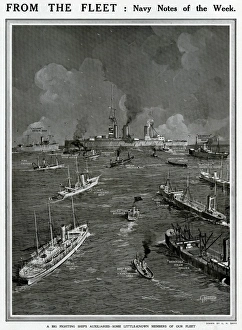
Background imageSurveying Collection: Big fighting ships auxiliaries by G. H. Davis

Big fighting ships auxiliaries by G. H. Davis
Navy notes of the week. A big fighting ships auxiliaries: some little-known members of the British fleet. 1912

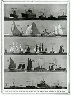
Background imageSurveying Collection: Ships that pass by G. H. Davis

Ships that pass by G. H. Davis
Ships that pass -- some notes for our readers who are spending their holidays by the sea shore. The ships are: cargo steamer, liner, coasting steamer, seagoing tug, oil carrier, racing yawl

Background imageSurveying Collection: 18th century French surveying techniques

18th century French surveying techniques
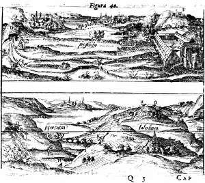
An explanation of six surveying techinques from 18th century France. Date: 18th Century

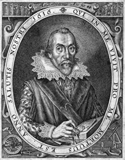
Background imageSurveying Collection: Aaron Rathbone

Aaron Rathbone
aRON RATHBONE mathematician and author of a treatise on surveying. Date: 1572 - ?

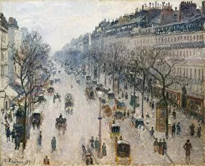
Background imageSurveying Collection: Boulevard Montmartre Winter Morning 1897 Oil

Boulevard Montmartre Winter Morning 1897 Oil
Artokoloro

Background imageSurveying Collection: Source Size = 3761 x 2498

Source Size = 3761 x 2498
A SURVEYING CRUISE AMONG THE SOLOMON ISLANDS: 1. Outside the Boat. 2. Inside the Boat: " Please, Sir, Heres a Big War Canoe Coming In." 3. Meeting the Bishop of Melanesia at Florida Island

Background imageSurveying Collection: Source Size = 5144 x 2196

Source Size = 5144 x 2196
Admiral Dundas Surveying the South Entrance to Cronstadt

Background imageSurveying Collection: Source Size = 3948 x 3096

Source Size = 3948 x 3096
The British Expedition to Abyssinia: Surveying Camp at Weah, and Mouth of the Tekonda Pass, 1867

Background imageSurveying Collection: Source Size = 3950 x 2755

Source Size = 3950 x 2755
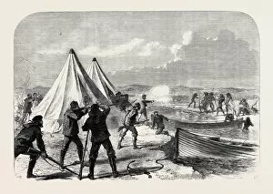
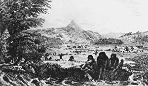
Surveying Party from H.M.s. Nassau Attacked by Natives of Terra Del Fuego, 1867

Background imageSurveying Collection: After a short survey, illustration to Pride & Prejudice by Jane Austen

After a short survey, illustration to Pride & Prejudice by Jane Austen
XJF466201 After a short survey, illustration to Pride & Prejudice by Jane Austen, edition published in 1894 (engraving) by Thomson

Background imageSurveying Collection: 2619047; out of copyright

2619047; out of copyright

Background imageSurveying Collection: James Brindley (1716-72) from Gallery of Portraits, published in 1833

James Brindley (1716-72) from Gallery of Portraits, published in 1833
KW189035 James Brindley (1716-72) from Gallery of Portraits, published in 1833 (engraving) by English School, (19th century); Private Collection; (add.info)

Background imageSurveying Collection: Balboas First Sight of the Pacific in 1513, illustration from Tales of

Balboas First Sight of the Pacific in 1513, illustration from Tales of
KW222561 Balboas First Sight of the Pacific in 1513, illustration from Tales of Travellers or A View of the World, published 1838 (litho) by English School

Background imageSurveying Collection: Arctic Exploration: The Eira, Mr Leigh Smiths Yacht, from The Illustrated

Arctic Exploration: The Eira, Mr Leigh Smiths Yacht, from The Illustrated
BAL127938 Arctic Exploration: The Eira, Mr Leigh Smiths Yacht, from The Illustrated London News, 7th January 1882 (engraving) by English School

Background imageSurveying Collection: American kestrel (Falco sparverius) male on fence post, Colorado

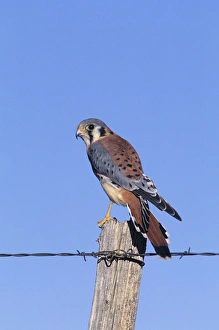
American kestrel (Falco sparverius) male on fence post, Colorado

Background imageSurveying Collection: Farmer examining stacked logs

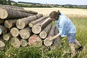
Farmer examining stacked logs

Background imageSurveying Collection: Farmer examining cereal

Farmer examining cereal

Background imageSurveying Collection: Farmer examining a young fruit tree

Farmer examining a young fruit tree

Background imageSurveying Collection: HONG KONG: SURVEYORS, 1884. Team of surveyors plotting the route of the Peak Tramway

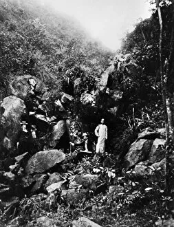
HONG KONG: SURVEYORS, 1884. Team of surveyors plotting the route of the Peak Tramway on Hong Kong Island, China. Photograph, 1884

Background imageSurveying Collection: HELIOTROPE, 1888. Surveying tool using a mirror to reflect sunlight over a distance

HELIOTROPE, 1888. Surveying tool using a mirror to reflect sunlight over a distance. Engraving, American, 1888

Background imageSurveying Collection: WORLD WAR I: TRANSPORT. U. S. Army soldiers surveying the transportation of supplies

WORLD WAR I: TRANSPORT. U. S. Army soldiers surveying the transportation of supplies
WORLD WAR I: TRANSPORT. U.S. Army soldiers surveying the transportation of supplies through the European countryside during World War I. Photograph, c1918

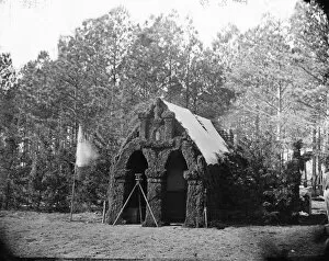
Background imageSurveying Collection: CIVIL WAR: HEADQUARTERS. Headquarters of the 50th New York Engineers in Petersburg, Virginia

CIVIL WAR: HEADQUARTERS. Headquarters of the 50th New York Engineers in Petersburg, Virginia. Photograph by Timothy H. O Sulivan, November 1864

Background imageSurveying Collection: Italy - Laboratorio di precisione, Roma - Precision Optics

Italy - Laboratorio di precisione, Roma - Precision Optics
Italy - Laboratorio di Precisione, Roma - Precision Optics made in Rome - produced optical instruments used in WW1 - suppliers to the Royal family in Italy Date: circa 1906

Background imageSurveying Collection: A Royal Engineer soldier drawing survey maps from notes and memory. 1937

A Royal Engineer soldier drawing survey maps from notes and memory. 1937

Background imageSurveying Collection: Surveyors carrying out work for the Ordnance Survey in Chislehurst, Kent

Surveyors carrying out work for the Ordnance Survey in Chislehurst, Kent 25 September 1937

Background imageSurveying Collection: Acoustic bat lure used to attract bats during survey, Colwick Woods, Nottingham, Nottinghamshire

Acoustic bat lure used to attract bats during survey, Colwick Woods, Nottingham, Nottinghamshire, England, October

Background imageSurveying Collection: Natterers Bat (Myotis nattereri) adult, held in gloved hand of researcher during survey at night

Natterers Bat (Myotis nattereri) adult, held in gloved hand of researcher during survey at night, Colwick Woods, Nottingham, Nottinghamshire, England, October

Background imageSurveying Collection: Entomologist surveying for invertebrates in river, above Catrigg Force, Stainforth Beck, Stainforth

Entomologist surveying for invertebrates in river, above Catrigg Force, Stainforth Beck, Stainforth, Yorkshire Dales N.P. North Yorkshire, England, November

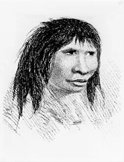
Background imageSurveying Collection: Jemmy Button, the Fuegian adopted by the expedition, as he appeared in

Jemmy Button, the Fuegian adopted by the expedition, as he appeared in 1834 after his return to his tribe. From Robert Fitzroy Narrative of the Surveying Voyages of His Majestys Ships Adventure

Background imageSurveying Collection: Cross-staffs used for surveying: in this case for measuring the width of a river by triangulation

Cross-staffs used for surveying: in this case for measuring the width of a river by triangulation. From Sebastian Munster Rudimenta Mathematica, Basle, 1551. Woodcut

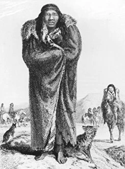
Background imageSurveying Collection: A Patagonian. From William Parker King Narrative of the Surveying Voyages of His

A Patagonian. From William Parker King Narrative of the Surveying Voyages of His Majestys Ships Adventure and Beagle Vol.I, London 1839. Charles Darwin was the naturalist on this expedition

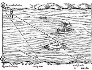
Background imageSurveying Collection: Measuring the distance from ship to shore, using a quadrant marked with shadow-scales

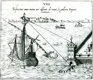
Measuring the distance from ship to shore, using a quadrant marked with shadow-scales. From Ottavius Fabri L usa della squadra mobile, Venice, 1598. Engraving

Background imageSurveying Collection: Finding the angular distance between two edges of a wood using a cross-staff. From

Finding the angular distance between two edges of a wood using a cross-staff. From Robert Fludd Utriusque cosmi... historia, Oppenheim, 1617-1619. Engraving

Background imageSurveying Collection: Patagonians at Gregory Bay. From Robert Fitzroy Narrative of the Surveying Voyages

Patagonians at Gregory Bay. From Robert Fitzroy Narrative of the Surveying Voyages of His Majestys Ships Adventure and Beagle Vol II, London 1839

Background imageSurveying Collection: Method of measuring angles with a cross-staff. From Edmund Gunter The Description

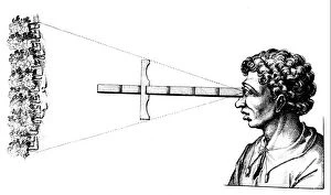
Method of measuring angles with a cross-staff. From Edmund Gunter The Description and Use of the Sector, London, 1636 (1st edition 1626). Engraving

Background imageSurveying Collection: Using a cross-staff to measure the height of a tower. From Robert Fludd Utriusque cosmi

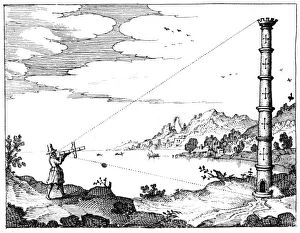
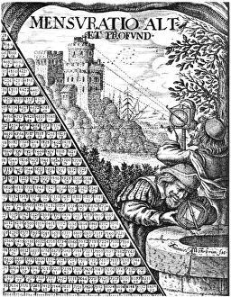
Using a cross-staff to measure the height of a tower. From Robert Fludd Utriusque cosmi... historia, Oppenheim, 1617-1619. Engraving

Background imageSurveying Collection: Measuring the altitude of the sun with ring dials. From Peter Apian Cosmographia

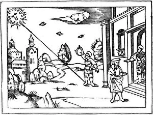
Measuring the altitude of the sun with ring dials. From Peter Apian Cosmographia, Antwerp, 1539

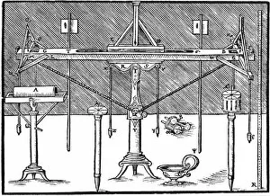
Background imageSurveying Collection: Planimeter used in conjunction with a set square for surveying. From Levinus Hulsius

Planimeter used in conjunction with a set square for surveying. From Levinus Hulsius Instrumentorum Mechanicorum, Frankfort-am-Main, 1605. Engraving

Background imageSurveying Collection: Forms of astrolabe in use for surveying. Vignette from a multiplication table published in 1650

Forms of astrolabe in use for surveying. Vignette from a multiplication table published in 1650. Engraving

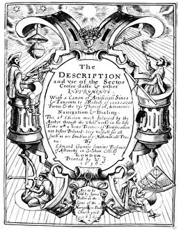
Background imageSurveying Collection: Title page of Edmund Gunter (1581-1626) The Description and Use of the Sector, London

Title page of Edmund Gunter (1581-1626) The Description and Use of the Sector, London, 1636 (1st edition 1626). This shows mariners holding various navigational instruments

Background imageSurveying Collection: A surveyors level. From Gaultherus Rivius Architechtur... Mathematischen Kunst, Nuremberg, 1547

A surveyors level. From Gaultherus Rivius Architechtur... Mathematischen Kunst, Nuremberg, 1547
A surveyors level. From Gaultherus Rivius Architechtur...Mathematischen Kunst, Nuremberg, 1547. Engraving

Background imageSurveying Collection: Using astrolabes to calculate the height of a steeple. From Peter Apian Cosmographia, Antwerp, 1539

Using astrolabes to calculate the height of a steeple. From Peter Apian Cosmographia, Antwerp, 1539. Woodcut

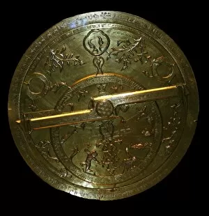
Background imageSurveying Collection: Astrolabe about AD 1345 - 1355 An astrolabe is an astronomical instrument that enables

Astrolabe about AD 1345 - 1355 An astrolabe is an astronomical instrument that enables the user to determine the time during the day with the help of the sun, and at night with the help of the stars

Background imageSurveying Collection: Surveying: Top: measuring angles using a quadrant. Bottom: obtaining levels and altitudes

Surveying: Top: measuring angles using a quadrant. Bottom: obtaining levels and altitudes using Hulsiuss planimeter. From Levinus Hulsius Instrumentorum Mechanicorum, Frankfort-am-Main, 1605

Background imageSurveying Collection: Fuegians at Woollya, with the expeditions camp in the background. From Robert

Fuegians at Woollya, with the expeditions camp in the background. From Robert Fitzroy Narrative of the Surveying Voyages of His Majestys Ships Adventure and Beagle, Vol. II, London, 1839

Background imageSurveying Collection: Measuring the distance of an inaccessible object by triangulation using a hinged staff

Measuring the distance of an inaccessible object by triangulation using a hinged staff. From Robert Fludd Utriusque cosmi... historia, Oppenheim, 1617-1619. Engraving

Background imageSurveying Collection: Title page of Samuel Sturmy Mariners Magazine, London, 1669. Sturmy (1633-69) was a sea captain

Title page of Samuel Sturmy Mariners Magazine, London, 1669. Sturmy (1633-69) was a sea captain and sailed to the West Indies and Virginia


All Professionally Made to Order for Quick Shipping

"Surveying: Unveiling the Past, Charting the Future" Step into a journey of discovery as we delve into the fascinating world of surveying. From historic battles to breathtaking landscapes, this captivating practice has shaped our understanding of the world around us. In 1982, during the Falklands War, surveyors played a crucial role in mapping out strategic locations and guiding troops through treacherous terrains. Similarly, in Lord Chelmsford's retreat from Isandhlwana during The Zulu War, surveying knowledge proved vital for navigating challenging landscapes. Travel back to 1872 with Gustave Doré's masterpiece "The New Zealander, " where surveyors meticulously measured and mapped uncharted territories. Their dedication paved the way for exploration and development. Closer to home, Larkswood Lido stands as a testament to meticulous planning by skilled surveyors who ensured every inch was perfectly aligned. Meanwhile, atop Wild Boar Fell in the north Pennines UK stands a trig point—a symbol of precision measurement that aids navigation across vast expanses. Venturing underground reveals surface buildings from Basset Mines in Illogan, Cornwall circa 1906. Surveyors painstakingly documented these structures that once thrived with activity—now preserved as historical landmarks. Alfred Stephenson on Anchorage Island showcases how technology evolved over time. Armed with his trusty theodolite—an instrument used for measuring angles—he captured precise data that contributed to scientific advancements. From ancient times to modern-day practices like PSCI2A-00073, young Washington's career as a surveyor laid foundations for his future leadership role. His experiences honed skills necessary for shaping nations and making history. Beyond measurements lie moments of collaboration; miniature depictions show surveyors sitting in circles during meetings—exchanging ideas and expertise—a tradition carried forward today within this vibrant community. Maps have always been invaluable tools; one such masterpiece is the 1891 color lithograph depicting Africa's treaty boundaries.